Turnagain Pass RSS

Archives
ARCHIVED - Forecasts expire after 24 hours.
Issued
Sat, December 17th, 2022 - 7:00AM
Expires
Sun, December 18th, 2022 - 7:00AM
Forecaster
John Sykes
Avalanche risk The Bottom Line

The avalanche danger is CONSIDERABLE above 1000′ today. Based on new reports yesterday, large human triggered avalanches 2-3′ deep on a weak layer of sugary faceted snow are possible today. Remote triggered avalanches are also a concern, which means you can trigger an avalanche from flat terrain and have it release on steeper terrain above, to the sides, or below where you are travelling. Conservative terrain selection is recommended. Below 1000′ the avalanche danger is MODERATE.

PORTAGE/PLACER: This area just opened to motorized use on Friday, so we have zero avalanche information from this zone. Please approach the mountains with caution and share your observations with us!!!

Special Announcements

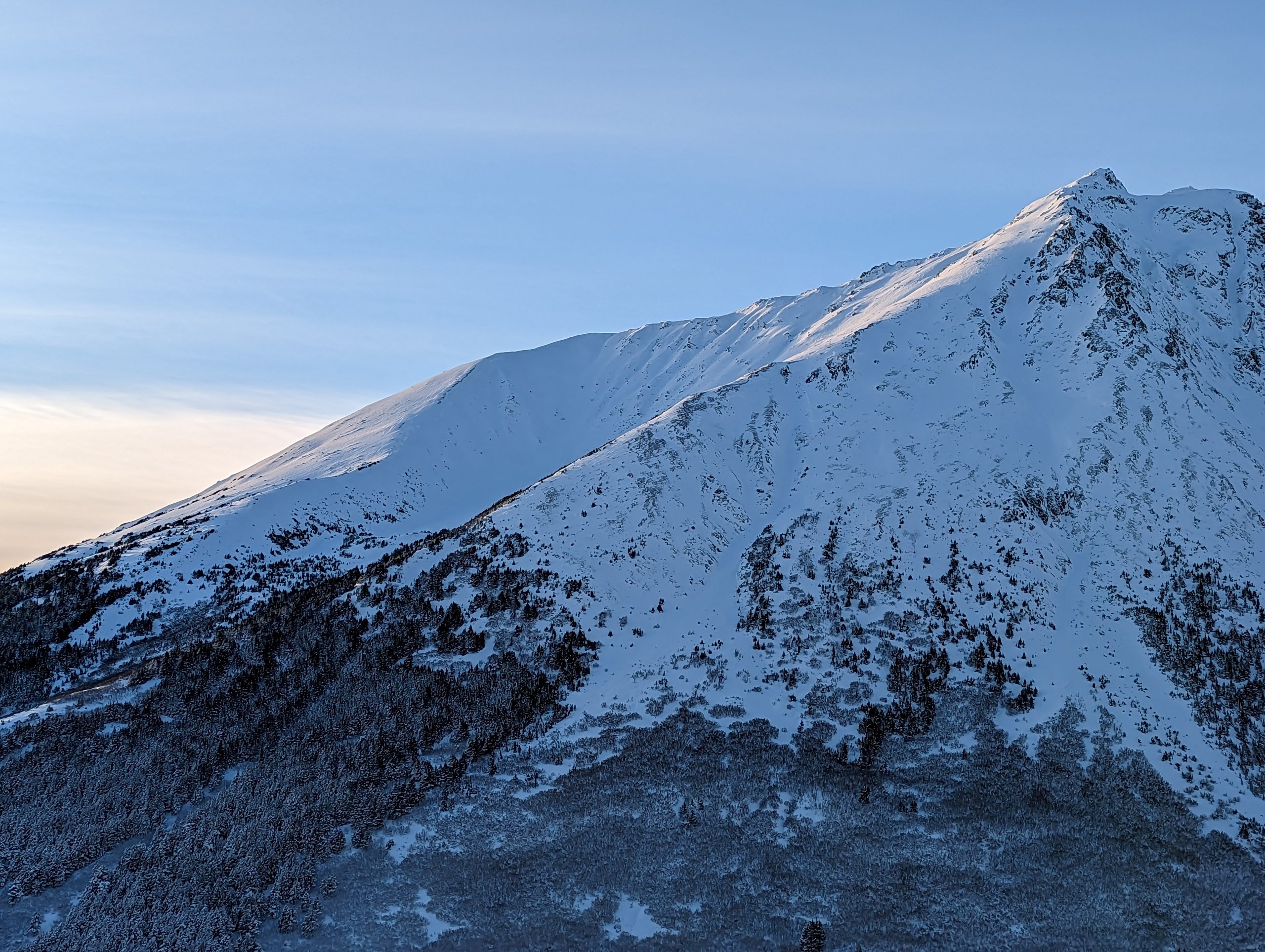
Chugach State Park: A large avalanche in the Hiland Road area was reported Thursday, which had very wide propagation on Harp Mountain. This is a strong indication that a persistent weak layer exists in the area that could produce more large avalanches.

BECOME A MEMBER IN DECEMBER!
If you use the forecast, we could use your help! Did you know that the best way to support the Chugach National Forest Avalanche Center is to become a member of the Friends, the cost-share nonprofit that supports our efforts? Memberships start at just $20, and every member who joins or renews will be entered to win one of the fabulous prizes from our sponsors. Make your gift today! https://www.cnfaic.org/friends/donate/

Sat, December 17th, 2022
Alpine
Above 2,500'
3 - Considerable
Avalanche risk
Treeline
1,000'-2,500'
3 - Considerable
Avalanche risk
Below Treeline
Below 1,000'
2 - Moderate
Avalanche risk
0 - No Rating
1 - Low
2 - Moderate
3 - Considerable
4 - High
5 - Extreme
Avalanche risk Avalanche risk Avalanche risk Avalanche risk Avalanche risk
Travel Advice Generally safe avalanche conditions. Watch for unstable snow on isolated terrain features. Heightened avalanche conditions on specific terrain features. Evaluate snow and terrain carefully; identify features of concern. Dangerous avalanche conditions. Careful snowpack evaluation, cautious route-finding, and conservative decision-making essential. Very dangerous avalanche conditions. Travel in avalanche terrain not recommended. Extraordinarily dangerous avalanche conditions. Avoid all avalanche terrain.
Likelihood of Avalanches Natural and human-triggered avalanches unlikely. Natural avalanches unlikely; human-triggered avalanches possible. Natural avalanches possible; human-triggered avalanches likely. Natural avalanches likely; human-triggered avalanches very likely. Natural and human-triggered avalanches certain.
Avalanche Size and Distribution Small avalanches in isolated areas or extreme terrain. Small avalanches in specific areas; or large avalanches in isolated areas. Small avalanches in many areas; or large avalanches in specific areas; or very large avalanches in isolated areas. Large avalanches in many areas; or very large avalanches in specific areas. Very large avalanches in many areas.
Recent Avalanches

Girdwood Valley – Lots of avalanche activity in the upper Girdwood Valley after the most recent snowfall on Wednesday and Thursday. We saw evidence of at least 5 large avalanches in the Crow Creek area during our field day yesterday. These released on a variety of different aspects with start zone elevations ranging from 2500′ to 3500′. The largest avalanches were failing on a layer of facets on top of the Thanksgiving melt freeze crust which resulted in wide propagation.

Two large natural avalanches that released on a layer of facets above the Thanksgiving melt freeze crust. Photo 12.16.22

Several more large avalanches near Magpie Peak which is close to the Crow Pass trail head. The combination of weak snow and wind loading on Thursday was enough for widespread natural avalanches in this area. Photo 12.16.22

Avalanche Problem 1
  • Persistent Slabs
    Persistent Slabs
  • Aspect/Elevation
  • Certain
    Very Likely
    Likely
    Possible
    Unlikely
    Likelihood
  • Historic (D4-5)
    Very Large (D3)
    Large (D2)
    Small (D1)
    Size
Persistent Slabs
Persistent Slab avalanches are the release of a cohesive layer of snow (a slab) in the middle to upper snowpack, when the bond to an underlying persistent weak layer breaks. Persistent layers include: surface hoar, depth hoar, near-surface facets, or faceted snow. Persistent weak layers can continue to produce avalanches for days, weeks or even months, making them especially dangerous and tricky. As additional snow and wind events build a thicker slab on top of the persistent weak layer, this avalanche problem may develop into a Deep Persistent Slab.

Aspect/Elevation of the Avalanche Problem
Specialists develop a graphic representation of the potential distribution of a particular avalanche problem across the topography. This aspect/elevation rose is used to indicate where the particular avalanche problem is thought to exist on all elevation aspects. Areas where the avalanche problem is thought to exist are colored grey, and it is less likely to be encountered in areas colored white.

Likelihood of Avalanches
Terms such as "unlikely", "likely", and "certain" are used to define the scale, with the chance of triggering or observing avalanches increasing as we move up the scale. For our purposes, "Unlikely" means that few avalanches could be triggered in avalanche terrain and natural avalanches are not expected. "Certain" means that humans will be able to trigger avalanches on many slopes, and natural avalanches are expected.

Size of Avalanches
Avalanche size is defined by the largest potential avalanche, or expected range of sizes related to the problem in question. Assigned size is a qualitative estimate based on the destructive classification system and requires specialists to estimate the harm avalanches may cause to hypothetical objects located in the avalanche track (AAA 2016, CAA 2014). Under this schema, "Small" avalanches are not large enough to bury humans and are relatively harmless unless they carry people over cliffs or through trees or rocks. Moving up the scale, avalanches become "Large" enough to bury, injure, or kill people. "Very Large" avalanches may bury or destroy vehicles or houses, and "Historic" avalanches are massive events capable of altering the landscape.

Signal Word Size (D scale) Simple Descriptor
Small 1 Unlikely to bury a person
Large 2 Can bury a person
Very Large 3 Can destroy a house
Historic 4 & 5 Can destroy part or all of a village
More info at Avalanche.org

Based on new observations yesterday (Crow Creek Area, Taylor Pass, Cornbiscuit) we believe a layer of faceted snow on top of the Thanksgiving melt freeze crust is the culprit for several large avalanches and large collapses across the forecast area. The Girdwood valley seems to be the most active area where avalanches have been releasing 2-3′ deep on this layer. However, several observations of large collapses from the skiers side of Turnagain Pass also indicate that this weak layer is reactive and could produce large avalanches. Based on this new information we are recommending a conservative mindset when travelling in the mountains today. Remote triggering avalanches is a strong possibility with this type of weak layer. That means you can trigger an avalanche from low angle terrain that could release on steeper terrain above, below, or to the sides of where you are travelling.

The most likely place to find these conditions are in areas with a relatively thinner and weaker snowpack. Due to early season conditions we have not been able to access large sections of the forecast region, like the southern end of Turnagain Pass near Johnson Pass trail head and Lynx Creek. These areas typically harbor a thinner snowpack compared to the northern end of the pass and we think it is likely that the weak layer is more reactive in these thinner areas. There is a lot of uncertainty in how widespread these conditions are in Turnagain Pass, so please let us know if you hear any large collapses or see recent avalanche activity on this layer today!

Wind Slabs lingering at upper elevations are also a concern today. These are most likely to be found along ridgelines and wind loaded gullies. Keep an eye out for stiff and hollow feeling snow, shooting cracks, and pillowy looking wind drifts to identify areas that could be harboring wind slabs.

In areas protected from the recent winds dry loose avalanches (aka sluffs) are likely with the soft snow on the surface today. The snow surface is faceting with the cold temperatures and clear skies which can cause fast running sluffs in steep terrain.

Snowpack structure near Crow Creek Road, where several large avalanches released in the past few days. Photo 12.16.22

Lots of signs of recent wind affect at upper elevations yesterday near Crow Pass. Photo 12.16.22


Weather
Sat, December 17th, 2022

Yesterday: A temperature inversion was in place yesterday, which kept a thin layer of clouds in valley bottoms with clear skies and warmer temperatures above. Winds were mostly light in the 0-10 mph range, with the exception of some stronger gap winds in the morning affecting higher peaks. No new snow.

Today: Weather conditions today, and through the next several days, look very similar to Friday with cold temperatures and mostly clear skies. Temperature inversions could cause valley fog with clear skies above. Currently, temperatures are in the -10 to 10 F range at lower elevations and 15 to 25 F at upper elevations. Winds should stay light today out of the SE at 0-5 mph.

Tomorrow: Temperatures will continue to get colder tomorrow with highs in the single digits at all elevations. Some high clouds could move through the area. Winds should remain light out of the SE. No new snowfall expected.

PRECIPITATION 24-hour data (6am – 6am)

Temp Avg (F) Snow (in) Water (in) Snow Depth (in)
Center Ridge (1880′) 12 0 0 42
Summit Lake (1400′) -3 0 0 31
Alyeska Mid (1700′) 10 0 0 44
Bear Valley (Portage) (132′) 12 0 0

RIDGETOP 24-hour data (6am – 6am)

Temp Avg (F) Wind Dir Wind Avg (mph) Wind Gust (mph)
Sunburst (3812′) 21 SW 5 14
Seattle Ridge (2400′) 17 NE 2 6
Observations
Recent Observations for Turnagain Pass
Date Region Location
04/16/24 Turnagain Observation: Cornbiscuit
04/15/24 Turnagain Observation: Taylor Pass
04/15/24 Turnagain Observation: Seward Highway – Tern Lake to Portage
04/14/24 Turnagain Observation: Sunburst
04/14/24 Turnagain Observation: Turnagain Pass Snomo
04/13/24 Turnagain Observation: Spokane Creek
04/11/24 Turnagain Observation: Tincan
04/10/24 Turnagain Avalanche: Seattle Ridge
04/10/24 Turnagain Observation: Cornbiscuit South Face
04/10/24 Turnagain Avalanche: Tincan
Riding Areas

The riding areas page has moved. Please click here & update your bookmarks.


Subscribe to Turnagain Pass
Avalanche Forecast by Email

This is a general backcountry avalanche advisory issued for Turnagain Arm with Turnagain Pass as the core advisory area. This advisory does not apply to highways, railroads or operating ski areas.