Maps
Avalanche Terrain Exposure Scale Web Map
Use this map to make decisions about travel in avalanche terrain. Winter travel is inherently dangerous including changing weather and snow conditions on the day of travel. Digital maps are not a replacement for evaluating avalanche terrain in the field. Click the image below to view the map.

Winter Motorized Recreation Maps
Ever wondered where exactly certain winter use boundaries lie on the Kenai? For example, where are the lines between the motorized and non-motorized zones? The Chugach National Forest has just come out with a great tool for winter recreationalists. Visit the link below.

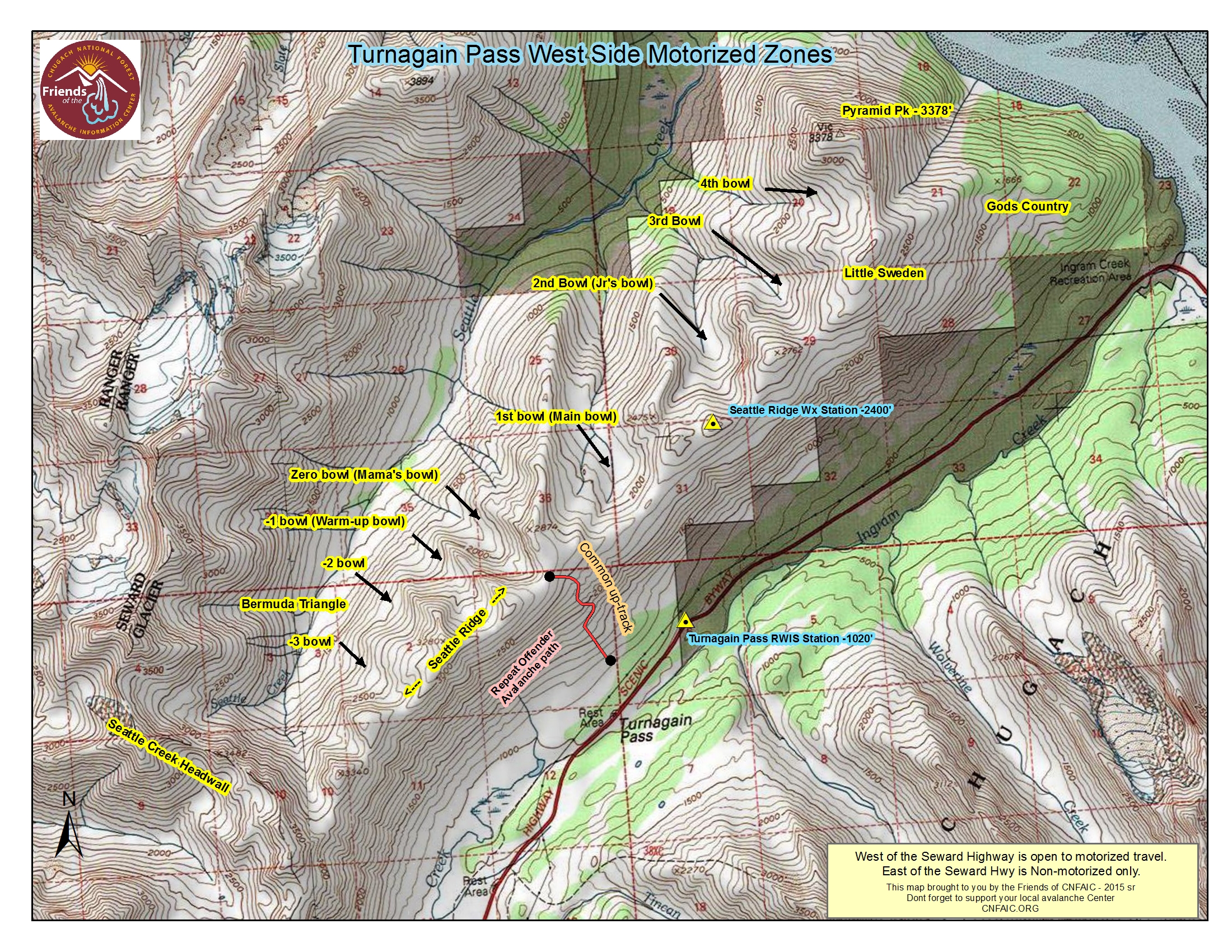
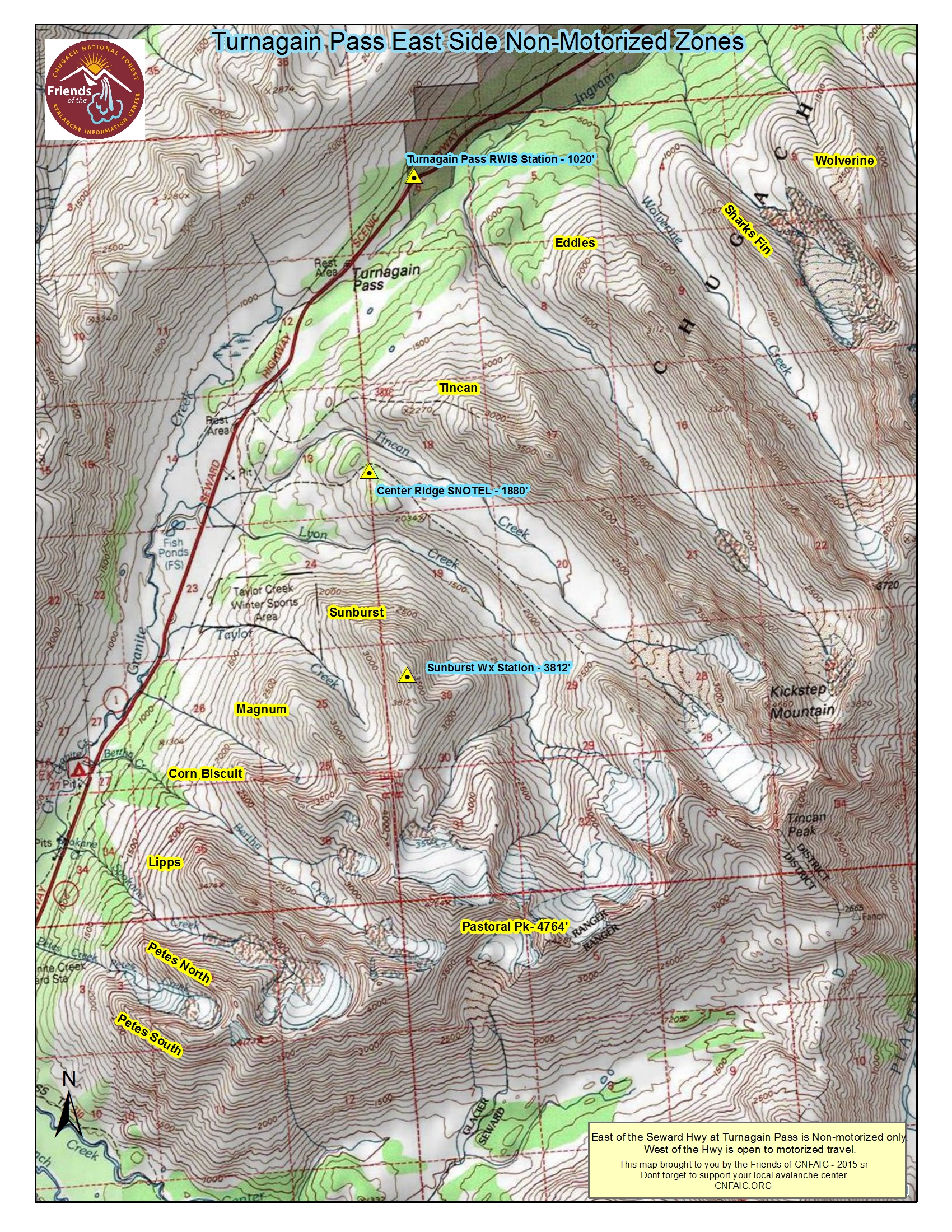
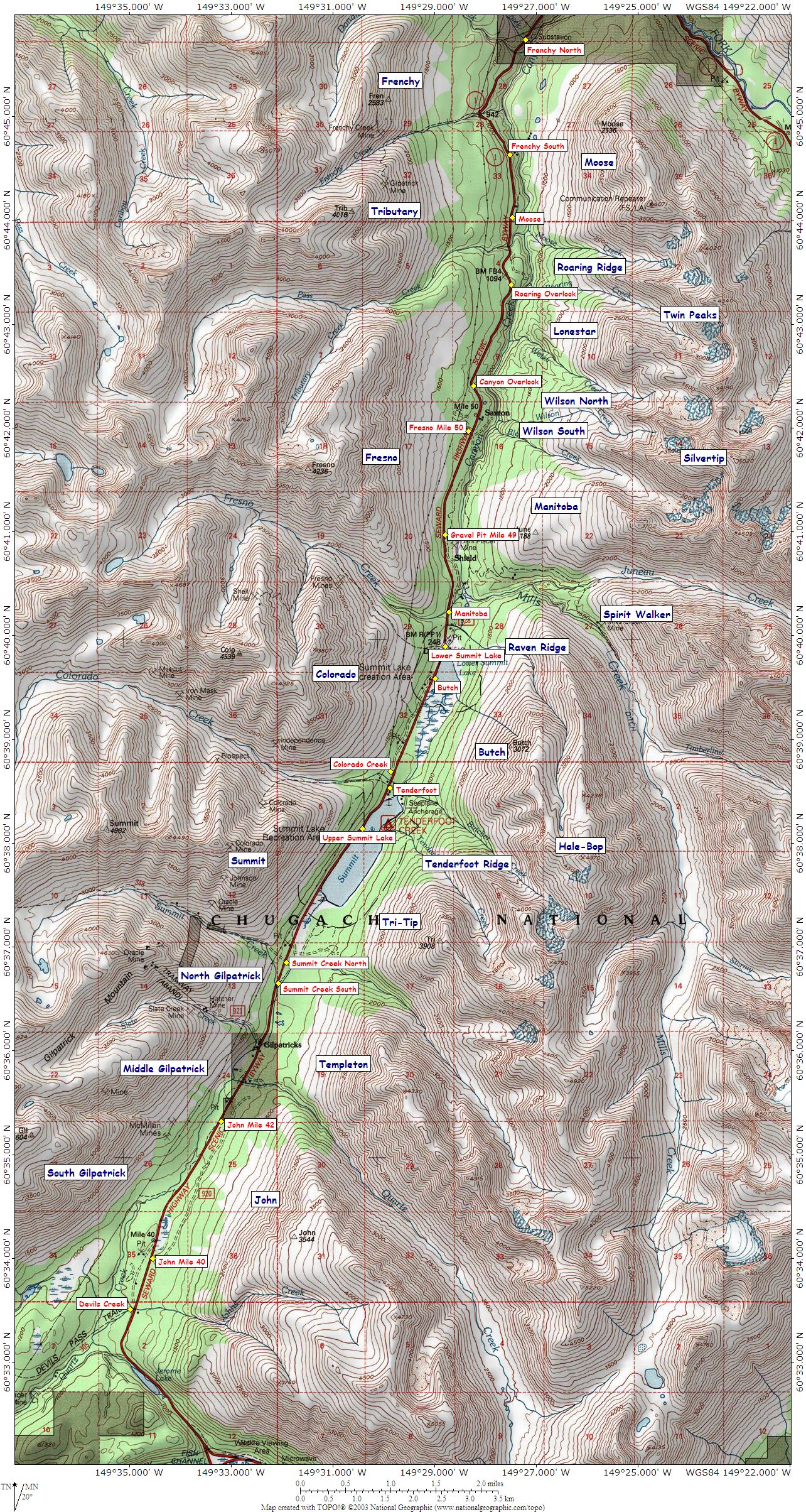
Turnagain Pass and Summit Lake Placenames Maps