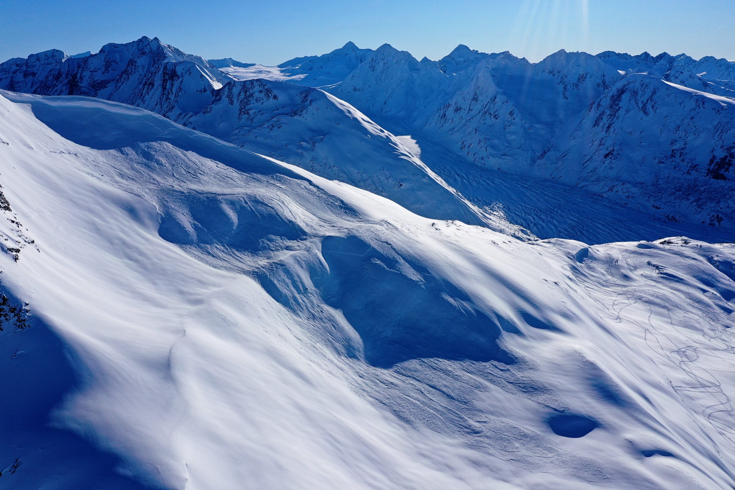
Turnagain Pass Avalanche Forecast
|
![]() ![]() |
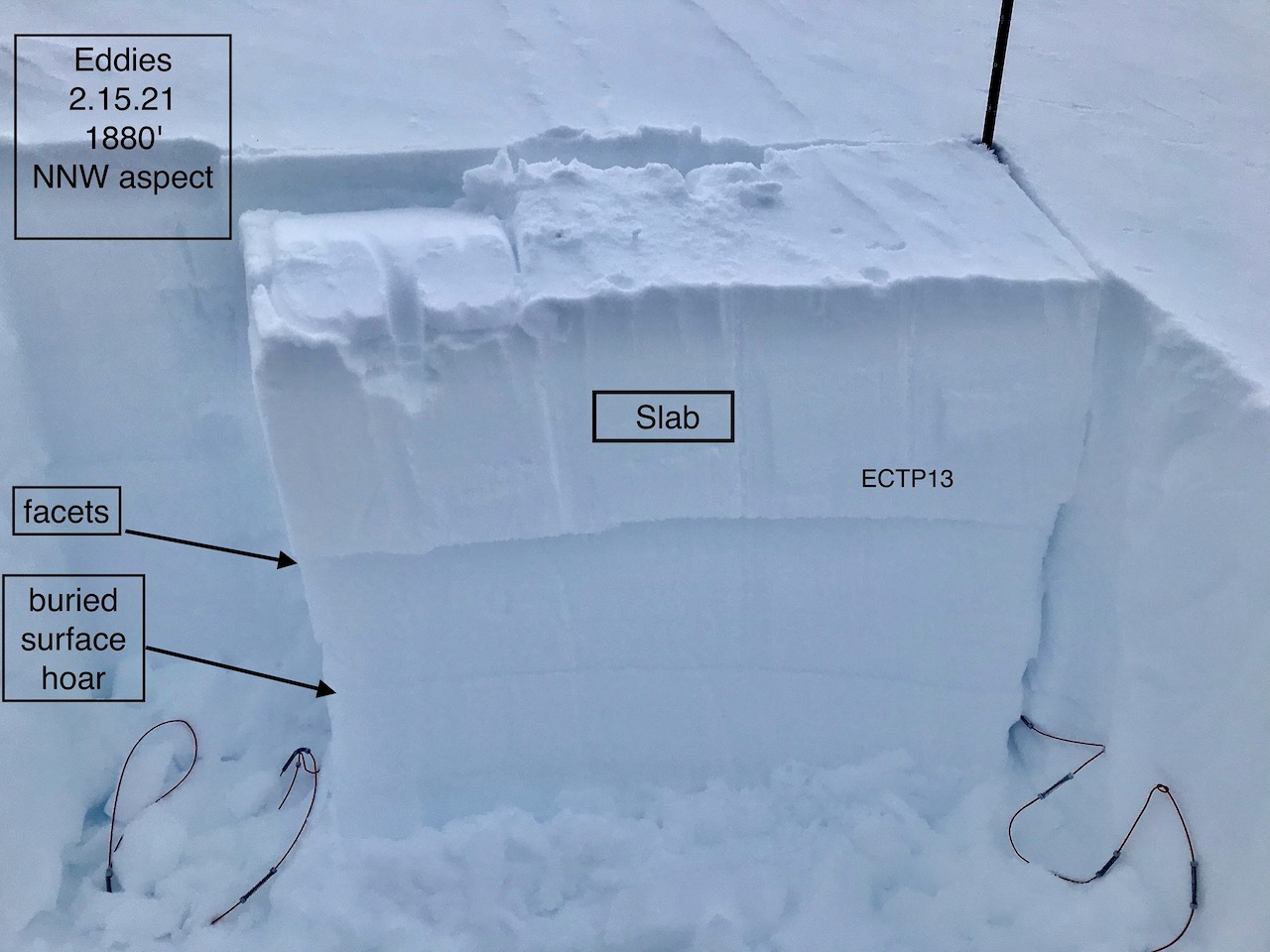
The avalanche danger is CONSIDERABLE today, and it is likely a person could trigger an avalanche on fresh wind slabs up to a foot deep, which could step down to deeper weak layers now buried 1-3’ deep. Strong winds overnight into this morning, along with up to 8″ of upside-down storm snow since early yesterday morning have increased the avalanche danger. Cautious route finding will be the name of the game today, which means avoiding steep terrain and paying attention to the slopes above you.
PLACER/PORTAGE: These areas are expected to see heavier snowfall today than the rest of the advisory area, and already have more snow sitting on top of the persistent weak layers. This makes larger avalanches easier to trigger, and extra caution is advised in these areas.
Signal Word | Size (D scale) | Simple Descriptor |
Small | 1 | Unlikely to bury a person |
Large | 2 | Can bury a person |
Very Large | 3 | Can destroy a house |
Historic | 4 & 5 | Can destroy part or all of a village |
Unfortunately, our latest round of stormy weather is proving to be mainly a wind event. Weather stations are showing sustained ridgetop wind speeds of 15-35 mph and gusts to 58 mph since around midnight last night. Along with these strong winds, we have gotten up to 9” of snow since Tuesday morning, with stations recording the highest totals near Girdwood. There are a few factors that make it likely that a person could trigger an avalanche today. First, the strong winds have created sensitive slabs of snow up to a foot thick that will be easily triggered. Second, temperatures are warming as the snow continues to trickle in. This means we will see an upside-down setup on the surface, making for sensitive avalanche conditions even in areas sheltered from the winds. And finally, we know there are multiple layers of weak snow buried a little deeper in the snowpack (more on this below). Even a relatively small avalanche that may be easily triggered near the surface could step down to these persistent weak layers, resulting in a large avalanche.
Today will not be a good day to try to get into steeper terrain. Our snowpack will need some time to adjust to the new load from the wind and fresh snow, and until it does, we will be dealing with dangerous avalanche conditions. Conservative decision making will be key today- this means sticking to low-angle terrain and keeping some distance from steep slopes overhead.
Signal Word | Size (D scale) | Simple Descriptor |
Small | 1 | Unlikely to bury a person |
Large | 2 | Can bury a person |
Very Large | 3 | Can destroy a house |
Historic | 4 & 5 | Can destroy part or all of a village |
As mentioned above, we are also concerned with multiple buried weak layers in the upper 2-3’ of the snowpack. We have found layers of buried surface hoar (more info here) and near-surface facets (details here), and we recently saw several natural and human-triggered avalanches failing on these weak layers after our last wind event (details from Comet/Squirrel Flats, Notch, and Eddies). These layers have been becoming more stubborn with time, but the strong winds today are pushing them close enough to their breaking point that it will be likely a person could trigger a large avalanche, and we might even see some natural activity. These layers are a little more sensitive at lower and mid-elevations, where they are sitting on top of a rain crust that goes up to around 1200-2000′.
Cornices: Today’s strong winds will make our large cornices a bit larger. Be sure to give them plenty of space, and minimize the amount of time you spend traveling below them.
Natural avalanche on Comet. The avalanche likely occurred during the 2/11 wind event. Photo submitted by Travis Smith, taken on 02.13.2021
Multiple buried weak layers in the upper snowpack at Eddies, just before the latest round of wind and snow. Photo: CNFAIC 02.15.2021
Yesterday: We received 2-5” low density snow, with mostly cloudy skies throughout the day. High temperatures were in the mid 20’s to lower 30’s F, with easterly winds blowing 5-10 mph during the day. Winds picked up around midnight, with sustained speeds of 15-35 mph and gusts to 58 mph.
Today: Continued strong easterly winds are expected until later this morning, with sustained speeds of 30-40 mph. Winds are expected to decrease to 10-15 mph by this afternoon. We might see 2-4” new snow today, with the highest chance for precipitation this morning and higher totals in the Portage and Placer valleys. The rain level is expected to rise to 500’ today, with highs in the low 30’s F at low elevations and in the mid 20’s F at upper elevations. Skies are expected to remain mostly cloudy through the day.
Tomorrow: There is another chance for snow late tonight into tomorrow morning, with another 3-7” possible by the end of the day. Easterly winds are expected at 10-20 mph at the ridgetops. Low temperatures will hover in the mid 20’s to 30 F tonight, and remain in the low 20’s to low 30’s F tomorrow.
PRECIPITATION 24-hour data (6am – 6am)
Temp Avg (F) | Snow (in) | Water (in) | Snow Depth (in) | |
---|---|---|---|---|
Center Ridge (1880′) | 27 | 1 | 0.2 | 115 |
Summit Lake (1400′) | 28 | 2 | 0.2 | 44 |
Alyeska Mid (1700′) | 28 | 4 | 0.3 | 114 |
RIDGETOP 24-hour data (6am – 6am)
Temp Avg (F) | Wind Dir | Wind Avg (mph) | Wind Gust (mph) | |
---|---|---|---|---|
Sunburst (3812′) | 19 | E | 13* | 58* |
Seattle Ridge (2400′) | 22 | SE | 11 | 28 |
*Winds have been averaging 20-35 mph since 2:00 a.m., with gusts 35-58 mph.
Date | Region | Location | Observer |
---|---|---|---|
05/22/23 | Turnagain | Avalanche: Tincan | Nick D'Alessio |
05/12/23 | Turnagain | Avalanche: Tincan, Sunburst, Magnum, Cornbiscuit | Heather Thamm |
05/07/23 | Turnagain | Observation: Tincan – Bear Tracks | CNFAIC Staff |
05/05/23 | Turnagain | Observation: Seattle Ridge | AS/ WW Forecaster |
05/02/23 | Turnagain | Observation: Cornbiscuit | Schauer/ Sturgess Forecaster |
05/02/23 | Turnagain | Observation: Seward Hwy Turnagain Pass | Joel Curtis |
04/30/23 | Turnagain | Observation: Magnum | Ayla, Kit Crosby, Barton |
04/29/23 | Turnagain | Observation: Tincan | John Sykes |
04/28/23 | Turnagain | Avalanche: Taylor Pass/Pastoral | Schauer/ Creighton Forecaster |
04/28/23 | Turnagain | Avalanche: Tincan | Andy Moderow |
Status of riding areas across the Chugach NF is managed by the Glacier and Seward Ranger Districts, not avalanche center staff. Riding area information is posted as a public service to our users and updated based on snow depth and snow density to prevent resource damage at trailhead locations. Riding area questions contact: mailroom_r10_chugach@fs.fed.us
Area | Status | Weather & Riding Conditions |
---|---|---|
Glacier District |
Subscribe to Turnagain Pass
Avalanche Forecast by Email
This is a general backcountry avalanche advisory issued for Turnagain Arm with Turnagain Pass as the core advisory area. This advisory does not apply to highways, railroads or operating ski areas.