Turnagain Pass RSS

Archives
ARCHIVED - Forecasts expire after 24 hours.
Issued
Sun, November 25th, 2018 - 7:00AM
Expires
Mon, November 26th, 2018 - 7:00AM
Forecaster
Wendy Wagner
Avalanche risk The Bottom Line

A powerful storm moving through is expected to increase the avalanche danger to HIGH in the upper elevations today. Over 1′ and up to 2′ of snow accumulating by this afternoon should cause natural avalanches to occur.  Warming temperatures will also increase the likelihood of avalanche activity at these high elevations and bring rain to 2,200′.  The avalanche danger is CONSIDERABLE in the treeline band as avalanches from above may run into these mid-elevations. Travel above treeline is NOT recommended.

Sun, November 25th, 2018
Alpine
Above 2,500'
4 - High
Avalanche risk
Treeline
1,000'-2,500'
3 - Considerable
Avalanche risk
Below Treeline
Below 1,000'
0 - No Rating
Avalanche risk
0 - No Rating
1 - Low
2 - Moderate
3 - Considerable
4 - High
5 - Extreme
Avalanche risk Avalanche risk Avalanche risk Avalanche risk Avalanche risk
Travel Advice Generally safe avalanche conditions. Watch for unstable snow on isolated terrain features. Heightened avalanche conditions on specific terrain features. Evaluate snow and terrain carefully; identify features of concern. Dangerous avalanche conditions. Careful snowpack evaluation, cautious route-finding, and conservative decision-making essential. Very dangerous avalanche conditions. Travel in avalanche terrain not recommended. Extraordinarily dangerous avalanche conditions. Avoid all avalanche terrain.
Likelihood of Avalanches Natural and human-triggered avalanches unlikely. Natural avalanches unlikely; human-triggered avalanches possible. Natural avalanches possible; human-triggered avalanches likely. Natural avalanches likely; human-triggered avalanches very likely. Natural and human-triggered avalanches certain.
Avalanche Size and Distribution Small avalanches in isolated areas or extreme terrain. Small avalanches in specific areas; or large avalanches in isolated areas. Small avalanches in many areas; or large avalanches in specific areas; or very large avalanches in isolated areas. Large avalanches in many areas; or very large avalanches in specific areas. Very large avalanches in many areas.
Avalanche Problem 1
  • Storm Slabs
    Storm Slabs
  • Certain
    Very Likely
    Likely
    Possible
    Unlikely
    Likelihood
  • Historic (D4-5)
    Very Large (D3)
    Large (D2)
    Small (D1)
    Size
Storm Slabs
Storm Slab avalanches are the release of a cohesive layer (a slab) of new snow that breaks within new snow or on the old snow surface. Storm-slabs typically last between a few hours and few days (following snowfall). Storm-slabs that form over a persistent weak layer (surface hoar, depth hoar, or near-surface facets) may be termed Persistent Slabs or may develop into Persistent Slabs.

Likelihood of Avalanches
Terms such as "unlikely", "likely", and "certain" are used to define the scale, with the chance of triggering or observing avalanches increasing as we move up the scale. For our purposes, "Unlikely" means that few avalanches could be triggered in avalanche terrain and natural avalanches are not expected. "Certain" means that humans will be able to trigger avalanches on many slopes, and natural avalanches are expected.

Size of Avalanches
Avalanche size is defined by the largest potential avalanche, or expected range of sizes related to the problem in question. Assigned size is a qualitative estimate based on the destructive classification system and requires specialists to estimate the harm avalanches may cause to hypothetical objects located in the avalanche track (AAA 2016, CAA 2014). Under this schema, "Small" avalanches are not large enough to bury humans and are relatively harmless unless they carry people over cliffs or through trees or rocks. Moving up the scale, avalanches become "Large" enough to bury, injure, or kill people. "Very Large" avalanches may bury or destroy vehicles or houses, and "Historic" avalanches are massive events capable of altering the landscape.

Signal Word Size (D scale) Simple Descriptor
Small 1 Unlikely to bury a person
Large 2 Can bury a person
Very Large 3 Can destroy a house
Historic 4 & 5 Can destroy part or all of a village
More info at Avalanche.org

CHANGING WEATHER AND INCREASING AVALANCHE DANGER

A warm, wet and windy storm is over the region currently. Roughly 10 to 12″ of snow has fallen in the Alpine zones with another 10 to 14″ expected today (above 2,500′). At the mid-elevations, roughly 6 to 10″ of wet snow has fallen with an additional 1″ of rain (yes rain) expected up to 2,200′ this afternoon. Easterly ridgetop winds will continue to be in the 20’s with gusts in the 50’s mph. 

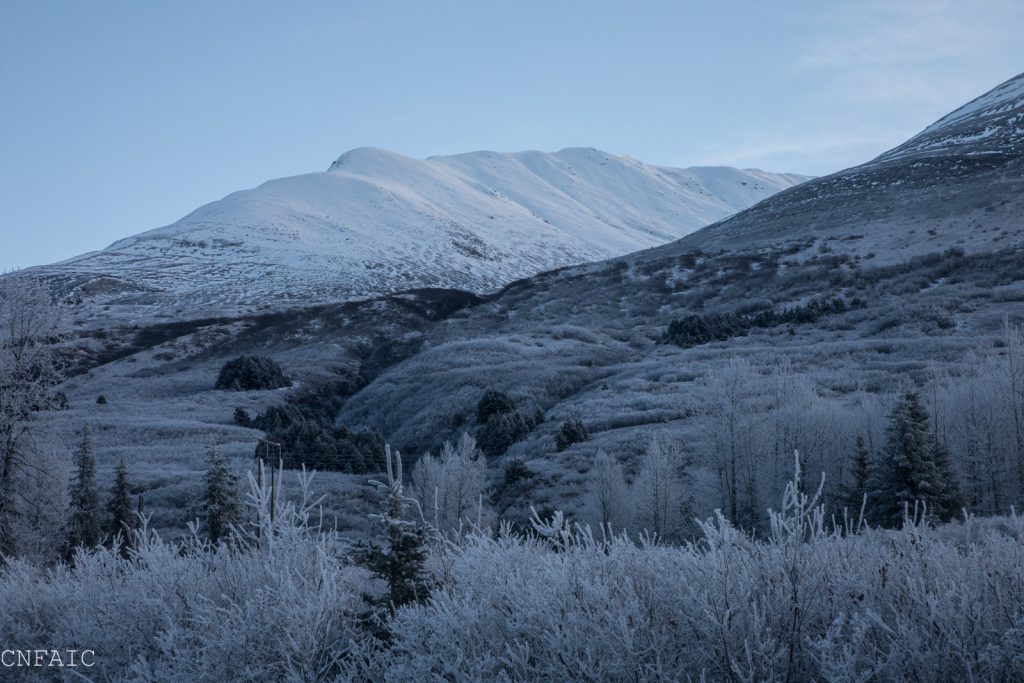
Although there was bare ground before this storm up to 2,000′, above this a shallow snowpack has been forming (see photos below). Rain last weekend followed by cool temperatures formed a crust up to the ridgetops on this pre-existing snow surface. The kicker is, surface hoar formed on the crust before it was buried yesterday. So, what we have is a perfect recipe for avalanche activity in the upper elevationsAny new snow accumulation is expected to slide off the old snow surface easily. How much avalanche activity we will have and how big those avalanches will be is directly related to how much snow falls. As of this morning, there is roughly a foot of snow from yesterday and another foot expected today – again, this is all above 2,500′. Therefore, storm slabs up to 2′ thick are possible and where winds have been loading up to 3 to 4+’ thick. 

Snow falling along the road and up to ~2,200′ is expected to turn to rain by this afternoon. This will saturate and melt much of the 6 to 10″ of wet snow existing in these mid-elevations (1,000′ to 2,500′). The worry at these elevations is being in the runout zone of an avalanche from above where debris can run. All this said, today is a day to leave the mountains alone and look ahead to the cooler weather on tap for the middle part of the week! 


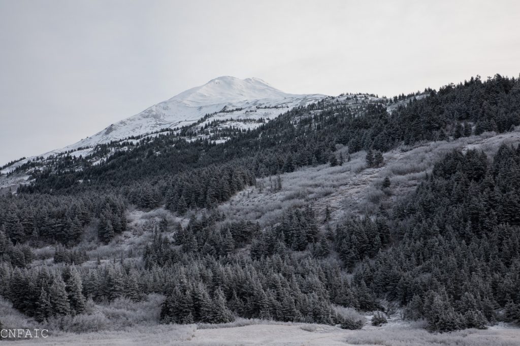
Sunburst, above the alders – hard snow with suspected surface hoar on top existed before this storm rolled in yesterday (Saturday)


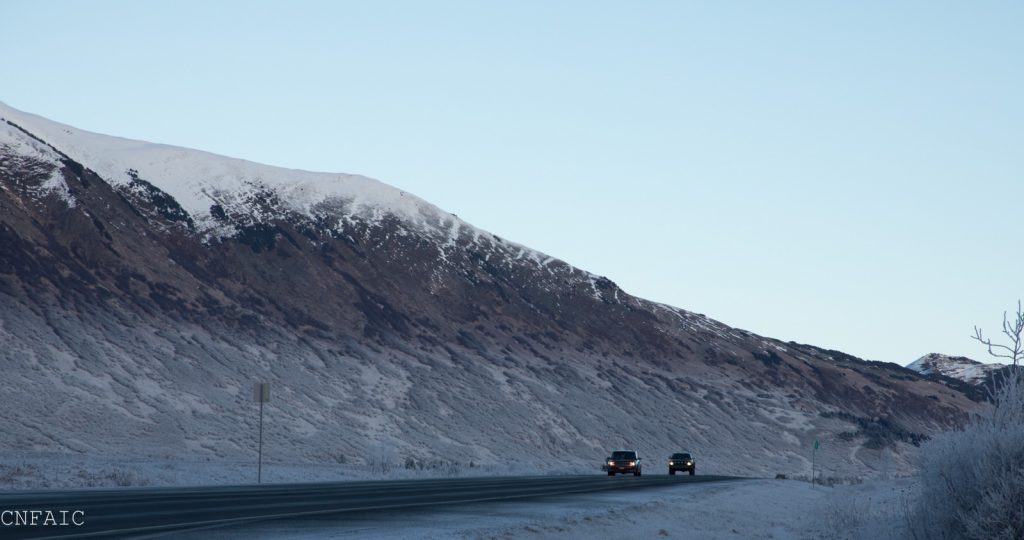
The pre-existing snow line was a little lower on Tincan, just above1500′


East facing slopes of Repeat Offender on Seattle Ridge on Friday, November 23. Snowline was around 2000′.


Looking into Lynx Creek drainage, Northern aspects before the storm on Friday.

Weather
Sun, November 25th, 2018

PRECIPITATION 24-hour data (6am – 6am)

  Temp Avg (F) Snow (in) Water (in) Snow Depth (in)
Center Ridge (1880′) 31   9   1   13  
Summit Lake (1400′) 31   1 0.2 1  
Alyeska Mid (1700′) 31   4   0.5   4  

RIDGETOP 24-hour data (6am – 6am)

  Temp Avg (F) Wind Dir Wind Avg (mph) Wind Gust (mph)
Sunburst (3812′) 25   NE   21   46  
Seattle Ridge (2400′) 30   E   11   33  
Observations
Recent Observations for Turnagain Pass
Date Region Location
03/28/24 Turnagain Observation: Sunburst
03/27/24 Turnagain Observation: Tincan Trees
03/26/24 Turnagain Observation: Cornbiscuit
03/25/24 Turnagain Observation: Tincan
03/22/24 Turnagain Avalanche: Magnum Northwest Aspect
03/21/24 Turnagain Observation: Sunburst
03/21/24 Turnagain Observation: Tincan Proper North Aspect
03/20/24 Turnagain Avalanche: Seattle Creek Drainage
03/19/24 Turnagain Observation: Tincan CFR
03/18/24 Turnagain Avalanche: Tincan – Eddies – Seattle Ridge
Riding Areas

The riding areas page has moved. Please click here & update your bookmarks.


Subscribe to Turnagain Pass
Avalanche Forecast by Email

This is a general backcountry avalanche advisory issued for Turnagain Arm with Turnagain Pass as the core advisory area. This advisory does not apply to highways, railroads or operating ski areas.