Turnagain Pass RSS

Archives
ARCHIVED - Forecasts expire after 24 hours.
Issued
Thu, March 2nd, 2017 - 7:00AM
Expires
Fri, March 3rd, 2017 - 7:00AM
Forecaster
Heather Thamm
Avalanche risk The Bottom Line

The avalanche danger could rise to CONSIDERABLE in the Alpine (above 2,500′) where triggering a fresh wind slab will be likely should sustained winds reach 30mph today. There also remains a possibility of triggering a more stubborn, and more dangerous avalanche 2-3′ deep on all aspects above 2000′. Today’s winds are also expected to be adding stress to cornices. Cautious route-finding and conservative decision making will be essential.  

The avalanche danger in the tree line zone (1000′-2500′) is  MODERATE  where triggering a fresh wind slab on steep features will be possible.

Below 1,000′ the avalanche danger is LOW where triggering an avalanche will be unlikely.

In Summit Lake, Girdwood, and on the southern end of Turnagain near Johnson Pass triggering a deeper more dangerous avalanche near the ground is still possible, but will be hard to trigger. Check out the Saturday Summit Summary HERE.

Special Announcements

Friends of the Chugach National Forest Avalanche Center is an  official  Pick. Click. Give. organization.  When you apply for your PFD please considering supporting your public avalanche center!!

Thu, March 2nd, 2017
Alpine
Above 2,500'
3 - Considerable
Avalanche risk
Treeline
1,000'-2,500'
2 - Moderate
Avalanche risk
Below Treeline
Below 1,000'
1 - Low
Avalanche risk
0 - No Rating
1 - Low
2 - Moderate
3 - Considerable
4 - High
5 - Extreme
Avalanche risk Avalanche risk Avalanche risk Avalanche risk Avalanche risk
Travel Advice Generally safe avalanche conditions. Watch for unstable snow on isolated terrain features. Heightened avalanche conditions on specific terrain features. Evaluate snow and terrain carefully; identify features of concern. Dangerous avalanche conditions. Careful snowpack evaluation, cautious route-finding, and conservative decision-making essential. Very dangerous avalanche conditions. Travel in avalanche terrain not recommended. Extraordinarily dangerous avalanche conditions. Avoid all avalanche terrain.
Likelihood of Avalanches Natural and human-triggered avalanches unlikely. Natural avalanches unlikely; human-triggered avalanches possible. Natural avalanches possible; human-triggered avalanches likely. Natural avalanches likely; human-triggered avalanches very likely. Natural and human-triggered avalanches certain.
Avalanche Size and Distribution Small avalanches in isolated areas or extreme terrain. Small avalanches in specific areas; or large avalanches in isolated areas. Small avalanches in many areas; or large avalanches in specific areas; or very large avalanches in isolated areas. Large avalanches in many areas; or very large avalanches in specific areas. Very large avalanches in many areas.
Avalanche Problem 1
  • Wind Slabs
    Wind Slabs
Wind Slabs
Wind Slab avalanches are the release of a cohesive layer of snow (a slab) formed by the wind. Wind typically transports snow from the upwind sides of terrain features and deposits snow on the downwind side. Wind slabs are often smooth and rounded and sometimes sound hollow, and can range from soft to hard. Wind slabs that form over a persistent weak layer (surface hoar, depth hoar, or near-surface facets) may be termed Persistent Slabs or may develop into Persistent Slabs.
More info at Avalanche.org

Today Northwest ridgetop winds are expected to be in the 15-30mph range with gusts in the 40’s this afternoon.  Loose surface snow (4-8” deep) can still be found in the heart of our forecast zone in the mid elevations and protected areas of the Alpine. Should winds reach the higher side of this spectrum, wind slabs 1-2’ thick will be likely to trigger on steep slopes. These slabs could be soft or hard, and may be forming on top of older wind slabs that exist on a variety of aspects. A brief wind event on Monday night (2/27) caused a natural avalanche cycle on the Southern end of our forecast zone (Lynx Creek to Summit Lake) with wind slabs ranging in the 12-20” deep. Its important to note that a NW flow can funnel winds through Turnagain Pass from a variety of directions and it’s not uncommon to see Southerly winds on the non-motorized side of the road. Today’s avalanche danger will depend on how strong the winds reach and how much snow is available for transport in the area you are traveling in. If large plumes of blowing snow are observed, this could add stress to existing weak layers deeper in the pack, and make it easier to trigger a deeper more dangerous slab. More details in Secondary Concerns. Shooting cracks will be an obvious clue that wind slabs are tender. 

Questions to keep in mind on today:  

  • Do I see blowing snow along ridgetops, an obvious sign of rapid loading?  
  • Does the snow feel hollow or drum-like below me? 
  • What are consequences of the terrain should I trigger a wind slab or a deeper layer within the snowpack?

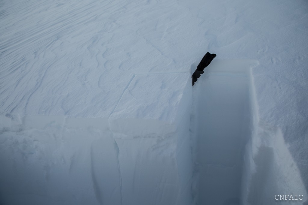
A wind slab that failed upon isolation in a compression test on the North ridge of Silvertip yesterday afternoon. This particular ridge was impacted significantly by the Monday night wind event. 

Avalanche Problem 2
  • Persistent Slabs
    Persistent Slabs
Persistent Slabs
Persistent Slab avalanches are the release of a cohesive layer of snow (a slab) in the middle to upper snowpack, when the bond to an underlying persistent weak layer breaks. Persistent layers include: surface hoar, depth hoar, near-surface facets, or faceted snow. Persistent weak layers can continue to produce avalanches for days, weeks or even months, making them especially dangerous and tricky. As additional snow and wind events build a thicker slab on top of the persistent weak layer, this avalanche problem may develop into a Deep Persistent Slab.
More info at Avalanche.org

Monday/Tuesday winds were likely enough to overload the February 9th buried surface hoar layers on the southern end of the advisory area.  This layer has been found to be quite a bit shallower (12 – 20” deep) on the southern end of Turnagain Pass, making it easier to trigger. In areas with a deeper overall snowpack (Seattle ridge, Tin Can, Sunburst, Girdwood Valley) this persistent weak layer is 2’-3’ below the surface and has been tougher to trigger in stability tests, but does continue to show the potential to fail and propagate

Should strong winds occur today, the Feb. 9th buried surface hoar could be closer to its tipping point. Winds today could also be creating more trigger spots -thinner areas of the snowpack – scoured terrain features and rocky area. This type of avalanche is likely to break above you and propagate further than expected. Be aware that no red flags may be present.

Deep Persistent Slab: We continue to find various layers of weak faceted snow and depth hoar near the bottom of the pack in certain areas. This includes Summit Lake zone, and some areas in Girdwood Valley and towards the Southern end of Turnagain pass, near Johnson Pass and Lynx Creek. Similar to the problem above, these layers will be very tough to trigger, but a possibility remains in places with this poor structure.

A natural avalanche on the SW shoulder of Captain’s Chair that was triggered naturally during Monday/Tuesday’s wind event. Due to how wide this avalanche propagated the suspected weak layer is the Feb.9 buried surface hoar. This avalanche ran 1000 vertical feet – note the debris in the lower left corner


Additional Concern
  • Cornice
    Cornice
Cornice
Cornice Fall is the release of an overhanging mass of snow that forms as the wind moves snow over a sharp terrain feature, such as a ridge, and deposits snow on the downwind (leeward) side. Cornices range in size from small wind drifts of soft snow to large overhangs of hard snow that are 30 feet (10 meters) or taller. They can break off the terrain suddenly and pull back onto the ridge top and catch people by surprise even on the flat ground above the slope. Even small cornices can have enough mass to be destructive and deadly. Cornice Fall can entrain loose surface snow or trigger slab avalanches.
More info at Avalanche.org

Cornices: Winds today may add stress to already large cornices.  These unpredictable hazards can release naturally and break farther back onto a ridge than expected. They also have the potential to trigger an avalanche on the slope below. Give cornices extra space and avoid being under them. 

Weather
Thu, March 2nd, 2017

Yesterday skies were partly cloudy and temperatures ranged between 0F and 15F. Winds were light from the NE and no precipitation was recorded.   Overnight temperatures dropped back to around 0F and winds were light.  

Today expect clear and sunny skies, and similar tempatures 0F-15F.   Northwest ridgetop winds will increase late morning to 15-30mph and gusts may reach the 40’s mph. This wind event is expected to peak this evening, but moderate winds are expected to last through tomorrow evening.    

Cold temperatures associated with a high pressure system over interior Alaska will continue to be our dominant weather pattern. This pattern will dominate Southcentral, Alaska into next week without much on the horizon of major changes in the extended forecast.

PRECIPITATION 24-hour data (6am – 6am)

  Temp Avg (F) Snow (in) Water (in) Snow Depth (in)
Center Ridge (1880′) 3   0   0   64  
Summit Lake (1400′) 1   0   0    30
Alyeska Mid (1700′) 8   0   0   59  

RIDGETOP 24-hour data (6am – 6am)

  Temp Avg (F) Wind Dir Wind Avg (mph) Wind Gust (mph)
Sunburst (3812′) 5    NE 3   8  
Seattle Ridge (2400′) 4   NE   7   21  
Observations
Recent Observations for Turnagain Pass
Date Region Location
05/13/24 Turnagain Observation: Eddie’s, Sunburst, Seattle, Cornbiscuit, Pete’s South
05/13/24 Turnagain Observation: Turnagain Pass non-motorized side
05/12/24 Turnagain Observation: Warm up Bowl
05/07/24 Turnagain Observation: Turnagain Pass Wet Slabs
04/29/24 Turnagain Avalanche: Turnagain aerial obs
04/27/24 Turnagain Observation: Johnson Pass
04/23/24 Turnagain Observation: Turnagain Sunny Side
04/21/24 Turnagain Observation: Bertha Creek
04/20/24 Turnagain Avalanche: Spokane Creek
04/16/24 Turnagain Observation: Cornbiscuit
Riding Areas

The riding areas page has moved. Please click here & update your bookmarks.


Subscribe to Turnagain Pass
Avalanche Forecast by Email

This is a general backcountry avalanche advisory issued for Turnagain Arm with Turnagain Pass as the core advisory area. This advisory does not apply to highways, railroads or operating ski areas.