Turnagain Pass Avalanche Forecast
|
![]() ![]() |
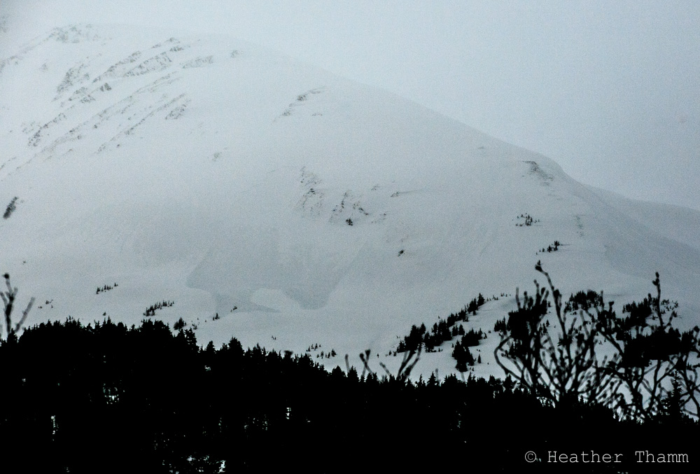
A CONSIDERABLE avalanche danger exists in the Alpine where a person could trigger an avalanche on slopes 30 degrees and steeper in Turnagain Pass and Girdwood. The snowpack still needs time to adjust to the 3″ of precipitation (apprioximately 2-3′ of snow) that has fallen since Tuesday night. Careful route finding and conservative decision-making will be crucial. Wind loaded areas, cornices and glide cracks should be avoided.
A MODERATE avalanche danger is present below 2500′ where the snowpack is wet and saturated and triggering a wet loose avalanche or wet slab on a steep slope is possible.
Below treeline a LOW danger exists where triggering an avalanche is unlikely.
Elevated caution and careful snowpack assessment is recommended for Summit Lake where strong winds and new snow have added stress to a thin snowpack. Click HERE to read the most current Summit Lake Summary and HERE for an observation from Wednesday.
Check out CNFAIC forecaster Graham Predeger’s latest installment in Alaska SnowRider on the importance of carrying an avalanche probe as part of your essential rescue gear. Click here to read the article.
Have you filed for the PFD? Remember you can still PICK.CLICK.GIVE to The Friends of the CNFAIC.Your donations are greatly appreciated and an integral part to making the CNFAIC possible and sustainable.
Approximately 3′ of snow or 3″ of rain has fallen in the advisory area since the storm started Tuesday night. This combined with strong ENE winds Tuesday through Thursday has created dangerous conditions in the mountains. Visibility was limited yesterday but fresh debris from a large natural avalanche was observed off of Seattle Ridge. The snowpack will still need time to adjust to this load today and allow the new snow to bond to the old snow surfaces. Elevated caution is advised. Slab depth, especially in wind loaded areas could be deep and very dangerous. Avoid slopes steeper than 30 degrees and be aware of what terrain is above you. Triggering a wind slab in leeward areas is likely. Look for patterns of wind loading, steer clear of stiff pillowed snow and watch for shooting cracks.
The warm wet snow combined with wind is prime cornice building conditions. Avoid travel underneath or on top of these today. They may easily fail naturally or under the weight of person or machine. When they fall they could overload slopes below and trigger a large avalanche.
A majority of the precipitation that fell on the snowpack in the Treeline elevation band (1000′-2500′) has been in the form of rain or very wet snow. This has created saturated conditions and the potential for wet loose and wet slab avalanches. This may change throughout the day as the temperatures are forecasted to drop. This could help stability increase as the snowpack freezes. On the flip side watch out for areas that receive direct sunshine (south facing) if skies clear, this may increase wet loose activity. We are at that point in the AK winter season where this will start becoming an issue. Avoid travel on steep slopes in this elevation band, especially areas where you could end up in a terrain trap.
Wet debris from Seattle Ridge. This avalanche ran almost into the flats near the motorized lot on Turnagain Pass yesterday.
Limited visibility yesterday made it hard to see how the glide cracks were behaving. The snowpack received extra weight and lubrication from rain and warm temperatures. This may cause increased glide activity and so may the cooling temperatures throughout the day. Glides are totally unpredictable. Avoid travel underneath them. We sound like a broken record as they have been in the forecast now for weeks however; they are really not something to mess with.
Yesterday skies were mostly cloudy with some clearing in the afternoon. Rain and snow continued to fall adding an additional .5″ of precipitation (5+” of snow above 1500′) to the snowpack. This brings our storm total to right around 3” of H2O (2-3′ of snow). ENE winds decreased throughout the day becoming calm overnight and temperatures were in the mid 20Fs @ 3000′ and in the mid 30Fs @ 1000′.
Today there will be scattered rain and snow showers mostly before noon with a clearing and cooling trend throughout the day. Winds will be calm and temperatures will be in the mid 20Fs to mid 30Fs. Tonight temperatures are forecasted to drop down into the teens and there is a chance for isolated snow showers.
Saturday will be mostly sunny as a stabilizing ridge dominates the weather pattern for the day. Clouds move back into the area overnight. Stay tuned for the next round of stormy conditions next week.
Temp Avg (F) | Snow (in) | Water (in) | Snow Depth (in) | |
Center Ridge (1880′) | 30 | 0 | .3 | 97 |
Summit Lake (1400′) | 34 | 0 | .1 | 28 |
Alyeska Mid (1700′) | 33 | 4.5 | .7 | 72 |
Temp Avg (F) | Wind Dir | Wind Avg (mph) | Wind Gust (mph) | |
Sunburst (3812′) |
26 | E* | 10* | 41* |
Seattle Ridge (2400′) | 27 | n/a | n/a | n/a |
*Sunburst anemometer has been down since 7 pm, 1/28.
Date | Region | Location | Observer |
---|---|---|---|
05/22/23 | Turnagain | Avalanche: Tincan | Nick D'Alessio |
05/12/23 | Turnagain | Avalanche: Tincan, Sunburst, Magnum, Cornbiscuit | Heather Thamm |
05/07/23 | Turnagain | Observation: Tincan – Bear Tracks | CNFAIC Staff |
05/05/23 | Turnagain | Observation: Seattle Ridge | AS/ WW Forecaster |
05/02/23 | Turnagain | Observation: Cornbiscuit | Schauer/ Sturgess Forecaster |
05/02/23 | Turnagain | Observation: Seward Hwy Turnagain Pass | Joel Curtis |
04/30/23 | Turnagain | Observation: Magnum | Ayla, Kit Crosby, Barton |
04/29/23 | Turnagain | Observation: Tincan | John Sykes |
04/28/23 | Turnagain | Avalanche: Taylor Pass/Pastoral | Schauer/ Creighton Forecaster |
04/28/23 | Turnagain | Avalanche: Tincan | Andy Moderow |
Status of riding areas across the Chugach NF is managed by the Glacier and Seward Ranger Districts, not avalanche center staff. Riding area information is posted as a public service to our users and updated based on snow depth and snow density to prevent resource damage at trailhead locations. Riding area questions contact: mailroom_r10_chugach@fs.fed.us
Area | Status | Weather & Riding Conditions |
---|---|---|
Glacier District |
Subscribe to Turnagain Pass
Avalanche Forecast by Email
This is a general backcountry avalanche advisory issued for Turnagain Arm with Turnagain Pass as the core advisory area. This advisory does not apply to highways, railroads or operating ski areas.