Turnagain Pass Avalanche Forecast
|
![]() ![]() |
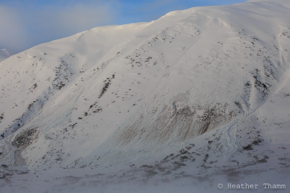
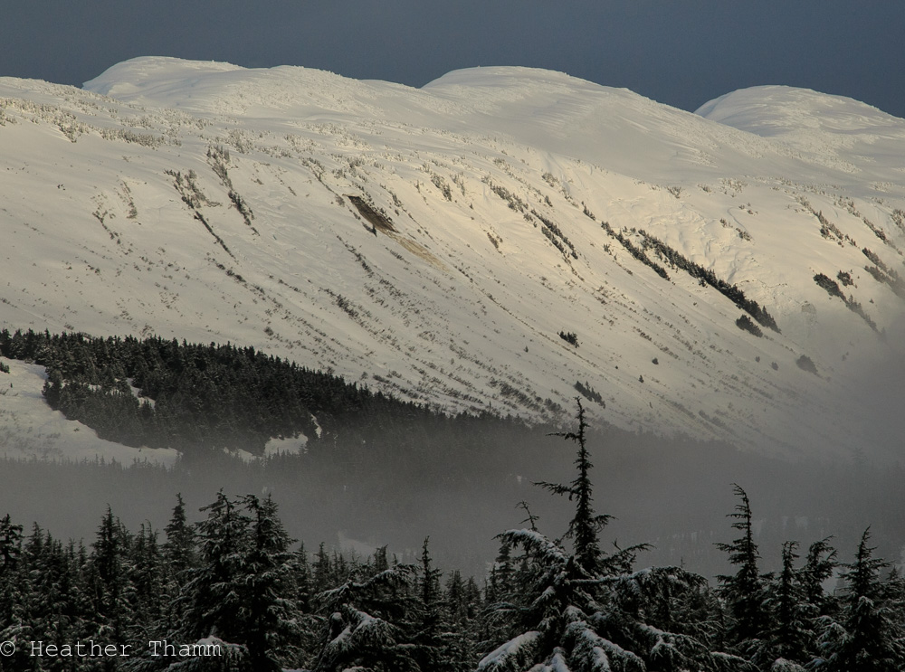
Today the avalanche danger is MODERATE in the Alpine and at Treeline where a variety of isolated avalanche problems linger. Above 2500′ it will be possible to trigger wind slabs 1-3′ thick on steep unsupported terrain features. In the Treeline elevation zone (1000′-2500′) glide cracks litter all aspects and can release without warning. In addition to avoiding these problems, recognize that today is the first sunny Saturday in many weeks and it will be extra important to be aware of other groups above and below you and practice safe travel protocols.
The avalanche danger is LOW below Treeline where a stout crust has formed with cooling temperatures.
*Elevated Caution is recommended for Summit Lake where less information is known about the snowpack following a warm and windy storm this week. Click HERE to read the most current Summit Lake Summary.
Unfortunate news coming out of British Columbia as we near the end of a deadly January in N. America. At least 3 separate groups of snowmachiners were involved in a very large avalanche that killed five people. Click HERE for more details.
Yesterday the Girdwood Nordic Ski Club partnered up with the USFS and groomed a 2.8K cross-country ski loop near Center Ridge in Turnagain Pass. Groomed trails can be accessed just beyond the outhouses on the non-motorized parking area. For information on becoming a member and supporting the Girdwood Nordic Ski Club click HERE.
Wind Slabs: Evidence of many large avalanches can be seen throughout Turnagain Pass following a two-day storm that brought strong Northeast winds, rain below 2500’ and 2.5’ of new snow in the Alpine. Wind slabs were active mid to late storm (Jan.27-28), but are healing quickly with cooling temperatures. Triggering a wind slab 1-3’ thick is still possible today in steep terrain where the snow is unsupported. Be on the look out for obvious signs of instability like shooting cracks or active wind loading. Be aware that both the Sunburst and Seattle Ridge anemometers are not functioning and current wind data is not available.
Cornices: With recent snow and wind loading, we can expect cornices to be tender. Remember cornices often break farther back than expected and can add a significant load to the slope below when they fall. Avoid travel on or below them.
Human Factor: Anticipate parking lots to be full and lots of people recreating throughout Turnagain Pass. Actively communicate with other groups and always practice these safe travel rituals to minimize your exposure in avalanche terrain.
Several crowns were observed in Todd’s Bowl and in the background on Eddies SW face, all likely occurred near the end of the Jan.27-28 storm.
A large D3 wet slab occured mid storm on an East aspect of Seattle Ridge, just South of the motorized lot. Cooling temperatures have helped to quickly stablize this avalanche problem.
The addition of rain and 2-3’ of new snow has accelerated the glide avalanche problem. Big brown streaks can be seen on many aspects of Turnagain Pass, including Seattle Ridge, Eddies, Wolverine, and Cornbiscuit. This problem is becoming more widespread in steep terrain between 1000’ to 2500’ where many more cracks have opened up and continue to widen. Since glide cracks can spontaneously release at any time, identify and avoid slopes with known cracks. We could see increased activity today with cooling temperatures – which is thought to be a possible trigger following a period of active loading and rain.
Recent glide avalanche on the East face of Seattle Ridge, North of the Motorized uptrack
This glide avalanched mid storm and is now covered by new snow, but be aware that glide cracks litter the entire East Face of Seattle Ridge.
With several feet of new snow and cooling temperatures triggering a point release is possible. Typically loose snow avalanches are not big enough to bury a person, but can catch you by surprise in the wrong place. This is an important hazard to manage in steep terrain where falling can have high consequences.
Yesterday skies cleared and temperatures cooled throughout the day dropping into the low to mid 20’s F overnight. At this time no wind data is available, but forecasted winds were expected to have been light.
Today skies are expected to be mostly sunny with patches of valley fog in Turnagain Pass and Turnagain Arm. Temperatures will be in the mid 20F to lower low 30’s F. Today’s forecast is calling for Westerly gap winds through Portage Valley, and light Southwest winds in Turnagain Pass.
Tempertures are expected to drop into the teens tonight and light Southwest winds will transition to Easterly winds by Sunday as clouds start moving back into the region
Temp Avg (F) | Snow (in) | Water (in) | Snow Depth (in) | |
Center Ridge (1880′) | 26 | 1 | 0.1 | 95 |
Summit Lake (1400′) | 26 | 0 | 0 | 28 |
Alyeska Mid (1700′) | 29 | 1 | 0.1 | 72 |
Temp Avg (F) | Wind Dir | Wind Avg (mph) | Wind Gust (mph) | |
Sunburst (3812′) | 21 | N/A | N/A | N/A |
Seattle Ridge (2400′) | 23 | N/A | N/A | N/A |
Date | Region | Location | Observer |
---|---|---|---|
05/22/23 | Turnagain | Avalanche: Tincan | Nick D'Alessio |
05/12/23 | Turnagain | Avalanche: Tincan, Sunburst, Magnum, Cornbiscuit | Heather Thamm |
05/07/23 | Turnagain | Observation: Tincan – Bear Tracks | CNFAIC Staff |
05/05/23 | Turnagain | Observation: Seattle Ridge | AS/ WW Forecaster |
05/02/23 | Turnagain | Observation: Cornbiscuit | Schauer/ Sturgess Forecaster |
05/02/23 | Turnagain | Observation: Seward Hwy Turnagain Pass | Joel Curtis |
04/30/23 | Turnagain | Observation: Magnum | Ayla, Kit Crosby, Barton |
04/29/23 | Turnagain | Observation: Tincan | John Sykes |
04/28/23 | Turnagain | Avalanche: Taylor Pass/Pastoral | Schauer/ Creighton Forecaster |
04/28/23 | Turnagain | Avalanche: Tincan | Andy Moderow |
Status of riding areas across the Chugach NF is managed by the Glacier and Seward Ranger Districts, not avalanche center staff. Riding area information is posted as a public service to our users and updated based on snow depth and snow density to prevent resource damage at trailhead locations. Riding area questions contact: mailroom_r10_chugach@fs.fed.us
Area | Status | Weather & Riding Conditions |
---|---|---|
Glacier District |
Subscribe to Turnagain Pass
Avalanche Forecast by Email
This is a general backcountry avalanche advisory issued for Turnagain Arm with Turnagain Pass as the core advisory area. This advisory does not apply to highways, railroads or operating ski areas.