Turnagain Pass RSS

Archives
ARCHIVED - Forecasts expire after 24 hours.
Issued
Mon, December 21st, 2020 - 7:00AM
Expires
Tue, December 22nd, 2020 - 7:00AM
Forecaster
Aleph Johnston-Bloom
Avalanche risk The Bottom Line

The avalanche danger is expected to rise to MODERATE today in the Alpine (above 2,500′) with light snow fall and increasing winds this afternoon. Human triggered wind slab avalanches, up to a foot thick, will be possible along ridgelines and in cross-loaded gullies. A LOW danger exists below 2,500′ and in areas without wind effect.

With very strong winds and heavy snow ramping up overnight, expect the avalanche danger to rise to HIGH at all elevations by tomorrow morning across the forecast area. The National Weather Service has issued a High Wind Warning in effect from 9 pm tonight until 6 pm Tuesday and a Blizzard Warning in effect from 9 pm tonight until noon Tuesday.

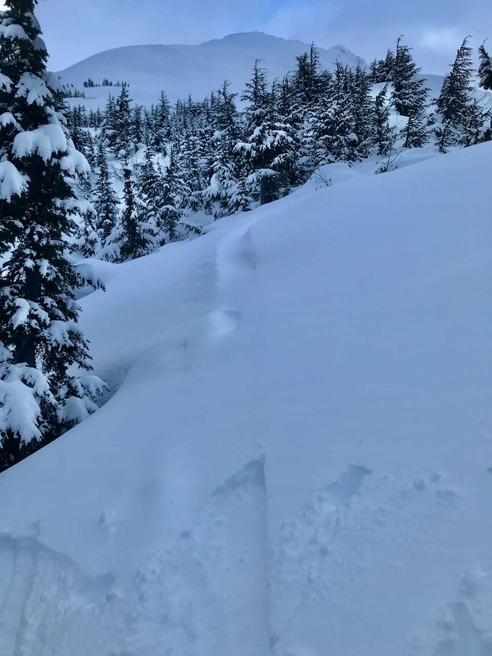
South of Turnagain Pass to SUMMIT LAKE:  A thinner and weaker snowpack exists in these areas. On steep rocky terrain above 2500′, there is still a chance a person could trigger a slab avalanche failing near the ground.

Special Announcements

It was a sad weekend for avalanche accidents in the lower 48. Three skiers were killed in Colorado and one snowmachiner in Wyoming. These were the first US avalanche fatalities of the 2020/21 season. Our thoughts go out to the families, friends, responders and all impacted by these accidents. Preliminary information can be found HERE.

Mon, December 21st, 2020
Alpine
Above 2,500'
2 - Moderate
Avalanche risk
Treeline
1,000'-2,500'
1 - Low
Avalanche risk
Below Treeline
Below 1,000'
1 - Low
Avalanche risk
0 - No Rating
1 - Low
2 - Moderate
3 - Considerable
4 - High
5 - Extreme
Avalanche risk Avalanche risk Avalanche risk Avalanche risk Avalanche risk
Travel Advice Generally safe avalanche conditions. Watch for unstable snow on isolated terrain features. Heightened avalanche conditions on specific terrain features. Evaluate snow and terrain carefully; identify features of concern. Dangerous avalanche conditions. Careful snowpack evaluation, cautious route-finding, and conservative decision-making essential. Very dangerous avalanche conditions. Travel in avalanche terrain not recommended. Extraordinarily dangerous avalanche conditions. Avoid all avalanche terrain.
Likelihood of Avalanches Natural and human-triggered avalanches unlikely. Natural avalanches unlikely; human-triggered avalanches possible. Natural avalanches possible; human-triggered avalanches likely. Natural avalanches likely; human-triggered avalanches very likely. Natural and human-triggered avalanches certain.
Avalanche Size and Distribution Small avalanches in isolated areas or extreme terrain. Small avalanches in specific areas; or large avalanches in isolated areas. Small avalanches in many areas; or large avalanches in specific areas; or very large avalanches in isolated areas. Large avalanches in many areas; or very large avalanches in specific areas. Very large avalanches in many areas.
Recent Avalanches

A snowboarder triggered a small wind slab in Juniors and was caught and carried with no burial or injury. They did deploy their airbag but it did not fully inflate.

Snowboard triggered wind slab, Juniors, 12.20.20.

Avalanche Problem 1
  • Wind Slabs
    Wind Slabs
  • Certain
    Very Likely
    Likely
    Possible
    Unlikely
    Likelihood
  • Historic (D4-5)
    Very Large (D3)
    Large (D2)
    Small (D1)
    Size
Wind Slabs
Wind Slab avalanches are the release of a cohesive layer of snow (a slab) formed by the wind. Wind typically transports snow from the upwind sides of terrain features and deposits snow on the downwind side. Wind slabs are often smooth and rounded and sometimes sound hollow, and can range from soft to hard. Wind slabs that form over a persistent weak layer (surface hoar, depth hoar, or near-surface facets) may be termed Persistent Slabs or may develop into Persistent Slabs.

Likelihood of Avalanches
Terms such as "unlikely", "likely", and "certain" are used to define the scale, with the chance of triggering or observing avalanches increasing as we move up the scale. For our purposes, "Unlikely" means that few avalanches could be triggered in avalanche terrain and natural avalanches are not expected. "Certain" means that humans will be able to trigger avalanches on many slopes, and natural avalanches are expected.

Size of Avalanches
Avalanche size is defined by the largest potential avalanche, or expected range of sizes related to the problem in question. Assigned size is a qualitative estimate based on the destructive classification system and requires specialists to estimate the harm avalanches may cause to hypothetical objects located in the avalanche track (AAA 2016, CAA 2014). Under this schema, "Small" avalanches are not large enough to bury humans and are relatively harmless unless they carry people over cliffs or through trees or rocks. Moving up the scale, avalanches become "Large" enough to bury, injure, or kill people. "Very Large" avalanches may bury or destroy vehicles or houses, and "Historic" avalanches are massive events capable of altering the landscape.

Signal Word Size (D scale) Simple Descriptor
Small 1 Unlikely to bury a person
Large 2 Can bury a person
Very Large 3 Can destroy a house
Historic 4 & 5 Can destroy part or all of a village
More info at Avalanche.org

Yesterday many people were out in forecast area enjoying the snow and stability. Observers did note a few wind slab pockets and wind effect in exposed terrain. Last night there was a brief bump in the ridgetop winds. Today there is still plenty of soft snow available for transport. With additional light snow in the forecast and winds building this afternoon, it will be important to pay attention to changing conditions. Wind slabs up to a foot thick will be possible in steep leeward terrain. Look for blowing snow, shooting cracks and stiff wind affected snow. Even a small wind slab avalanche in steep terrain can take a skier or boarder for an unpleasant ride. As always, give cornices plenty of space, they often break back farther than you would expect.

In addition, don’t forget loose snow avalanches, i.e. sluffing, in steep wind protected terrain. Observers commented on these being big enough push folks around and it will be possible to see more of the same today.

The big news is the incoming storm. As noted above in the Bottom Line, the NWS has issued a High Wind Warning and a Blizzard Warning starting tonight. Today is not the day to get stuck out after dark, especially on the shortest day of the year. Conditions are expected to deteriorate rapidly.

Wind drifts on the Petes North skin track, 12.20.20. Pay attention to wind loading and blowing snow today.

Storm total snow forecast, 4 to 6″ of total water weight is expected. There still is some uncertainty about when it the storm will shift to rain at lower elevations and what the rain/snow line will be. Stay tuned! Think cold thoughts. #snowtosealevelplease

Additional Concern
  • Deep Persistent Slabs
    Deep Persistent Slabs
Deep Persistent Slabs
Deep Persistent Slab avalanches are the release of a thick cohesive layer of hard snow (a slab), when the bond breaks between the slab and an underlying persistent weak layer deep in the snowpack. The most common persistent weak layers involved in deep, persistent slabs are depth hoar or facets surrounding a deeply buried crust. Deep Persistent Slabs are typically hard to trigger, are very destructive and dangerous due to the large mass of snow involved, and can persist for months once developed. They are often triggered from areas where the snow is shallow and weak, and are particularly difficult to forecast for and manage.
More info at Avalanche.org

We know there is weak snow at the base of the snowpack throughout the advisory area, which has been a concern above 2500′ where the stout crust December 1st crust disappears.  However, the facet layer (sugar snow) is variable in grain size, layer thickness and has shown signs of gaining strength. With no avalanche activity failing at this layer in over two weeks, very few signs indicating instability, and no significant loading in over a week, it has become very unlikely to trigger an avalanche deep in the snowpack. This layer remains a bit more concerning in areas with thinner snowpack such as Crow Pass, and as you head south from Turnagain Pass (Lynx Creek, Silvertip) towards Summit Lake. This type of avalanche problem is tricky. Deeply buried weak layers can often lay dormant for weeks or longer without showing any signs of activity before somebody finds just the wrong spot to trigger one. If you want to avoid the chance of this type of avalanche entirely, you can stay off steep, rocky, slopes over 35 degrees.

With a heavy loading event in the forecast tonight through tomorrow, we will be watching to see if this layer gets woken up from it’s slumber…

Weather
Mon, December 21st, 2020

Yesterday: Skies were partly cloudy with light southerly winds and temperatures in the teens to mid 20°Fs. Overnight skies remained partly cloudy, ridgetop winds were westerly, 5-15 mph with gusts into the 30s. Temperatures were in the low teens to low 20°Fs. There was a trace of snow overnight in Girdwood.

Today: Happy Solstice! 5.5 hrs of daylight today. Skies will be mostly cloudy with snow showers starting mid-day, 1-5″ forecast. Light southerly winds this morning becoming easterly this afternoon, 10-20 mph gusting into the 30s. Temperatures will be in the teens in the Alpine and the low 30°Fs at sea level. Overnight easterly winds are forecast to increase to 40 to 65 mph with gusts to 90 mph expected. Snow is expected to be heavy, falling 2″ per hour with over 2′ by the morning. Temperatures will be in the 20°Fs.

Tomorrow: Heavy snow and then heavy rain expected. Rain/snowline is still TBD, with another 1-2′ of snow forecast. Winds will remain very strong until mid day and then ease off a little by late afternoon. Temperatures will be in the 40°Fs at sea level and the high 20°Fs at ridgetops. Heavy rain and snow continue overnight, 4-6″ of total water from the storm is expected by Wednesday morning. The weather pattern remains active through the holiday weekend.

PRECIPITATION 24-hour data (6am – 6am)

Temp Avg (F) Snow (in) Water (in) Snow Depth (in)
Center Ridge (1880′) 22 0 0 59
Summit Lake (1400′) 15 0 0 27
Alyeska Mid (1700′) 21 trace 0 59

RIDGETOP 24-hour data (6am – 6am)

Temp Avg (F) Wind Dir Wind Avg (mph) Wind Gust (mph)
Sunburst (3812′) 13 SW 8 35
Seattle Ridge (2400′) 16 SE 5 15
Observations
Recent Observations for Turnagain Pass
Date Region Location
04/21/24 Turnagain Observation: Bertha Creek
04/20/24 Turnagain Avalanche: Spokane Creek
04/16/24 Turnagain Observation: Cornbiscuit
04/15/24 Turnagain Observation: Taylor Pass
04/15/24 Turnagain Observation: Seward Highway – Tern Lake to Portage
04/14/24 Turnagain Observation: Sunburst
04/14/24 Turnagain Observation: Turnagain Pass Snomo
04/13/24 Turnagain Observation: Spokane Creek
04/11/24 Turnagain Observation: Tincan
04/10/24 Turnagain Avalanche: Seattle Ridge
Riding Areas

The riding areas page has moved. Please click here & update your bookmarks.


Subscribe to Turnagain Pass
Avalanche Forecast by Email

This is a general backcountry avalanche advisory issued for Turnagain Arm with Turnagain Pass as the core advisory area. This advisory does not apply to highways, railroads or operating ski areas.