Weak faceted snow buried 2-3′ deep is our main avalanche concern. This type of avalanche can often lie dormant for days to weeks before getting the right combination of snow load and trigger to release. The recent avalanche at Alyeska yesterday is a reminder that persistent slabs can release on lower angle terrain than expected, propagate more widely than expected, and be stubborn to trigger, with the fourth skier on the slope having triggered the avalanche. Taking a conservative approach to selecting terrain (smaller terrain features, slope angles below 35 degrees), travelling one at a time in avalanche terrain, and spotting your partners is essential to manage this avalanche hazard. If you are travelling to one of the newly opened motorized areas (Placer, Skookum, Lynx, Johnson Pass, Lost Lake, ect) keep in mind that we have very limited information and recommend a conservative approach while we can start to visit more areas and get more public observations.
So far the new snow loads from the past 48 hours and during the week of Thanksgiving have not been enough to produce significant natural avalanches on these persistent weak layers. Instead they have incrementally loaded these weak layers to the point where the size of the avalanche that could be triggered has increased. Based on our exploration of the snowpack on Tincan yesterday, it seems like the weak layers are more prevalent below 3000′ where the Halloween melt freeze layer is thicker and a thicker layer of weak faceted snow remains from the cold spell in mid-November. Most of the avalanches reported in the advisory area in the past week have been at or below 3000′ (Seattle ridge, Girdwood, Tincan, Alyeska yesterday).
Digging a snowpit can be a good way to check on persistent weak layers in the area you are travelling. Keep in mind that snowpits only give you information about a single point and can vary greatly across a slope, so choosing a representative location is key. Stability tests can struggle to initiate a failure in deeply buried weak layers and can provide confusing results. The bigger value is just to understand the snowpack structure in your area and determine whether persistent weak layers are present and how sugary and soft they are.
Wind Slabs: In higher elevation areas, above 2500′, that saw the brunt of the winds from early yesterday morning it is still possible to trigger a wind slab. Look for firm and hollow feeling snow and signs of active wind transport. These are especially likely along ridgelines or in passes at higher elevations.
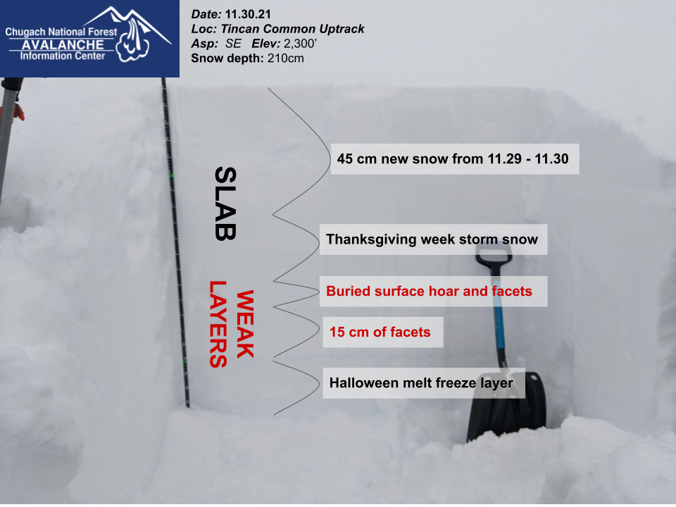 Snowpack structure near treeline on Tincan at 2300′ on 11.30.21. This pit has a well defined slab and weak layer combination, with very sugary weak snow (fist hardness) in the weak layers.
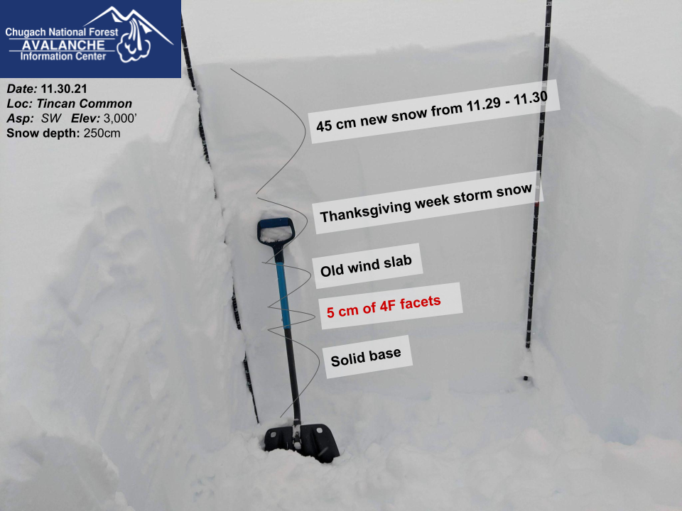 Snowpack structure from 3000′ on Tincan on 11.30.21. This area had more wind effect in the upper snowpack and a thinner layer of faceted snow that had smaller grain size and were stronger than what we saw at 2300′.
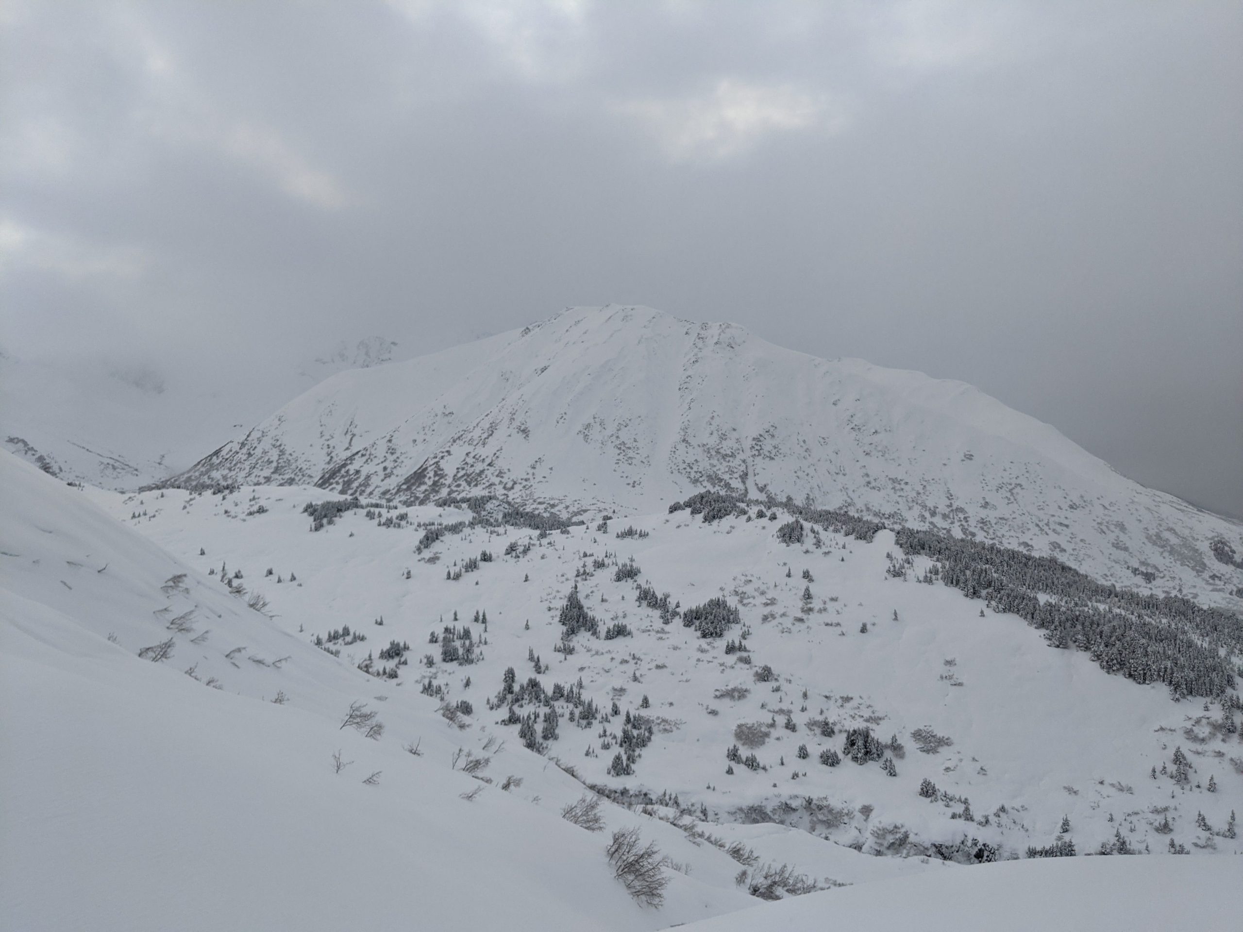
 Recent wind scouring with rocks exposed on ridge features along north face of Sunburst from strong winds in early morning hours of 11.30.21


 Avalanche on facets over Halloween crust with wide propagation between chair 4 and chair 6 at Alyeska. Avalanche was triggered during control work. Photo: Alyeska Ski Patrol 11.30.21