Turnagain Pass
|
|
This update comes in the middle of a spell of quiet weather, which is expected to persist for a few more days before an upper level high pressure ridge moves out of the area, giving way to more active weather later in the week. For now, there are two main things to watch for if you plan to travel in the mountains.
Wind Slabs: Yesterday we found a widespread layer of surface hoar on the snow surface (more details here) all the way from the highway to the ridgetop. Sunday’s storm finished warm and left a thin crust up to around 3000′ just below the surface. With the clear skies we’ve had since then, that crust has already started to turn into facets, leaving plenty of snow on the surface to be blown around. Winds increased slightly yesterday afternoon and are expected to blow 10-20 mph out of the east through tomorrow. This will likely build fresh wind slabs on top of a weak layer- the perfect combination for an avalanche. Be on the lookout for active wind loading, and watch for signs like shooting cracks and fresh avalanche activity as a warning that a person could trigger an avalanche.
The October facet layer on the ground is a tricky one. It is showing signs of gaining strength in our snowpits (details here and here). On the other hand, we saw another round of big avalanches failing on the ground after last Sunday’s storm (details). Without another round of loading, it seems unlikely for a person to trigger an avalanche on this layer, but we are still working with limited info and trying to figure out how reactive this layer is.
Observations are starting to trickle in from Summit Lake, and signs are pointing to a thin snowpack with weak snow at the bottom. Skiers reported poor stability test results and multiple collapses at Manitoba yesterday (details here), and there was a large natural avalanche on Butch that failed near the ground after Sunday’s storm. Keep this poor structure in mind if you are thinking about checking out the Summit area.
Weather Outlook: It is looking like we have a few more days of quiet weather before things pick up later in the week. Highs today and tomorrow are looking to be in the mid to upper 30’s F, with easterly winds at 10-20 mph. High clouds today will bring a chance for some light precipitation today, and with the rain line all the way up at 4000′ this would unfortunately mean drizzle for most of the advisory area. Be on the lookout for a change in the pattern starting Friday night, as the high pressure ridge moves east and chances for precipitaiton increase. For now it is looking like any precipitation will be light, but the snow line should fall as precip picks up.
Avalanche Center Operations: One more conditions update will be issued this Saturday (11/19) with daily avalanche forecasts starting middle of next week, Thanksgiving week.
 Avalanches like this one on Seattle Ridge’s Widowmaker will be possible on slopes where winds are building fresh wind slabs on top of weak snow. Photo: Zach Behney, 11.14.2022
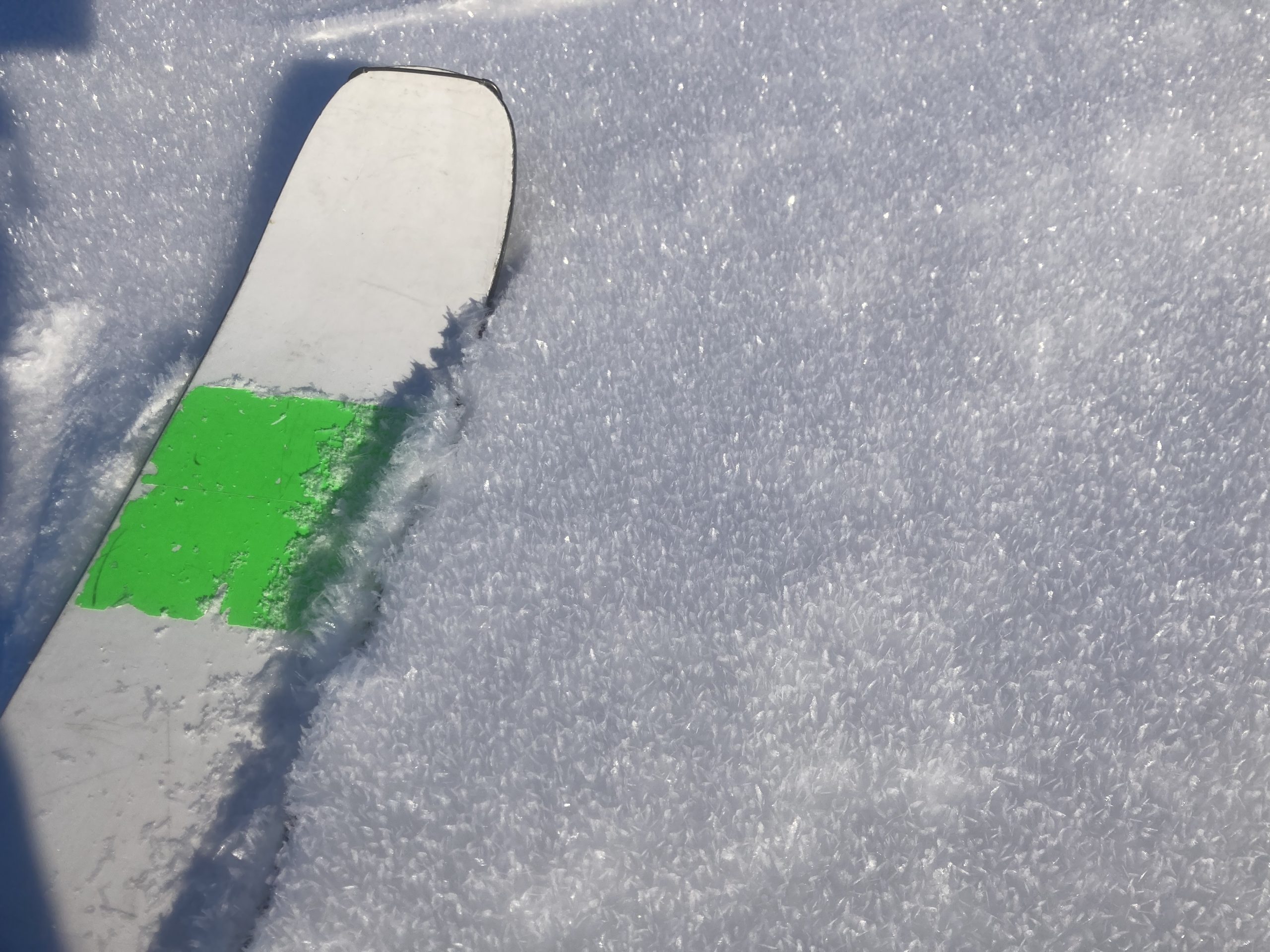 A continuous layer of surface hoar on the surface will make any fresh wind slabs a little more reactive than usual. Photo from 3600′ on Sunburst 11.15.2022.
 Recent avalanches like this one on Pastoral serve as a reminder that the October facet layer is still lurking down there on some slopes. 11.15.2022
Click this link if the video below doesn’t load in your browser.
Apply for a scholarship!
