Turnagain Pass
|
|
Weekend Update: A warm storm is impacting our forecast area with strong winds at upper elevations, averaging 30-45 mph with gusts to 70 mph overnight, and rain up to 1500′. Unfortunately the snow line is expected to remain at 1500 – 2200′ throughout the weekend. Storm totals from Friday Nov 11th at 6am to Saturday Nov 12th at 6am throughout the forecast area:
- Turnagain Pass: 0.3″ of water
- Girdwood: 1.1″ of water
- Portage: 3″ of water
Another 0.75 – 1.5″ of water is forecast for Saturday and Sunday in Turnagain Pass and Girdwood. Portage and more coastal areas could see an additional 1 – 3″ of water over the weekend. Keep in mind these are water totals and you can roughly translate 1″ of water to a similar load on the snowpack as 12″ of average density snow. This amounts to a significant load on the snowpack!
If you decide to brave the stormy weather be aware that a layer of faceted snow about 5-10 cm thick on the ground has been producing fairly large and well connected avalanches (see ob here). On Tincan yesterday we were surprised at how reactive this layer was in our snowpit tests. As this storm adds more load to the snowpack it is possible that we could see large natural or human triggered avalanches releasing on this layer.
The strong winds association with the storm will also make wind slabs likely at higher elevations where the snow remains dry and can be easily transported. Keep an eye out for shooting cracks on wind loaded features in the upper treeline and alpine elevations as a sign of reactive wind slabs.
After this storm passes the weather is forecast to be less active during the week. We plan to issue another update middle of next week to report on the developing conditions. Daily avalanche forecasts are scheduled to begin Thanksgiving week.
 Snowpack structure at treeline on Tincan. Photo 11.11.22
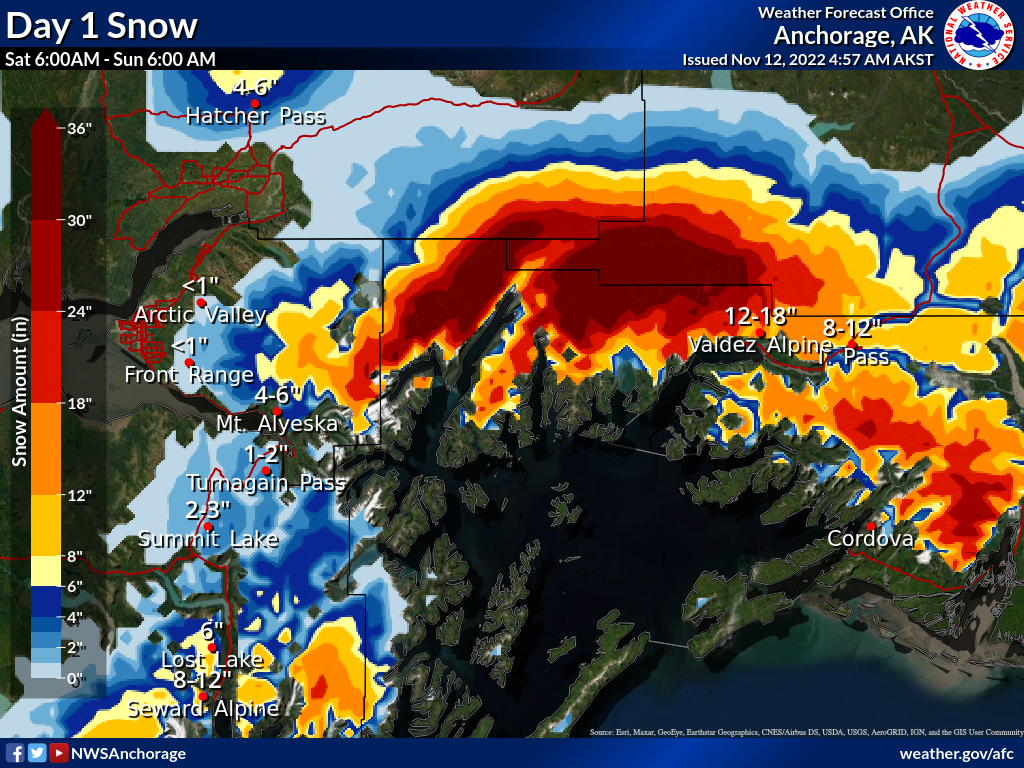 Snowfall totals for Saturday Nov 12th. Graphic courtesy of NWS Anchorage 11.12.22
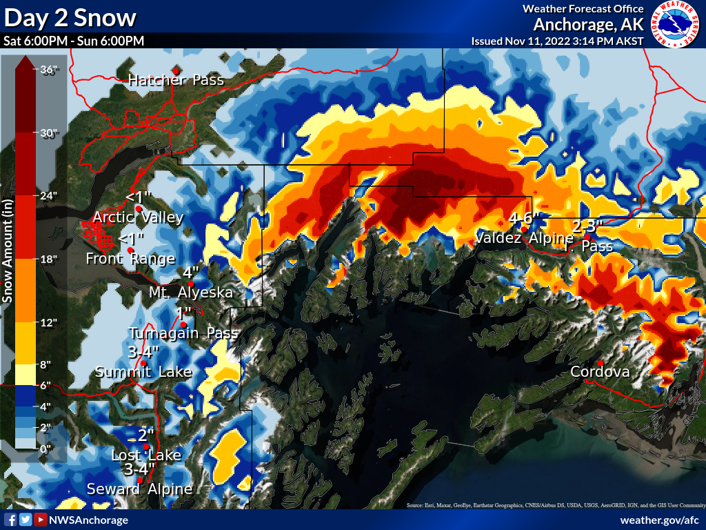 Snowfall totals for Sunday Nov 13th. Graphic courtesy of NWS Anchorage 11.12.22