Turnagain Pass
|
![]() ![]() |
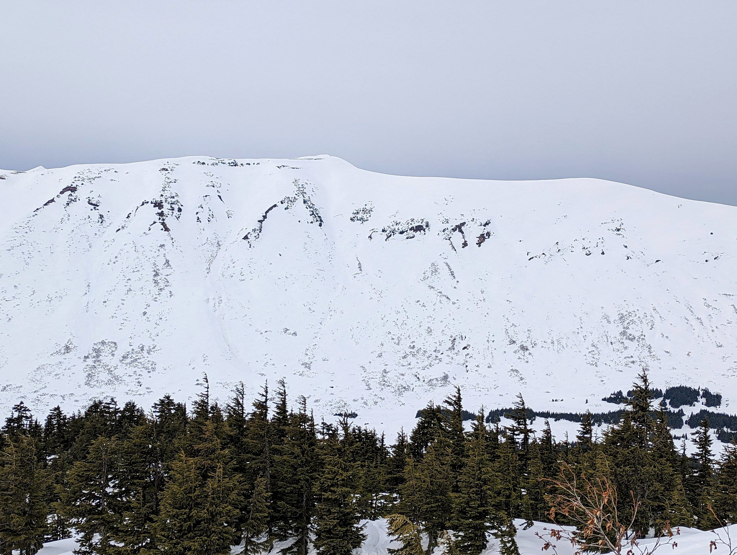
The avalanche danger will start out MODERATE and rise to CONSIDERABLE above 2500′ as strong winds pick up this afternoon. On northerly aspects there is a buried weak layer of facets about 1-2′ deep that could become more sensitive to human triggers in areas being actively wind loaded. From 2500′ to 1000′ the avalanche danger is MODERATE. Temperatures reaching into the 40s F today combined with potential for rain up to 1300′ this evening will make wet loose avalanches likely. Below 1000′ the avalanche danger is LOW.
PORTAGE VALLEY: Avalanches failing at mid and upper elevations often impact the low-elevation hiking trails in the spring. Be aware of this overhead hazard even if you are not trying to get up high into the mountains.
End of season operations: This is the final advisory for the 2022/23 winter season. We will continue to issue periodic snowpack updates for the following week as active weather continues, and will post our final springtime tips at the end of the week.
![]() |
![]() |
![]() |
![]() |
![]() |
|
Travel Advice | Generally safe avalanche conditions. Watch for unstable snow on isolated terrain features. | Heightened avalanche conditions on specific terrain features. Evaluate snow and terrain carefully; identify features of concern. | Dangerous avalanche conditions. Careful snowpack evaluation, cautious route-finding, and conservative decision-making essential. | Very dangerous avalanche conditions. Travel in avalanche terrain not recommended. | Extraordinarily dangerous avalanche conditions. Avoid all avalanche terrain. |
Likelihood of Avalanches | Natural and human-triggered avalanches unlikely. | Natural avalanches unlikely; human-triggered avalanches possible. | Natural avalanches possible; human-triggered avalanches likely. | Natural avalanches likely; human-triggered avalanches very likely. | Natural and human-triggered avalanches certain. |
Avalanche Size and Distribution | Small avalanches in isolated areas or extreme terrain. | Small avalanches in specific areas; or large avalanches in isolated areas. | Small avalanches in many areas; or large avalanches in specific areas; or very large avalanches in isolated areas. | Large avalanches in many areas; or very large avalanches in specific areas. | Very large avalanches in many areas. |
No recent avalanches have been observed since the two small wind slabs that Andrew reported yesterday (ob here)
Signal Word | Size (D scale) | Simple Descriptor |
Small | 1 | Unlikely to bury a person |
Large | 2 | Can bury a person |
Very Large | 3 | Can destroy a house |
Historic | 4 & 5 | Can destroy part or all of a village |
The primary concern for today is a layer of facets that exists at upper elevations on northern aspects which is buried underneath 1-2′ of storm snow from the past week. This layer has shown signs that it could produce avalanches with wider propagation based on stability tests in the past week (details here and here). Winds increasing to 30-40 mph throughout the day will start to load this weak layer again which will make triggering a persistent slab avalanche more likely in the afternoon or evening. Shallower wind slabs 6-12″ deep are also possible today in areas with dry snow on the surface that can be transported onto leeward slopes. To identify problematic areas keep an eye out for northern aspects above 2000′ that are being actively wind loaded.
Since this persistent weak layer is in the upper snowpack it is pretty accessible to test with either travelling tests, like hand pits and jumping on small test slopes, or by digging a snowpit to test the weak layer using stability tests like a compression test or extended column test. We have not seen any notable avalanche activity on this layer yet, but it could still be problematic if more cold storm systems arrive this week and add additional snow load. The combination of this weak layer 1-2′ deep and the deep persistent weak layer 3-6′ deep from mid-March are making the potential consequences of triggering an avalanche on high elevation north facing slopes much higher than a typical spring (see additional concern for more info).
The weak layer of facets is buried about 1-2′ deep on northern aspects and in this extended column test it failed both at the top and middle of the 4″ thick layer of facets. Photo 4.26.23
Signal Word | Size (D scale) | Simple Descriptor |
Small | 1 | Unlikely to bury a person |
Large | 2 | Can bury a person |
Very Large | 3 | Can destroy a house |
Historic | 4 & 5 | Can destroy part or all of a village |
The sunshine this morning combined with temperatures reaching into the 40s F at low and mid elevations and the potential for rain up to 1300′ this evening will make wet loose avalanches likely. Yesterday the surface melt freeze crust was starting to soften to the point of being unsupportable around 1-2 pm on east and south aspects and at lower elevations. Pay attention to changing conditions and increasing danger as the snow surface heats up later in the day. If you start to notice wet and sloppy snow near the surface it is time to move to shady aspects or head back to the parking lot. There is a small chance that a wet snow avalanche failing near the surface may pull out a bigger slab on its way down.
Glide Avalanches have been starting to release along south and southeast aspects of Seattle ridge as well as on the south faces of Eddies and Wolverine. Yesterday we saw a lot more glide cracks starting to open up at mid elevations on Seattle Ridge, which could be an indication that the spring shed cycle is around the corner. These can be very large and destructive avalanches when they release, so we recommend trying to avoid spending time in the runout of an open glide crack.
A handful of open glide cracks are visible mid slope on Seattle Ridge. Photo 4.29.23
A layer of facets buried 3-6′ deep that caused a series of very large avalanches over that past month and a half (details of most recent near miss here) is still a concern for isolated north facing aspects at upper elevations. This weak layer has been responsible for many close calls so far this season and the uncertainty around where it could still be possible to trigger an avalanche like this makes the consequences of seeking out steep north facing terrain much higher than a typical spring. Unfortunately, the layer is too deep to assess anymore and the only way to mitigate it is to avoid steep north facing terrain. Eventually when the winter weather yields to warmer temperatures we might see this layer become active again as a potential weak layer for wet slab avalanches.
Yesterday: Partly sunny to start then day then shifting to overcast cloud cover in the afternoon. Light winds averaging less than 5 mph. High temperatures reached the mid to upper 40s at lower elevations and stayed in the high 20s to low 30s at upper elevations. No new snowfall or rain.
Today: Sky cover is expected to start out mostly clear with clouds moving into the area in the late morning. Winds start out light before ramping up throughout the day, with averages reaching 30-40 mph by late Sunday evening. Light snowfall will accompany the increasing winds this evening and overnight into Monday, with 1-2″ expected to fall in Turnagain pass and Girdwood. Snowline will increase to 1300′ during the warmest part of the day.
Tomorrow: Winds will peak overnight Sunday then drop of slightly with sustained wind speeds of 20 mph throughout the day on Monday. An additional 1-3″ of new snow is expected from Monday morning to Tuesday morning. Snowline is expected be 700-900′ on Monday.
PRECIPITATION 24-hour data (6am – 6am)
Temp Avg (F) | Snow (in) | Water (in) | Snow Depth (in) | |
---|---|---|---|---|
Center Ridge (1880′) | 37 | 0 | 0 | 82 |
Summit Lake (1400′) | 37 | 0 | 0 | 35 |
Alyeska Mid (1700′) | 37 | 0 | 0 | 73 |
Bear Valley – Portage (132′) | 38 | 0 | 0 | – |
RIDGETOP 24-hour data (6am – 6am)
Temp Avg (F) | Wind Dir | Wind Avg (mph) | Wind Gust (mph) | |
---|---|---|---|---|
Sunburst (3812′) | 27 | WNW | 2 | 8 |
Seattle Ridge (2400′) | 31 | NW | 1 | 5 |
Date | Region | Location | Observer |
---|---|---|---|
10/27/24 | Turnagain | Observation: Tincan | Michael Kerst |
10/21/24 | Turnagain | Observation: Turnagain Pass Road Observation | Trevor Clayton |
10/19/24 | Turnagain | Observation: Tincan – Below Todds Run | Andy Moderow |
10/18/24 | Turnagain | Observation: Taylor Pass | Eli Neuffer |
10/15/24 | Turnagain | Observation: Tincan Common | John Sykes Forecaster |
10/14/24 | Turnagain | Avalanche: Tincan | CNFAC Staff |
05/13/24 | Turnagain | Observation: Eddie’s, Sunburst, Seattle, Cornbiscuit, Pete’s South | H Thamm |
05/13/24 | Turnagain | Observation: Turnagain Pass non-motorized side | Amy Holman |
05/12/24 | Turnagain | Observation: Warm up Bowl | Tony Naciuk |
05/07/24 | Turnagain | Observation: Turnagain Pass Wet Slabs | A S |
The riding areas page has moved. Please click here & update your bookmarks.
Subscribe to Turnagain Pass
Avalanche Forecast by Email