| Trigger | Unknown | Remote Trigger | Unknown |
| Avalanche Type | Unknown | Aspect | Unknown |
| Elevation | unknown | Slope Angle | unknown |
| Crown Depth | unknown | Width | unknown |
| Vertical Run | unknown |
Avalanche: Turnagain
Location: Tincan
Tincan to 2900′ (the dog leg before the final part up to Tincan Common)
Avalanche Details
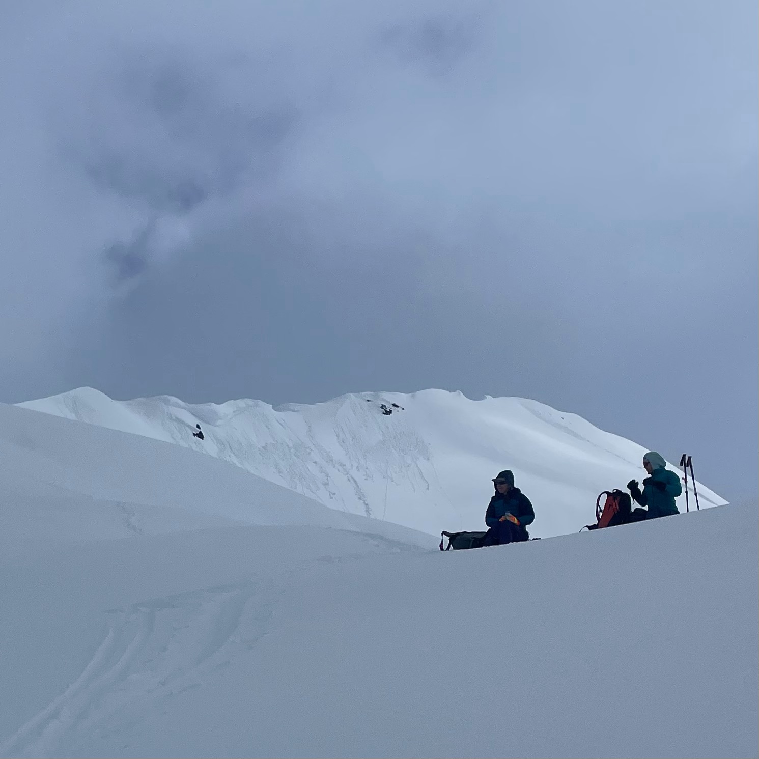
Recent wet loose avalanches from days prior and today on Seattle Ridge, D1 - 1.5 in size
Some smaller new wet loose activity on the north end of Seattle Ridge by the time we left at 2 PM, with the sun still cooking things...
Obvious signs of instability
| Recent Avalanches? | Yes |
| Collapsing (Whumphing)? | No |
| Cracking (Shooting cracks)? | No |
Observer Comments
Recent wet loose avalanches from days prior and today on Seattle Ridge, D1 - 1.5 in size
Some smaller new wet loose activity on the north end of Seattle Ridge by the time we left at 2 PM, with the sun still cooking things...
A few fairly recent glide releases, as previously reported on Eddies, and Seattle Ridge, potentially Sharks Fin as well
One small skier triggered D1 on Tincan Common face from the past two days, with the debris looking shallow and likely moist (photo below)
Weather
THE SUN WOW. 40s down low, and probably near freezing at 2900' midday.
Broken high clouds with sun casting shadows most of the morning.. moments of thicker clouds in the early afternoon.
Occasional light winds from the east.
Snow surface
A trace to 1cm of new snow overnight.
The snow surface was rapidly changing throughout the day, depending on aspect and slope angle due to the sun
At 1500' at 11 AM, a NW aspect had a 2" thick firm crust whereas a steep SE aspect had no crust and wet grains in the top 4"
Even in the morning, areas getting any sun at all - even west aspects getting just a little - were already softening
Runnels present on solar aspects below 1800', as pictured below
At our high point of 2900', a NNW feature had a fragile 1cm thick melt freeze crust from melting the day prior
Snowpack
See snowpit structure and results below from 2900', where on a northerly aspect the snowpack was dry @ 2 PM
When we descended around 2 PM (with warming/sun still ramping up after we left):
Below 1300', the recent snow was wet melt forms on solar aspects with ski penetration of 2-4"
Between 1300' - 1800', the recent snow was moist to wet melt forms below a 3-6cm breakable crust
Between 1800' - 2500', the recent snow was moist decomposing grains below a 1-3cm breakable crust
Between 2500' - 2900', a 1-3cm breakable crust was over dry recent snow. This elevation band included flat areas/generally West/NW aspect
At 2900', a thin crust from warming during the days prior was present on a NNW aspect.

Pit results from the wind loaded, NNW micro slope just before the final left hand turn up Common.
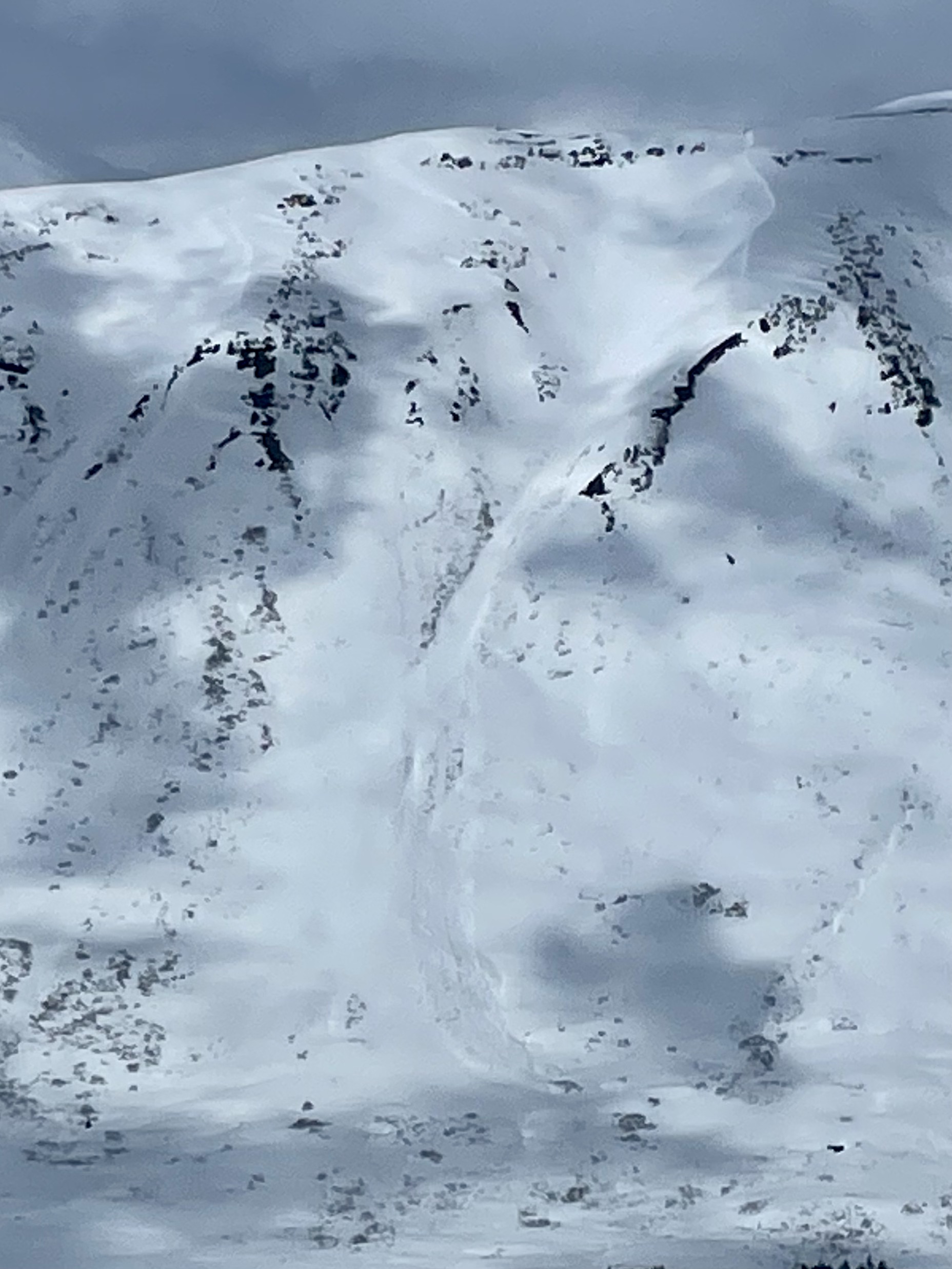
One of numerous wet loose avalanches that were present across the way on Seattle Ridge. These generally started in steep rocky areas.

Runnels at 1500' from days prior. These runnels were very pronounced on solar aspects, but weren't on northerly aspects.
Rollerballs from days prior above hippy bowl

Very shallow skier triggered D1 avalanche from days prior