Turnagain Pass RSS

Archives
ARCHIVED - Forecasts expire after 24 hours.
Issued
Thu, April 21st, 2022 - 7:00AM
Expires
Fri, April 22nd, 2022 - 7:00AM
Forecaster
John Sykes
Avalanche risk The Bottom Line

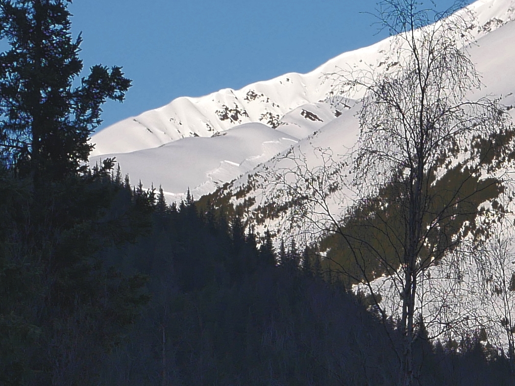
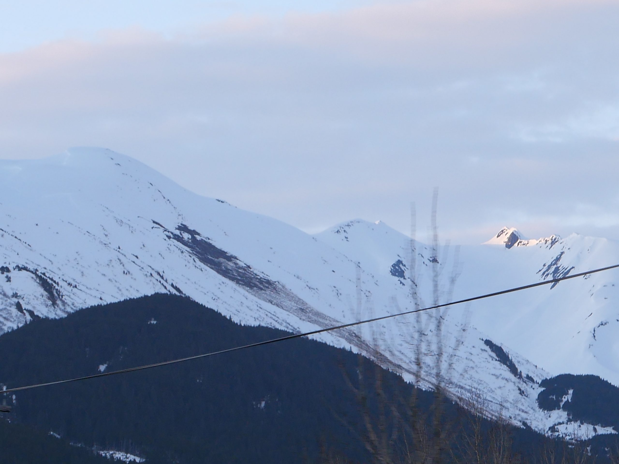
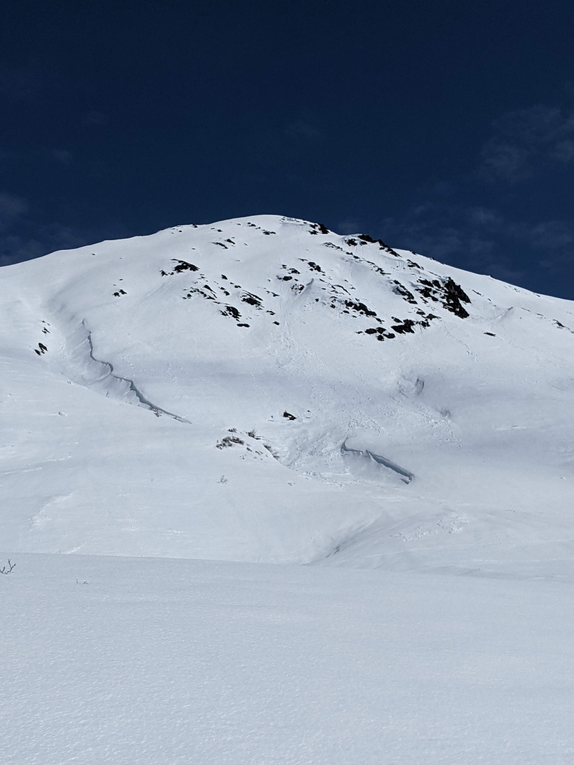
The avalanche danger will start out LOW at all elevations, but will rise to MODERATE above 2500′ this afternoon as winds pick up ahead of a storm system entering the area. In the afternoon and evening fresh wind slabs up to a foot deep are likely to build at upper elevations in shaded areas with dry snow available for wind transport. Until the winds start to increase ‘normal caution’ avalanche conditions will persist, which includes being aware of wet loose avalanches, cornice fall, and glide avalanches. Wet slab avalanches are also possible today if we get enough sun and warm temperatures to melt surface crusts.

FRIDAY AVALANCHE OUTLOOK: A storm entering the area tonight is expected to bring anywhere from 12-24″ of snowfall and strong winds from Thursday night through Saturday afternoon. We are expecting an increase in avalanche danger on Friday with the new snow and wind arriving.

Special Announcements
  • NEW Sunburst Webcam! If you have not seen the images yet, they are on the sunburst weather station page – at the bottom. Thank you to all the members and donators that made this possible through the Friend of the Chugach Avalanche Center!
  • End of Season Operations:  Forecasts will be issued on Tuesday, Thursday, Saturday and Sunday through the end of April. If a dramatic change in avalanche conditions occurs on an off day, we will provide a forecast. The final forecast will be on Saturday, April 30th.
Thu, April 21st, 2022
Alpine
Above 2,500'
2 - Moderate
Avalanche risk
Treeline
1,000'-2,500'
1 - Low
Avalanche risk
Below Treeline
Below 1,000'
1 - Low
Avalanche risk
0 - No Rating
1 - Low
2 - Moderate
3 - Considerable
4 - High
5 - Extreme
Avalanche risk Avalanche risk Avalanche risk Avalanche risk Avalanche risk
Travel Advice Generally safe avalanche conditions. Watch for unstable snow on isolated terrain features. Heightened avalanche conditions on specific terrain features. Evaluate snow and terrain carefully; identify features of concern. Dangerous avalanche conditions. Careful snowpack evaluation, cautious route-finding, and conservative decision-making essential. Very dangerous avalanche conditions. Travel in avalanche terrain not recommended. Extraordinarily dangerous avalanche conditions. Avoid all avalanche terrain.
Likelihood of Avalanches Natural and human-triggered avalanches unlikely. Natural avalanches unlikely; human-triggered avalanches possible. Natural avalanches possible; human-triggered avalanches likely. Natural avalanches likely; human-triggered avalanches very likely. Natural and human-triggered avalanches certain.
Avalanche Size and Distribution Small avalanches in isolated areas or extreme terrain. Small avalanches in specific areas; or large avalanches in isolated areas. Small avalanches in many areas; or large avalanches in specific areas; or very large avalanches in isolated areas. Large avalanches in many areas; or very large avalanches in specific areas. Very large avalanches in many areas.
Recent Avalanches
  • Gulch Creek near Hope Y: Very large avalanche observed from a distance and assumed to be a wet slab releasing on the November facets above the Halloween crust. This crown was at least 1000′ wide and estimated at 6-8′ deep (see ob here).

Crown from a very large wet slab up Gulch Creek near the Hope Y observed from the road. Photo 4.20.22

  • Crow Pass Area: Wet slab released on 4.19.22 while a group was skiing in the area. We suspect this avalanche occurred on the November facets above the Halloween crust.

Wet slab avalanche occurred after the glide avalanche had already released on a south aspect at around 3000′ near the Crow Pass trailhead.

  • Twentymile: Very large glide avalanche up Twentymile drainage observed from the highway (see ob here).

Large glide avalanche up Twentymile drainage on a south aspect. Photo 4.20.22

Avalanche Problem 1
  • Wind Slabs
    Wind Slabs
  • Certain
    Very Likely
    Likely
    Possible
    Unlikely
    Likelihood
  • Historic (D4-5)
    Very Large (D3)
    Large (D2)
    Small (D1)
    Size
Wind Slabs
Wind Slab avalanches are the release of a cohesive layer of snow (a slab) formed by the wind. Wind typically transports snow from the upwind sides of terrain features and deposits snow on the downwind side. Wind slabs are often smooth and rounded and sometimes sound hollow, and can range from soft to hard. Wind slabs that form over a persistent weak layer (surface hoar, depth hoar, or near-surface facets) may be termed Persistent Slabs or may develop into Persistent Slabs.

Likelihood of Avalanches
Terms such as "unlikely", "likely", and "certain" are used to define the scale, with the chance of triggering or observing avalanches increasing as we move up the scale. For our purposes, "Unlikely" means that few avalanches could be triggered in avalanche terrain and natural avalanches are not expected. "Certain" means that humans will be able to trigger avalanches on many slopes, and natural avalanches are expected.

Size of Avalanches
Avalanche size is defined by the largest potential avalanche, or expected range of sizes related to the problem in question. Assigned size is a qualitative estimate based on the destructive classification system and requires specialists to estimate the harm avalanches may cause to hypothetical objects located in the avalanche track (AAA 2016, CAA 2014). Under this schema, "Small" avalanches are not large enough to bury humans and are relatively harmless unless they carry people over cliffs or through trees or rocks. Moving up the scale, avalanches become "Large" enough to bury, injure, or kill people. "Very Large" avalanches may bury or destroy vehicles or houses, and "Historic" avalanches are massive events capable of altering the landscape.

Signal Word Size (D scale) Simple Descriptor
Small 1 Unlikely to bury a person
Large 2 Can bury a person
Very Large 3 Can destroy a house
Historic 4 & 5 Can destroy part or all of a village
More info at Avalanche.org

The glorious spring weather we have experienced so far this week is on it’s way out today and increasing winds and scattered snow showers are expected to impact the area starting this afternoon. The increasing winds today have the potential to build fresh wind slabs at upper elevations, especially on north facing terrain where dry snow remains on the surface and will be more prone to wind transport. Wind slabs up to a foot deep are the primary avalanche problem today and will be possible for a person to trigger along ridgelines, cross loaded gullies, and convex roll overs, but they won’t be an issue until the winds start to pick up this afternoon. Until then the same normal caution avalanche conditions we have experienced so far this week are expected throughout the first half of the day.

Cornices: The warm temperatures and sunshine this week are weakening cornices and the potential for part of a cornice to randomly fall off or be more prone for human triggering from the ridgeline exists. Be aware if cornices are getting direct sun above you and try to avoid spending too much time underneath them if that is the case. Give them a wide berth if you are travelling along ridgelines today.

Avalanche Problem 2
  • Wet Slab
    Wet Slab
  • Certain
    Very Likely
    Likely
    Possible
    Unlikely
    Likelihood
  • Historic (D4-5)
    Very Large (D3)
    Large (D2)
    Small (D1)
    Size
Wet Slab
Wet Slab avalanches are the release of a cohesive layer of snow (a slab) that is generally moist or wet when the flow of liquid water weakens the bond between the slab and the surface below (snow or ground). They often occur during prolonged warming events and/or rain-on-snow events. Wet Slabs can be very unpredictable and destructive.

Likelihood of Avalanches
Terms such as "unlikely", "likely", and "certain" are used to define the scale, with the chance of triggering or observing avalanches increasing as we move up the scale. For our purposes, "Unlikely" means that few avalanches could be triggered in avalanche terrain and natural avalanches are not expected. "Certain" means that humans will be able to trigger avalanches on many slopes, and natural avalanches are expected.

Size of Avalanches
Avalanche size is defined by the largest potential avalanche, or expected range of sizes related to the problem in question. Assigned size is a qualitative estimate based on the destructive classification system and requires specialists to estimate the harm avalanches may cause to hypothetical objects located in the avalanche track (AAA 2016, CAA 2014). Under this schema, "Small" avalanches are not large enough to bury humans and are relatively harmless unless they carry people over cliffs or through trees or rocks. Moving up the scale, avalanches become "Large" enough to bury, injure, or kill people. "Very Large" avalanches may bury or destroy vehicles or houses, and "Historic" avalanches are massive events capable of altering the landscape.

Signal Word Size (D scale) Simple Descriptor
Small 1 Unlikely to bury a person
Large 2 Can bury a person
Very Large 3 Can destroy a house
Historic 4 & 5 Can destroy part or all of a village
More info at Avalanche.org

We have received two observations of wet slab avalanches over the past two days that appear to have released in the November facets above the Halloween crust, but we have not had a close enough look to know for sure (observations here and here). These avalanches are very large and destructive and we know that this weak layer and crust combination exists throughout the region and is especially prominent in areas with a thinner overall snowpack depth (e.g. Crow Pass, Summit Lake). Wet slabs are unpredictable but require melt water pooling in a weak layer in order to release, which means they are most likely to fail during times of high melt from the sun and warm temperatures. The weather moving in today might save us from having enough melt for more wet slabs to release, but it is still important to be aware of the potential for these very large avalanches.

The best way to avoid wet slab avalanches is to pay attention to how much the surface snow is melting during the day and move to another aspect if you start sinking in more than ankle deep or start to see wet loose avalanches releasing naturally.

Wet Loose Avalanches: Depending on the timing of the wind and cloud cover moving in today there could be enough time for melt freeze crusts to soften enough to cause wet loose avalanches in steep south facing terrain. Yesterday on the south face of Cornbiscuit my boots were sinking in about ankle deep at 2 pm and the potential for wet loose off the steeper south facing rocky terrain seemed to just be starting. If the clouds move in earlier in the day or the winds pick up and keep the snow surface cool we might not see much melt on the surface crusts.

Rollerballs and wet loose avalanches on the south face of Cornbiscuit. Photo 4.20.22

Avalanche Problem 3
  • Glide Avalanches
    Glide Avalanches
  • Historic (D4-5)
    Very Large (D3)
    Large (D2)
    Small (D1)
    Size
Glide Avalanches
Glide Avalanches are the release of the entire snow cover as a result of gliding over the ground. Glide avalanches can be composed of wet, moist, or almost entirely dry snow. They typically occur in very specific paths, where the slope is steep enough and the ground surface is relatively smooth. They are often proceeded by full depth cracks (glide cracks), though the time between the appearance of a crack and an avalanche can vary between seconds and months. Glide avalanches are unlikely to be triggered by a person, are nearly impossible to forecast, and thus pose a hazard that is extremely difficult to manage.

Size of Avalanches
Avalanche size is defined by the largest potential avalanche, or expected range of sizes related to the problem in question. Assigned size is a qualitative estimate based on the destructive classification system and requires specialists to estimate the harm avalanches may cause to hypothetical objects located in the avalanche track (AAA 2016, CAA 2014). Under this schema, "Small" avalanches are not large enough to bury humans and are relatively harmless unless they carry people over cliffs or through trees or rocks. Moving up the scale, avalanches become "Large" enough to bury, injure, or kill people. "Very Large" avalanches may bury or destroy vehicles or houses, and "Historic" avalanches are massive events capable of altering the landscape.

Signal Word Size (D scale) Simple Descriptor
Small 1 Unlikely to bury a person
Large 2 Can bury a person
Very Large 3 Can destroy a house
Historic 4 & 5 Can destroy part or all of a village
More info at Avalanche.org
Glide avalanches continue to release throughout the forecast area and we need to be aware to stay out from underneath existing glide cracks. These are different from the wet slab avalanches that were discussed in problem 2, because they don't require melt water pooling in a weak layer in order to release. They can release totally randomly, regardless of the current weather or snowpack conditions. We have seen a lot of glide avalanches releasing over the past week, so please continue to be on the lookout for new glide cracks and avoid spending time underneath them. Video of glide avalanche on Seattle Ridge from 4.19.22
Weather
Thu, April 21st, 2022

Yesterday: Mostly clear skies and calm to light winds. Temperatures reached up to the low 40’s F at lower elevations and stayed in the low 30’s F to upper 20’s F at upper elevations.

Today: Clouds are expected to move into the area from the southeast today, along with precipitation in coastal areas in the afternoon and evening. Winds are also forecast to pick up this afternoon with averages of 10-25 mph by this evening and gusts up to 40 mph. Scattered showers are possible during the day producing little accumulation and snowfall in earnest is expected to start late Thursday night. Snow line should be 700-900′ on Thursday.

Tomorrow: Snowfall is expected to start overnight tonight and continue throughout the day on Friday and Saturday before tapering off Saturday evening. The most intense snowfall is forecast on Friday and storm totals from Thursday through Saturday could range from 12-24″. Snowline is expected to be between 1000-1300′ on Friday and then move up to 1500-1800′ on Saturday. Strong winds will accompany the snowfall, with averages in the 30-50 mph range at upper elevations and gusts up to 75 mph.

PRECIPITATION 24-hour data (6am – 6am)

Temp Avg (F) Snow (in) Water (in) Snow Depth (in)
Center Ridge (1880′) 34 0 0 103
Summit Lake (1400′) 30 0 0 35
Alyeska Mid (1700′) 34 0 0 NA

RIDGETOP 24-hour data (6am – 6am)

Temp Avg (F) Wind Dir Wind Avg (mph) Wind Gust (mph)
Sunburst (3812′) 25 E 5 12
Seattle Ridge (2400′) 29 SE 3 9
Observations
Recent Observations for Turnagain Pass
Date Region Location
03/27/24 Turnagain Observation: Tincan Trees
03/26/24 Turnagain Observation: Cornbiscuit
03/25/24 Turnagain Observation: Tincan
03/22/24 Turnagain Avalanche: Magnum Northwest Aspect
03/21/24 Turnagain Observation: Sunburst
03/21/24 Turnagain Observation: Tincan Proper North Aspect
03/20/24 Turnagain Avalanche: Seattle Creek Drainage
03/19/24 Turnagain Observation: Tincan CFR
03/18/24 Turnagain Avalanche: Tincan – Eddies – Seattle Ridge
03/18/24 Turnagain Observation: Tincan
Riding Areas

The riding areas page has moved. Please click here & update your bookmarks.


Subscribe to Turnagain Pass
Avalanche Forecast by Email

This is a general backcountry avalanche advisory issued for Turnagain Arm with Turnagain Pass as the core advisory area. This advisory does not apply to highways, railroads or operating ski areas.