Turnagain Pass RSS

Archives
ARCHIVED - Forecasts expire after 24 hours.
Issued
Tue, March 30th, 2021 - 7:00AM
Expires
Wed, March 31st, 2021 - 7:00AM
Forecaster
Wendy Wagner
Avalanche risk The Bottom Line

The avalanche danger is CONSIDERABLE today for how we should approach the mountains. Three large natural avalanches released yesterday just south of our forecast zone in Summit Lake, one covering the highway. Although natural avalanches are not expected today, springtime warming and this event deserves our respect for unusual avalanches this time of year.

That said, human triggered slab avalanches 1-3′ deep remain possible on slopes 35 degrees and steeper due to buried weak layers. Additionally, watch for shallow new wind slabs formed in yesterday’s 4-6″ of new snow as well as sluffs in the new snow. Slopes with recent wind loading will be the most likely places to trigger a slab avalanche. Pay attention to signs of unstable snow and any warming on the snow surface that may occur this afternoon.

SUMMIT LAKE/LOST LAKE/SEWARD:  Increased avalanche danger exists in areas south of the forecast zone. Warmer temperatures in this area may be playing a role in creating unstable snow. Extra caution is warranted by staying off of and out from under avalanche terrain.

Special Announcements

Heavy snowfall and dangerous avalanche conditions exist at Hatcher Pass. Please see HPAC’s avalanche advisory updated yesterday.

Region-wide: Warmer springtime temperatures with snowfall and winds are increasing avalanche hazard in many parts of Southcentral Alaska currently. Remember, most natural avalanches occur not only during stormy weather but also during warm afternoons/evenings.

Tue, March 30th, 2021
Alpine
Above 2,500'
3 - Considerable
Avalanche risk
Treeline
1,000'-2,500'
3 - Considerable
Avalanche risk
Below Treeline
Below 1,000'
3 - Considerable
Avalanche risk
0 - No Rating
1 - Low
2 - Moderate
3 - Considerable
4 - High
5 - Extreme
Avalanche risk Avalanche risk Avalanche risk Avalanche risk Avalanche risk
Travel Advice Generally safe avalanche conditions. Watch for unstable snow on isolated terrain features. Heightened avalanche conditions on specific terrain features. Evaluate snow and terrain carefully; identify features of concern. Dangerous avalanche conditions. Careful snowpack evaluation, cautious route-finding, and conservative decision-making essential. Very dangerous avalanche conditions. Travel in avalanche terrain not recommended. Extraordinarily dangerous avalanche conditions. Avoid all avalanche terrain.
Likelihood of Avalanches Natural and human-triggered avalanches unlikely. Natural avalanches unlikely; human-triggered avalanches possible. Natural avalanches possible; human-triggered avalanches likely. Natural avalanches likely; human-triggered avalanches very likely. Natural and human-triggered avalanches certain.
Avalanche Size and Distribution Small avalanches in isolated areas or extreme terrain. Small avalanches in specific areas; or large avalanches in isolated areas. Small avalanches in many areas; or large avalanches in specific areas; or very large avalanches in isolated areas. Large avalanches in many areas; or very large avalanches in specific areas. Very large avalanches in many areas.
Recent Avalanches

As seen in last night’s news, debris from a natural avalanche in Summit Lake covered both lanes of the Seward Highway near Mile Post 45 around 4pm yesterday. One vehicle was pushed to the side of road in the moving debris. This avalanche was one of three naturals that occurred off of Summit Mountain on an ESE aspect with start zones around 3,500′; the other two slides did not run to the road. Due to poor visibility and not being able to see the slopes above, we have little information as to the character of the slides at this time.

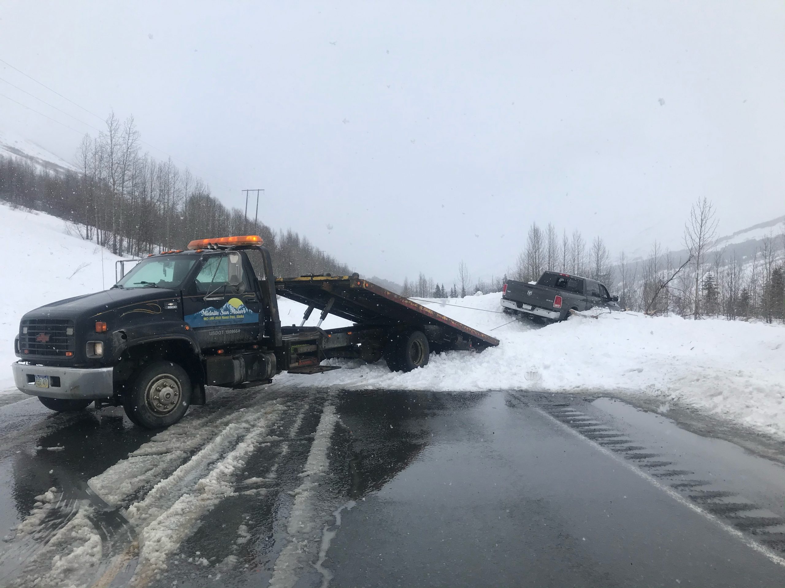
Natural avalanche in Summit Lake (MP 45 Seward Highway). 3.30.21.


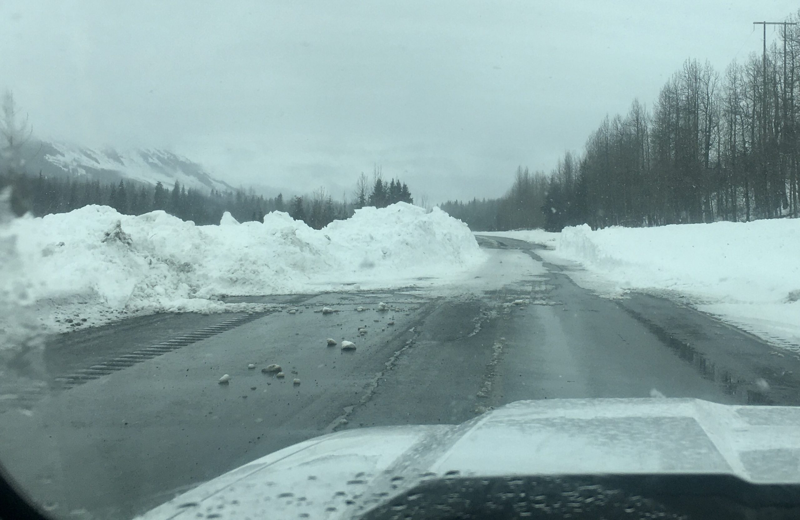
Debris from slide on the road was around 4-6′ deep and covered around a 100′ stretch.

Avalanche Problem 1
  • Persistent Slabs
    Persistent Slabs
  • Certain
    Very Likely
    Likely
    Possible
    Unlikely
    Likelihood
  • Historic (D4-5)
    Very Large (D3)
    Large (D2)
    Small (D1)
    Size
Persistent Slabs
Persistent Slab avalanches are the release of a cohesive layer of snow (a slab) in the middle to upper snowpack, when the bond to an underlying persistent weak layer breaks. Persistent layers include: surface hoar, depth hoar, near-surface facets, or faceted snow. Persistent weak layers can continue to produce avalanches for days, weeks or even months, making them especially dangerous and tricky. As additional snow and wind events build a thicker slab on top of the persistent weak layer, this avalanche problem may develop into a Deep Persistent Slab.

Likelihood of Avalanches
Terms such as "unlikely", "likely", and "certain" are used to define the scale, with the chance of triggering or observing avalanches increasing as we move up the scale. For our purposes, "Unlikely" means that few avalanches could be triggered in avalanche terrain and natural avalanches are not expected. "Certain" means that humans will be able to trigger avalanches on many slopes, and natural avalanches are expected.

Size of Avalanches
Avalanche size is defined by the largest potential avalanche, or expected range of sizes related to the problem in question. Assigned size is a qualitative estimate based on the destructive classification system and requires specialists to estimate the harm avalanches may cause to hypothetical objects located in the avalanche track (AAA 2016, CAA 2014). Under this schema, "Small" avalanches are not large enough to bury humans and are relatively harmless unless they carry people over cliffs or through trees or rocks. Moving up the scale, avalanches become "Large" enough to bury, injure, or kill people. "Very Large" avalanches may bury or destroy vehicles or houses, and "Historic" avalanches are massive events capable of altering the landscape.

Signal Word Size (D scale) Simple Descriptor
Small 1 Unlikely to bury a person
Large 2 Can bury a person
Very Large 3 Can destroy a house
Historic 4 & 5 Can destroy part or all of a village
More info at Avalanche.org

It’s definitely springtime and with that longer days and warmer temperatures. The snowpack can react in wild ways and yesterday’s natural avalanches have us on guard. This is the number one Red Flag for avalanche potential. With similar, but slightly warmer, weather today, we have to be extra cautious. Triggering an avalanche is still in the ‘possible’ category, which fits a MODERATE danger. What fits CONSIDERABLE is the travel advice on the Danger Scale, ‘cautious route-finding and conservative decision-making’. Poor visibility will likely keep many of us out of larger terrain, but avoiding being under large slopes and sticking to smaller terrain and low angle slopes, under 35 degrees, is just a good bet today.

Snowfall yesterday brought around 4″ of moist snow to the mid elevations and possibly up to 6″ at the high elevations. Precipitation has decreased this morning but may set back in later today with another inch or two. The winds have been steady from a southerly direction in the 5-15mph range with stronger gusts and these are forecast to decrease through the day.

Persistent Slabs:  As Aleph described yesterday, wind slabs keep developing over facets or buried surface hoar (persistent weak layers) that have transitioned into persistent slabs as they linger. These are now covered with 4″ or so of new snow and possibly some shallow new wind slabs. Every so often, and what is likely the culprit in the Summit Lake avalanches, is these weak layer(s) fail and produce an avalanche. This remains our concern for people venturing onto steeper slopes. There is a weak layer about a foot down that seems to be our current issue.  The natural avalanches on Raggedtop and the skier triggered slab on Tri Tip last week are the most recent human triggered avalanches. Be on the lookout for areas with previously wind-loaded snow and those with any new wind-loading. The most suspect terrain will likely be at upper and mid elevations, immediately below ridgelines, in cross-loaded gullies, and below convexities.

Wind Slabs:  Watch for new small wind slabs in the 6-8″ range. These are most likely to be found in the higher terrain along ridgelines where the southerly winds blew enough to move the new snow.

Loose snow avalanches: Expect sluffs on steep slopes in the new snow as well the older loose snow that escaped last weekend’s winds. Wet sluffs are likely in the mid and lower elevations in the new snow as the day warms up. The south slopes may run further as old sun crusts sit under the new snow. While it is unlikely these loose snow avalanches will be big enough to bury you, they can be dangerous if they drag you into terrain traps like cliffs, trees, rocks, or gullies.

Weather
Tue, March 30th, 2021

Yesterday:  Cloudy skies and light snowfall was over the area. Mid elevations weather stations picked up 4″ of moist snow pretty consistently and there could be up to 6″ of drier snow in the higher terrain. Ridgetop winds were southerly in the 10-15mph with stronger gusts. Temperatures were hovering in the low 20’sF along ridgetops and rose to the low 30’sF at the mid elevations.

Today:  Cloudy skies with another pulse of moisture late this afternoon/evening is forecast. A trace to 2″ is expected with a rain/snow line around sea level. Ridgetop winds should decrease from the south through the day (5-10mph) before switching northwest tonight and picking up to 10-15mph. Temperatures should stay in the low 20’sF along ridgelines and near 32F at 1,000′.

Tomorrow:  Skies should begin to clear tomorrow with cooler northwest winds over the region. These winds look to be 10-20mph along ridgelines through the day before easing off Thursday. Temperatures look to dip back to the low teens in the higher terrain and daytime warming should rise mid elevations into the 30’sF.

PRECIPITATION 24-hour data (6am – 6am)

Temp Avg (F) Snow (in) Water (in) Snow Depth (in)
Center Ridge (1880′) 28 4 0.4 114
Summit Lake (1400′) 29 4 0.3 52
Alyeska Mid (1700′) 27 4 0.4 121

RIDGETOP 24-hour data (6am – 6am)

Temp Avg (F) Wind Dir Wind Avg (mph) Wind Gust (mph)
Sunburst (3812′) 20 S 10 27
Seattle Ridge (2400′) 22 SE 10 14
Observations
Recent Observations for Turnagain Pass
Date Region Location
04/23/24 Turnagain Observation: Turnagain Sunny Side
04/21/24 Turnagain Observation: Bertha Creek
04/20/24 Turnagain Avalanche: Spokane Creek
04/16/24 Turnagain Observation: Cornbiscuit
04/15/24 Turnagain Observation: Taylor Pass
04/15/24 Turnagain Observation: Seward Highway – Tern Lake to Portage
04/14/24 Turnagain Observation: Sunburst
04/14/24 Turnagain Observation: Turnagain Pass Snomo
04/13/24 Turnagain Observation: Spokane Creek
04/11/24 Turnagain Observation: Tincan
Riding Areas

The riding areas page has moved. Please click here & update your bookmarks.


Subscribe to Turnagain Pass
Avalanche Forecast by Email

This is a general backcountry avalanche advisory issued for Turnagain Arm with Turnagain Pass as the core advisory area. This advisory does not apply to highways, railroads or operating ski areas.