Turnagain Pass RSS

Archives
ARCHIVED - Forecasts expire after 24 hours.
Issued
Sat, March 26th, 2022 - 7:00AM
Expires
Sun, March 27th, 2022 - 7:00AM
Forecaster
John Sykes
Avalanche Warning
Issued: March 26, 2022 6:00 am
Travel in avalanche terrain is not recommended. Avoid being on or beneath all steep slopes.
Avalanche risk The Bottom Line

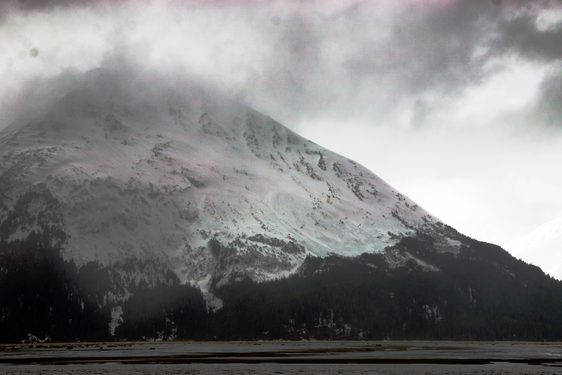
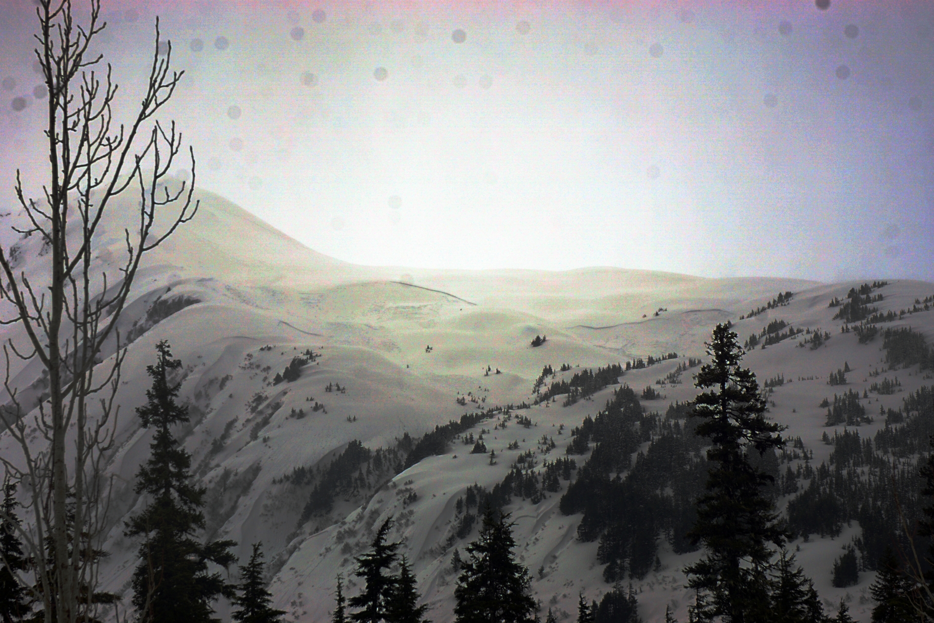
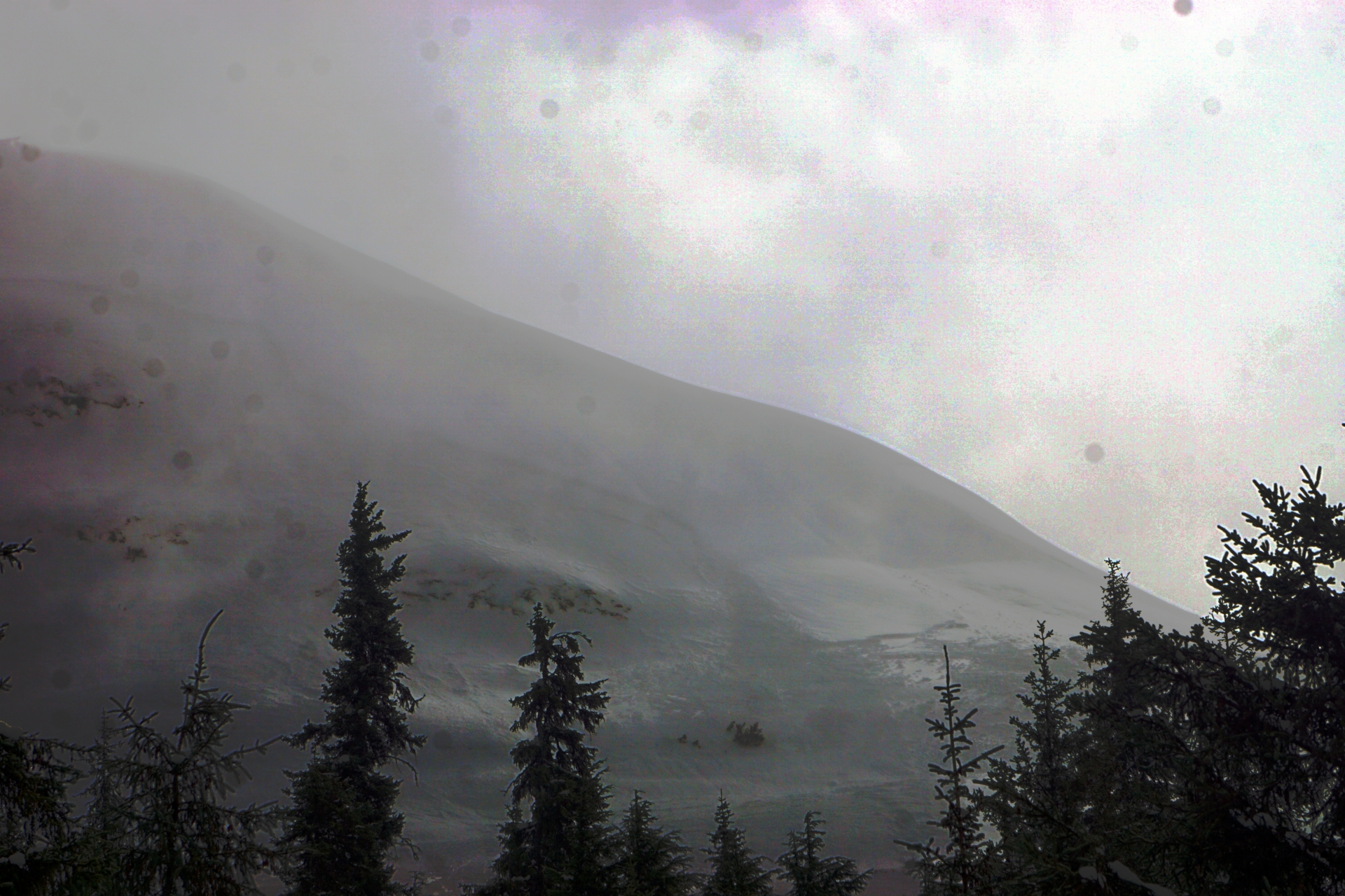
The avalanche danger remains HIGH at all elevations today and an AVALANCHE WARNING has been issued through 6 pm Saturday, March 26th. Over the past three days the forecast area has received roughly 3.5 to 5.5′ (yes, feet) of new snow with strong winds averaging 20-40 mph and gusts up to 80 mph. We recommend avoiding all avalanche terrain and any areas that are within the runout of avalanche terrain. The avalanche conditions are very dangerous right now and unless you are very confident that you can avoid being exposed to overhead hazards I would recommend not going into the backcountry today. We have multiple layers of buried surface hoar in the snowpack that could produce very large avalanches with the potential to runout much further than normal.

SUMMIT LAKE: Despite receiving less snowfall compared to Turnagain Pass, the avalanche conditions at Summit Lake are also very dangerous due to a weaker overall snowpack. Very large avalanches releasing on buried weak layers are likely due to the new snow and wind loading over the past several days.

SEWARD/LOST LAKE/SNUG HARBOR: The recent storm has impacted areas across the Kenai Peninsula creating dangerous avalanche conditions due to new snow and strong winds. Very conservative decision-making is recommended in all areas and some patience in required to allow the snowpack to adjust to the new load before entering avalanche terrain.

Special Announcements
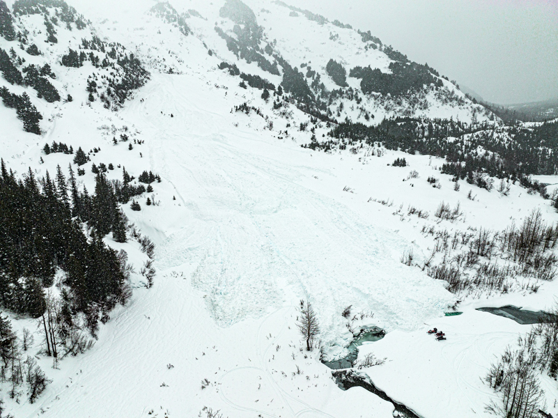
  • Chugach State Park: A very large natural avalanche struck Highland road in South Fork of Eagle River yesterday and clean up crews will likely be operating in the area for several days. Dangerous avalanche conditions exist throughout the area due to a weak snowpack and recent wind loading.
Sat, March 26th, 2022
Alpine
Above 2,500'
4 - High
Avalanche risk
Treeline
1,000'-2,500'
4 - High
Avalanche risk
Below Treeline
Below 1,000'
4 - High
Avalanche risk
0 - No Rating
1 - Low
2 - Moderate
3 - Considerable
4 - High
5 - Extreme
Avalanche risk Avalanche risk Avalanche risk Avalanche risk Avalanche risk
Travel Advice Generally safe avalanche conditions. Watch for unstable snow on isolated terrain features. Heightened avalanche conditions on specific terrain features. Evaluate snow and terrain carefully; identify features of concern. Dangerous avalanche conditions. Careful snowpack evaluation, cautious route-finding, and conservative decision-making essential. Very dangerous avalanche conditions. Travel in avalanche terrain not recommended. Extraordinarily dangerous avalanche conditions. Avoid all avalanche terrain.
Likelihood of Avalanches Natural and human-triggered avalanches unlikely. Natural avalanches unlikely; human-triggered avalanches possible. Natural avalanches possible; human-triggered avalanches likely. Natural avalanches likely; human-triggered avalanches very likely. Natural and human-triggered avalanches certain.
Avalanche Size and Distribution Small avalanches in isolated areas or extreme terrain. Small avalanches in specific areas; or large avalanches in isolated areas. Small avalanches in many areas; or large avalanches in specific areas; or very large avalanches in isolated areas. Large avalanches in many areas; or very large avalanches in specific areas. Very large avalanches in many areas.
Recent Avalanches

We saw too many avalanches yesterday to record them all here. I have focused on the largest and most significant avalanches that have been observed in the past 24 hours and will link to relevant observations for those who want to dig into the details. (Turnagain road obs, Summit road obs, Magnum, Manitoba)

  • Kern – Multiple large avalanches came down onto the railroad tracks during avalanche mitigation work yesterday morning.

Avalanche debris crossing the railroad tracks near Kern Creek after the avalanche mitigation work. Photo 3.25.22

  • Pyramid – Large debris piles at the base of E and N face of Pyramid visible during brief clearing yesterday.

Large debris piles at the base of N face of Pyramid, the crown is not visible due to clouds at upper elevations. Photo 3.25.22

  • Eddies – Multiple large avalanches in N bowl of Eddies with wide propagation on all features steep enough to avalanche. We also saw several avalanches on the W face of Eddies with one very large avalanche on the lookers lower right side of the W face.

Wide propagating and large avalanches on N bowl of Eddies at 2000-2500′, there were also some smaller avalanches in the steep gullies on the N face. Photo 3.25.22


W face of Eddies with a small crown in the foreground and very large crown along the skyline in the photo which encompassed the entire lookers lower right face of Eddies. Photo 3.25.22

  • Magnum – We never got good enough light to get an accurate sense of the size of the avalanche on W face of Magnum, but based on the debris it is possible that a large avalanche propagated across most of the W face with debris running midway into the alder covered runout zone below. (see photo Magnum)
  • Lipps – This is the largest avalanche we saw, propagating across the entire W face of Lipps around the corner onto the S face. The avalanche took out the normal skin track and we estimated the width at 1500-2000′ with a crown depth of 3-6′. Unfortunately the light was not great so the photos do not do the avalanche justice. Hopefully we get some decent visibility so someone can get a better photo of the avalanche before the next storm comes in and buries the crown. (additional photo Turnagain road obs)

Part of the crown on W face of Lipps, which came down around the low angle terrain in the middle right of this photo and then back up and around the corner onto the S face. Photo 3.25.22

  • Pete’s South – It appears that the entire S face of Pete’s south avalanched, with debris across the face down to 1000-1500′. We could see the crown along the upper ridgeline during a breif clearing but it was already mostly filled in with wind loaded snow. A group travelling up Johnson Pass sent in this photo from the debris at the base of Pete’s South.

Debris from part of the Pete’s S avalanche that ran to the creek bottom and reportedly had large trees within the debris. Photo from Anonymous 3.25.22

Avalanche Problem 1
  • Storm Slabs
    Storm Slabs
  • Certain
    Very Likely
    Likely
    Possible
    Unlikely
    Likelihood
  • Historic (D4-5)
    Very Large (D3)
    Large (D2)
    Small (D1)
    Size
Storm Slabs
Storm Slab avalanches are the release of a cohesive layer (a slab) of new snow that breaks within new snow or on the old snow surface. Storm-slabs typically last between a few hours and few days (following snowfall). Storm-slabs that form over a persistent weak layer (surface hoar, depth hoar, or near-surface facets) may be termed Persistent Slabs or may develop into Persistent Slabs.

Likelihood of Avalanches
Terms such as "unlikely", "likely", and "certain" are used to define the scale, with the chance of triggering or observing avalanches increasing as we move up the scale. For our purposes, "Unlikely" means that few avalanches could be triggered in avalanche terrain and natural avalanches are not expected. "Certain" means that humans will be able to trigger avalanches on many slopes, and natural avalanches are expected.

Size of Avalanches
Avalanche size is defined by the largest potential avalanche, or expected range of sizes related to the problem in question. Assigned size is a qualitative estimate based on the destructive classification system and requires specialists to estimate the harm avalanches may cause to hypothetical objects located in the avalanche track (AAA 2016, CAA 2014). Under this schema, "Small" avalanches are not large enough to bury humans and are relatively harmless unless they carry people over cliffs or through trees or rocks. Moving up the scale, avalanches become "Large" enough to bury, injure, or kill people. "Very Large" avalanches may bury or destroy vehicles or houses, and "Historic" avalanches are massive events capable of altering the landscape.

Signal Word Size (D scale) Simple Descriptor
Small 1 Unlikely to bury a person
Large 2 Can bury a person
Very Large 3 Can destroy a house
Historic 4 & 5 Can destroy part or all of a village
More info at Avalanche.org

The March madness continues with another 1.4″ of SWE at Turnagain Pass which should translate to 12-18″ of new snow in the past 24 hours at upper elevations. Girdwood is showing slightly less SWE at comparable elevation, but the upper elevation weather station at Alyeska is reporting 1.8″ of SWE which should be 15-18″ of new snow at upper elevations. The storm total snowfall estimates at 2,500′ beginning Wednesday to 6am Saturday are:

Girdwood Valley:   40-60″ snow, 4.7″ water equivalent
Turnagain Pass:   40-66″ snow,  5.0″ water equivalent
Summit lake:    15-20″ snow, 1.5″ water equivalent*

*SNOTEL seems to be under reporting, these estimated totals for Summit are based on this observation

All this new snow is accompanied by strong winds at upper elevations with averages of 15-40 mph and gusts up to 70 mph, which are actively transporting snow. Overall, the message is clear; avoid all avalanche terrain and give the snowpack time to adjust to this large new load. That includes runout zones from overhead avalanche paths. Yesterday was the first time I have ever decided not to get out of the car and ski Tincan trees because of the potential for avalanches. I know this terrain seems benign, and 99% of the time it is, but with the amount of new snow we have received and the potential for wide propagation, remote triggering, and avalanches on low angle slopes due to the layers of buried surface hoar there are real hazards in this type of terrain right now. Even small terrain features could produce avalanches large enough to bury a person right now especially if there is any kind of terrain trap below.


Avalanche Problem 2
  • Persistent Slabs
    Persistent Slabs
  • Certain
    Very Likely
    Likely
    Possible
    Unlikely
    Likelihood
  • Historic (D4-5)
    Very Large (D3)
    Large (D2)
    Small (D1)
    Size
Persistent Slabs
Persistent Slab avalanches are the release of a cohesive layer of snow (a slab) in the middle to upper snowpack, when the bond to an underlying persistent weak layer breaks. Persistent layers include: surface hoar, depth hoar, near-surface facets, or faceted snow. Persistent weak layers can continue to produce avalanches for days, weeks or even months, making them especially dangerous and tricky. As additional snow and wind events build a thicker slab on top of the persistent weak layer, this avalanche problem may develop into a Deep Persistent Slab.

Likelihood of Avalanches
Terms such as "unlikely", "likely", and "certain" are used to define the scale, with the chance of triggering or observing avalanches increasing as we move up the scale. For our purposes, "Unlikely" means that few avalanches could be triggered in avalanche terrain and natural avalanches are not expected. "Certain" means that humans will be able to trigger avalanches on many slopes, and natural avalanches are expected.

Size of Avalanches
Avalanche size is defined by the largest potential avalanche, or expected range of sizes related to the problem in question. Assigned size is a qualitative estimate based on the destructive classification system and requires specialists to estimate the harm avalanches may cause to hypothetical objects located in the avalanche track (AAA 2016, CAA 2014). Under this schema, "Small" avalanches are not large enough to bury humans and are relatively harmless unless they carry people over cliffs or through trees or rocks. Moving up the scale, avalanches become "Large" enough to bury, injure, or kill people. "Very Large" avalanches may bury or destroy vehicles or houses, and "Historic" avalanches are massive events capable of altering the landscape.

Signal Word Size (D scale) Simple Descriptor
Small 1 Unlikely to bury a person
Large 2 Can bury a person
Very Large 3 Can destroy a house
Historic 4 & 5 Can destroy part or all of a village
More info at Avalanche.org

The message is simple right now, do not enter avalanche terrain or areas exposed to the runout zone of avalanche terrain. It is not worth the risk of being involved an avalanche of the size we have observed across the forecast area in the past 24 hours. Driving through Turnagain Pass yesterday we saw very large avalanches with wide propagation on relatively low angle terrain in many locations. It is a pretty safe guess that one of the three layers of buried surface hoar currently residing in our snowpack are the culprit for most of these avalanches. The potential for triggering very large avalanches still exists today and due to the persistent nature of these weak layers it will take time for them to adapt to the new snow load before it becomes safe to travel in the mountains again. Unfortunately, it looks like another storm is coming on Sunday afternoon which will create dangerous avalanche conditions again. Please be patient and give the mountains time to settle down before venturing out.

A layer of buried surface hoar in a snowpit from the Summit Lake area. Photo Andy Moderow 3.25.22 

Weather
Sat, March 26th, 2022

Yesterday: Mostly overcast with precipitation throughout the day but brief periods of broken clouds and marginal visibility. Temperatures were warm, in the mid to upper 30s at road elevation and twenties at ridgetops. Winds were strong at upper elevations averaging 15 – 40 mph with gusts up to 70 mph causing widespread snow transport along upper ridgelines. Another roughly 12-16″ of snow fell at Turnagain Pass over the past 24 hours with slighly lower values in Girdwood at comparable elevation. However, the upper weather station at Alyeska is reporting almost another 2″ of SWE which could be up to 24″ of new snow in the past 24 hours.

Today: Off and on snow showers expected today with 1-3″ of snow possible and diminishing wind speeds averaging 15-25 mph at upper elevation with gusts possible to 40 mph. Cloud cover may provide a glimpse at the mountains this afternoon before the next low pressure system moves into the area on Sunday afternoon. Snow line is forecast to stay at sea level today, but with the warm temperatures we may not see snow accumulation at lower elevations.

Tomorrow: A brief lull starting Saturday afternoon will quickly transition back to active snowfall and strong winds Sunday afternoon. Another strong low pressure system is expected to impact our area Sunday night through Tuesday. Stay tuned for updates.

PRECIPITATION 24-hour data (6am – 6am)

Temp Avg (F) Snow (in) Water (in) Snow Depth (in)
Center Ridge (1880′) 32 14 1.5 129
Summit Lake (1400′) 34 0 0 43
Alyeska Mid (1700′) 33 10 0.9 NA

RIDGETOP 24-hour data (6am – 6am)

Temp Avg (F) Wind Dir Wind Avg (mph) Wind Gust (mph)
Sunburst (3812′) 22 ENE 33 83
Seattle Ridge (2400′) 26 SE 19 43
Observations
Recent Observations for Turnagain Pass
Date Region Location
03/27/24 Turnagain Observation: Tincan Trees
03/26/24 Turnagain Observation: Cornbiscuit
03/25/24 Turnagain Observation: Tincan
03/22/24 Turnagain Avalanche: Magnum Northwest Aspect
03/21/24 Turnagain Observation: Sunburst
03/21/24 Turnagain Observation: Tincan Proper North Aspect
03/20/24 Turnagain Avalanche: Seattle Creek Drainage
03/19/24 Turnagain Observation: Tincan CFR
03/18/24 Turnagain Avalanche: Tincan – Eddies – Seattle Ridge
03/18/24 Turnagain Observation: Tincan
Riding Areas

The riding areas page has moved. Please click here & update your bookmarks.


Subscribe to Turnagain Pass
Avalanche Forecast by Email

This is a general backcountry avalanche advisory issued for Turnagain Arm with Turnagain Pass as the core advisory area. This advisory does not apply to highways, railroads or operating ski areas.