Turnagain Pass RSS

Archives
ARCHIVED - Forecasts expire after 24 hours.
Issued
Fri, February 25th, 2022 - 7:00AM
Expires
Sat, February 26th, 2022 - 7:00AM
Forecaster
Andrew Schauer
Avalanche Warning
Issued: February 24, 2022 6:00 pm
Travel in avalanche terrain is not recommended. Avoid being on or beneath all steep slopes.
Avalanche risk The Bottom Line

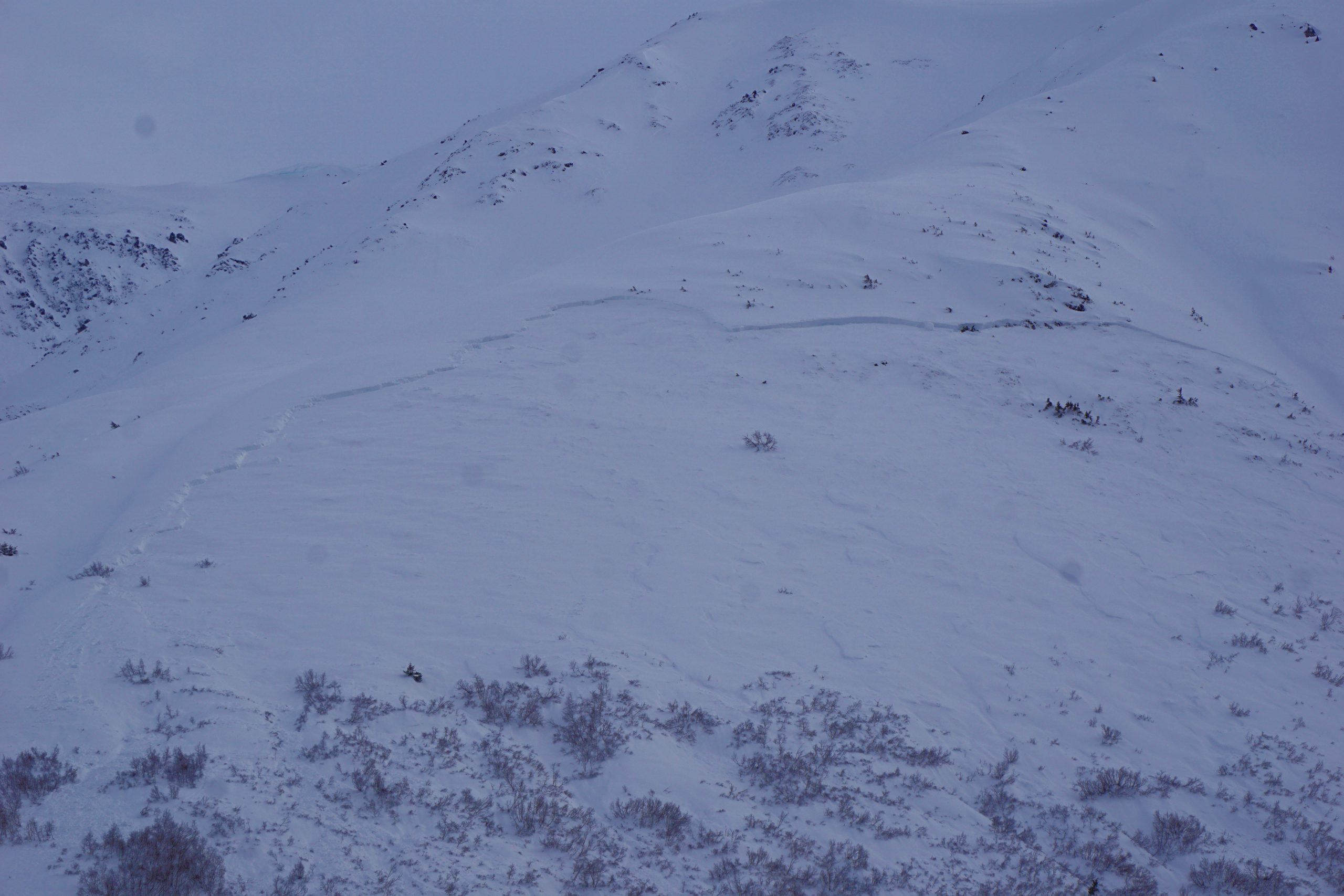
We have issued an Avalanche Warning through the National Weather Service that continues until 6 p.m. this evening. We are expecting heavy snowfall and strong winds today, which will lead to very dangerous avalanche conditions. Large natural avalanches failing 2-4′ deep or deeper in new and wind-drifted snow are likely, and some locations may see very large avalanches failing on deeper weak layers. Avalanches are expected to run long distances into valley bottoms. Travel in avalanche terrain is not recommended.

*Roof Avalanches: With warm temperatures and heavy rain at lower elevations, it is likely there will be some roof avalanches today. Keep an eye on children and pets, and be careful where you park your vehicles.

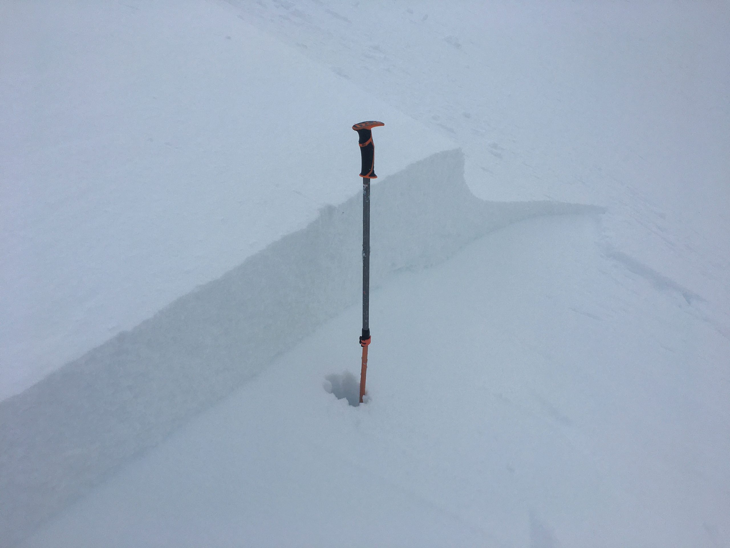
SUMMIT LAKE: There is very weak snow in the middle of the snowpack in the Summit Lake area. New snow and strong winds will load start zones and push these weak layers near their breaking point, making for dangerous avalanche conditions.

Special Announcements

The National Weather Service has issued a Special Weather Statement for western Prince William Sound including Girdwood, Whittier, Moose Pass, and Seward.

Fri, February 25th, 2022
Alpine
Above 2,500'
4 - High
Avalanche risk
Treeline
1,000'-2,500'
4 - High
Avalanche risk
Below Treeline
Below 1,000'
4 - High
Avalanche risk
0 - No Rating
1 - Low
2 - Moderate
3 - Considerable
4 - High
5 - Extreme
Avalanche risk Avalanche risk Avalanche risk Avalanche risk Avalanche risk
Travel Advice Generally safe avalanche conditions. Watch for unstable snow on isolated terrain features. Heightened avalanche conditions on specific terrain features. Evaluate snow and terrain carefully; identify features of concern. Dangerous avalanche conditions. Careful snowpack evaluation, cautious route-finding, and conservative decision-making essential. Very dangerous avalanche conditions. Travel in avalanche terrain not recommended. Extraordinarily dangerous avalanche conditions. Avoid all avalanche terrain.
Likelihood of Avalanches Natural and human-triggered avalanches unlikely. Natural avalanches unlikely; human-triggered avalanches possible. Natural avalanches possible; human-triggered avalanches likely. Natural avalanches likely; human-triggered avalanches very likely. Natural and human-triggered avalanches certain.
Avalanche Size and Distribution Small avalanches in isolated areas or extreme terrain. Small avalanches in specific areas; or large avalanches in isolated areas. Small avalanches in many areas; or large avalanches in specific areas; or very large avalanches in isolated areas. Large avalanches in many areas; or very large avalanches in specific areas. Very large avalanches in many areas.
Avalanche Problem 1
  • Storm Slabs
    Storm Slabs
  • Certain
    Very Likely
    Likely
    Possible
    Unlikely
    Likelihood
  • Historic (D4-5)
    Very Large (D3)
    Large (D2)
    Small (D1)
    Size
Storm Slabs
Storm Slab avalanches are the release of a cohesive layer (a slab) of new snow that breaks within new snow or on the old snow surface. Storm-slabs typically last between a few hours and few days (following snowfall). Storm-slabs that form over a persistent weak layer (surface hoar, depth hoar, or near-surface facets) may be termed Persistent Slabs or may develop into Persistent Slabs.

Likelihood of Avalanches
Terms such as "unlikely", "likely", and "certain" are used to define the scale, with the chance of triggering or observing avalanches increasing as we move up the scale. For our purposes, "Unlikely" means that few avalanches could be triggered in avalanche terrain and natural avalanches are not expected. "Certain" means that humans will be able to trigger avalanches on many slopes, and natural avalanches are expected.

Size of Avalanches
Avalanche size is defined by the largest potential avalanche, or expected range of sizes related to the problem in question. Assigned size is a qualitative estimate based on the destructive classification system and requires specialists to estimate the harm avalanches may cause to hypothetical objects located in the avalanche track (AAA 2016, CAA 2014). Under this schema, "Small" avalanches are not large enough to bury humans and are relatively harmless unless they carry people over cliffs or through trees or rocks. Moving up the scale, avalanches become "Large" enough to bury, injure, or kill people. "Very Large" avalanches may bury or destroy vehicles or houses, and "Historic" avalanches are massive events capable of altering the landscape.

Signal Word Size (D scale) Simple Descriptor
Small 1 Unlikely to bury a person
Large 2 Can bury a person
Very Large 3 Can destroy a house
Historic 4 & 5 Can destroy part or all of a village
More info at Avalanche.org

This storm has been slow to start, but we are still expecting a strong system to bring 1-1.5″ water to Girdwood and Turnagain Pass, with 2-3″ in the Portage and Placer Valleys. This will fall mostly as rain up to 1000-1500′, but will bring storm totals of 1-2′ to Girdwood and Turnagain Pass, and 2-3′ or more snow to Portage and Placer. Strong winds ramped up yesterday and are expected to continue through most of the day today before starting to back off this afternoon. The Sunburst weather station has been recording sustained winds of 30-50 mph for the past 24 hours, with speeds of 66-77 mph and gusts as high as 117 mph since 3 a.m. today. That same pattern is expected to continue until later this afternoon.

If this forecast verifies today, this system will be a bigger loading event than either of the systems that lead to two big avalanche cycles in the past week (check out the avalanche observations from last Friday and Tuesday for more details). These previous storm events resulted in avalanches running down to valley bottoms, putting debris on the road and dusting houses with a powder cloud. Needless to say, we are expecting very dangerous avalanche conditions if the storm delivers today. Predicted snow and wind totals mean we can see avalanches failing in new and wind-drifted snow to be 1-3′ deep in Girdwood and Turnagain Pass, and 2-6′ deep in Portage and Placer. If this new snow overloads the deeper weak layers present in some parts of our advisory area, there is a potential to see very large avalanches. More on this in Problem 2 below. Avalanches may run far into valley bottoms today, which makes any kind of travel in avalanche terrain very dangerous. For today, travel in avalanche terrain is not recommended.

The size of the avalanches we see today will depend largely on the amount of snow we get. If the storm misses us we can still expect to see dangerous conditions based on the strong winds alone, but they will not be quite as large.

Crown of a small skier-triggered wind slab avalanche in the Tincan trees yesterday. Avalanches will be bigger and more sensitive as strong winds and heavy snowfall continue today. 02.24.2022


Avalanche Problem 2
  • Persistent Slabs
    Persistent Slabs
  • Certain
    Very Likely
    Likely
    Possible
    Unlikely
    Likelihood
  • Historic (D4-5)
    Very Large (D3)
    Large (D2)
    Small (D1)
    Size
Persistent Slabs
Persistent Slab avalanches are the release of a cohesive layer of snow (a slab) in the middle to upper snowpack, when the bond to an underlying persistent weak layer breaks. Persistent layers include: surface hoar, depth hoar, near-surface facets, or faceted snow. Persistent weak layers can continue to produce avalanches for days, weeks or even months, making them especially dangerous and tricky. As additional snow and wind events build a thicker slab on top of the persistent weak layer, this avalanche problem may develop into a Deep Persistent Slab.

Likelihood of Avalanches
Terms such as "unlikely", "likely", and "certain" are used to define the scale, with the chance of triggering or observing avalanches increasing as we move up the scale. For our purposes, "Unlikely" means that few avalanches could be triggered in avalanche terrain and natural avalanches are not expected. "Certain" means that humans will be able to trigger avalanches on many slopes, and natural avalanches are expected.

Size of Avalanches
Avalanche size is defined by the largest potential avalanche, or expected range of sizes related to the problem in question. Assigned size is a qualitative estimate based on the destructive classification system and requires specialists to estimate the harm avalanches may cause to hypothetical objects located in the avalanche track (AAA 2016, CAA 2014). Under this schema, "Small" avalanches are not large enough to bury humans and are relatively harmless unless they carry people over cliffs or through trees or rocks. Moving up the scale, avalanches become "Large" enough to bury, injure, or kill people. "Very Large" avalanches may bury or destroy vehicles or houses, and "Historic" avalanches are massive events capable of altering the landscape.

Signal Word Size (D scale) Simple Descriptor
Small 1 Unlikely to bury a person
Large 2 Can bury a person
Very Large 3 Can destroy a house
Historic 4 & 5 Can destroy part or all of a village
More info at Avalanche.org

As mentioned in Problem 1 above, this storm is expected to add a major load to our snowpack. In areas like Crow Pass, Lynx Creek, and Silvertip Creek, it is likely that this load will be enough to tip the scales and create very large avalanches failing on weak, faceted snow that was buried earlier in the season. The large avalanches in Crow Creek and California Creek last week are an example of the kind of activity we might see.

Given the predicted storm totals and the winds we are already seeing, avalanches failing within the new snow will have the potential to be quite large even without a deeper weak layer. This persistent slab problem is just one more reason to avoid travel in avalanche terrain today.

Crown of a very large avalanche on Goat Mtn. that crossed a creek and dusted a house with the powder cloud late Monday night. If the storm forecast verifies, similar avalanches may happen today. 02.23.2022


Click here if the video below does not load in your browser.

Weather
Fri, February 25th, 2022

Yesterday: Winds started picking up yesterday morning and have stepped up again this morning, with sustained easterly winds at 30-77 mph gusting up to 117 mph at Sunburst, and 10-30 mph gusting 40-55 mph on Seattle Ridge and near Girdwood. We  received 1-3″ snow equaling 0.3-0.4″ snow water equivalent. High temperatures were in the upper 20’s to mid 30’s F during the day, dropping slightly to the mid 20’s to low 30’s overnight. The rain level was around 1300′.

Today: Strong easterly winds continue this morning and are expected to stay around 30-50 mph with gusts of 50-75 mph until mid afternoon. We expect to see 1.0-1.5″ SWE in Girdwood and Turnagain Pass, with 2-3″ SWE in Portage and Placer by this afternoon. This precipitation will fall mostly as rain up to 1300′, but will result in snow totals of 12-18″ in Girdwood and Turnagain pass, and 2-3′ or more in Portage and Placer. High temperatures are expected to be in the upper 20’s to mid 30’s F. Clouds may break up a bit this afternoon as the storm subsides.

Tomorrow: We are expecting a break in the action tomorrow, with mostly cloudy skies and light southeasterly winds around 5-10 mph. We might see another inch or so of snow tonight before the storm passes, with lows in the mid 20’s to low 30’s overnight and daytime highs in the upper 20’s to mid 30’s F tomorrow.

PRECIPITATION 24-hour data (6am – 6am)

Temp Avg (F) Snow (in) Water (in) Snow Depth (in)
Center Ridge (1880′) 34 3 0.5 95
Summit Lake (1400′) 36 0 0 43
Alyeska Mid (1700′) 33 4 0.5 N/A

RIDGETOP 24-hour data (6am – 6am)

Temp Avg (F) Wind Dir Wind Avg (mph) Wind Gust (mph)
Sunburst (3812′) 24 ENE 45 117
Seattle Ridge (2400′) 27 SE 20 48
Observations
Recent Observations for Turnagain Pass
Date Region Location
03/28/24 Turnagain Observation: Sunburst
03/27/24 Turnagain Observation: Tincan Trees
03/26/24 Turnagain Observation: Cornbiscuit
03/25/24 Turnagain Observation: Tincan
03/22/24 Turnagain Avalanche: Magnum Northwest Aspect
03/21/24 Turnagain Observation: Sunburst
03/21/24 Turnagain Observation: Tincan Proper North Aspect
03/20/24 Turnagain Avalanche: Seattle Creek Drainage
03/19/24 Turnagain Observation: Tincan CFR
03/18/24 Turnagain Avalanche: Tincan – Eddies – Seattle Ridge
Riding Areas

The riding areas page has moved. Please click here & update your bookmarks.


Subscribe to Turnagain Pass
Avalanche Forecast by Email

This is a general backcountry avalanche advisory issued for Turnagain Arm with Turnagain Pass as the core advisory area. This advisory does not apply to highways, railroads or operating ski areas.