The avalanche danger is CONSIDERABLE above 2500′, as another round of strong winds has made human-triggered avalanches up to a foot deep likely and natural avalanches possible. The most likely places to find dangerous conditions will be near ridgelines, convex rolls, and in wind-loaded gullies. Be cautious with terrain use if you are traveling in the alpine today. The danger is MODERATE between 1000′-2500′, where recent winds have not been as strong, making natural avalanches unlikely, but human-triggered avalanches may still be possible. The danger is LOW below 1000′.
SUMMIT LAKE: The mountains around Summit Lake have a much weaker snowpack than what we have been discussing in our core advisory area in Turnagain Pass and Girdwood. This includes buried weak layers near multiple crusts in the upper snowpack, which have been producing avalanches the past two days. Conditions are more dangerous in the Summit Lake area, making human triggered avalanches likely. Be cautious with your terrain choices in Summit today.
Fri, February 11th, 2022
Alpine
Above 2,500'
3 - Considerable
Treeline
1,000'-2,500'
2 - Moderate
Below Treeline
Below 1,000'
1 - Low
0 - No Rating
1 - Low
2 - Moderate
3 - Considerable
4 - High
5 - Extreme
Travel Advice
Generally safe avalanche conditions. Watch for unstable snow on isolated terrain features.
Heightened avalanche conditions on specific terrain features. Evaluate snow and terrain carefully; identify features of concern.
Natural avalanches likely; human-triggered avalanches very likely.
Natural and human-triggered avalanches certain.
Avalanche Size and Distribution
Small avalanches in isolated areas or extreme terrain.
Small avalanches in specific areas; or large avalanches in isolated areas.
Small avalanches in many areas; or large avalanches in specific areas; or very large avalanches in isolated areas.
Large avalanches in many areas; or very large avalanches in specific areas.
Very large avalanches in many areas.
Recent Avalanches
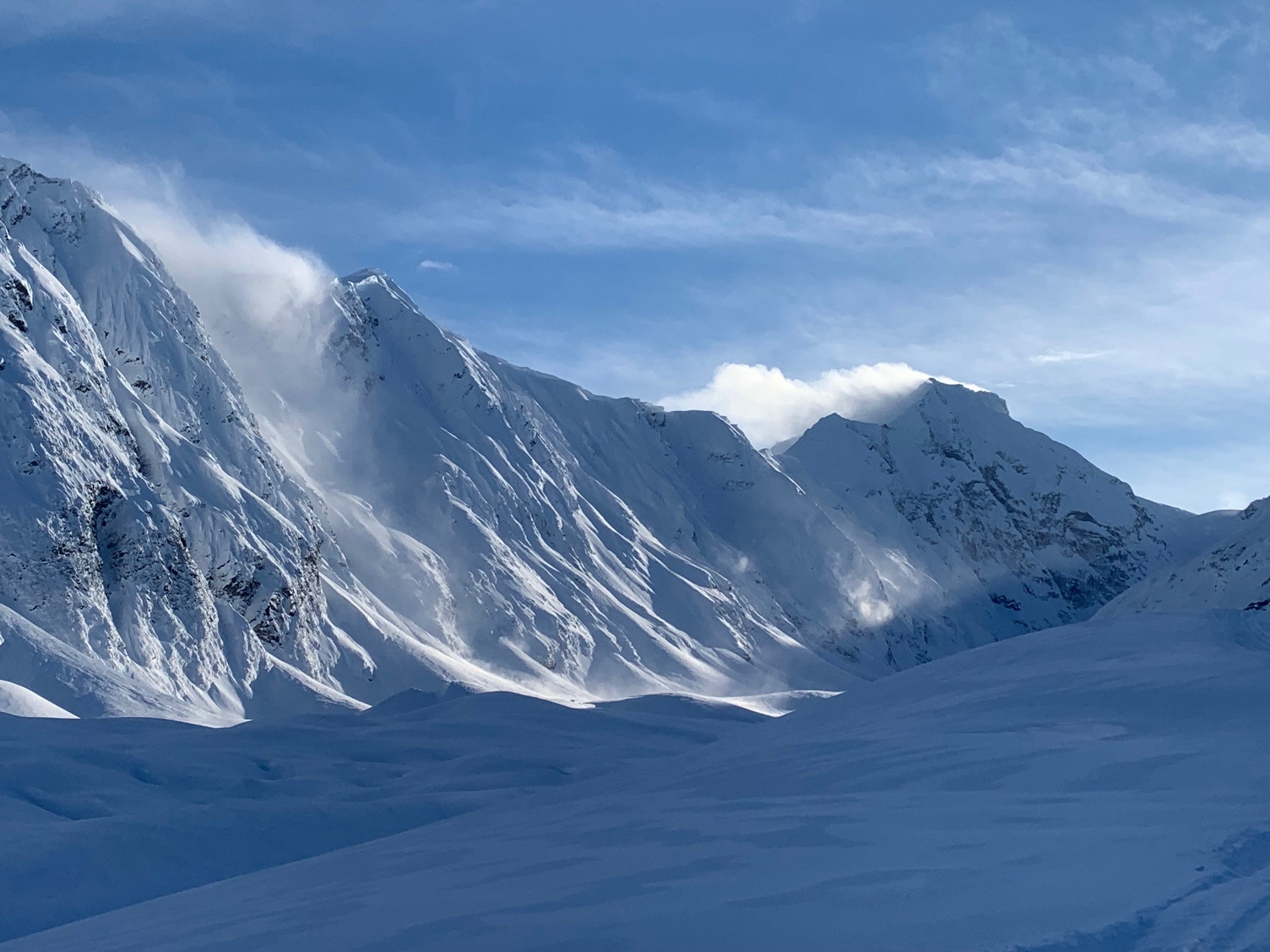
We received reports of multiple natural avalanches following the strong southwesterly winds late Wednesday into early Thursday. There was some activity in the middle of our advisory area, with widespread activity on the south end of Turnagain Pass and Summit Lake.
Sunburst: A natural wind slab failed in the steep north-facing terrain off Sunburst ridge at around 2400′. The avalanche was around 2′ deep, 150′ wide, and ran an estimated 800′. More details here and here.
Seattle Ridge: We saw debris from multiple small natural wind slabs on the front side of Seattle Ridge, right across from the motorized lot.
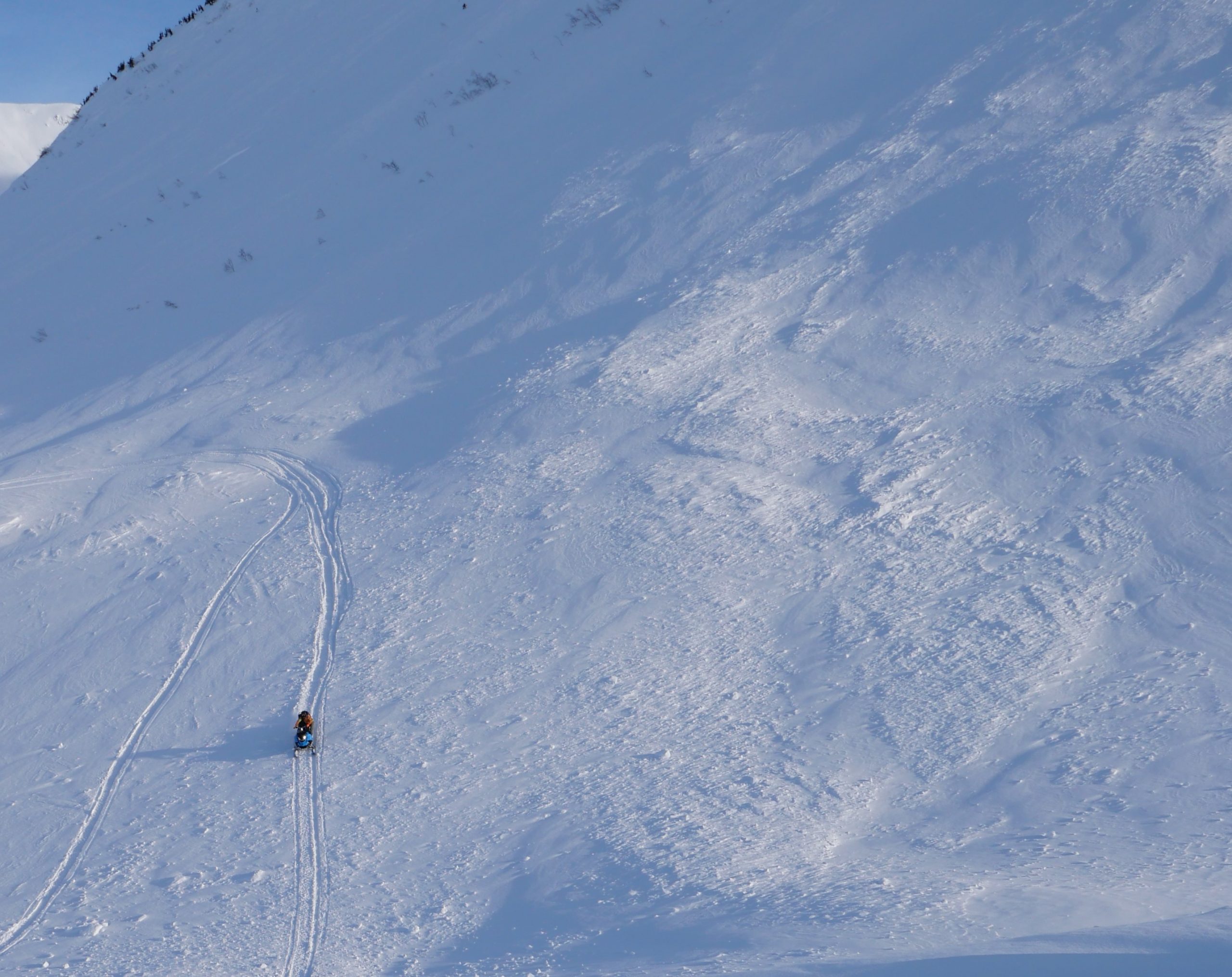
Lynx Creek: There was a widespread cycle up Lynx Creek, with multiple natural wind slab avalanches around 2′ deep, over 500′ wide, running 1000′ vertical or more. Based on the depth of the avalanches and several snowpits we dug nearby, it is unlikely these failed on a persistent weak layer, but it is noteworthy how wide these avalanches propagated. Details here.
Summit Lake: Natural avalanches were reported on Fresno, Butch, Tri Tip, and Summit Peak. Many of these avalanches started as wind slabs around 1.5′-2.5′ deep, and stepped down to deeper weak layers surrounding the New Year’s and Halloween crusts. More photos here.
Natural avalanche on the north side of Sunburst. Submitted by the AAI/AAS Pro 2 group. 02.10.2022
Natural avalanche in a wind loaded bowl in the Summit Lake area. Photo: Paul Wunnicke. 02.10.2022
Avalanche Problem 1
Wind Slabs
Certain
Very Likely
Likely
Possible
Unlikely
Likelihood
Historic (D4-5)
Very Large (D3)
Large (D2)
Small (D1)
Size
Wind Slabs
Wind Slab avalanches are the release of a cohesive layer of snow (a slab) formed by the wind. Wind typically transports snow from the upwind sides of terrain features and deposits snow on the downwind side. Wind slabs are often smooth and rounded and sometimes sound hollow, and can range from soft to hard. Wind slabs that form over a persistent weak layer (surface hoar, depth hoar, or near-surface facets) may be termed Persistent Slabs or may develop into Persistent Slabs.
Likelihood of Avalanches
Terms such as "unlikely", "likely", and "certain" are used to define the scale, with the chance of triggering or observing
avalanches increasing as we move up the scale. For our purposes, "Unlikely" means that few avalanches could be triggered in avalanche terrain and
natural avalanches are not expected. "Certain" means that humans will be able to trigger avalanches on many slopes, and natural avalanches are expected.
Size of Avalanches
Avalanche size is defined by the largest potential avalanche, or expected range of sizes related to the problem in question.
Assigned size is a qualitative estimate based on the destructive classification system and requires specialists to estimate the harm avalanches may cause to
hypothetical objects located in the avalanche track (AAA 2016, CAA 2014). Under this schema, "Small" avalanches are not large enough to bury humans and are
relatively harmless unless they carry people over cliffs or through trees or rocks. Moving up the scale, avalanches become "Large" enough to bury, injure,
or kill people. "Very Large" avalanches may bury or destroy vehicles or houses, and "Historic" avalanches are massive events capable of altering the landscape.
Winds have ramped up overnight after a brief lull in the action yesterday, with sustained speeds of 20-40 mph and gusts to 60 mph out of the east at the Sunburst station since 11 p.m. last night. With only a trace to 3″ snow overnight, wind slabs are once again the primary concern today. The strong winds are expected to slowly taper down during the day, but not before building a new round of sensitive wind slabs that will be easy to trigger. The size of the avalanches will be limited by the soft snow on the surface available for wind transport, which is unfortunately becoming harder to find. Don’t be fooled by the firm surfaces- the wind has a way of finding snow to move around, especially with another switch in direction yesterday. New wind slabs could be a foot deep or deeper, which is plenty deep enough to carry and bury a person. Be on the lookout for unstable snow near ridgelines, on convex rolls, and in steep gullies. These will be most likely in the alpine, but it will be possible to find reactive slabs near treeline as well.
In addition to the fresh slabs formed overnight, it may also be possible to trigger a stubborn wind slab avalanche on slopes that were loaded in the previous 48 hours. In some areas, downslope winds have loaded slopes farther down from ridgelines than we would typically expect (See Graham’s photo from the Skookum valley below for an example). This includes aprons below steeper terrain that we don’t always think of as dangerous avalanche terrain. This slightly more complicated distribution will require heightened awareness. Pay attention to clear signs of unstable snow like fresh avalanches, shooting cracks, and collapsing. Take the time to step off the skin track or hop off your machine and poke into the snow. If you notice stiffer wind-drifted snow on top of softer snow, stay off the steep slopes. Be aware that with the strong winds over the past two days, we could be dealing with a hard slab that will allow a person to venture out into the middle of a slope before triggering an avalanche. This makes it hard to avoid getting caught in a slide if things go wrong.
Cornices: As strong winds continue today, cornices are growing and will remain touchy. Be sure to maintain plenty of space from the edge, as these have a reputation of breaking back farther from the ridgeline than people expect.
More than just a little snow blowing off the top of Carpathian and Byron, above the Skookum glacier yesterday. Note the snow blowing downslope in the foreground, loading the lower elevation aprons at the same time the upper elevation start zones are being loaded. Photo: Graham Predeger. 02.10.2022
This is just one of many natural avalanches we saw in the Lynx Creek drainage yesterday. The snowpack seems to be more reactive towards the south end of Turnagain Pass, and especially touchy in the Summit Lake area. Dangerous conditions are expected to continue today. 02.10.2022
Local motorhead Andy Moderow riding over debris from a large natural avalanche in Lynx Creek that had released and gotten partially buried by winds within the past 24 hours. 02.10.2022
Click Here if the video below doesn’t load in your browser.
Weather
Fri, February 11th, 2022
Yesterday: A break in the weather yesterday brought partly sunny skies for most of the day, with increasing cloud cover in the afternoon. High temperatures were in the upper teens to low 20’s F, with the coldest temperatures in the morning in the single digits to mid teens F. Stations are showing a trace to 3″ snow overnight, with easterly winds increasing to 30-40 mph and gusts to 60 mph since 11 p.m. yesterday.
Today: Winds are expected to slowly taper during the day, dropping from 25-40 mph out of the east with gusts of 40-50 mph this morning to 10-20 mph by late afternoon. High temperatures will be in the low to upper 20’s F and may break in to the low 30’s F at sea level. We may see a trace of snow during the day, but clouds are expecting to break up again with some sun poking through.
Tomorrow: Clouds will roll in again later this afternoon into the early evening as another round of light precipitation brings another 2-3″ overnight. Winds are expected to stay light out of the southeast with lows in the low 20’s F. The snow line may creep up to 900′.
This is a general backcountry avalanche advisory issued for Turnagain Arm with Turnagain Pass as the core advisory area.
This advisory does not apply to highways, railroads or operating ski areas.