Turnagain Pass Avalanche Forecast RSS

Archives
ARCHIVED FORECAST - All forecasts expire after 24 hours from the posting date/time.
Issued
Fri, February 3rd, 2023 - 7:00AM
Expires
Sat, February 4th, 2023 - 7:00AM
Forecaster
Graham Predeger
Avalanche risk The Bottom Line

The avalanche danger is MODERATE above 1000′. It still may be possible for a person to trigger a large avalanche on a layer of surface hoar buried 2-3′ deep. We know this layer to be widespread throughout the forecast area and as such it is worth testing and identifying any features of concern before committing to big terrain.  Shallow areas that are wind scoured or near rock outcroppings are more like spots to find and potentially trigger this weak layer with your skis or snowmachine.

Additionally, some steep alpine slopes are harboring enough new or weak surface snow where loose snow avalanches/ sluffs could be a concern if folks push into steeper terrain today.  Below 1,000’ the danger is LOW.

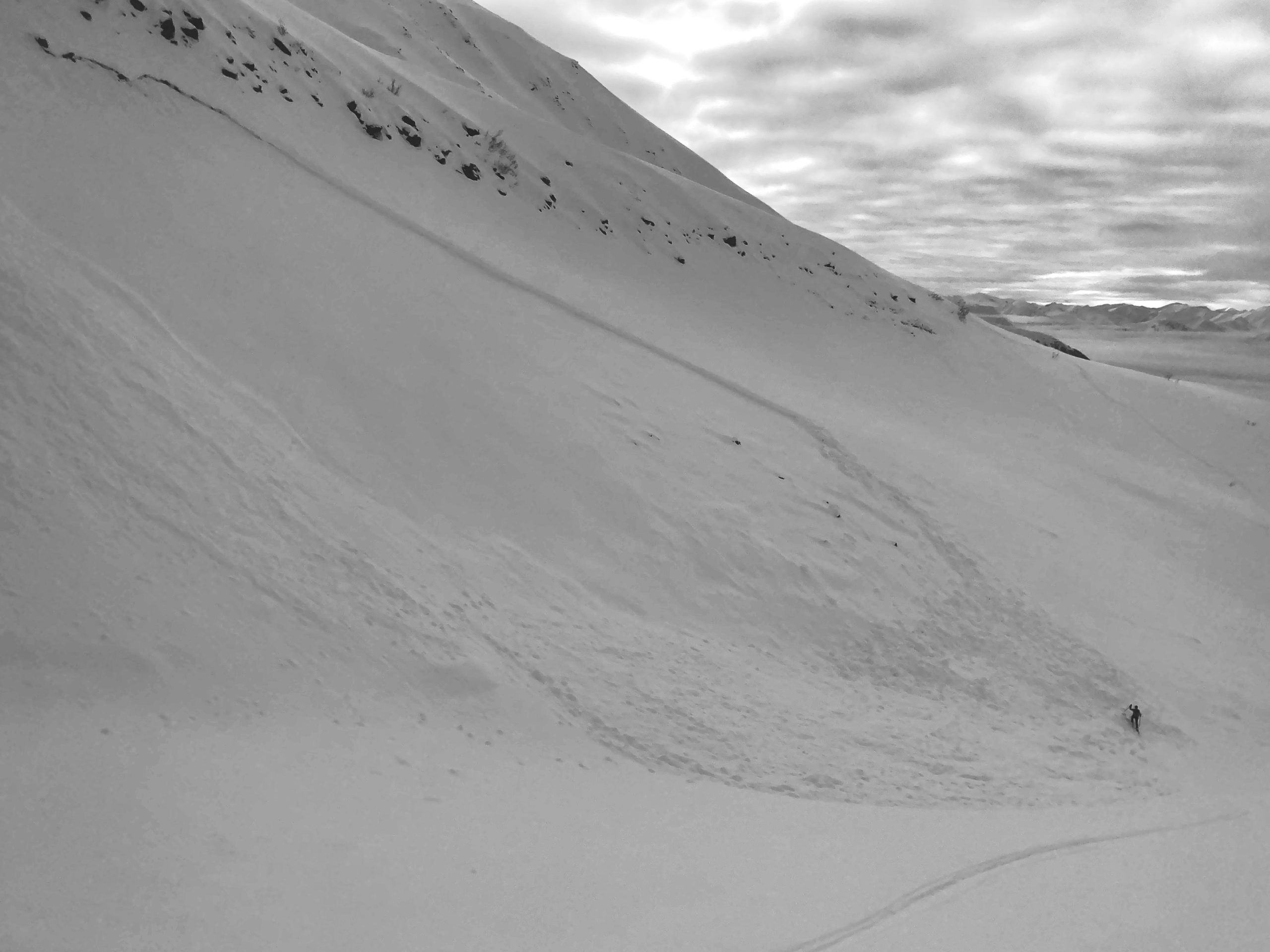
SUMMIT LAKE: The snowpack in the Summit Lake area has a similar structure to Turnagain Pass, but it is thinner and weaker. This makes human-triggered avalanches a little more likely, which means we should be a little more cautious around steep terrain.

Special Announcements

Tickets on Sale Now for the Snowball on Feb. 14! Join us on Valentine’s Day to celebrate a great snow season. Dance to lively music by the Jangle Bees, bid on the silent auction, and enjoy 49th State Brewing libations and decadent desserts. Bring your sweetie or your best backcountry partners—or find new ones on the dance floor. All proceeds from this event benefit the Friends of the Chugach Avalanche Center and the Alaska Avalanche School, so you can let loose knowing it’s for a great cause! Tickets are limited, so get yours soon. Click here for tickets and more information.

Thanks to our sponsors!
Fri, February 3rd, 2023
Alpine
Above 2,500'
Moderate (2)
Avalanche risk
Treeline
1,000'-2,500'
Moderate (2)
Avalanche risk
Below Treeline
Below 1,000'
Low (1)
Avalanche risk
Alpine
Above 2,500'
Avalanche risk
Moderate (2)
Treeline
1,000'-2,500'
Avalanche risk
Moderate (2)
Below Treeline
Below 1,000'
Avalanche risk
Low (1)
Danger Scale:
No Rating (0)
Low (1)
Moderate (2)
Considerable (3)
High (4)
Extreme (5)
Recent Avalanches

The last human-triggered avalanches were 13 days ago now, when multiple people were caught, carried, and some partially buried in avalanches failing on the layer of buried surface hoar we are still concerned with. You can find details from some of these avalanches here and here.

Avalanche Problem 1
  • Persistent Slabs
    Persistent Slabs
  • Aspect/Elevation
  • Almost Certain
    Very Likely
    Likely
    Possible
    Unlikely
    Likelihood
  • Historic (D4-5)
    Very Large (D3)
    Large (D2)
    Small (D1)
    Size
Persistent Slabs
Persistent Slab avalanches are the release of a cohesive layer of snow (a slab) in the middle to upper snowpack, when the bond to an underlying persistent weak layer breaks. Persistent layers include: surface hoar, depth hoar, near-surface facets, or faceted snow. Persistent weak layers can continue to produce avalanches for days, weeks or even months, making them especially dangerous and tricky. As additional snow and wind events build a thicker slab on top of the persistent weak layer, this avalanche problem may develop into a Deep Persistent Slab.

Aspect/Elevation of the Avalanche Problem
Specialists develop a graphic representation of the potential distribution of a particular avalanche problem across the topography. This aspect/elevation rose is used to indicate where the particular avalanche problem is thought to exist on all elevation aspects. Areas where the avalanche problem is thought to exist are colored grey, and it is less likely to be encountered in areas colored white.

Likelihood of Avalanches
Terms such as "unlikely", "likely", and "certain" are used to define the scale, with the chance of triggering or observing avalanches increasing as we move up the scale. For our purposes, "Unlikely" means that few avalanches could be triggered in avalanche terrain and natural avalanches are not expected. "Certain" means that humans will be able to trigger avalanches on many slopes, and natural avalanches are expected.

Size of Avalanches
Avalanche size is defined by the largest potential avalanche, or expected range of sizes related to the problem in question. Assigned size is a qualitative estimate based on the destructive classification system and requires specialists to estimate the harm avalanches may cause to hypothetical objects located in the avalanche track (AAA 2016, CAA 2014). Under this schema, "Small" avalanches are not large enough to bury humans and are relatively harmless unless they carry people over cliffs or through trees or rocks. Moving up the scale, avalanches become "Large" enough to bury, injure, or kill people. "Very Large" avalanches may bury or destroy vehicles or houses, and "Historic" avalanches are massive events capable of altering the landscape.

Signal Word Size (D scale) Simple Descriptor
Small 1 Unlikely to bury a person
Large 2 Can bury a person
Very Large 3 Can destroy a house
Historic 4 & 5 Can destroy part or all of a village
More info at Avalanche.org

Today looks to be another insignificant day of weather for contributing to any heightened avalanche activity.  We are however, still dealing with a lurking layer of buried surface hoar 2-3’ under the surface that was responsible for a very active human-triggered avalanche cycle two weekends ago.  Our benign weather this week has further allowed this layer to gain strength and it is proving more stubborn to trigger but we can’t forget about it just yet.

Buried surface hoar is a notoriously tricky weak layer that tends to persist (ie: persistent slab) and has potential to cause problems weeks after it is buried.  Hence why a cautious mindset is still warranted even two weeks after it was last active in our area.  It’s still worth taking the time to test this layer on your snowmachine or skis before committing to any bigger, more consequential terrain.  A quick snowpit or sled cut on a small no-consequence slope is a great way to feel out this weak layer 2-3’ down.  If you get any propagating results from a snowpit or other red flags (cracking or collapsing in the snowpack), that should be evidence enough to keep your terrain mellow.  You can still avoid this problem entirely by sticking to slopes less than 30 degrees.

Loose snow/ sluffs: There have been reports of just enough loose snow at the surface (4-8″ of new snow this week combined with surface faceting) to justify mentioning the possibility of loose snow avalanches/ sluffs.  Keep your sluff management in mind if you find yourself pushing onto steep, high alpine slopes today.


This avalanche ran on the layer of buried surface hoar that is widespread throughout or region, 2-3′ below the surface.  Though becoming less likely to trigger,  it’s important to keep consequences in mind.  If the slope does slide, am I above a terrain trap or is there a clean runout?  Photo: Goat Mountain (Girdwood Valley), 2.2.2023


If the video doesn’t load in your browser you can click here to view it.

Additional Concern
  • Deep Persistent Slabs
    Deep Persistent Slabs
Deep Persistent Slabs
Deep Persistent Slab avalanches are the release of a thick cohesive layer of hard snow (a slab), when the bond breaks between the slab and an underlying persistent weak layer deep in the snowpack. The most common persistent weak layers involved in deep, persistent slabs are depth hoar or facets surrounding a deeply buried crust. Deep Persistent Slabs are typically hard to trigger, are very destructive and dangerous due to the large mass of snow involved, and can persist for months once developed. They are often triggered from areas where the snow is shallow and weak, and are particularly difficult to forecast for and manage.
More info at Avalanche.org

We’ve catalogued the Thanksgiving crust/ facet layer as an ‘additional concern’.  It still exists toward the bottom of our snowpack (4-8’ deep) but is becoming very unlikely that a person could trigger an avalanche that deep.  With a major loading event or significant warm up this may pop back up as a more prominent concern in the forecast but for now its very unlikely to see an avalanche breaking this deep in our snowpack.

Weather
Fri, February 3rd, 2023

Yesterday: Another day of eerily calm winds at ridgetop locations where gusts at Sunburst (3800’) never broke single digits. A bit of sunshine over Turnagain Pass in the morning gave way to partly cloudy skies by the afternoon.  Temperatures were mild and fluctuated very little throughout the day/ night.  Low 20s F at ridgetops and right around 30 F at lower elevations.

Today: Low clouds/ fog may persist in Girdwood and eastern Turnagain Arm this morning as there isn’t much wind expected to mix the atmosphere.  Temperatures have dropped a bit from yesterday and are expected to be in the high teens F at ridgetops and mid to high 20s near sea level.  We may see periods of light snow with the passing shortwaves moving through but accumulation is expected to be in the 1-2″ range through the forecast period.

Tomorrow: Another shortwave trough moves north tomorrow and we may see another trace to an inch of snow, mostly cloudy skies and light winds from the East.  Tomorrow night there appears to be a lull before a larger, more potent winter storm moves out of the Gulf of Alaska and into our area.  Details are still being refined but Sunday/ Monday looks to be our next good chance for a reset.  Stay tuned!

PRECIPITATION 24-hour data (6am – 6am)

Temp Avg (F) Snow (in) Water (in) Snow Depth (in)
Center Ridge (1880′) 25 0 0 62
Summit Lake (1400′) 23 0 0 34
Alyeska Mid (1700′) 25 2 .15 63
Bear Valley – Portage (132′) 28 trace .01

RIDGETOP 24-hour data (6am – 6am)

Temp Avg (F) Wind Dir Wind Avg (mph) Wind Gust (mph)
Sunburst (3812′) 20 var 3 13
Seattle Ridge (2400′) 23 var 0 2
Observations
Recent Observations for Turnagain Pass
Date Region Location
05/22/23 Turnagain Avalanche: Tincan
05/12/23 Turnagain Avalanche: Tincan, Sunburst, Magnum, Cornbiscuit
05/07/23 Turnagain Observation: Tincan – Bear Tracks
05/05/23 Turnagain Observation: Seattle Ridge
05/02/23 Turnagain Observation: Cornbiscuit
05/02/23 Turnagain Observation: Seward Hwy Turnagain Pass
04/30/23 Turnagain Observation: Magnum
04/29/23 Turnagain Observation: Tincan
04/28/23 Turnagain Avalanche: Taylor Pass/Pastoral
04/28/23 Turnagain Avalanche: Tincan
Riding Areas
Updated Sat, September 23rd, 2023

Status of riding areas across the Chugach NF is managed by the Glacier and Seward Ranger Districts, not avalanche center staff. Riding area information is posted as a public service to our users and updated based on snow depth and snow density to prevent resource damage at trailhead locations. Riding area questions contact: mailroom_r10_chugach@fs.fed.us

Area Status Weather & Riding Conditions
Glacier District
Johnson Pass
Closed
Scheduled opening per Chugach National Forest plan December 1. Subject to adequate snow cover.
Placer River
Closed
Scheduled opening per Chugach National Forest plan December 1. Subject to adequate snow cover.
Skookum Drainage
Closed
Scheduled opening per Chugach National Forest plan December 1. Subject to adequate snow cover.
Turnagain Pass
Closed
Scheduled opening on the Wednesday before Thanksgiving per Chugach National Forest plan. Subject to adequate snow cover.
Twentymile
Closed
Scheduled opening per Chugach National Forest plan December 1. Subject to adequate snow cover.
Seward District
Carter Lake
Closed
Scheduled opening per Chugach National Forest plan December 1. Subject to adequate snow cover.
Lost Lake Trail
Closed
Scheduled opening per Chugach National Forest plan December 1. Subject to adequate snow cover.
Primrose Trail
Closed
Scheduled opening per Chugach National Forest plan December 1. Subject to adequate snow cover.
Resurrection Pass Trail
Closed
Scheduled opening per Chugach National Forest plan December 1. Subject to adequate snow cover.
Snug Harbor
Closed
Scheduled opening per Chugach National Forest plan December 1. Subject to adequate snow cover.
South Fork Snow River Corridor
Closed
Scheduled opening per Chugach National Forest plan December 1. Subject to adequate snow cover.
Summit Lake
Closed
Scheduled opening per Chugach National Forest plan December 1. Subject to adequate snow cover.

Subscribe to Turnagain Pass
Avalanche Forecast by Email

This is a general backcountry avalanche advisory issued for Turnagain Arm with Turnagain Pass as the core advisory area. This advisory does not apply to highways, railroads or operating ski areas.