| Trigger | Natural | Remote Trigger | No |
| Avalanche Type | Hard Slab | Aspect | Northwest |
| Elevation | 3100ft | Slope Angle | 35deg |
| Crown Depth | 24in | Width | 150ft |
| Vertical Run | 100ft |
Avalanche: Girdwood
Location: Goat Mtn.
We toured up Goat Mtn. and stopped to take a look at an avalanche that failed on the 1/10 buried surface hoar layer sometime in the past week. Our ski objectives were modest today, more just a good day to get out and take a look around. We skied from about 4000′ and enjoyed some good turns before we battle-skied our way back down through the creek. The approach is still a bit of a jungle-flavored spirit quest and not for the faint of heart.
Avalanche Details
Our best guess was this avalanche failed last Saturday, triggered by a smaller wet loose avalanche running off the steeper rocky terrain above the slope that failed.
The avalanche was about 2' deep on average, 150' wide and 100' vertical. It wasn't a very big piece of terrain, but the gully in the runout zone piled up quite a bit of debris in a small area. It failed on the 1/10 buried surface hoar, with a hard slab above and below the weak layer. The slope was in a spot that looked like it gets loaded regularly.
Weather
Skies were partly cloudy this morning, with increasing clouds throughout the day. Calm winds and no precipitation while we were out. Light snog as we were driving back to Girdwood.
Snow surface
There was about 2" new snow from last night, with anywhwere from 4-8" soft snow on the surface from the past week at higher elevations.
Snowpack
We found the same structure in this zone that we've been seeing throughout the advisory area. The most concerning layer is still the 1/10 BSH layer, with a mid-pack crust (the Christmas crust) buried about 2' deep at 1700' elevation, and closer to 3 or 4' deep at 3000' elevation. There was a lot of debris from last Saturday, but most of it had a few inches of snow on top of it from the past week.
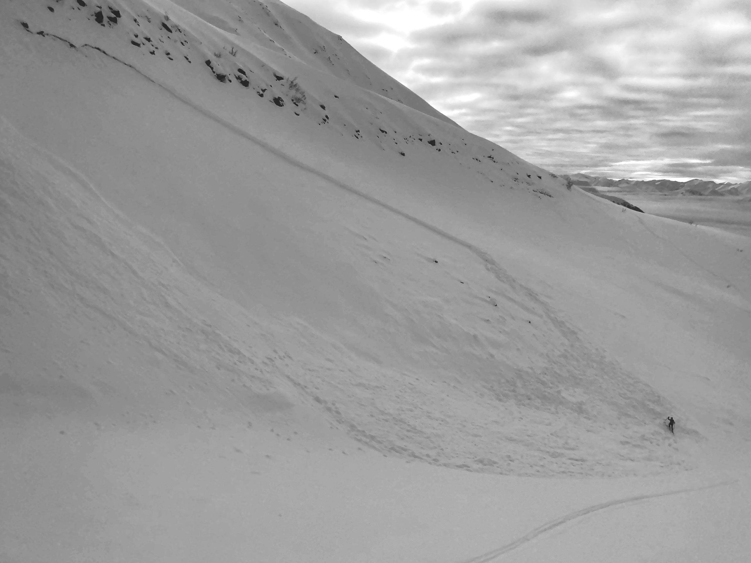
View of the avalanche from an adjacent moraine. PW on the debris for scale. 02.02.2023

Looking across the crown of the avalanche. 02.02.2023
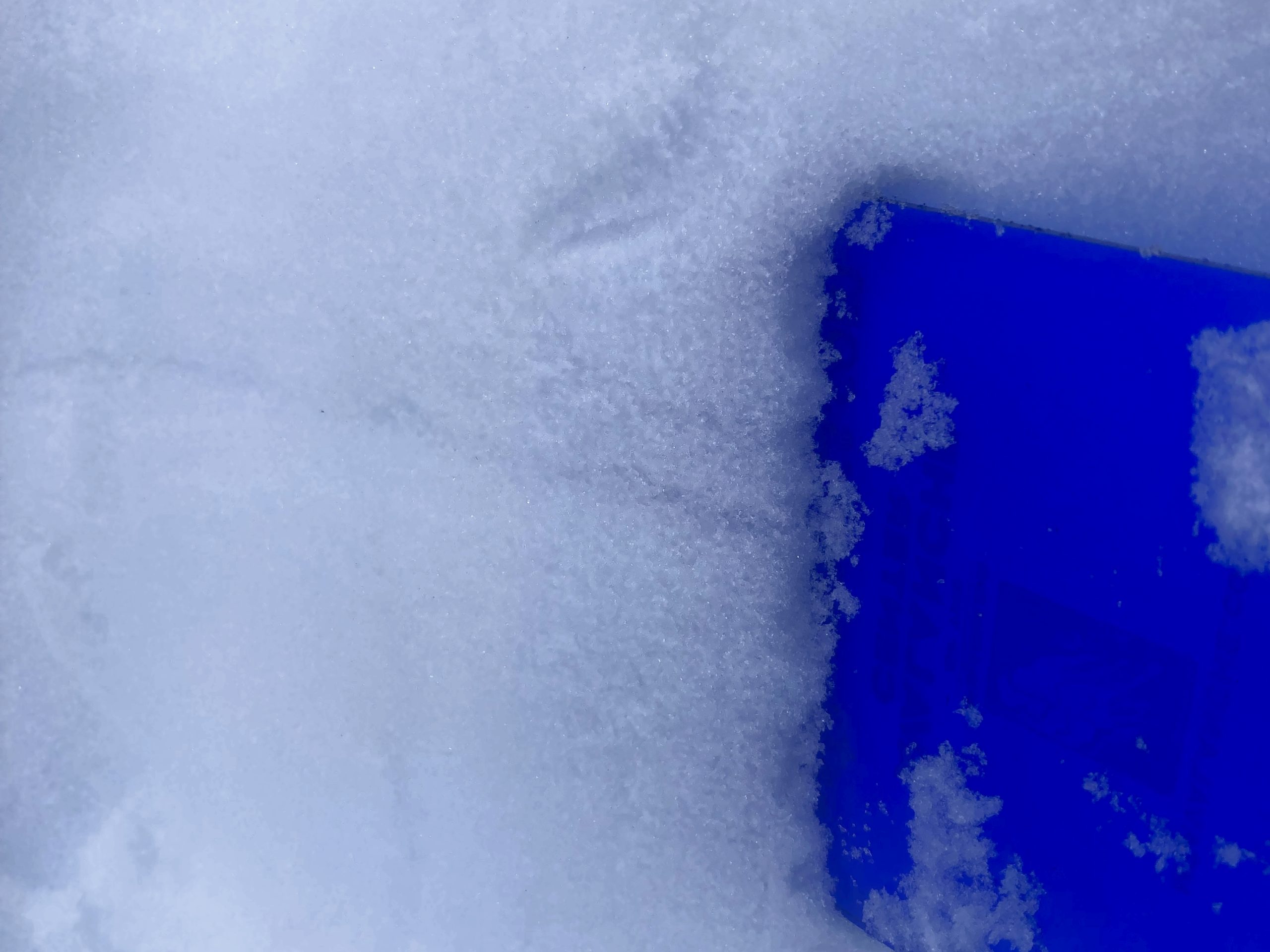
The culprit for the avalanche was hard to spot without a little bit of investigation. It was still shearing cleanly with a shovel. 02.02.2023