The avalanche danger is HIGH above 2500′ as strong winds and continued snow will make natural avalanches likely and human-triggered avalanches very likely. With strong winds since yesterday evening and plenty of soft snow already on the ground ahead of this storm, wind slab avalanches are expected to be 2-4′ deep or deeper. Very dangerous avalanche conditions exist, and travel in avalanche terrain is not recommended in the alpine.
The avalanche danger is CONSIDERABLE below 2500′, where human triggered wind slab avalanches are likely and natural avalanches 1-3′ deep will be possible. The rain level is expected to creep up to 2300′ during the day, which will make loose wet avalanches likely. Be cautious with your terrain choices, avoiding traveling on or below steep slopes. Be mindful of the terrain above you, as natural avalanches failing in upper elevation start zones may run down into lower elevations.
*Roof Avalanches: Warm temperatures and rain at lower elevations will make roof avalanches likely today. These can be very dangerous, as the snow and ice that has piled up on roofs can weigh thousands of pounds. Keep and eye on children and pets, and be mindful of where you park your vehicles.
PORTAGE/PLACER/LOST LAKE/SEWARD: These zones are expected to see more intense precipitation than the Girdwood and Turnagain Pass areas. This will make avalanches larger and more likely. Travel in avalanche terrain is not recommended.
Fri, January 21st, 2022
Alpine
Above 2,500'
4 - High
Treeline
1,000'-2,500'
3 - Considerable
Below Treeline
Below 1,000'
3 - Considerable
0 - No Rating
1 - Low
2 - Moderate
3 - Considerable
4 - High
5 - Extreme
Travel Advice
Generally safe avalanche conditions. Watch for unstable snow on isolated terrain features.
Heightened avalanche conditions on specific terrain features. Evaluate snow and terrain carefully; identify features of concern.
Natural avalanches likely; human-triggered avalanches very likely.
Natural and human-triggered avalanches certain.
Avalanche Size and Distribution
Small avalanches in isolated areas or extreme terrain.
Small avalanches in specific areas; or large avalanches in isolated areas.
Small avalanches in many areas; or large avalanches in specific areas; or very large avalanches in isolated areas.
Large avalanches in many areas; or very large avalanches in specific areas.
Very large avalanches in many areas.
Recent Avalanches
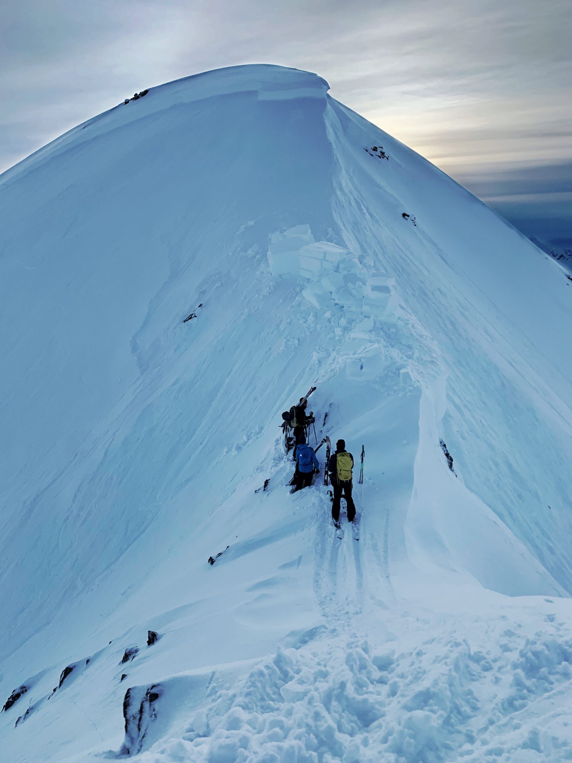
A skier triggered a large avalanche on the northwest aspect of Tincan Proper yesterday afternoon as he was bootpacking up to the summit. Luckily he was able to get off the slab to avoid being carried down to the valley 2000′ below. The avalanche was 2-5′ deep and likely failed on facets above the New Year’s crust. The slope had been getting loaded by strong winds during the day yesterday. See this observation for more details.
The group standing just below the crown of a large human-triggered avalanche on Tincan Proper. The avalanche was 2-5′ deep and failed on a weak layer of facets on top of the New Year’s crust. Photo submitted anonymously. 01.20.2022
Avalanche Problem 1
Wind Slabs
Certain
Very Likely
Likely
Possible
Unlikely
Likelihood
Historic (D4-5)
Very Large (D3)
Large (D2)
Small (D1)
Size
Wind Slabs
Wind Slab avalanches are the release of a cohesive layer of snow (a slab) formed by the wind. Wind typically transports snow from the upwind sides of terrain features and deposits snow on the downwind side. Wind slabs are often smooth and rounded and sometimes sound hollow, and can range from soft to hard. Wind slabs that form over a persistent weak layer (surface hoar, depth hoar, or near-surface facets) may be termed Persistent Slabs or may develop into Persistent Slabs.
Likelihood of Avalanches
Terms such as "unlikely", "likely", and "certain" are used to define the scale, with the chance of triggering or observing
avalanches increasing as we move up the scale. For our purposes, "Unlikely" means that few avalanches could be triggered in avalanche terrain and
natural avalanches are not expected. "Certain" means that humans will be able to trigger avalanches on many slopes, and natural avalanches are expected.
Size of Avalanches
Avalanche size is defined by the largest potential avalanche, or expected range of sizes related to the problem in question.
Assigned size is a qualitative estimate based on the destructive classification system and requires specialists to estimate the harm avalanches may cause to
hypothetical objects located in the avalanche track (AAA 2016, CAA 2014). Under this schema, "Small" avalanches are not large enough to bury humans and are
relatively harmless unless they carry people over cliffs or through trees or rocks. Moving up the scale, avalanches become "Large" enough to bury, injure,
or kill people. "Very Large" avalanches may bury or destroy vehicles or houses, and "Historic" avalanches are massive events capable of altering the landscape.
Very dangerous avalanche conditions exist as strong winds, snow, and rain continue in our area through the day today. Easterly winds began picking up yesterday afternoon and continued last night, with sustained speeds of 40-60 mph and gusts up to 97 mph last night through this morning. 24-hour snow totals by the end of the day are expected to be around 8-10″ in Girdwood, 4-8″ in Turnagain Pass, and 8-12″ near Portage and Placer. This new snow is falling on top of close to a foot of soft snow that was already on the ground, which means there is plenty of ammunition for the strong winds to build large and sensitive slabs. We expect to see very dangerous avalanche conditions today along with this active weather, with large human-triggered avalanches very likely and natural avalanches likely in the alpine. Travel in avalanche terrain is not recommended above 2500′.
Conditions will still be dangerous at and below treeline, but slightly weaker winds and lower storm totals mean avalanches will be slightly smaller (around 1-3′ deep), and slightly less reactive. If you plan on throwing on the Gore-Tex and getting out in the trees during the storm today, be cautious with your terrain choices. Avoid traveling on or below steep slopes, and be very aware of the potential for large natural avalanches releasing in upper-elevation start zones above you and running into lower elevations. Warming temperatures as this storm progresses mean dense snow is falling on top of colder, drier snow. Expect to find upside-down storm slabs, which will be sensitive on sheltered slopes as well as those being actively wind loaded. With modest storm totals, these avalanches may not be as large, but they can still be dangerous if they catch you off guard.
Yesterday’s human-triggered avalanche on Tincan Proper is a scary and somewhat surprising reminder that there may still be some more concerning deeper weak layers lurking on isolated slopes. This layer will be tested as wind and snow continue to load the snowpack today. Most of our observations have been indicating that it is unlikely we will see activity on this layer, but yesterday’s avalanche should not be ignored. This means that in addition to large avalanches failing in fresh wind slabs forming today, there is an outside chance we may see some very large avalanches failing on the deeper weak snow on top of the New Year’s crust. Given the dangerous conditions already mentioned above, this issue does not really impact our travel advice, but it is one more thing to be aware of.
Loose Wet Avalanches: And now for the news that nobody wants to hear- rain levels are expected to creep up to around 2200-2400′ as temperatures hang in the low to mid 30’s F today. As rain saturates the snow at the mid- and lower elevations, it is likely we will see some loose wet avalanches up to 2400′.
Cornice Fall: Strong winds have been building large and sensitive cornices. If you are traveling near ridgelines, be careful to give cornices plenty of space. Keep in mind they are notorious for breaking farther back than people expect. Take a look at this observation from Goldpan for details from a scary encounter with a cornice fall on Sunday.
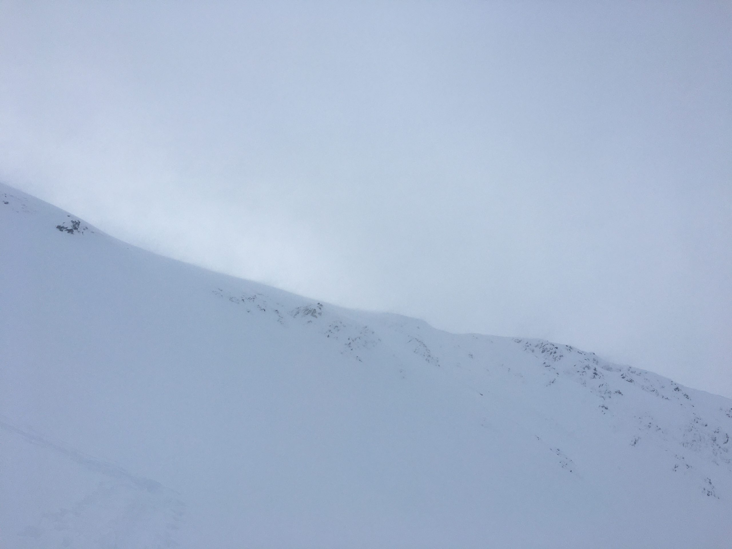
Winds starting to load start zones near the ridgeline at the top of Super Bowl yesterday afternoon. These strong winds have continued overnight and are expected to hang around through the day, which means wind slabs will get larger and more sensitive. 01.20.2022
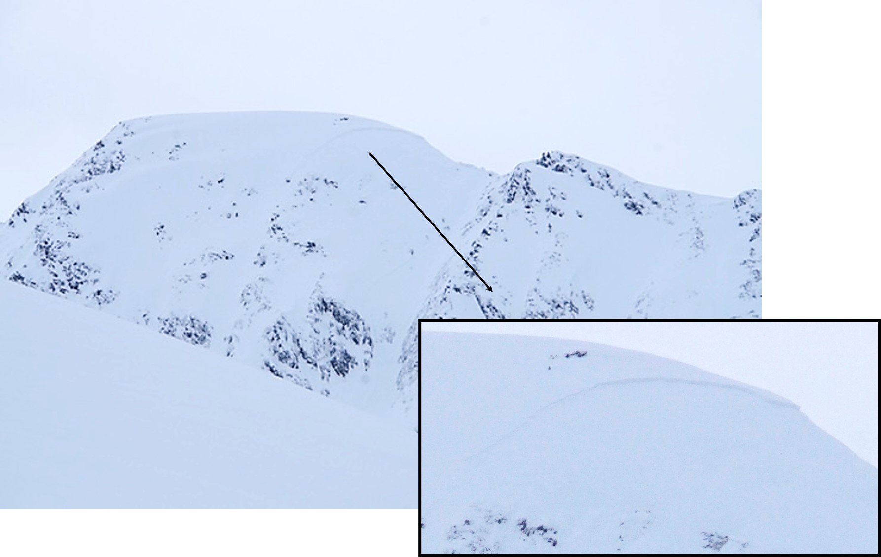
Large avalanche triggered by a skier hiking along the Tincan ridgeline yesterday. This avalanche failed on facets above the New Year’s crust, which we had thought had become unreactive. Time will tell whether this is an outlier event or a sign of more activity to come, but for today this is just one more reason to avoid travel in avalanche terrain in the alpine. Photo: Andy Moderow. 01.20.2022
Click Here for a link to a video describing snow conditions ahead of the storm yesterday afternoon:
Weather
Fri, January 21st, 2022
Yesterday: Yesterday morning saw partly cloudy skies, light westerly winds, and temperatures in the upper teens to 20 F. Cloud cover increased during the day, with overcast skies in the afternoon. Winds shifted easterly and started increasing in the afternoon, with sustained speeds of 40-60 mph overnight and gusts as high as 97 mph by this morning. As of 6:00 this morning, 2-5″ of snow has fallen so far. Temperatures have been on a steady climb since yesterday morning, with current temperatures right around 30 F.
Today: Winds are expected to persist at 20-35 mph with gusts of 40-55 mph out of the southeast. Another 2-6″ snow is expected to fall in Girdwood and Turnagain pass, with 8-10″ in Portage and Placer. Rain is expected to make it up to 2200-2400′. Temperatures are expected to hang in the low to mid 30’s F.
Tomorrow: Snow showers are expected to continue overnight, with another 1-2″ at Turnagain Pass, 4-6″ near Girdwood, and 6-8″ near Portage and Placer. The rain line is expected to linger around 2200′. Winds should ease slightly, with sustained speeds of 15-20 mph and gusts of 30-40 mph. Another significant round of snow and rain is expected to follow this system, moving in late Sunday through Monday.
This is a general backcountry avalanche advisory issued for Turnagain Arm with Turnagain Pass as the core advisory area.
This advisory does not apply to highways, railroads or operating ski areas.