Turnagain Pass RSS

Archives
ARCHIVED - Forecasts expire after 24 hours.
Issued
Tue, January 1st, 2019 - 7:00AM
Expires
Wed, January 2nd, 2019 - 7:00AM
Forecaster
Wendy Wagner
Avalanche risk The Bottom Line

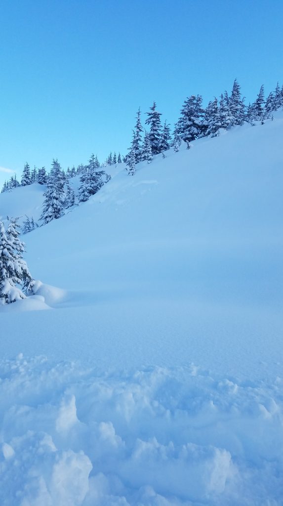
Hurricane force wind plus another foot of new snow overnight has brought the avalanche danger to HIGH in the Alpine. Natural storm snow avalanches 2-4′ thick are likely while this second storm hits. The avalanche danger is CONSIDERABLE in the treeline and below treeline band where natural storm snow avalanches may occur and human triggered avalanches are likely. Wet snow avalanches below 1,000′ are possible with forecast rising temperatures.  

Travel is NOT recommended in the Alpine, above the trees, or in runout zones at all elevations.  Cautious route-finding and conservative decision-making are essential if choosing to travel in the trees.  

GIRDWOOD:  Roof avalanches are expected with warming temperatures. Pay attention to children and pets and where you park your car.  

SUMMIT LAKE / JOHNSON PASS / LYNX DRAINAGE:    South of Turnagain Pass, keep in mind old buried weak layers exist and there is a potential for very large avalanches to occur that break near the ground.  

Special Announcements
  • Parking may be difficult along Turnagain Pass. Please be aware of parking safely and avoid blocking unplowed lots as DOT crews work to clear roads and parking areas.
Tue, January 1st, 2019
Alpine
Above 2,500'
4 - High
Avalanche risk
Treeline
1,000'-2,500'
3 - Considerable
Avalanche risk
Below Treeline
Below 1,000'
3 - Considerable
Avalanche risk
0 - No Rating
1 - Low
2 - Moderate
3 - Considerable
4 - High
5 - Extreme
Avalanche risk Avalanche risk Avalanche risk Avalanche risk Avalanche risk
Travel Advice Generally safe avalanche conditions. Watch for unstable snow on isolated terrain features. Heightened avalanche conditions on specific terrain features. Evaluate snow and terrain carefully; identify features of concern. Dangerous avalanche conditions. Careful snowpack evaluation, cautious route-finding, and conservative decision-making essential. Very dangerous avalanche conditions. Travel in avalanche terrain not recommended. Extraordinarily dangerous avalanche conditions. Avoid all avalanche terrain.
Likelihood of Avalanches Natural and human-triggered avalanches unlikely. Natural avalanches unlikely; human-triggered avalanches possible. Natural avalanches possible; human-triggered avalanches likely. Natural avalanches likely; human-triggered avalanches very likely. Natural and human-triggered avalanches certain.
Avalanche Size and Distribution Small avalanches in isolated areas or extreme terrain. Small avalanches in specific areas; or large avalanches in isolated areas. Small avalanches in many areas; or large avalanches in specific areas; or very large avalanches in isolated areas. Large avalanches in many areas; or very large avalanches in specific areas. Very large avalanches in many areas.
Avalanche Problem 1
  • Storm Slabs
    Storm Slabs
  • Certain
    Very Likely
    Likely
    Possible
    Unlikely
    Likelihood
  • Historic (D4-5)
    Very Large (D3)
    Large (D2)
    Small (D1)
    Size
Storm Slabs
Storm Slab avalanches are the release of a cohesive layer (a slab) of new snow that breaks within new snow or on the old snow surface. Storm-slabs typically last between a few hours and few days (following snowfall). Storm-slabs that form over a persistent weak layer (surface hoar, depth hoar, or near-surface facets) may be termed Persistent Slabs or may develop into Persistent Slabs.

Likelihood of Avalanches
Terms such as "unlikely", "likely", and "certain" are used to define the scale, with the chance of triggering or observing avalanches increasing as we move up the scale. For our purposes, "Unlikely" means that few avalanches could be triggered in avalanche terrain and natural avalanches are not expected. "Certain" means that humans will be able to trigger avalanches on many slopes, and natural avalanches are expected.

Size of Avalanches
Avalanche size is defined by the largest potential avalanche, or expected range of sizes related to the problem in question. Assigned size is a qualitative estimate based on the destructive classification system and requires specialists to estimate the harm avalanches may cause to hypothetical objects located in the avalanche track (AAA 2016, CAA 2014). Under this schema, "Small" avalanches are not large enough to bury humans and are relatively harmless unless they carry people over cliffs or through trees or rocks. Moving up the scale, avalanches become "Large" enough to bury, injure, or kill people. "Very Large" avalanches may bury or destroy vehicles or houses, and "Historic" avalanches are massive events capable of altering the landscape.

Signal Word Size (D scale) Simple Descriptor
Small 1 Unlikely to bury a person
Large 2 Can bury a person
Very Large 3 Can destroy a house
Historic 4 & 5 Can destroy part or all of a village
More info at Avalanche.org

The second storm, in a two-part series, is over the region now and bringing in the 2019 New Year with a bang. The highest wind gust recorded this season occurred at 0200 this morning at the Sunburst weather station – 113mph from the NE. Not to mention an hourly average of 76mph… This second system is a bit more blow than snow. Overnight, roughly a foot of new snow has fallen at the upper elevations with 2-5″ forecast for today. It is the winds that are expected to create much of the havoc and induce avalanche activity, which will be in the form of cornice falls, wind slabs, storm slabs and loose snow avalanches. 

Skies opened yesterday and small pockets of storm slabs were seen and reported from the first storm. The good news was all avalanche activity we know of was confined to the storm snow and did not show wide propagation. However, there are still many areas we have no information for, such as upper Girdwood Valley, Johnson Pass, Lynx Crk and Summit Lake. 

The other issue is a layer of buried surface hoar (buried by the first storm beginning 12/30) that now sits 2-3′ deep. Observations yesterday pointed to little reactivity in the layer as it was sandwiched between very loose soft snow. Settlement and wind effect can quickly turn loose snow into a slab and avalanche potential rises quickly. 

If you’re headed into the trees look for signs of collapsing/cracking and recent avalanches breaking deeper than you may expect. If avalanches begin to break in the buried surface hoar they will be unmanageable. Watch for any area with stiffer snow over softer snow and stay well clear of runout paths from terrain above you.

 New Year Storm Cycle – total snowfall at mid-elevations from Sunday to 6am Tuesday: 

  • Turnagain Pass SNOTEL: 23″ 
  • Girdwood – Alyeska Midway: 25” 
  • Summit Lake: 7-12″ 

SNOW IMMERSION SUFFOCATION:  Getting caught in a tree well, stuck head down in a depression and other means of snow immersion are all possible with so much snow. Watch your partners and be aware of this hazard! 


Natural storm slab avalanche from Sunday night below Hippy Bowl on Tincan’s SW face. (Photo: Nikki Champion)


Small natural storm slab avalanche in the Tincan Trees from Sunday night. (Photo: Nikki Champion)

Avalanche Problem 2
  • Glide Avalanches
    Glide Avalanches
  • Certain
    Very Likely
    Likely
    Possible
    Unlikely
    Likelihood
  • Historic (D4-5)
    Very Large (D3)
    Large (D2)
    Small (D1)
    Size
Glide Avalanches
Glide Avalanches are the release of the entire snow cover as a result of gliding over the ground. Glide avalanches can be composed of wet, moist, or almost entirely dry snow. They typically occur in very specific paths, where the slope is steep enough and the ground surface is relatively smooth. They are often proceeded by full depth cracks (glide cracks), though the time between the appearance of a crack and an avalanche can vary between seconds and months. Glide avalanches are unlikely to be triggered by a person, are nearly impossible to forecast, and thus pose a hazard that is extremely difficult to manage.

Likelihood of Avalanches
Terms such as "unlikely", "likely", and "certain" are used to define the scale, with the chance of triggering or observing avalanches increasing as we move up the scale. For our purposes, "Unlikely" means that few avalanches could be triggered in avalanche terrain and natural avalanches are not expected. "Certain" means that humans will be able to trigger avalanches on many slopes, and natural avalanches are expected.

Size of Avalanches
Avalanche size is defined by the largest potential avalanche, or expected range of sizes related to the problem in question. Assigned size is a qualitative estimate based on the destructive classification system and requires specialists to estimate the harm avalanches may cause to hypothetical objects located in the avalanche track (AAA 2016, CAA 2014). Under this schema, "Small" avalanches are not large enough to bury humans and are relatively harmless unless they carry people over cliffs or through trees or rocks. Moving up the scale, avalanches become "Large" enough to bury, injure, or kill people. "Very Large" avalanches may bury or destroy vehicles or houses, and "Historic" avalanches are massive events capable of altering the landscape.

Signal Word Size (D scale) Simple Descriptor
Small 1 Unlikely to bury a person
Large 2 Can bury a person
Very Large 3 Can destroy a house
Historic 4 & 5 Can destroy part or all of a village
More info at Avalanche.org

Under all this new snow are hidden glide cracks. They are looming over popular ski and snowmachine terrain. Today isn’t the day to be in the runnout of these anyhow but when skies clear and the storm snow issues settle down, don’t forget to watch for brown cracks and limit as much time under them as possible. They can release at anytime and have already done so in high use areas of Corn Biscuit and Lipps. 

Additional Concern
  • Persistent Slabs
    Persistent Slabs
Persistent Slabs
Persistent Slab avalanches are the release of a cohesive layer of snow (a slab) in the middle to upper snowpack, when the bond to an underlying persistent weak layer breaks. Persistent layers include: surface hoar, depth hoar, near-surface facets, or faceted snow. Persistent weak layers can continue to produce avalanches for days, weeks or even months, making them especially dangerous and tricky. As additional snow and wind events build a thicker slab on top of the persistent weak layer, this avalanche problem may develop into a Deep Persistent Slab.
More info at Avalanche.org

South of Turnagain:  A shallow and poor snowpack structure exists in the Summit Lake zone. Buried weak layers of facets associated with crusts sit near the base of the snowpack. Although Summit did not get as much precipitation with these storms it will be important not to forget the possibility of triggering a larger avalanche that could release near the ground. Check out the Summit observations HERE for the most current information. 

Weather
Tue, January 1st, 2019

Yesterday:   Partly cloudy skies with good visibility. Winds died down into the teens across the region before picking back up in the evening as the next storm moved in. Ridgetop winds have been averaging 25-75mph with gusts over 100mph. The rain/snow line has been near 500′. Temperatures remain near 32F at 1,000′ and in the 20’sF along the ridgetops.  

24-hour precipitation and wind:  

  • Turnagain Pass SNOTEL: 8″ (0.9″ SWE), Sunburst wx station winds:  NE, 40-76 mph, gusting to 113
  • Girdwood €“ Alyeska Midway: 5 € (0.6 € SWE), Max’s wx station winds: E-NE 25-35 mph, gusting to 76
  • Summit Lake: 4-6″ (0.3 € SWE)

Today:   Light snowfall should continue today adding another 2-5″ as the brunt of the storm has passed. Temperatures should rise to the mid-30’sF at 1,000′ bringing the snow line up to 1,000′ (possibly 1,500′ in places). Ridgetop winds should start a slow decline into the 20-40mph range from the east – which is still very strong however. Tonight we could see another inch or so of snow as the storm heads out for good.

Tomorrow:   A cooling and drying trend is on tap for Wednesday and the latter part of the week as a ridge of high-pressure builds over the region.

*Seattle Ridge weather station was heavily rimed and the anemometer (wind sensor) was destroyed.    

PRECIPITATION 24-hour data (6am – 6am)

  Temp Avg (F) Snow (in) Water (in) Snow Depth (in)
Center Ridge (1880′) 30   8   0.9   69  
Summit Lake (1400′) 32   4   0.3   18 (estimate)  
Alyeska Mid (1700′) 31   5   0.6   53  

RIDGETOP 24-hour data (6am – 6am)

  Temp Avg (F) Wind Dir Wind Avg (mph) Wind Gust (mph)
Sunburst (3812′) 23   ENE   41   113  
Seattle Ridge (2400′) 28   *N/A    *N/A *N/A  
Observations
Recent Observations for Turnagain Pass
Date Region Location
04/21/24 Turnagain Observation: Bertha Creek
04/20/24 Turnagain Avalanche: Spokane Creek
04/16/24 Turnagain Observation: Cornbiscuit
04/15/24 Turnagain Observation: Taylor Pass
04/15/24 Turnagain Observation: Seward Highway – Tern Lake to Portage
04/14/24 Turnagain Observation: Sunburst
04/14/24 Turnagain Observation: Turnagain Pass Snomo
04/13/24 Turnagain Observation: Spokane Creek
04/11/24 Turnagain Observation: Tincan
04/10/24 Turnagain Avalanche: Seattle Ridge
Riding Areas

The riding areas page has moved. Please click here & update your bookmarks.


Subscribe to Turnagain Pass
Avalanche Forecast by Email

This is a general backcountry avalanche advisory issued for Turnagain Arm with Turnagain Pass as the core advisory area. This advisory does not apply to highways, railroads or operating ski areas.