Turnagain Pass Avalanche Forecast
|
![]() ![]() |
The avalanche danger continues to be MODERATE above 1000′ where triggering a hard slab avalanche 2-4+ feet thick is possible. These hard slabs could be found on all aspects and may be remotely triggered from the side or below. Additionally, watch for old wind slabs along ridgelines and give cornices a wide berth.
Poor snowpack structure exists at Summit Lake and hard slab avalanches remain a concern there as well. Check out the most recent Summit snowpack and avalanche summary if you are headed South of Turnagain Pass.
Signal Word | Size (D scale) | Simple Descriptor |
Small | 1 | Unlikely to bury a person |
Large | 2 | Can bury a person |
Very Large | 3 | Can destroy a house |
Historic | 4 & 5 | Can destroy part or all of a village |
As we enter the last week of Marvelous March, we are in a holding pattern of sorts avalanche-wise. The snowpack structure remains poor. Various weak layers in the middle and the base of the pack are persisting, keeping the avalanche danger at MODERATE for triggering a hard slab avalanche 2-4 feet thick. As time passes, the likelihood of triggering one of these dangerous avalanches is decreasing, but with the high consequences conservative terrain choices continue to be recommended. Many folks are taking advantage of the hard-pack snow conditions by long tours and exploring. With this however, keep in mind this avalanche problem is tricky and triggering a slab from the flats below a slope is possible. Being aware of runout zones and considering how far an avalanche could send debris should be in the forefront of our minds this spring.
In case you are just tuning in, our problem layers are from January. They are facets sitting on a slick melt/freeze crust at the mid elevations and facets mixed with buried surface hoar at the upper elevations. The slab on top is 2-4′ thick and very hard due to a strong Northwest wind event that ended last Thursday. This wind event caused unusual loading patterns and created a situation where the typical windward slopes (thinner weaker snow) are more loaded and avalanches could be triggered in unexpected places. To show this, observers have found poor structure along scoured ridges and under sastrugi. The last avalanche we know of was Friday (three days ago) in the Girdwood Valley and was remotely triggered from 200 yards away.
*Keep in mind that the snowpack may not show any obvious signs before the slope releases. It may be the 10th skier or snowmachiner onto a slope that finds a thin part of the snowpack (a trigger point). It is always good for us to take a moment and visualize the consequences if the slope are exposed to does slide.
This photo is looking up at the Southwest face of Sunburst. This old avalanche was triggered exactly two weeks ago today after the last snowfall event. On that Monday, a storm ended that brought 2-3′ of new snow to Turnagain. This snow has now settled to around a foot or less and experienced much wind and sun damage over the past two weeks.
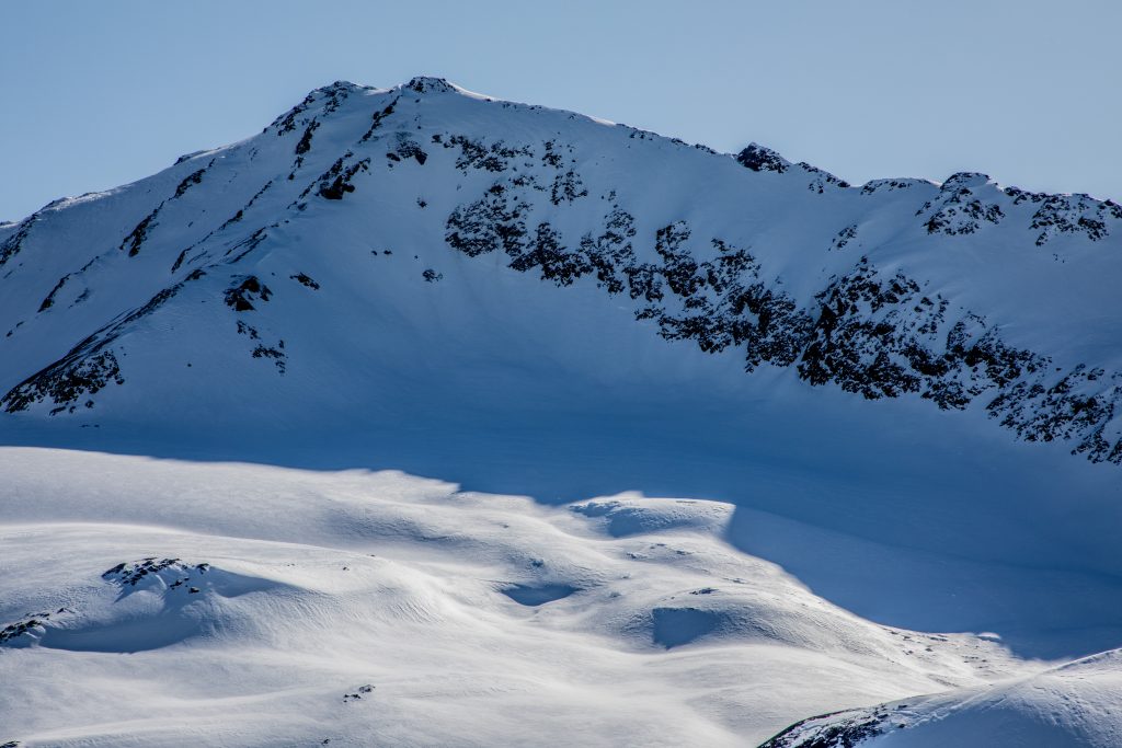
Pastoral Peak on the left and Kickstep on the right. The mountains look deceptively stable with a hard wind and sun affected surface.
–
Wind Slabs: Old hard wind slabs may be lurking on a variety of aspects due to prior unusual loading patterns. Steep rocky terrain, where slabs sit on unsupported slopes, are the most suspect for triggering a wind slab. This type of terrain is also suspect for triggering a deeper slab mentioned above.
Cornices: Cornices are large in places and the sun and above freezing temperatures can make them more unstable. Give cornices plenty of space and limit exposure underneath them.
Sunny skies again filled the region yesterday before cloud cover moved in during sunset. The anticipated snow flurries never developed. Ridgetop winds remained Easterly in the 10-20mph range with the strongest recordings early this morning, gusting to the mid 30’s mph. Temperatures have remained in the teens along ridgetops during the past 24-hours but cloud cover has kept valley bottoms warm where stations are reporting 25-30F temperatures this morning.
Today, Monday, expect overcast skies, cool temperatures and moderate ridgetop Easterly winds. There is a chance a few snow flurries could make it down to the ground, but this is more likely on the Southern and Eastern most part of the Kenai Peninsula. Temperatures look to remain in the teens along ridgetops today with valley bottoms hovering in the mid 30’sF. Ridgetop winds are expected to remain in the 10-20mph range from the East.
For Tuesday and into Wednesday, a front moves through Western Alaska and may bring a light snow to Southcentral. There is much uncertainty as to this system, yet it doesn’t look like the Turnagain Pass area will see much snowfall, mainly cloud cover at this point.
Temp Avg (F) | Snow (in) | Water (in) | Snow Depth (in) | |
Center Ridge (1880′) | 26 | 0 | 0 | 79 |
Summit Lake (1400′) | 25 | 0 | 0 | 32 |
Alyeska Mid (1700′) | 27 | 0 | 0 | 73 |
Temp Avg (F) | Wind Dir | Wind Avg (mph) | Wind Gust (mph) | |
Sunburst (3812′) | 17 | NE | 12 | 34 |
Seattle Ridge (2400′) | 23 | ESE | 17 | 34 |
Date | Region | Location | Observer |
---|---|---|---|
05/21/22 | Turnagain | Avalanche: Magnum, Lipps and Tincan | CNFAIC Staff |
05/17/22 | Turnagain | Avalanche: Sunburst | CNFAIC Staff |
05/17/22 | Turnagain | Observation: Tincan Ridge | Joe Kurtak |
05/11/22 | Turnagain | Avalanche: Cornbiscuit and Magnum west faces | CNFAIC Staff Forecaster |
05/07/22 | Turnagain | Observation: Granddaddy | Kit Barton |
04/29/22 | Turnagain | Observation: Sunburst wx station | AS/ MM/ AM/ NH |
04/28/22 | Turnagain | Observation: More Turnagain Pass/Summit Lake wet slab activity | Alex Marienthal |
04/27/22 | Turnagain | Observation: Magnum | Sykes / Buttrick Forecaster |
04/27/22 | Turnagain | Observation: Girdwood/Summit/Turnagain Road obs | A S |
04/24/22 | Turnagain | Avalanche: Seattle Ridge – large glide avalanche on Repeat Offender path | CNFAIC Staff Forecaster |
Status of riding areas across the Chugach NF is managed by the Glacier and Seward Ranger Districts, not avalanche center staff. Riding area information is posted as a public service to our users and updated based on snow depth and snow density to prevent resource damage at trailhead locations. Riding area questions contact: mailroom_r10_chugach@fs.fed.us
Area | Status | Weather & Riding Conditions |
---|---|---|
Glacier District |
Subscribe to Turnagain Pass
Avalanche Forecast by Email
This is a general backcountry avalanche advisory issued for Turnagain Arm with Turnagain Pass as the core advisory area. This advisory does not apply to highways, railroads or operating ski areas.