Turnagain Pass Avalanche Forecast
|
![]() ![]() |
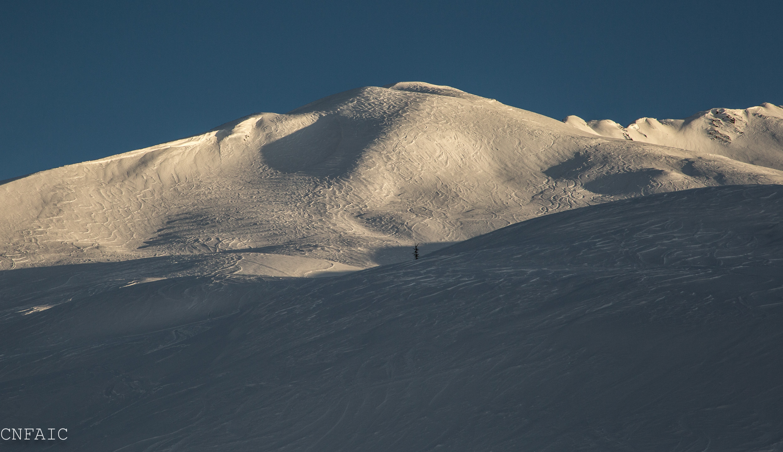
There is a MODERATE avalanche danger today in the alpine and treeline elevation bands where triggering a hard wind slab will be possible on steep, unsupported slopes. Above 3,000′ deep slab avalanches are still a possibility given the poor structure that we know exists high in the alpine. If you decide to venture out, cautious route finding and conservative decision-making will be key today given our current avalanche concerns.
There is no hazard rating below 1,000′ due to a lack of snow.
**Click HERE for the Summit Lake Summary posted yesterday.
WIND was the word yesterday. Moderate to strong easterly winds are wrecking havoc in the upper elevations thru Turnagain Pass. Even mid- slope yesterday, easterly winds were actively transporting any loose surface snow available and building hard wind slabs in leeward terrain, leaving only scoured ridges and anti-tracks in its wake. Any wind slabs today will be hard and supportable (to a skiers weight) and may lure a skier well onto a slope before it fails. Be suspect of unsupported slopes steeper than 30 degrees that have a fat, smooth, pillow-type shape to them. Listen for that hollow, drum-like sound below your skis or use a pole to probe for that hard snow over weak set up. Triggering even a small wind slab could have very high consequences especially in the upper elevations where there is also a potential for initiating a much larger and more dangerous deep slab avalanche. More on deep slabs below.
Impressive wind transport in the alpine looking South across Turnagain Arm from the Forest Service office in Girdwood.
Anti-tracks and a variable surface of mostly hard, wind-affected snow left in Common bowl, Tincan.
The recipe for deep slab avalanches has been found in the upper elevations of our forecast zone, above 3000’ on slopes that did not avalanche during the early December storm cycle. The snowpack ranges from 3-5+’ thick and is sitting on weak basal facets. Observations over the last few weeks indicate this poor structure is widespread across our region in the alpine elevations. This is a high consequence avalanche problem that is impossible to outsmart.
When dealing with a deep slab avalanche problem, keep in mind:
On Wednesday December 20th, two skiers approaching Pastoral Peak remotely triggered this very large avalanche from below. Luckily they were able to run from its path and avoid being caught. This is a very scary set-up that is likely not going away soon. More info on this avalanche here.
Clear skies and strong Easterly winds dominated our region yesterday. Generally ridge top winds were in the 20-30mph range and gusting into the 40s during the daylight hours. Winds peaked late last night with Sunburst seeing a gust to 93mph at midnight. Pockets of warm air in the Valleys were stubborn to erode with temps in Girdwood and Portage in the 40’s F thru much of the day. Ridge top temps were in the mid to high 20’s F.
Today we can expect to see 1- 3 € of snow as a weak front moves north across the Kenai Peninsula. Temperatures are expected to drop with the approach of the front and should promote snow in most areas. Ridge top winds will be in the 10-30mph range from the East. Daytime temperatures at 1,000′ are expected to be in the low 30’s F and dipping into the 20’s overnight.
Whatever precip we can squeeze out between now and the end of Christmas Day may be it for a few days as another high pressure looks to be setting up as we head back in to the work week.
**Center Ridge SNOTEL is reporting erroneous temperature data. See Turnagain Pass DOT weather station for accurate temperature at 1000′
Temp Avg (F) | Snow (in) | Water (in) | Snow Depth (in) | |
Center Ridge (1880′) | **27 | 0 | 0 | 31 |
Summit Lake (1400′) | 29 | 0 | 0 | 11 |
Alyeska Mid (1700′) | 32 | 0 | 0 | 26 |
Temp Avg (F) | Wind Dir | Wind Avg (mph) | Wind Gust (mph) | |
Sunburst (3812′) | 24 | ENE | 42 | 93 |
Seattle Ridge (2400′) | 28 | ESE | 26 | 70 |
Date | Region | Location | Observer |
---|---|---|---|
05/22/23 | Turnagain | Avalanche: Tincan | Nick D'Alessio |
05/12/23 | Turnagain | Avalanche: Tincan, Sunburst, Magnum, Cornbiscuit | Heather Thamm |
05/07/23 | Turnagain | Observation: Tincan – Bear Tracks | CNFAIC Staff |
05/05/23 | Turnagain | Observation: Seattle Ridge | AS/ WW Forecaster |
05/02/23 | Turnagain | Observation: Cornbiscuit | Schauer/ Sturgess Forecaster |
05/02/23 | Turnagain | Observation: Seward Hwy Turnagain Pass | Joel Curtis |
04/30/23 | Turnagain | Observation: Magnum | Ayla, Kit Crosby, Barton |
04/29/23 | Turnagain | Observation: Tincan | John Sykes |
04/28/23 | Turnagain | Avalanche: Taylor Pass/Pastoral | Schauer/ Creighton Forecaster |
04/28/23 | Turnagain | Avalanche: Tincan | Andy Moderow |
Status of riding areas across the Chugach NF is managed by the Glacier and Seward Ranger Districts, not avalanche center staff. Riding area information is posted as a public service to our users and updated based on snow depth and snow density to prevent resource damage at trailhead locations. Riding area questions contact: mailroom_r10_chugach@fs.fed.us
Area | Status | Weather & Riding Conditions |
---|---|---|
Glacier District |
Subscribe to Turnagain Pass
Avalanche Forecast by Email
This is a general backcountry avalanche advisory issued for Turnagain Arm with Turnagain Pass as the core advisory area. This advisory does not apply to highways, railroads or operating ski areas.