Turnagain Pass RSS

Archives
ARCHIVED - Forecasts expire after 24 hours.
Issued
Wed, December 6th, 2017 - 7:00AM
Expires
Thu, December 7th, 2017 - 7:00AM
Forecaster
Aleph Johnston-Bloom
Avalanche risk The Bottom Line

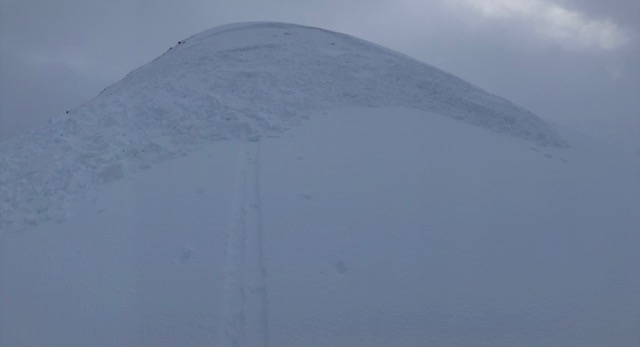
The avalanche danger is  CONSIDERABLE  near and above  treeline (above 1000′). The recent storm has loaded a weak snowpack.  Triggering a slab 2-3+ feet thick is likely on slopes steeper than 30 degrees. Remote triggered avalanches are possible. Cautious route-finding and conservative decision-making are essential today.    

Below 1000′ the avalanche danger is  MODERATE  where there is minimal snow cover, but an avalanche running from above is still possible.


Special Announcements

**Increased avalanche conditions have been seen across Southcentral, Alaska. This includes at Hatcher Pass, see forecast and recent observations at  hpavalanche.org.  

Motorized use on Turnagain Pass is closed due to insufficient snow cover.  Please see riding area status at the bottom of this page for the most up-to-date information.

Big thanks to the 130 people that came out for the  Snowmachine Specific €“ Avalanche Safety and Lessons Learned last night and to thanks to AMDS for hosting!!! #getthetraining

Join us this SATURDAY in Seward:

Know Before You Go – Avalanche Awareness at the Seward Community Library, December 8th,  1 pm – 4 pm  | FREE  Join CNFAIC for a great intro to avalanche recognition and rescue, including hands-on beacon practice.


Wed, December 6th, 2017
Alpine
Above 2,500'
3 - Considerable
Avalanche risk
Treeline
1,000'-2,500'
3 - Considerable
Avalanche risk
Below Treeline
Below 1,000'
2 - Moderate
Avalanche risk
0 - No Rating
1 - Low
2 - Moderate
3 - Considerable
4 - High
5 - Extreme
Avalanche risk Avalanche risk Avalanche risk Avalanche risk Avalanche risk
Travel Advice Generally safe avalanche conditions. Watch for unstable snow on isolated terrain features. Heightened avalanche conditions on specific terrain features. Evaluate snow and terrain carefully; identify features of concern. Dangerous avalanche conditions. Careful snowpack evaluation, cautious route-finding, and conservative decision-making essential. Very dangerous avalanche conditions. Travel in avalanche terrain not recommended. Extraordinarily dangerous avalanche conditions. Avoid all avalanche terrain.
Likelihood of Avalanches Natural and human-triggered avalanches unlikely. Natural avalanches unlikely; human-triggered avalanches possible. Natural avalanches possible; human-triggered avalanches likely. Natural avalanches likely; human-triggered avalanches very likely. Natural and human-triggered avalanches certain.
Avalanche Size and Distribution Small avalanches in isolated areas or extreme terrain. Small avalanches in specific areas; or large avalanches in isolated areas. Small avalanches in many areas; or large avalanches in specific areas; or very large avalanches in isolated areas. Large avalanches in many areas; or very large avalanches in specific areas. Very large avalanches in many areas.
Avalanche Problem 1
  • Persistent Slabs
    Persistent Slabs
Persistent Slabs
Persistent Slab avalanches are the release of a cohesive layer of snow (a slab) in the middle to upper snowpack, when the bond to an underlying persistent weak layer breaks. Persistent layers include: surface hoar, depth hoar, near-surface facets, or faceted snow. Persistent weak layers can continue to produce avalanches for days, weeks or even months, making them especially dangerous and tricky. As additional snow and wind events build a thicker slab on top of the persistent weak layer, this avalanche problem may develop into a Deep Persistent Slab.
More info at Avalanche.org

The facets buried now by both the Thanksgiving storm and the past weekend’s storm are still reactive and our main layer of concern. Observers reported multiple whumpfs, shooting cracks and a couple of avalanches triggered on both Monday and Tuesday. Quote from an observation on Monday, “I triggered a couple of house sized collapses and then a city block sized collapse at the top of the 10-15 degree willow slopes during the approach. These released above the crust. This was my spookiest trip up Sunburst ever, in hundreds of trips up it.” These red flags are all saying that this snowpack is not to be trusted. Those pesky facets are now buried around 3 feet deep. This means that a slab releasing on them could have high consequences. Snowpack tests yesterday also showed that the facets were reactive with propagation potential but may be a stubborn to initiate. An avalanche may not be triggered by the first person onto the slope but once a failure starts in the weak layer it could travel long distances across terrain and cause a large avalanche. This is not a set-up to mess with. The travel advice for Considerable hazard is important to highlight today. 

Remote triggered avalanche on Sunburst 12.4.17 Photo: Chris Flowers

Small avalanche triggered yesterday on Tincan. Note the slab depth. (Thanks to anonymous observer for sharing)

Pit profile at 2250′. The facets are sitting on an old melt freeze crust 20 cm above the ground. 


Avalanche Problem 2
  • Wind Slabs
    Wind Slabs
Wind Slabs
Wind Slab avalanches are the release of a cohesive layer of snow (a slab) formed by the wind. Wind typically transports snow from the upwind sides of terrain features and deposits snow on the downwind side. Wind slabs are often smooth and rounded and sometimes sound hollow, and can range from soft to hard. Wind slabs that form over a persistent weak layer (surface hoar, depth hoar, or near-surface facets) may be termed Persistent Slabs or may develop into Persistent Slabs.
More info at Avalanche.org

Very high winds (over 100 mph) during the storm Saturday have loaded leeward slopes. An additional 4-6″ of snow fell yesterday and ENE winds blew 15-25 mph with gusts as high as 60. Winds slabs are likely found along ridgelines as well as lower down slopes due to those high wind speeds on Saturday. Look for drifting or areas that look “fat”. Pay attention to cracking and hollow sounding snow. Wind slabs could be soft or hard depending on exposure to winds and if triggered could release a larger persistent slab lower down on the slope. Today is not the time to be pushing into steep terrain. Avoiding slopes greater than 30 degrees is recommended.


Wind loading on leeward slopes, CFR. 


Weather
Wed, December 6th, 2017

Yesterday skies were overcast in the morning with rain showers at sea level and snow falling above approximately 700′, adding 4-6″ of snow to the snowpack. The precipitation tapered off and the skies became broken in the afternoon. Winds were easterly 15-25 with higher gusts into the 50-60s. Temperatures were in the mid 30Fs at sea level and the mid 20s at ridgeline stations. There was slight cooling overnight.  

Today is forecasted to be mostly to partly cloudy with a chance of snow showers in the morning. Winds will shift to the north, 5-15 mph. Temperatures will be low to mid 30Fs at 1000′ and low to mid 20Fs at 3000′. Temperatures should dip into the low 20Fs overnight but then climb again Thursday morning as the next wave of forecasted moisture moves into the area. Again timing, precipitation amounts and temperatures are not certain. The models are having trouble with these waves beyond 24 hrs out according to the NWS. Stay tuned. Into the weekend looks to be stormy! For a good visual of the atmospheric river that is sending all the weather into the Gulf of Alaska check out Windy.com.

*Center Ridge SNOTEL is reporting erroneous temperature data. See  Turnagain Pass DOT weather station  for accurate temperature at 1000′.

**Seattle Ridge anemometer is rimed.

PRECIPITATION 24-hour data (6am – 6am)

  Temp Avg (F) Snow (in) Water (in) Snow Depth (in)
Center Ridge (1880′) 32* 4   .3   32  
Summit Lake (1400′) 30    1  .1  12
Alyeska Mid (1700′) 33 5    .4  20

RIDGETOP 24-hour data (6am – 6am)

  Temp Avg (F) Wind Dir Wind Avg (mph) Wind Gust (mph)
Sunburst (3812′) 24   ENE    20 63  
Seattle Ridge (2400′)  27 n/a**   n/a**   n/a **
Observations
Recent Observations for Turnagain Pass
Date Region Location
04/21/24 Turnagain Observation: Bertha Creek
04/20/24 Turnagain Avalanche: Spokane Creek
04/16/24 Turnagain Observation: Cornbiscuit
04/15/24 Turnagain Observation: Taylor Pass
04/15/24 Turnagain Observation: Seward Highway – Tern Lake to Portage
04/14/24 Turnagain Observation: Sunburst
04/14/24 Turnagain Observation: Turnagain Pass Snomo
04/13/24 Turnagain Observation: Spokane Creek
04/11/24 Turnagain Observation: Tincan
04/10/24 Turnagain Avalanche: Seattle Ridge
Riding Areas

The riding areas page has moved. Please click here & update your bookmarks.


Subscribe to Turnagain Pass
Avalanche Forecast by Email

This is a general backcountry avalanche advisory issued for Turnagain Arm with Turnagain Pass as the core advisory area. This advisory does not apply to highways, railroads or operating ski areas.