Turnagain Pass RSS

Archives
ARCHIVED - Forecasts expire after 24 hours.
Issued
Thu, March 16th, 2017 - 7:00AM
Expires
Fri, March 17th, 2017 - 7:00AM
Forecaster
Graham Predeger
Avalanche risk The Bottom Line

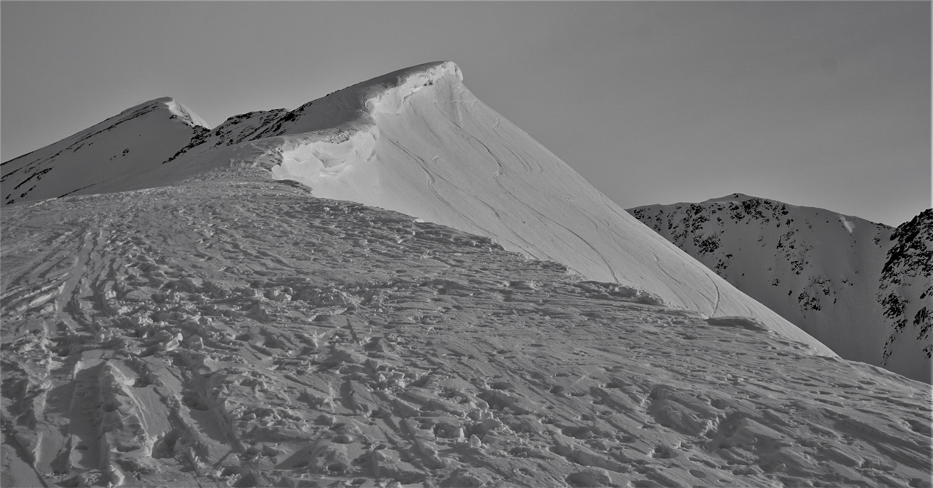
Avalanche danger remains LOW today at all elevations across the advisory area.   Triggering an avalanche is unlikely though still not impossible.   Steep, wind-loaded features do have all the ingredients for an outlier avalanche.   Very steep (extreme) terrain may also produce fast-moving loose dry sluffs.   Cornices and glide cracks also deserve a mention.  If either of these features fail, a large avalanche could be possible.  

Good travel habits are important, even during ‘green light conditions’.   Expose only one person at a time in avalanche terrain, watch your partners closely, communicate and have an escape route planned in case the snow moves.  

Summit Lake, South of Johnson Pass and North in parts of the Girdwood Valley (around Crow Pass):  A reminder that the snowpack remains thinner in these areas with a poor structure. There is still a chance for triggering an avalanche deeper in the snowpack in these areas. Read the  Saturday Summit Summary  HERE.

Special Announcements

Consider showing your support for public avalanche centers when applying for your 2017 PFD!!  Friends of the Chugach National Forest Avalanche Center is an  official  Pick. Click. Give. organization!

Thu, March 16th, 2017
Alpine
Above 2,500'
1 - Low
Avalanche risk
Treeline
1,000'-2,500'
1 - Low
Avalanche risk
Below Treeline
Below 1,000'
1 - Low
Avalanche risk
0 - No Rating
1 - Low
2 - Moderate
3 - Considerable
4 - High
5 - Extreme
Avalanche risk Avalanche risk Avalanche risk Avalanche risk Avalanche risk
Travel Advice Generally safe avalanche conditions. Watch for unstable snow on isolated terrain features. Heightened avalanche conditions on specific terrain features. Evaluate snow and terrain carefully; identify features of concern. Dangerous avalanche conditions. Careful snowpack evaluation, cautious route-finding, and conservative decision-making essential. Very dangerous avalanche conditions. Travel in avalanche terrain not recommended. Extraordinarily dangerous avalanche conditions. Avoid all avalanche terrain.
Likelihood of Avalanches Natural and human-triggered avalanches unlikely. Natural avalanches unlikely; human-triggered avalanches possible. Natural avalanches possible; human-triggered avalanches likely. Natural avalanches likely; human-triggered avalanches very likely. Natural and human-triggered avalanches certain.
Avalanche Size and Distribution Small avalanches in isolated areas or extreme terrain. Small avalanches in specific areas; or large avalanches in isolated areas. Small avalanches in many areas; or large avalanches in specific areas; or very large avalanches in isolated areas. Large avalanches in many areas; or very large avalanches in specific areas. Very large avalanches in many areas.
Avalanche Problem 1
  • Normal Caution
    Normal Caution
Normal Caution
Normal Caution means triggering an avalanche is unlikely but not impossible.
More info at Avalanche.org

What a long strange trip it’s been without any measurable precipitation… 22 days for those that are counting!  Surface conditions are made up primarily of thin crusts, hard wind board on ridges and near surface facets (recycled powder) in favored areas sheltered from the recent winds.  Avalanche concerns to keep in mind today if venturing out:

 Wind Slabs: Some fresher wind slabs likely formed during Tuesday’s wind event and could be tender, though likely small in size.  Watch for shooting cracks indicating recently loaded slopes and fresher wind slabs.  Older, stiffer wind slabs such as the one triggered on Seattle ridge last weekend will be less likely to trigger by a skier or snowmachiner today. Smooth pillowed snow on steep unsupported features or in rocky areas will be the most suspect of areas for someone to initiate an old wind slab.  

Loose Snow Avalanches (Sluffs): Dry sluffs on steep slopes are probable and have been fast moving this week.  Keep terrain choices and potential consequences in mind when managing sluffs.

Glide Avalanches: Glide cracks continue to slowly open above popular terrain on Seattle Ridge and in other zones across the advisory area. These may release at any time.  Minimize exposure time spent under visible cracks.

Cornices: Cornices should always be given an extra wide berth if travelling along a corniced ridge.  Like glide cracks, minimize your exposure time spent under these backcountry bombs. 

Persistent Slabs and Deep Slabs: There are various weak layers in our thin snowpack. Buried surface hoar sits 1-3+’ below the surface and faceted snow sits in the mid and base of the pack. Given plenty of time and a lack of changing weather, these weak layers (with varying degrees of strength) are in a ‘dormant stage’.  Although unlikely, an avalanche breaking deeper in the pack isn’t completely out of the question in areas such as Johnson Pass, Lynx Creek and in parts of Girdwood Valley (especially around Crow Pass).  A cornice fall or glide crack release could also be a large enough trigger to wake up one of these persistent slabs.  

Wind-buffed Magnum ridge with a sizeable cornice still in-tact over PMS bowl.  photo: Conrad Chapman

Thin sun-crust capping chained Facets at 2,400′ yesterday on Magnum.  photo: Conrad Chapman

Weather
Thu, March 16th, 2017

High clouds making for a grey-bird day were a welcome €˜change’ for many a backcountry enthusiasts in south-central Alaska yesterday.   Unfortunately those clouds weren’t of the precip-producing type.   Temps continue to be unseasonably cool with a high topping out in the single digits at 1880′ on Center ridge.   Winds were light to moderate from the NW at ridgetop levels.

High clouds today will give way to mostly sunny skies by this afternoon.  Expect light winds from the NNE today as the worst of the blow appear to be over (at least for now).  Temps will again start out cool but should warm a bit more today to the low 20’s F at 1,000′.  No measurable precip is expected.  

Expect mostly clear skies, light winds and cool overnight temps recovering to the 20’s F thru the weekend.  We’ve got some “chances of snow” materializing in the longer term forecast by early next week.  Stay tuned!

PRECIPITATION 24-hour data (6am – 6am)

  Temp Avg (F) Snow (in) Water (in) Snow Depth (in)
Center Ridge (1880′) 6   0   0    59
Summit Lake (1400′)  9 0   0   29  
Alyeska Mid (1700′)  9 0   0    56

RIDGETOP 24-hour data (6am – 6am)

  Temp Avg (F) Wind Dir Wind Avg (mph) Wind Gust (mph)
Sunburst (3812′)  0 WNW 5   16  
Seattle Ridge (2400′)  3 N   6   20  
Observations
Recent Observations for Turnagain Pass
Date Region Location
04/16/24 Turnagain Observation: Cornbiscuit
04/15/24 Turnagain Observation: Taylor Pass
04/15/24 Turnagain Observation: Seward Highway – Tern Lake to Portage
04/14/24 Turnagain Observation: Sunburst
04/14/24 Turnagain Observation: Turnagain Pass Snomo
04/13/24 Turnagain Observation: Spokane Creek
04/11/24 Turnagain Observation: Tincan
04/10/24 Turnagain Avalanche: Seattle Ridge
04/10/24 Turnagain Observation: Cornbiscuit South Face
04/10/24 Turnagain Avalanche: Tincan
Riding Areas

The riding areas page has moved. Please click here & update your bookmarks.


Subscribe to Turnagain Pass
Avalanche Forecast by Email

This is a general backcountry avalanche advisory issued for Turnagain Arm with Turnagain Pass as the core advisory area. This advisory does not apply to highways, railroads or operating ski areas.