No obvious signs of instability
Observation: Turnagain
Location: N side of Cornbiscuit, PMS bowl/ Magnum to 3500'
Toured up between Magnum and Cornbiscuit. Dug pits on the N side of Cornbiscuit and the SW slope below PMS bowl on Magnum. Topped out on the ridgeline of Magnum at 3500′.
Observer Comments
Weather
Cold and sunny in the morning, 6F at the trail head. Skies clouded over as the day progressed. Light winds in the alpine and at ridgeline.
Snow surface
Variable wind skin at treeline and into the alpine. Thin sun crust present on steeper southerly aspects. Ridgetop had been hammered by wind. Snow surface conditions from throughout our tour:
1000' - 4-6mm surface hoar over 15cm of 1mm near surface facets.
1200' - Surface hoar had disappeared
1500' - Thin wind skin over 18cm of 1mm near surface facets
2400' - (Shaded aspect) Thin wind skin over 20cm of 1mm near surface facets
2400' - (Sun exposed aspect) 1cm Sun crust
3100' - 1cm sun crust (faceting) over 20cm near surface facets
Snowpack
15-20cm of loose near surface facets along most of our tour. The rain crust below the facets was no longer supportable below 1200' but was slick skinning above that to around 2000' with the near surface facets on it.
Pit 1: N face of Cornbiscuit, 2400', 30 degree slope.
HS: 200cm
Pit depth: 105cm
Wanted to get some data from a cool, shady, North aspect. Found the Feb 9th buried surface hoar sandwiched between pencil hard slabs. The layer was reactive during tests:
CT22 @ 60cm down from surface. Failed on 4-6mm buried surface hoar.
ECTP21 @ 60cm down from surface. Failed on 4-6mm buried surface hoar. Clean, smooth, and energetic failure.
Other results occurred higher in the snowpack and did not show any propagation:
CT15 @ 15cm down from surface.
CT21 @ 20cm & 30cm down from surface.
Pit 2: SW face of Magnum, 2400', 30 degree slope
HS: 166cm
Looking to see what the snowpack was doing in a more sun exposed location. Surface had interesting cupped facets, due to advanced near surface faceting and sun crust was faceting away. Bottom of the snowpack is still pencil to knife hard old melt freeze crust/ depth hoar combo. Had a few test results on the (near surface facets that were buried on Feb. 9th) hardness interface 40cm down from the surface but none of the results showed propagation:
CT26 @ 40cm down from surface. Failed on a hardness interface (Feb 9th nsf).
CT27 @ 40cm Same as above
ECTN24 @ 40cm Same as above

Surface conditions at 1000'. Widespread surface hoar.
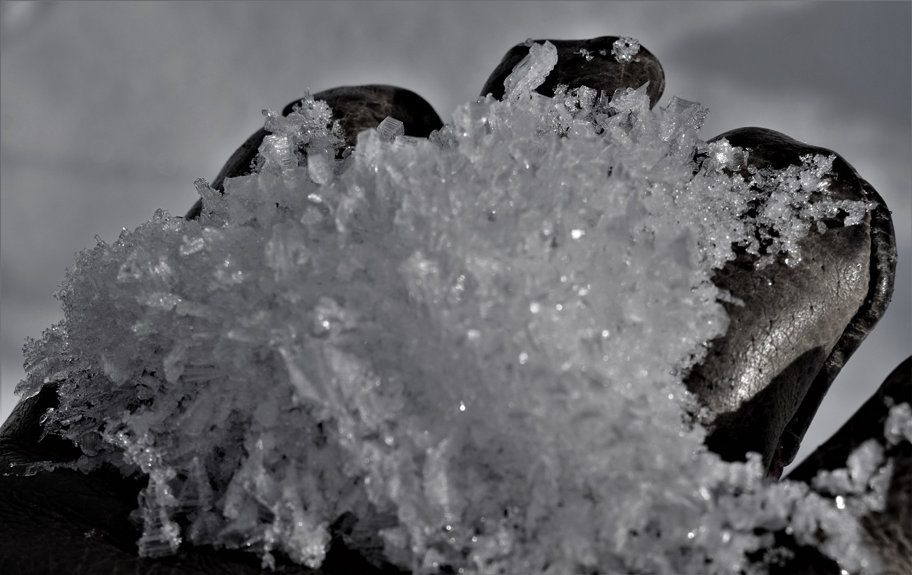
Cupped surface hoar from 1000'.

Surface conditions from 1500'. Lightly wind textured surface.
Thicker sun crust from a steeper South facing slope.

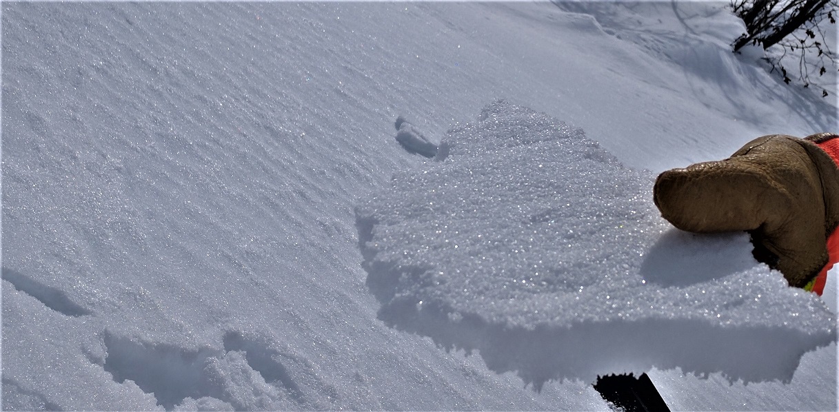
Sun crust over chained facets. Surface conditions at 2400'.
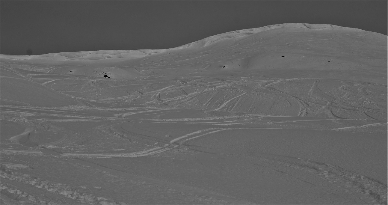
Surface conditions at 3000'. Lots of tracks that had set up much harder than their surroundings.
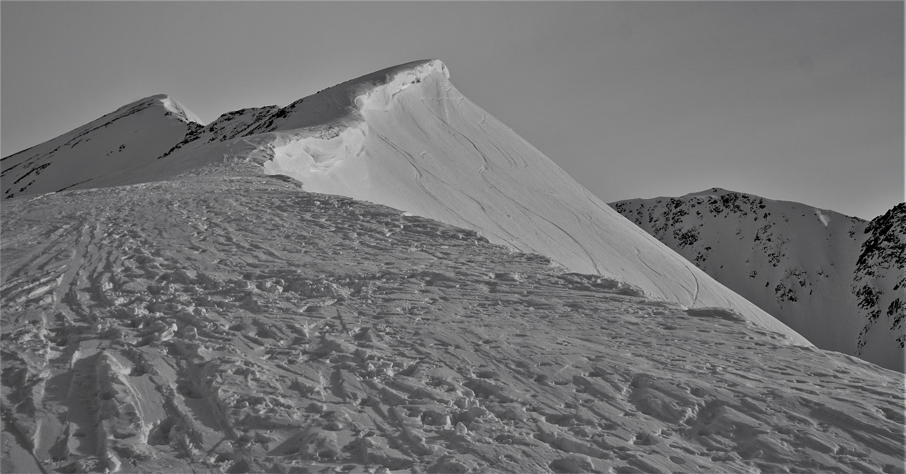
Wind hammered snow surface on the ridgetop of Magnum. Cornice hanging over PMS Bowl.

Lots of ski tracks off Super Bowl. Some small skier triggered sluffs.

Hardness profile from Pit 2.

Ski tracks off the S face of Sunburst. Far running skier triggered sluffs.