Turnagain Pass Avalanche Forecast RSS

Archives
ARCHIVED FORECAST - All forecasts expire after 24 hours from the posting date/time.
Issued
Thu, February 18th, 2016 - 7:00AM
Expires
Fri, February 19th, 2016 - 7:00AM
Forecaster
Heather Thamm
Avalanche risk The Bottom Line

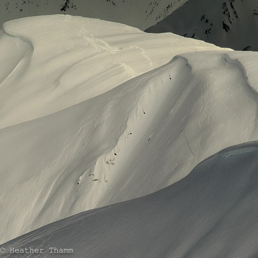
Today a MODERATE avalanche danger exists in the Alpine (above 2500′) where cornices and lingering wind slabs may prove tender today with recent wind loading and increased sun exposure. At Treeline elevations (below 2500′) the danger is MODERATE where it is necessary to plan your route to avoid being underneath glide cracks and cornices.      

*Shallow snowpack zones: South of Turnagain Pass and the Summit Lake area have old weak layers in the snowpack where triggering a much larger avalanche is possible. This is something to keep in mind if you are headed to these zones. Click HERE for a recent photo of large Natural avalanche between Lynx Creek and Silvertip Creek.  

Special Announcements

Saturday, February 20th  Hatcher Pass Avalanche Center is having their annual fundraiser at Gov’t Peak Chalet near Hatcher Pass. This event will feature a slide show by local climber and ski mountaineer, Kirsten Kremer,  a Silent Auction, Live Music and FUN!  Click  HERE  for more info.

Thanks to our sponsors!
Thu, February 18th, 2016
Alpine
Above 2,500'
Moderate (2)
Avalanche risk
Treeline
1,000'-2,500'
Moderate (2)
Avalanche risk
Below Treeline
Below 1,000'
No Rating (0)
Avalanche risk
Alpine
Above 2,500'
Avalanche risk
Moderate (2)
Treeline
1,000'-2,500'
Avalanche risk
Moderate (2)
Below Treeline
Below 1,000'
Avalanche risk
No Rating (0)
Danger Scale:
No Rating (0)
Low (1)
Moderate (2)
Considerable (3)
High (4)
Extreme (5)
Avalanche Problem 1
  • Wind Slabs
    Wind Slabs
Wind Slabs
Wind Slab avalanches are the release of a cohesive layer of snow (a slab) formed by the wind. Wind typically transports snow from the upwind sides of terrain features and deposits snow on the downwind side. Wind slabs are often smooth and rounded and sometimes sound hollow, and can range from soft to hard. Wind slabs that form over a persistent weak layer (surface hoar, depth hoar, or near-surface facets) may be termed Persistent Slabs or may develop into Persistent Slabs.
More info at Avalanche.org

Yesterday wind loading was observed in Turnagain Pass with Northeast ridgetop winds blowing 15-25 mph for most of the day. These fresh slabs could be tender and may awaken older deeper wind slabs (1-3’ thick) that formed over Valentine’s Day weekend. Be aware of this problem on slopes steeper than 35°, especially near rocks and on unsupported terrain features. Over the last few days observations have shown good bonding since Monday when two separate human triggered avalanches occurred in the Goldpan area of Turnagain Pass.  Avalanching has not been widespread, but this set-up needs to be considered, especially later in the day with increased sun exposure.

Loose snow avalanches: There is the potential for wet loose avalanches on steep southerly slopes and dry loose avalanches on steep northerly slopes. Remember these will release at your feet but may gain momentum and catch you from behind as you travel downhill. Evaluate terrain where taking a fall could have high consequences. 

Two small (D1) avalanches on ‘Juniors’  West aspect of Seatte Ridge, apear to be skier triggered. No official report of timing of these avalanches, but likely occured on Monday.

Avalanche Problem 2
  • Cornice
    Cornice
Cornice
Cornice Fall is the release of an overhanging mass of snow that forms as the wind moves snow over a sharp terrain feature, such as a ridge, and deposits snow on the downwind (leeward) side. Cornices range in size from small wind drifts of soft snow to large overhangs of hard snow that are 30 feet (10 meters) or taller. They can break off the terrain suddenly and pull back onto the ridge top and catch people by surprise even on the flat ground above the slope. Even small cornices can have enough mass to be destructive and deadly. Cornice Fall can entrain loose surface snow or trigger slab avalanches.
More info at Avalanche.org

Cornices have released naturally over the last few days and many have triggered fresh wind slabs. When approaching a ridgeline it can be challenging to recognize a safe distance. Be very skeptical of other tracks along ridgetops and don’t be tempted to walk to the edge for a better look. Cornices are notorious for breaking much further back than expected and if one releases it will be very large. Natural cornice fall activity should also be anticipated with warming from the sun, thus avoid spending time below cornices.

A massive cornice feature above ‘Mamma’s Bowl’ on Seattle Ridge at the very top of the up-track.

Additional Concern
  • Glide Avalanches
    Glide Avalanches
Glide Avalanches
Glide Avalanches are the release of the entire snow cover as a result of gliding over the ground. Glide avalanches can be composed of wet, moist, or almost entirely dry snow. They typically occur in very specific paths, where the slope is steep enough and the ground surface is relatively smooth. They are often proceeded by full depth cracks (glide cracks), though the time between the appearance of a crack and an avalanche can vary between seconds and months. Glide avalanches are unlikely to be triggered by a person, are nearly impossible to forecast, and thus pose a hazard that is extremely difficult to manage.
More info at Avalanche.org

Glide Cracks cover many steep slopes between 1000’ to 2500’ and continue to release without warming. Over the last few days several have released and many have significantly widened. Be extra diligent about planning your route to avoid these unpredictable hazards. Minimize any time directly underneath and do not re-group below them.

A very large glide crack above a common “re-group” area in Main Bowl in Seattle Creek.


Weather
Thu, February 18th, 2016

Yesterday was partly sunny becoming mostly cloudy by mid afternoon. Temperatures warmed to the mid 30’s F along the highway, but remained cooler, low 20’s F at higher elevations. Moderate Northeast winds 15-25mph blew all day and just started subsiding this morning.  

Partly sunny skies are anticipated again today with Easterly ridgetop wind decreasing to 10-15mph. Day time temperatures with sun exposure may reach the mid 30’s F again today, but shaded area will likely remain in the 20’sF.

A similar pattern is expected tonight into tomorrow, but with increased cloud cover.  

PRECIPITATION 24-hour data (6am – 6am)

  Temp Avg (F) Snow (in) Water (in) Snow Depth (in)
Center Ridge (1880′) 28   0   0     102  
Summit Lake (1400′) 24   0     0     30  
Alyeska Mid (1700′) 27   0   0     86  

RIDGETOP 24-hour data (6am – 6am)

  Temp Avg (F) Wind Dir Wind Avg (mph) Wind Gust (mph)
Sunburst (3812′) 19   ENE   12   35  
Seattle Ridge (2400′) 22   ~   ~   ~  
Observations
Recent Observations for Turnagain Pass
Date Region Location
05/22/23 Turnagain Avalanche: Tincan
05/12/23 Turnagain Avalanche: Tincan, Sunburst, Magnum, Cornbiscuit
05/07/23 Turnagain Observation: Tincan – Bear Tracks
05/05/23 Turnagain Observation: Seattle Ridge
05/02/23 Turnagain Observation: Cornbiscuit
05/02/23 Turnagain Observation: Seward Hwy Turnagain Pass
04/30/23 Turnagain Observation: Magnum
04/29/23 Turnagain Observation: Tincan
04/28/23 Turnagain Avalanche: Taylor Pass/Pastoral
04/28/23 Turnagain Avalanche: Tincan
Riding Areas
Updated Sat, September 23rd, 2023

Status of riding areas across the Chugach NF is managed by the Glacier and Seward Ranger Districts, not avalanche center staff. Riding area information is posted as a public service to our users and updated based on snow depth and snow density to prevent resource damage at trailhead locations. Riding area questions contact: mailroom_r10_chugach@fs.fed.us

Area Status Weather & Riding Conditions
Glacier District
Johnson Pass
Closed
Scheduled opening per Chugach National Forest plan December 1. Subject to adequate snow cover.
Placer River
Closed
Scheduled opening per Chugach National Forest plan December 1. Subject to adequate snow cover.
Skookum Drainage
Closed
Scheduled opening per Chugach National Forest plan December 1. Subject to adequate snow cover.
Turnagain Pass
Closed
Scheduled opening on the Wednesday before Thanksgiving per Chugach National Forest plan. Subject to adequate snow cover.
Twentymile
Closed
Scheduled opening per Chugach National Forest plan December 1. Subject to adequate snow cover.
Seward District
Carter Lake
Closed
Scheduled opening per Chugach National Forest plan December 1. Subject to adequate snow cover.
Lost Lake Trail
Closed
Scheduled opening per Chugach National Forest plan December 1. Subject to adequate snow cover.
Primrose Trail
Closed
Scheduled opening per Chugach National Forest plan December 1. Subject to adequate snow cover.
Resurrection Pass Trail
Closed
Scheduled opening per Chugach National Forest plan December 1. Subject to adequate snow cover.
Snug Harbor
Closed
Scheduled opening per Chugach National Forest plan December 1. Subject to adequate snow cover.
South Fork Snow River Corridor
Closed
Scheduled opening per Chugach National Forest plan December 1. Subject to adequate snow cover.
Summit Lake
Closed
Scheduled opening per Chugach National Forest plan December 1. Subject to adequate snow cover.

Subscribe to Turnagain Pass
Avalanche Forecast by Email

This is a general backcountry avalanche advisory issued for Turnagain Arm with Turnagain Pass as the core advisory area. This advisory does not apply to highways, railroads or operating ski areas.