Turnagain Pass Avalanche Forecast
|
![]() ![]() |
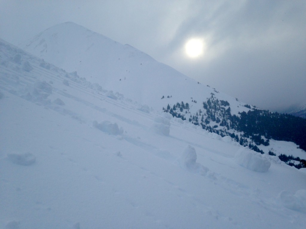
The avalanche danger is CONSIDERABLE for both wet avalanches and glide avalanches at elevations between 1,000′ and 2,500′. This is due to rain-on-snow and warm temperatures that are weakening the snowpack in this mid-elevation band. Above 2,500′, in the Alpine terrain, we also have a CONSIDERABLE avalanche danger, where human triggered wind slab avalanches are likely in steep leeward terrain and cornices will be tender.
Below Treeline (-1000′) a MODERATE danger exists where an avalanche in steep channeled terrain could run into this elevation band.
***Elevated caution is also advised in the Summit Lake area. Please see the Summit Lake Summary for more information and check out the observations page.
Tomorrow Hatcher Pass Avalanche Center, Friends of the CNFAIC and Alaska Avalanche School are hosting a FREE companion rescue workshop from 10:30am-12:30pm at Hatcher Pass in the Gold Mint parking lot. Please join us! Click HERE for more information!
Temperatures staying above freezing and rain falling to around 2200′ have elevated the concern for glide avalanches. There are many glide cracks that haven’t released, especially on Seattle Ridge, in terrain that threatens where people recreate. Today is a good day to stay away from these slopes and the runout zones. The large release on Eddies yesterday illustrates the magnitude of this hazard. New cracks may also appear and release without warning. This whole glide phenomenon is very unpredictable and the best advice is to steer clear!
Glide avalanche on Eddies. This released sometime late 2/10-early 2/11.
An inch of water fell yesterday as rain to approximately 2200′ (closer to 2″ in Girdwood Valley). This began to saturate the settled storm snow and wet loose activity was observed.Temperatures at 1880′ (Center Ridge) were above 32F for 24 hrs. Additional rain today will continue to add stress and decrease strength as it penetrates into the snow stitting on the 1/27 rain crust. Wet loose and wet slab avalanches are likely in the mid-elevation band (1000′-2500′) in steep terrain.These may occur naturally or be triggered by the weight of skier or snowmachiner.
Skier triggered roller balls on Tenderfoot.
There are a variety of storm snow concerns today.
Storm Slabs: This warm, wet snow should bond quickly to the surfaces below but the warmer snow over slightly colder snow may create storm slabs. Quick hand pits are a good way to determine if the new snow is sticking to the old snow.
Wind slabs: Yesterday above approximately 2200′ we received a foot of new snow and sustained winds. It will be possible to trigger a wind slab in steep wind-loaded terrain. Be on the lookout for stiff, pillowed snow and shooting cracks.
Cornices: The fresh snow/wind combination will also add to already large cornices that may be very tender due to warm temperatures. Avoid travel on or below these behemoths.
Persistent Slab: In areas outside of our core forecast zone, including South of Turnagain Pass and the Summit Lake area, the snowpack is shallower and harbors various weak layers; the most notable weak layer is a layer of buried surface hoar 2-3′ deep in the pack. We have found these to be unreactive in the past week but with the warm weather and additional load they could re-activate. For more information see this report from the Lynx Creek drainage and the avalanche triggered January 30th.
Wind transport in the Alpine on Tenderfoot yesterday.
Yesterday was mostly cloudy and rain and snow fell throughout the day. The area recieved 1-2″ of water, with snow falling above 2200′. Winds were from the ENE blowing in the 30s(mph) for most of the day and gusting into the 70s. Tempertatures were in the 30Fs.
Today will be mostly cloudy with another few inches of snow possible or rain showers depending on elevation. Rain/snow line is again forecasted to be around 2200′. Winds will be Easterly 15-30 mph. Temperatures will be in the 30Fs.
Tonight will be slightly cooler and rain/snow showers will continue into tomorrow as the overall pattern persists into the weekend.
Temp Avg (F) | Snow (in) | Water (in) | Snow Depth (in) | |
Center Ridge (1880′) | 33 | 0 | 1 | 102 |
Summit Lake (1400′) | 35 | 0 | .3 | 31 |
Alyeska Mid (1700′) | 33 | 1.5 | 1 | 87 |
Temp Avg (F) | Wind Dir | Wind Avg (mph) | Wind Gust (mph) | |
Sunburst (3812′) | 26 | ENE | 25 | 71 |
Seattle Ridge (2400′) | 28 | n/a | n/a | n/a |
Date | Region | Location | Observer |
---|---|---|---|
05/22/23 | Turnagain | Avalanche: Tincan | Nick D'Alessio |
05/12/23 | Turnagain | Avalanche: Tincan, Sunburst, Magnum, Cornbiscuit | Heather Thamm |
05/07/23 | Turnagain | Observation: Tincan – Bear Tracks | CNFAIC Staff |
05/05/23 | Turnagain | Observation: Seattle Ridge | AS/ WW Forecaster |
05/02/23 | Turnagain | Observation: Cornbiscuit | Schauer/ Sturgess Forecaster |
05/02/23 | Turnagain | Observation: Seward Hwy Turnagain Pass | Joel Curtis |
04/30/23 | Turnagain | Observation: Magnum | Ayla, Kit Crosby, Barton |
04/29/23 | Turnagain | Observation: Tincan | John Sykes |
04/28/23 | Turnagain | Avalanche: Taylor Pass/Pastoral | Schauer/ Creighton Forecaster |
04/28/23 | Turnagain | Avalanche: Tincan | Andy Moderow |
Status of riding areas across the Chugach NF is managed by the Glacier and Seward Ranger Districts, not avalanche center staff. Riding area information is posted as a public service to our users and updated based on snow depth and snow density to prevent resource damage at trailhead locations. Riding area questions contact: mailroom_r10_chugach@fs.fed.us
Area | Status | Weather & Riding Conditions |
---|---|---|
Glacier District |
Subscribe to Turnagain Pass
Avalanche Forecast by Email
This is a general backcountry avalanche advisory issued for Turnagain Arm with Turnagain Pass as the core advisory area. This advisory does not apply to highways, railroads or operating ski areas.