Turnagain Pass RSS

Archives
ARCHIVED - Forecasts expire after 24 hours.
Issued
Fri, January 1st, 2016 - 7:00AM
Expires
Sat, January 2nd, 2016 - 7:00AM
Forecaster
Aleph Johnston-Bloom
Avalanche risk The Bottom Line

A  CONSIDERABLE  avalanche danger exists both at Treeline and in the Alpine where human triggered  windslabs 1-4′ thick are likely on steep wind loaded features. The storm coming in today will bring new snow, rain and wind adding load and building sensitive storm slabs. Natural avalanches will be possible. Cautious route-finding and conservative terrain choices will be important.  Conditions may change rapidly in the afternoon into the evening, when the precipitation instensity is forecasted to be the heaviest.  

A  MODERATE  avalanche danger exists below 1000′ where a larger avalanche from above could run into this elevation band.

Special Announcements

Happy New Year! Filing for the PFD today? Remember The Friends of the CNFAIC is part of PICK.CLICK.GIVE. Your donations are greatly appreciated and integral to making the CNFAIC possible and sustainable.  

Did you make a resolution to get avalanche education in 2016? FCNFAIC is now accepting applications for TWO NEW scholarships! Both scholarships are for avalanche education up to $500. One will be awarded to a snowmachiner and the other to a skier or non-motorized user.

 Please include in your application: name, mailing address, your financial need and how you plan to spread avalanche awareness to your community post-award.   Applications due by 10PM on January 6th.   Please send  your applications to  chugachavyfriends@gmail.com

The Friends-CNFAIC board  looks forward to hearing from you!  

Fri, January 1st, 2016
Alpine
Above 2,500'
3 - Considerable
Avalanche risk
Treeline
1,000'-2,500'
3 - Considerable
Avalanche risk
Below Treeline
Below 1,000'
2 - Moderate
Avalanche risk
0 - No Rating
1 - Low
2 - Moderate
3 - Considerable
4 - High
5 - Extreme
Avalanche risk Avalanche risk Avalanche risk Avalanche risk Avalanche risk
Travel Advice Generally safe avalanche conditions. Watch for unstable snow on isolated terrain features. Heightened avalanche conditions on specific terrain features. Evaluate snow and terrain carefully; identify features of concern. Dangerous avalanche conditions. Careful snowpack evaluation, cautious route-finding, and conservative decision-making essential. Very dangerous avalanche conditions. Travel in avalanche terrain not recommended. Extraordinarily dangerous avalanche conditions. Avoid all avalanche terrain.
Likelihood of Avalanches Natural and human-triggered avalanches unlikely. Natural avalanches unlikely; human-triggered avalanches possible. Natural avalanches possible; human-triggered avalanches likely. Natural avalanches likely; human-triggered avalanches very likely. Natural and human-triggered avalanches certain.
Avalanche Size and Distribution Small avalanches in isolated areas or extreme terrain. Small avalanches in specific areas; or large avalanches in isolated areas. Small avalanches in many areas; or large avalanches in specific areas; or very large avalanches in isolated areas. Large avalanches in many areas; or very large avalanches in specific areas. Very large avalanches in many areas.
Avalanche Problem 1
  • Storm Slabs
    Storm Slabs
Storm Slabs
Storm Slab avalanches are the release of a cohesive layer (a slab) of new snow that breaks within new snow or on the old snow surface. Storm-slabs typically last between a few hours and few days (following snowfall). Storm-slabs that form over a persistent weak layer (surface hoar, depth hoar, or near-surface facets) may be termed Persistent Slabs or may develop into Persistent Slabs.
More info at Avalanche.org

After a break in the stormy weather for most of the day yesterday we are back in it today. The first storm of 2016 could bring another 2 inches of moisture to the advisory area today and tonight as well as ramping up the winds. Rain/snow line is forecasted to be around 1800′ again. There will be a variety of storm snow concerns today. Look for signs of instability while traveling: recent avalanches, cracking and whumpfing are all indications that the snowpack is becoming stressed. As always use safe travel protocols and don’t linger in runout zones. 

1) Storm slab: As the new snow falls today it may not initially bond to the existing snow surface and/or be wetter and heavier. This could create sensitive slabs in much of the terrain.

2) Wind slab: Triggering a wind slab 1-4’ thick is likely on steep wind loaded features where multiple layers of wind affected snow exist. Yesterday these wind loaded areas were easy to spot due to their pillow-like shape, but today another 10” of snow is expected and Easterly winds 30-50 mph will be transporting more new snow on top, thus adding additional stress to the snowpack and the potential for more wind slabs.

3) Cornices: With such strong winds and warm snow at ridgetops, we can expect cornices to be tender. These ‘backcountry bombs’ are likely to trigger a wind slab or step down to a deeper instability. Avoid ridgelines with large cornices and don’t put yourself below one.

4) Wet loose avalanches: More rain on snow will saturate the upper layers of the snowpack below 1800’. This is more of a concern in areas with terrain traps and in steep channeled terrain where an avalanche from above will be impossible to escape. 

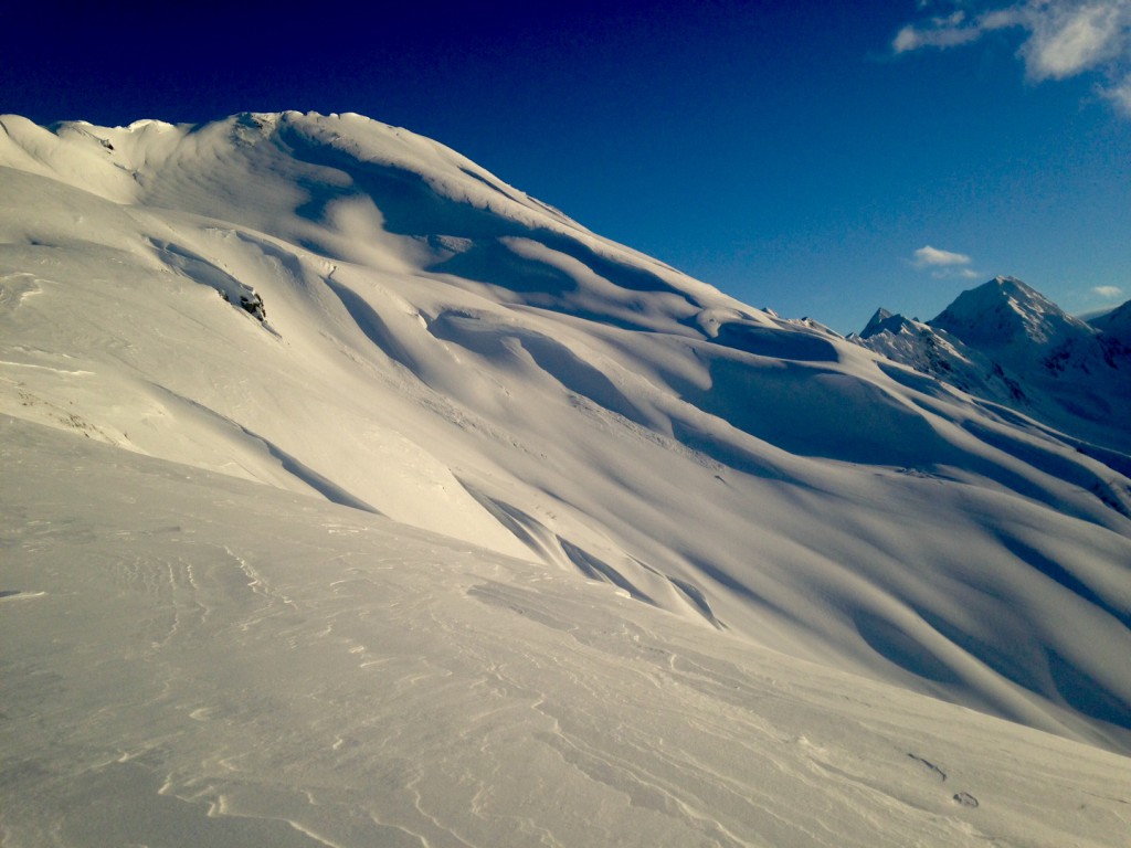
Wind effected snow in Hippy Bowl yesterday: cornices, wind-pillows and sculpted ridgelines will all change with the additional snow and wind today. 


Avalanche Problem 2
  • Deep Persistent Slabs
    Deep Persistent Slabs
Deep Persistent Slabs
Deep Persistent Slab avalanches are the release of a thick cohesive layer of hard snow (a slab), when the bond breaks between the slab and an underlying persistent weak layer deep in the snowpack. The most common persistent weak layers involved in deep, persistent slabs are depth hoar or facets surrounding a deeply buried crust. Deep Persistent Slabs are typically hard to trigger, are very destructive and dangerous due to the large mass of snow involved, and can persist for months once developed. They are often triggered from areas where the snow is shallow and weak, and are particularly difficult to forecast for and manage.
More info at Avalanche.org

The Thanksgiving Rain Crust (TRC)/small facet combo is getting more and more deeply buried but continues to be on our radar as a concern. Yesterday we received additional reports of avalanches breaking into older weak snow primarily in the periphery of our advisory area. As the snowpack gets yet another load we will be monitoring whether slides are breaking in old snow on this persistent weak layer. Cautious travel is already advised. Deep slab potential is another reason to not put more than one skier/rider or sledder on the slope in avalanche terrain and to watch out for thin spots where triggering may be easier. 

Pit from Tincan 2300′, SW aspect. Note: facets over the TRC buried over 3′ deep.


Weather
Fri, January 1st, 2016

Yesterday skies mostly cleared after a burst of precipitation favoring the Girdwood Valley in the early morning. Temperatures were in the mid 20Fs at ridgeline and warmer in the valleys. Winds were easterly and blew 10-20 mph throughout the day.

Clouds increased overnight as the next storm moved into the region. Today will be overcast with rain/snow falling. 5-10 inches of snow is forecasted for the mountains today. Rain/snow line should be approximately 1800′. Easterly winds will increase to 30-50 mph this afternoon. Temperatures will be in the high 20Fs-mid 30Fs. The storm will continue overnight with an additional 3-12 inches of snow forecasted to fall. The rain/snow line will be dropping as temperatures cool slightly.  

Rain/snow showers will continue through the weekend as the active pattern persists. The series of Low pressure systems continue to move into the Gulf in conjuntion with a moisture plume being pushed over the area by the jet.  

PRECIPITATION 24-hour data (6am – 6am)

  Temp Avg (F) Snow (in) Water (in) Snow Depth (in)
Center Ridge (1880′) 30    1 .1   71  
Summit Lake (1400′)  32  0  0 18  
Alyeska Mid (1700′)  31 4.5 .54   59  

RIDGETOP 24-hour data (6am – 6am)

  Temp Avg (F) Wind Dir Wind Avg (mph) Wind Gust (mph)
Sunburst (3812′) 23   ENE    20 52  
Seattle Ridge (2400′) 25  n/a n/a   n/a  
Observations
Recent Observations for Turnagain Pass
Date Region Location
04/16/24 Turnagain Observation: Cornbiscuit
04/15/24 Turnagain Observation: Taylor Pass
04/15/24 Turnagain Observation: Seward Highway – Tern Lake to Portage
04/14/24 Turnagain Observation: Sunburst
04/14/24 Turnagain Observation: Turnagain Pass Snomo
04/13/24 Turnagain Observation: Spokane Creek
04/11/24 Turnagain Observation: Tincan
04/10/24 Turnagain Avalanche: Seattle Ridge
04/10/24 Turnagain Observation: Cornbiscuit South Face
04/10/24 Turnagain Avalanche: Tincan
Riding Areas

The riding areas page has moved. Please click here & update your bookmarks.


Subscribe to Turnagain Pass
Avalanche Forecast by Email

This is a general backcountry avalanche advisory issued for Turnagain Arm with Turnagain Pass as the core advisory area. This advisory does not apply to highways, railroads or operating ski areas.