Turnagain Pass Avalanche Forecast
|
![]() ![]() |
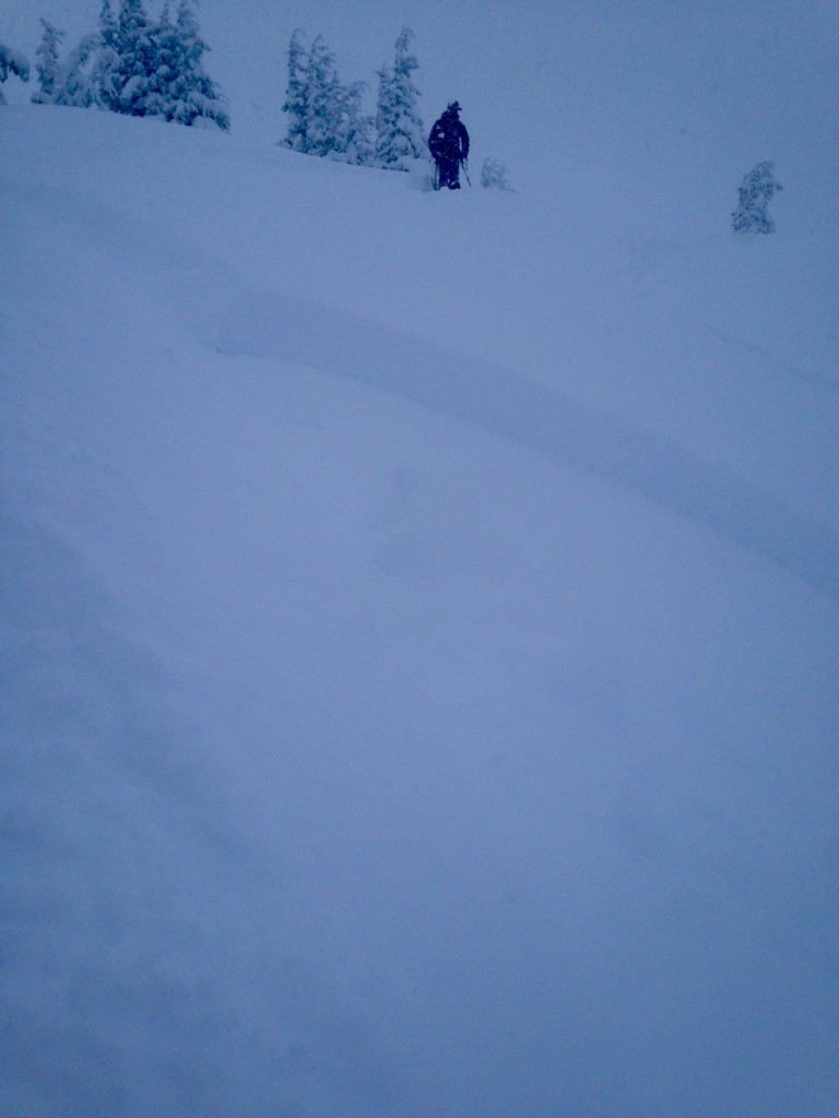
The avalanche danger at and above Treeline is CONSIDERABLE. The storm that ended yesterday brought 15+ inches of new snow and sustained winds to Turnagain Pass. Human (skier/rider or snowmachiner) triggered avalanches are likely in steep wind loaded terrain. The potential exists to initiate a slab avalanche 1-4′ deep. Cautious route finding, safe travel protocols and conservative decision-making will be essential elements to a fun, safe day in the backcountry.
A MODERATE danger exists below 1,000′ where an avalanche occurring above may run into this zone.
Please come join us TODAY at 11 am in the motorized lot at Turnagain Pass for aFree Avalanche Rescue Workshop!!! This event is hosted by the CNFAIC forecasters and is a great opportunity to practice beacon searches and learn strategic shoveling techniques. This workshop is open to everyone and anyone (motorized and non-motorized), novices and experts, bring your friends!
The storm continued on Turnagain pass yesterday depositing an additional 8+ inches during the day. There was a period where snow was falling over an inch/per hr. Easterly winds were strong enough to move the new snow around. There was very limited visibility and no opportunity to see if there was natural avalanche activity in the Alpine. Observers reported reactive storm slabs near treeline and shooting cracks in wind effected snow. Today the snowpack will need time to adjust after this new load. Look for signs of instability. Shooting cracks, whumpfing and recent avalanching all indicate that the snowpack is tender. Watch out for areas that have stiffer snow over soft snow and look for the patterns of wind loading. Leeward and cross loaded areas in steep terrain (35 degrees and steeper) have the most potential hazard today. Fresh cornices may break very easily and should be given a wide berth. Loose snow avalanches and soft storm slabs are also possible today in steep terrain. Watch out for terrain traps, gullies and depressions, where even a small slide can bury you very deeply. Don’t let clearing skies and fresh snow lure you into making poor decisions. Practice safe travel techniques: ride/ski slopes one at a time, stop in save zones, have escape routes planned and as always carry rescue gear!
We continue to monitor the buried Surface Hoar and Near Surface Facets that sit over the Thanksgiving Rain Crust to 3000′ and over stiff old snow in the Alpine. These have been non-reactive in most tests on Turnagain Pass. Yesterday we couldn’t see into the upper elevation start zones to see if the new load triggered any deeper slabs (or storm slabs). We did find both grain types in our pit yesterday. This buried weak layer/bed surface combination is also a concern in the shallower Summit Lake snowpack. Signs are pointing to this becoming a non-issue but it is worth thinking about today. The snowpack has recieved a significant load and needs time to adjust. If the snowpack fails at this depth the slab could be deep and very dangerous.
Photo by Andy Moderow: Buried Surface Hoar intact and laid over.
Yesterday’s storm brought an additional 8+ inches to Turnagain Pass, with high preciptation intensity for much of the day. The storm shut down much earlier in the Girdwood Valley and there was significantly less snow south of the Pass. Storm totals: Turnagain Pass 15-18″, Girdwood Valley 10-13″, Summit Lake 2-5.” Winds were Easterly and blew 20-30 mph gusting in the high 40s during the height of the storm. Temperatures ranged from the upper 20Fs to mid 30Fs with rain falling at sea level to approximately 800′.
Today will be partly cloudy to mostly sunny. Temperatures will be in the 20Fs and winds will be Northerly and light. Tonight will be mostly cloudy.
Tomorrow will be cloudy with a chance for scattered snow showers as a low in the Gulf pushes moisture into Southcentral. The Jet dips south later in the week and allows colder, drier air to move into the region over the holiday.
Temp Avg (F) | Snow (in) | Water (in) | Snow Depth (in) | |
Center Ridge (1880′) | 28 | 8 | 1.1 | 63 |
Summit Lake (1400′) | 30 | 1 | .1 | 19 |
Alyeska Mid (1700′) | 30 | 3 | .2 | 39 |
Temp Avg (F) | Wind Dir | Wind Avg (mph) | Wind Gust (mph) | |
Sunburst (3812′) | 22 | ENE | 18 | 35 |
Seattle Ridge (2400′) | 22 | ESE* | 10* | 20* |
*Seattle Ridge was only collecting wind data from 5am-4pm 12/19/15.
Date | Region | Location | Observer |
---|---|---|---|
05/22/23 | Turnagain | Avalanche: Tincan | Nick D'Alessio |
05/12/23 | Turnagain | Avalanche: Tincan, Sunburst, Magnum, Cornbiscuit | Heather Thamm |
05/07/23 | Turnagain | Observation: Tincan – Bear Tracks | CNFAIC Staff |
05/05/23 | Turnagain | Observation: Seattle Ridge | AS/ WW Forecaster |
05/02/23 | Turnagain | Observation: Cornbiscuit | Schauer/ Sturgess Forecaster |
05/02/23 | Turnagain | Observation: Seward Hwy Turnagain Pass | Joel Curtis |
04/30/23 | Turnagain | Observation: Magnum | Ayla, Kit Crosby, Barton |
04/29/23 | Turnagain | Observation: Tincan | John Sykes |
04/28/23 | Turnagain | Avalanche: Taylor Pass/Pastoral | Schauer/ Creighton Forecaster |
04/28/23 | Turnagain | Avalanche: Tincan | Andy Moderow |
Status of riding areas across the Chugach NF is managed by the Glacier and Seward Ranger Districts, not avalanche center staff. Riding area information is posted as a public service to our users and updated based on snow depth and snow density to prevent resource damage at trailhead locations. Riding area questions contact: mailroom_r10_chugach@fs.fed.us
Area | Status | Weather & Riding Conditions |
---|---|---|
Glacier District |
Subscribe to Turnagain Pass
Avalanche Forecast by Email
This is a general backcountry avalanche advisory issued for Turnagain Arm with Turnagain Pass as the core advisory area. This advisory does not apply to highways, railroads or operating ski areas.