Turnagain Pass Avalanche Forecast RSS

Archives
ARCHIVED FORECAST - All forecasts expire after 24 hours from the posting date/time.
Issued
Thu, April 23rd, 2015 - 7:00AM
Expires
Fri, April 24th, 2015 - 7:00AM
Forecaster
Heather Thamm
Avalanche risk The Bottom Line

Today the avalanche danger will start out LOW in the morning and increase to MODERATE as solar radiation begins to heat up the surface snow on sunny aspects. Natural wet loose avalanches will be possible both in the Alpine and at Treeline. Pay attention to changing surface conditions and if the snow becomes wet and unconsolidated avoid steep sun exposed slopes.

In the alpine triggering a small isolated wind slab is possible in steep terrain near ridgetops. Be on the lookout for tender pockets that could knock you off your feet in the wrong place.  

Thanks to our sponsors!
Thu, April 23rd, 2015
Alpine
Above 2,500'
Moderate (2)
Avalanche risk
Treeline
1,000'-2,500'
Moderate (2)
Avalanche risk
Below Treeline
Below 1,000'
No Rating (0)
Avalanche risk
Alpine
Above 2,500'
Avalanche risk
Moderate (2)
Treeline
1,000'-2,500'
Avalanche risk
Moderate (2)
Below Treeline
Below 1,000'
Avalanche risk
No Rating (0)
Danger Scale:
No Rating (0)
Low (1)
Moderate (2)
Considerable (3)
High (4)
Extreme (5)
Avalanche Problem 1
  • Wet Loose
    Wet Loose
Wet Loose
Wet Loose avalanches are the release of wet unconsolidated snow or slush. These avalanches typically occur within layers of wet snow near the surface of the snowpack, but they may quickly gouge into lower snowpack layers. Like Loose Dry Avalanches, they start at a point and entrain snow as they move downhill, forming a fan-shaped avalanche. Other names for loose-wet avalanches include point-release avalanches or sluffs. Loose Wet avalanches can trigger slab avalanches that break into deeper snow layers.
More info at Avalanche.org

Over the last three days cooler temps have helped freeze and stabilize the snowpack following a large wet storm that caused a widespread avalanche cycle this past weekend. A supportable crust has formed on all aspects below 4000’ and a few inches of new snow is sitting on top. If winds are calm as forecasted today, the sun could heat up this surface snow quickly and start breaking down the crust below it.

Wet loose avalanches will be possible both in the alpine at mid elevations. Expect activity to be of the most concern on Eastern aspects where the snowpack is thin and the sun has the most affect earlier in the day. On Southern and Western aspects pay attention as a supportable crust begins to soften in the afternoon. If you find the snow becoming wet and heavy avoid steep sun baked aspects. It will be on these aspects where a wet loose avalanche could be difficult to ski/ride out of as it starts to entrain snow and gain momentum.

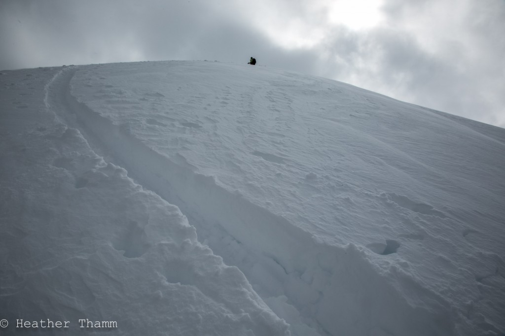
In a pit at 3550′ on Sunburst several melt/freeze crusts were found winin the top meter of the snowpack. These crusts were formed by rain and wet snow that fell last weekend (4/17-4/19.) 


A D2 avlanche on Taylor Pass released last weekend during a large storm that brought gale force winds and heavy rain to Southcentral Alaska. Luckily cool temperatures over the last few days have allowed the snowpack to freeze and stabilze quickly.  


Avalanche Problem 2
  • Wind Slabs
    Wind Slabs
Wind Slabs
Wind Slab avalanches are the release of a cohesive layer of snow (a slab) formed by the wind. Wind typically transports snow from the upwind sides of terrain features and deposits snow on the downwind side. Wind slabs are often smooth and rounded and sometimes sound hollow, and can range from soft to hard. Wind slabs that form over a persistent weak layer (surface hoar, depth hoar, or near-surface facets) may be termed Persistent Slabs or may develop into Persistent Slabs.
More info at Avalanche.org

Wind slabs:

Northeast winds yesterday morning formed wind slabs up to 12” thick on leeward features along ridgetops. These small isolated pockets are a low consequence hazard and unlikely to bury a person. However if venturing into steep terrain be on the lookout for tender pockets that could knock you off your feet in the wrong place. 

Wind transported snow exists on leeward features near ridgetops like along the uptrack on the Western ridge of Sunburst.

Weather
Thu, April 23rd, 2015

Yesterday morning temperatures were in the mid 20 F, skies were mostly cloudy and winds were 15-20mph from the Northeast along ridgetops.   By mid afternoon skies cleared and ridgetop winds became calm from the Northeast. Daytime temperatures warmed into the low 40s F at lower elevations and low 30s F in the alpine.

Overnight temperatures cooled into the 20s F and winds remained light from the Northeast. No new precipitation was recorded yesterday in Turnagain Pass.

Today clear skies and calm winds will allow daytime temperatures to reach the mid 30s F in the alpine and high 40s F at sea level. Winds will be calm from the Northeast and no precipitation is expected.  

PRECIPITATION 24-hour data (6am – 6am)

  Temp Avg (F) Snow (in) Water (in) Snow Depth (in)
Center Ridge (1880′) 33   0   0   73  
Summit Lake (1400′) 32   1   0.1   14  
Alyeska Mid (1700′) 34   0   0   46  

RIDGETOP 24-hour data (6am – 6am)

  Temp Avg (F) Wind Dir Wind Avg (mph) Wind Gust (mph)
Sunburst (3812′) 24   NE   8   34  
Seattle Ridge (2400′) 26   n/a   7   26  
Observations
Recent Observations for Turnagain Pass
Date Region Location
05/22/23 Turnagain Avalanche: Tincan
05/12/23 Turnagain Avalanche: Tincan, Sunburst, Magnum, Cornbiscuit
05/07/23 Turnagain Observation: Tincan – Bear Tracks
05/05/23 Turnagain Observation: Seattle Ridge
05/02/23 Turnagain Observation: Cornbiscuit
05/02/23 Turnagain Observation: Seward Hwy Turnagain Pass
04/30/23 Turnagain Observation: Magnum
04/29/23 Turnagain Observation: Tincan
04/28/23 Turnagain Avalanche: Taylor Pass/Pastoral
04/28/23 Turnagain Avalanche: Tincan
Riding Areas
Updated Sat, September 23rd, 2023

Status of riding areas across the Chugach NF is managed by the Glacier and Seward Ranger Districts, not avalanche center staff. Riding area information is posted as a public service to our users and updated based on snow depth and snow density to prevent resource damage at trailhead locations. Riding area questions contact: mailroom_r10_chugach@fs.fed.us

Area Status Weather & Riding Conditions
Glacier District
Johnson Pass
Closed
Scheduled opening per Chugach National Forest plan December 1. Subject to adequate snow cover.
Placer River
Closed
Scheduled opening per Chugach National Forest plan December 1. Subject to adequate snow cover.
Skookum Drainage
Closed
Scheduled opening per Chugach National Forest plan December 1. Subject to adequate snow cover.
Turnagain Pass
Closed
Scheduled opening on the Wednesday before Thanksgiving per Chugach National Forest plan. Subject to adequate snow cover.
Twentymile
Closed
Scheduled opening per Chugach National Forest plan December 1. Subject to adequate snow cover.
Seward District
Carter Lake
Closed
Scheduled opening per Chugach National Forest plan December 1. Subject to adequate snow cover.
Lost Lake Trail
Closed
Scheduled opening per Chugach National Forest plan December 1. Subject to adequate snow cover.
Primrose Trail
Closed
Scheduled opening per Chugach National Forest plan December 1. Subject to adequate snow cover.
Resurrection Pass Trail
Closed
Scheduled opening per Chugach National Forest plan December 1. Subject to adequate snow cover.
Snug Harbor
Closed
Scheduled opening per Chugach National Forest plan December 1. Subject to adequate snow cover.
South Fork Snow River Corridor
Closed
Scheduled opening per Chugach National Forest plan December 1. Subject to adequate snow cover.
Summit Lake
Closed
Scheduled opening per Chugach National Forest plan December 1. Subject to adequate snow cover.

Subscribe to Turnagain Pass
Avalanche Forecast by Email

This is a general backcountry avalanche advisory issued for Turnagain Arm with Turnagain Pass as the core advisory area. This advisory does not apply to highways, railroads or operating ski areas.