Turnagain Pass Avalanche Forecast RSS

Archives
ARCHIVED FORECAST - All forecasts expire after 24 hours from the posting date/time.
Issued
Sun, December 29th, 2013 - 7:00AM
Expires
Mon, December 30th, 2013 - 7:00AM
Forecaster
Wendy Wagner
Avalanche risk The Bottom Line

There remains a MODERATE avalanche danger today for triggering a slab avalanche 12-18 € deep. The chances for finding and triggering a slab will be most pronounced on steep slopes (approaching 40 degrees and steeper) and on all aspects near and above treeline. Conditions today remain similar to those on Thursday when a skier triggered a sizeable avalanche on Turnagain Pass.

From outside of our advisory area we had a report come in yesterday of a skier triggered class 2 avalanche (no one caught). This was in the South Fork zone north of Anchorage. You can read it  HERE.

Thanks to our sponsors!
Sun, December 29th, 2013
Alpine
Above 2,500'
Moderate (2)
Avalanche risk
Treeline
1,000'-2,500'
Low (1)
Avalanche risk
Below Treeline
Below 1,000'
Low (1)
Avalanche risk
Alpine
Above 2,500'
Avalanche risk
Moderate (2)
Treeline
1,000'-2,500'
Avalanche risk
Low (1)
Below Treeline
Below 1,000'
Avalanche risk
Low (1)
Danger Scale:
No Rating (0)
Low (1)
Moderate (2)
Considerable (3)
High (4)
Extreme (5)
Avalanche Problem 1
  • Persistent Slabs
    Persistent Slabs
Persistent Slabs
Persistent Slab avalanches are the release of a cohesive layer of snow (a slab) in the middle to upper snowpack, when the bond to an underlying persistent weak layer breaks. Persistent layers include: surface hoar, depth hoar, near-surface facets, or faceted snow. Persistent weak layers can continue to produce avalanches for days, weeks or even months, making them especially dangerous and tricky. As additional snow and wind events build a thicker slab on top of the persistent weak layer, this avalanche problem may develop into a Deep Persistent Slab.
More info at Avalanche.org

For most folks that have been in the backcountry lately it is hard not to notice the collapsing in the snowpack. Other than a few avalanches in the past week, this has been our prominent ‘obvious clue’ as to the weak snow lying 12-18” below the surface. If you look at the two observations sent in yesterday, both highlight collapsing (or whoomphing). You can see them HERE and HERE. Other red flags are found by digging in the snow. However, a collapse trumps all and essentially means that if a slope is steep enough chances are it will avalanche.

With weak layers in the pack that are hard to assess from the surface, keeping with safe travel practices will help to hedge your bets if riding/skiing on steep slopes. These include watching your partners, exposing only one person at a time and having an escape route planned if the slope avalanches.

Below is a cross section of the snowpack at 3,200′. You can see a vertical crack in the ‘slab’ and the weak snow (lighter colored) below a crust. This if from a snow pit on Magnum, SW facing. – more details and video HERE.


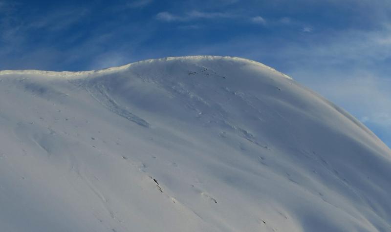
We received 2-3″ of snow from Friday night that was blown into drifts on the ridgelines. Cornices grew a bit with this event and some small to medium natural cornice failures were seen yesterday. This snow has shown signs of bonding well with the surface and is now part of the ‘slab’ mentioned above.

Below treeline the slab is losing its cohesion and the pack is unsupportable. Though there is some localized collapsing in the alders, triggering an avalanche is unlikely.

Weather
Sun, December 29th, 2013

During the past 24-hours we have seen a slight warm up above treeline (20-25deg) and a slight cool down at sea level (upper 30’s to low 20’sF) due to minimal cloud cover producing a weak inversion. Winds have been light from the Southeast and have switched to the Northwest overnight. We only picked up ~3 € above treeline with Friday night’s snow event.

Today we will see a weak disturbance move over us from the Gulf bringing mostly cloudy skies and continued warm temperatures. Ridgetops will be in the mid 20’sF with winds shifting back to the Southeast and picking up through the day to the 20mph range by the evening hours.

There is a possibility for precip on Tuesday into Wednesday as a warm low pressure system moves in from the South. How much will depend on the track this low takes but it is fairly warm with rain at sea level likely.

Observations
Recent Observations for Turnagain Pass
Date Region Location
05/22/23 Turnagain Avalanche: Tincan
05/12/23 Turnagain Avalanche: Tincan, Sunburst, Magnum, Cornbiscuit
05/07/23 Turnagain Observation: Tincan – Bear Tracks
05/05/23 Turnagain Observation: Seattle Ridge
05/02/23 Turnagain Observation: Cornbiscuit
05/02/23 Turnagain Observation: Seward Hwy Turnagain Pass
04/30/23 Turnagain Observation: Magnum
04/29/23 Turnagain Observation: Tincan
04/28/23 Turnagain Avalanche: Taylor Pass/Pastoral
04/28/23 Turnagain Avalanche: Tincan
Riding Areas
Updated Thu, June 01st, 2023

Status of riding areas across the Chugach NF is managed by the Glacier and Seward Ranger Districts, not avalanche center staff. Riding area information is posted as a public service to our users and updated based on snow depth and snow density to prevent resource damage at trailhead locations. Riding area questions contact: mailroom_r10_chugach@fs.fed.us

Area Status Weather & Riding Conditions
Glacier District
Johnson Pass
Closed
Closed May 15.
Placer River
Closed
Closed May 15.
Skookum Drainage
Closed
Will close to motorized use on April 1, 2023 per the National Forest Plan.
Turnagain Pass
Closed
Will close on June 1.
Twentymile
Closed
Scheduled closure May 1.
Seward District
Carter Lake
Closed
Scheduled closure May 1.
Lost Lake Trail
Closed
Scheduled closure May 1.
Primrose Trail
Closed
Scheduled closure May 1.
Resurrection Pass Trail
Closed
Closed to motorized use for the 2022/23 winter season per Forest Plan. Open next season.
Snug Harbor
Closed
Extended opening until May 15.
South Fork Snow River Corridor
Closed
Scheduled closure May 1.
Summit Lake
Closed
Scheduled closure May 1.

Subscribe to Turnagain Pass
Avalanche Forecast by Email

This is a general backcountry avalanche advisory issued for Turnagain Arm with Turnagain Pass as the core advisory area. This advisory does not apply to highways, railroads or operating ski areas.