Turnagain Pass
|
|
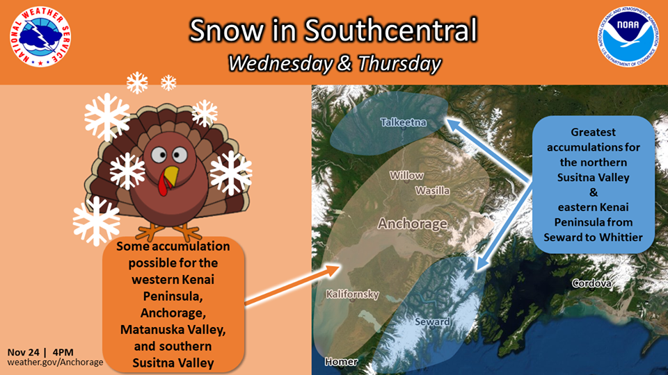
It is starting to look like winter across the Turnagain Forecast area. Let’s do a quick snowfall recap to paint the picture of the season so far. A storm on 10/22-23 brought about 2′ of snow with snow line around 2000′ and strong winds. During the next storm on 10/27-28 it rained to 3500′ washing the snow below 2500′ away. This storm had peak wind gusts over 100 mph. It was pretty warm and boring for the first two weeks of November with a few dustings above 3500′. The 11/14-15 storm brought a trace of snow to sea level and 1′ or so above 2500′ falling on patches of old lingering October snow. The storm last Thursday 11/21 started with warm temperatures, strong winds and rain, but ended cold with the winds easing off. Total water for the storm ranged from 2″ SWE at upper elevations in Girdwood to 1.5″ SWE on Turnagain Pass. Across the forecast area this equated to approximately 1-2 feet of new snow above 2500′. The 11/21 storm had high winds with peak gust of 99 mph on Sunburst from the NE. Be on the lookout for lingering wind slabs off higher ridge lines, potentially under some soft snow from the end of the storm and the trace that fell 11/24.
A few people have been venturing out. Check out the observations from Manitoba and Sunnyside (Seattle Ridge). It is definitely early season conditions at low elevations with shrubbery hazards and rocks. As there is limited information about the snowpack, especially above 3500′, ease into terrain, look for signs of instability, and use good travel protocol. This is also a great time to practice rescue skills! We are closely watching the forecast for the storm on Wednesday (see the Special Weather Statement) with hopes that it will produce. Stay tuned and pay attention to changing conditions. There is plenty of soft snow that can easily get blown around as the storm approaches. Cold temperatures are already starting to facet out the surface snow and shallow snowpack areas.
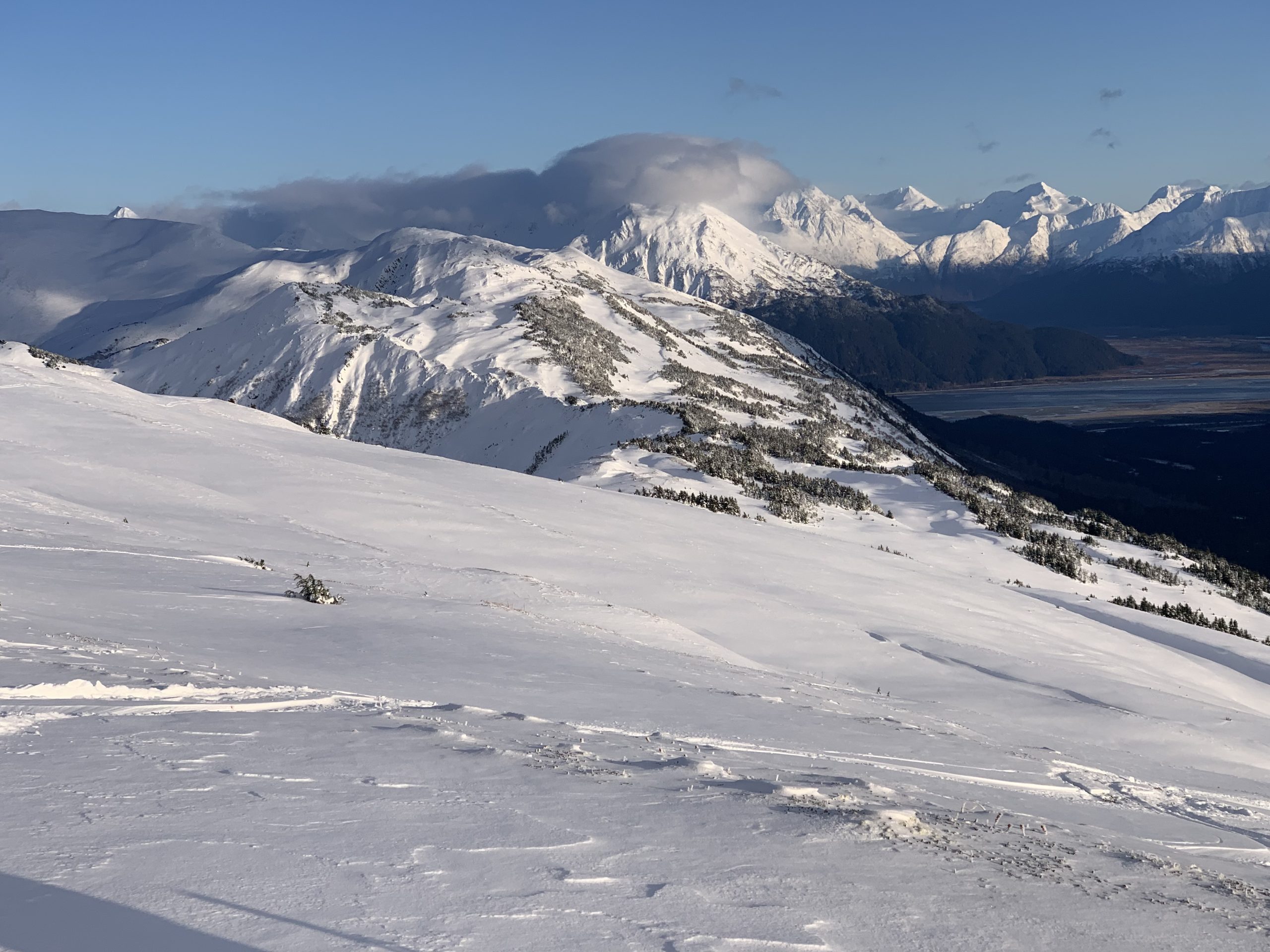
Coverage on Seattle R. Looking north, 11/25. Photo: Graham Predeger

Pit, Sunnyside at 2500’, 11/25 Photo: Graham Predeger
Avalanche Center Operations: We are planning on issuing the first forecast of the season later this week if conditions warrant it.
Getting into the mountains? Please send us your snow/avalanche reports so we can post them on our observation page! Simply click ‘submit observation’ under the Observation tab. This is a huge benefit for the community and our forecasters.
*Keep tabs on early season conditions and events on Facebook and follow us on Instagram.*
If you are heading to Hatcher Pass don’t forget to check hpavalanche.org and their Facebook page.
Tuesday, Dec 3rd: Turnagain Pass – Snow, Weather and Avalanches @ Ski AK
6:30pm – 8:00pm. Cost FREE!
Join CNFAIC forecasters for a look under the hood at the avalanche center. We’ll discuss current Turnagain Pass snow and avalanche conditions, how avalanche forecasts are produced and some tips on being your own avalanche forecaster.
