Turnagain Pass
|
|
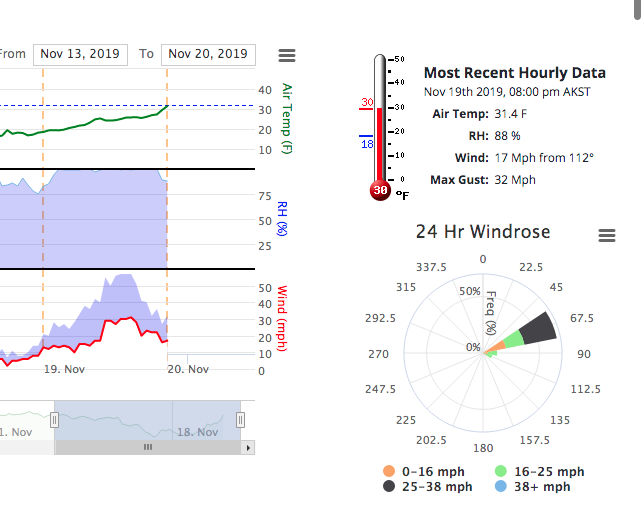
Over the weekend a little snow actually made it to sea level. Girdwood had a few inches in town while Turnagain Pass at road level (1000′) only received a half an inch of snow. Upper elevations (above 2500′) received around a 1′ of snow. Late Friday night also brought stronger easterly winds with gusts into the 50s. Taking a look around Turnagain Pass on Monday showed a thin snow cover with obvious wind scouring. Warming temperatures Tuesday shifted snow to rain and brought strong easterly winds to the region again. The warming trend is forecast to continue with snow level around 3000′ today. Thursday there is hope for more snow and the weather pattern looks to remain active into the next week. Overall uncertainty remains while we wait to see where cold air and moisture will actually meet. Longer range models seem to have a promising outlook for cooler temperatures and precipitation. Stay tuned! If you are venturing out remember the upper elevations now have a few different layers of snow that may not be bonding well together and there has been some significant wind loading. Please check out this recent observation from Jewel Glacier. Look for signs of instability and ease into terrain. Please don’t be an early season avalanche statistic!
West face of Magnum, 11/18

Rookie Hill and Seattle Ridge, 11/18
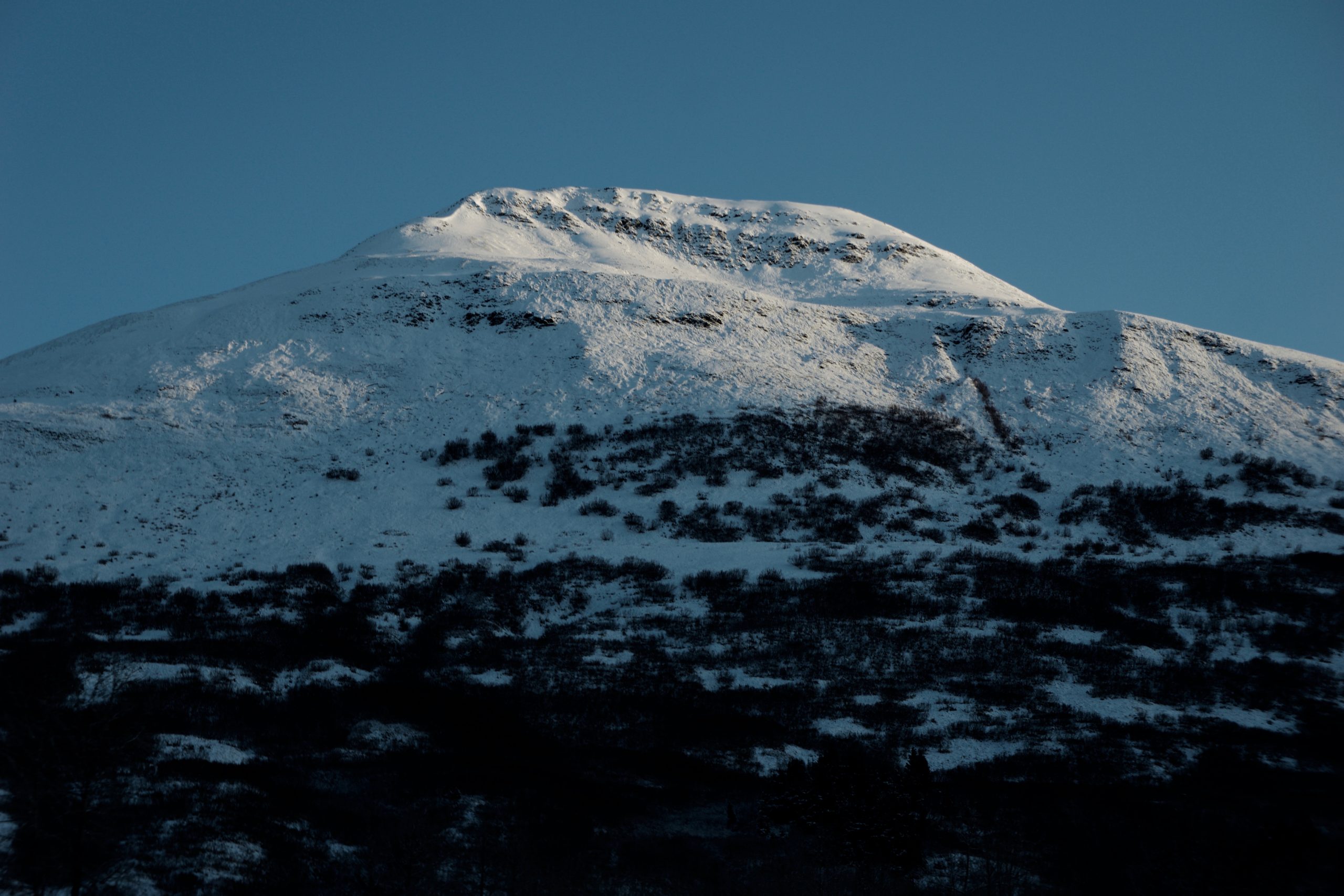
Strong NE winds and rising temperatures on Sunburst 11/19.
Avalanche Center Operations: Daily avalanche forecasts are planned to begin during Thanksgiving week – #prayforsnow and #knowbeforeyougo
Getting into the mountains? Please send us your snow/avalanche reports so we can post them on our observation page! Simply click ‘submit observation’ under the Observation tab. This is a huge benefit for the community and our forecasters.
*Keep tabs on early season conditions and events on Facebook and follow us on Instagram.*
If you are heading to Hatcher Pass don’t forget to check hpavalanche.org and their Facebook page.
Thursday, Nov 21st: Snowmachine Specific Avalanche Awareness @ AMDS
5:30pm – 7:00pm. Cost: FREE!
Join Wendy Wagner and Graham Predeger for a discussion on ‘recognizing unstable snow on the go’, a review of last year’s Seattle Ridge avalanche cycles at Turnagain Pass, some common avalanche myths and more!
Tuesday, Dec 3rd: Turnagain Pass – Snow, Weather and Avalanches @ Ski AK
6:30pm – 8:00pm. Cost FREE!
Join CNFAIC forecasters for a look under the hood at the avalanche center. We’ll discuss current Turnagain Pass snow and avalanche conditions, how avalanche forecasts are produced and some tips on being your own avalanche forecaster.