Turnagain Pass
|
|
Sat, November 14th, 2020
With snow starting in the late afternoon yesterday the mountains picked up 1-2″ of light, fluffy snow overnight. Temperatures are dropping as cooler air is moving into the region. There is a slight chance of snow today and a clearing skies and sunshine on tap for Sunday into the coming week. Winds should remain light for the next few days.
With improving visibility, fresh snow and early season stoke this weekend, it is important to remember that there is now plenty of snow to slide and known weak layer of old October snow. Observers from Girdwood to Summit Lake are consistently hearing and feeling whumpfs and finding a poor snowpack structure above 2200′. It’s worth being suspect of steep slopes moving forward as skies clear and travel in the Alpine becomes easier. Ease into terrain, look for signs of instability, and use good travel protocol.
Persistent Slab avalanches: Weak October snow is sitting under a slab formed by the 1-3′ of snow from the last two storms. This current snowpack structure has the potential to be triggered by the weight of a skier or rider and cause an avalanche releasing in the facets (sugar snow) at the bottom of the snowpack. This structure becomes a concern around 2,200′ – the higher in elevation you travel the more likely it will be to encounter this issue. Whumpfing and/or cracking are signs this layer is reactive. Snow covered slopes with a 30° slope angle and steeper are suspect. If an avalanche releases near the ground it could result in a very dangerous slide.

Snowpack structure at 2800′ in Main Bowl/1st Bowl on the backside of Seattle Ridge. Our Extended Column Test propagated at 13 taps on the facets (sugar snow) above the crust. 11.13.20
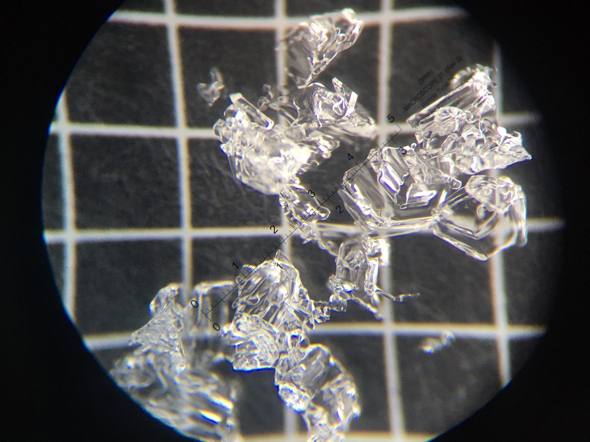
Close up of the 2mm facets above the crust.
For link to video click HERE.
***If you are heading to Hatcher Pass please check hpavalanche.org for the Saturday morning forecast and follow their Facebook page.
Avalanche Center Operations: We will continue to provide conditions updates and are planning on issuing the first forecast around Thanksgiving.
Getting into the mountains? Please send us your snow/avalanche reports so we can post them on our observation page! Simply click ‘submit observation’ under the Observation tab. This is a huge benefit for the community and our forecasters.
*Keep tabs on early season conditions and events on Facebook and follow us on Instagram.*
EVENTS:
Thursday, Nov 19:
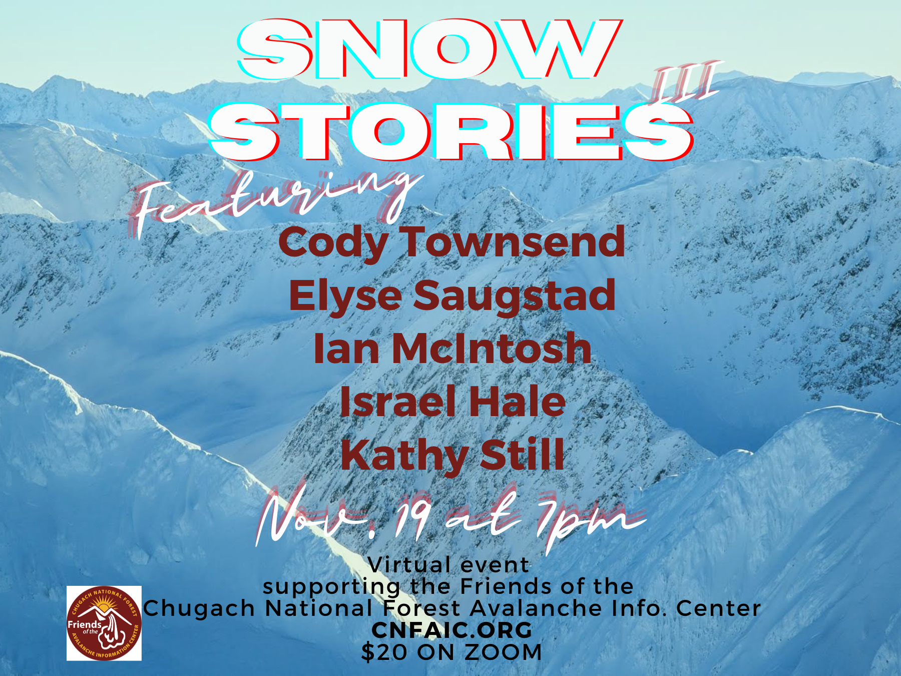
The 3rd annual fundraiser will have an amazing line up of storytellers on the virtual stage. Watch Cody Townsend, Elyse Saugstad, Ian McIntosh, Israel Hale and Kathy Still share their personal stories on snow. Anticipate a wild evening of lessons learned, adventure and camaraderie. Expect to laugh, cry and maybe learn something new.
All proceeds made from ticket sales go to funding the Chugach National Forest Avalanche Information Center (CNFAIC) operations.
Cost: 20$. For Zoom tickets register on HERE.
December 1, 15, 29 and January 14:
CNFAIC Forecaster Chat Series – VIRTUAL!
Time: 7-8pm, Cost: FREE
Forecasters will hold a series of online chats. These will begin with a recap of last season, an outlook for the coming year, and move into an in depth discussion on the various avalanche problems and how they impact the Turnagain Pass region. These are great opportunity to ask questions about specific avalanche conditions and decision-making.
