Turnagain Pass Avalanche Forecast RSS

Archives
ARCHIVED FORECAST - All forecasts expire after 24 hours from the posting date/time.
Issued
Tue, March 24th, 2020 - 7:00AM
Expires
Wed, March 25th, 2020 - 7:00AM
Forecaster
Ryan Van Luit
Avalanche risk The Bottom Line

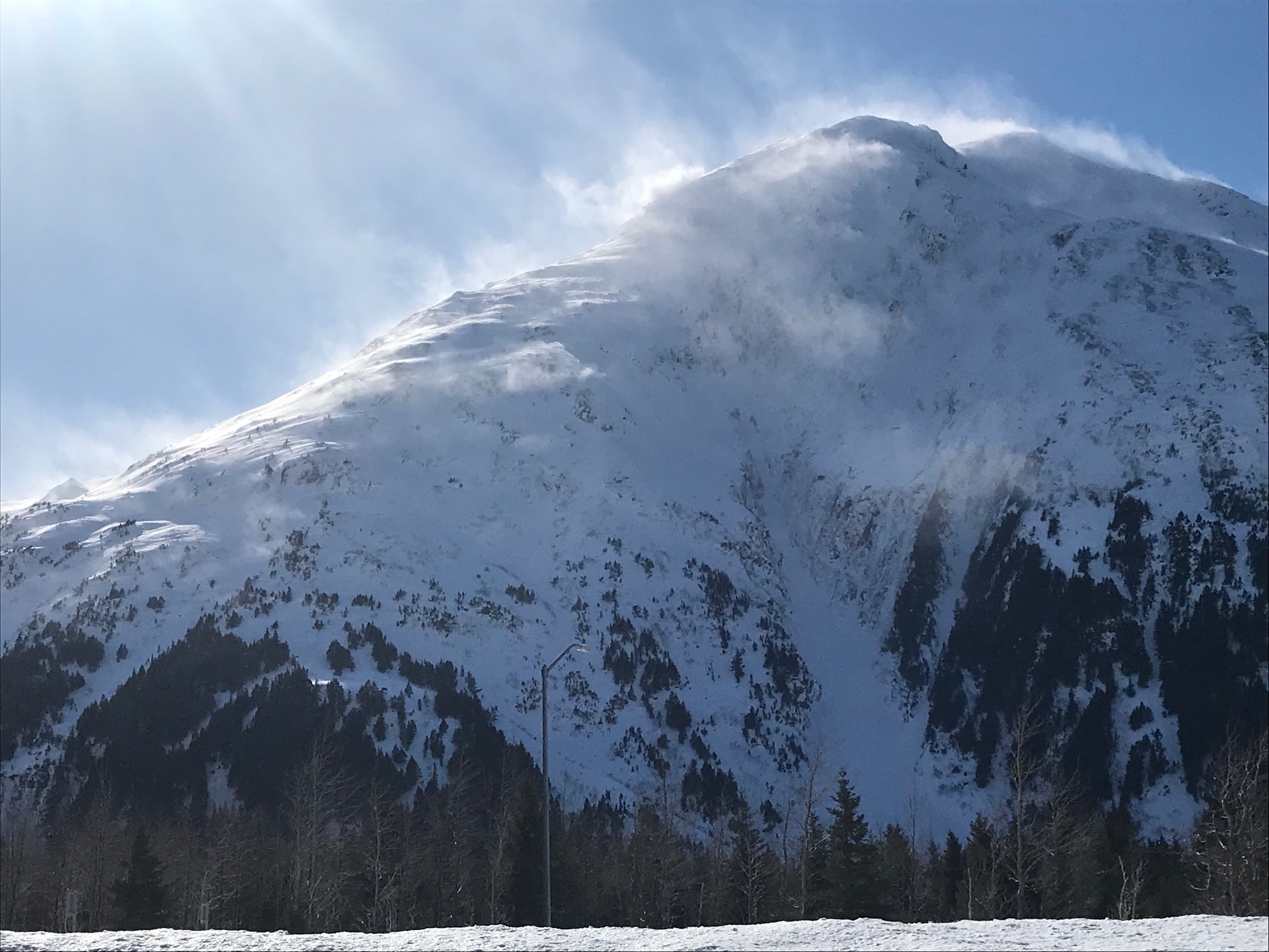
The avalanche danger will become CONSIDERABLE at all elevations today as air temperatures rise and the direct sun begins to impact slopes.  Triggering a wet loose avalanche will be likely on steeper slopes as the surface snow warms.  Also, winds from the past few days have created windslabs 1-2′ thick in leeward terrain that will still be possible to human trigger.  Cornices could weaken with the increase in temperatures.  Cautious route finding and a conservative approach are warranted.

SUMMIT LAKE:  This shallower snowpack has been recently wind loaded and has weak snow in the mid and base of the snowpack.  This is the case in the southern end of Turnagain Pass and south to Summit Lake.  Extra caution is advised.

PORTAGE VALLEY/Byron Glacier Trail: Avoid avalanche runout zones such as the Byron Glacier hiking trail up to the ice caves.

***Roof Avalanches:  Roofs may still shed remaining snow!

Special Announcements

As our community hunkers down, remember social distancing is good travel advice, and staying home is a good choice due to the spread of novel coronavirus. It is important we all do our part to reduce the spread of COVID-19.  Please do not carpool with people outside your household, keep groups small, don’t share snacks, drinks or smokes and don’t have social gatherings in the parking lot.  Please do not add to the stress and risk for the rescue and healthcare community by having an accident. Thank you from everyone.

Thanks to our sponsors!
Tue, March 24th, 2020
Alpine
Above 2,500'
Considerable (3)
Avalanche risk
Treeline
1,000'-2,500'
Considerable (3)
Avalanche risk
Below Treeline
Below 1,000'
Considerable (3)
Avalanche risk
Alpine
Above 2,500'
Avalanche risk
Considerable (3)
Treeline
1,000'-2,500'
Avalanche risk
Considerable (3)
Below Treeline
Below 1,000'
Avalanche risk
Considerable (3)
Danger Scale:
No Rating (0)
Low (1)
Moderate (2)
Considerable (3)
High (4)
Extreme (5)
Avalanche Problem 1
  • Wet Loose
    Wet Loose
  • Almost Certain
    Very Likely
    Likely
    Possible
    Unlikely
    Likelihood
  • Historic (D4-5)
    Very Large (D3)
    Large (D2)
    Small (D1)
    Size
Wet Loose
Wet Loose avalanches are the release of wet unconsolidated snow or slush. These avalanches typically occur within layers of wet snow near the surface of the snowpack, but they may quickly gouge into lower snowpack layers. Like Loose Dry Avalanches, they start at a point and entrain snow as they move downhill, forming a fan-shaped avalanche. Other names for loose-wet avalanches include point-release avalanches or sluffs. Loose Wet avalanches can trigger slab avalanches that break into deeper snow layers.

Likelihood of Avalanches
Terms such as "unlikely", "likely", and "certain" are used to define the scale, with the chance of triggering or observing avalanches increasing as we move up the scale. For our purposes, "Unlikely" means that few avalanches could be triggered in avalanche terrain and natural avalanches are not expected. "Certain" means that humans will be able to trigger avalanches on many slopes, and natural avalanches are expected.

Size of Avalanches
Avalanche size is defined by the largest potential avalanche, or expected range of sizes related to the problem in question. Assigned size is a qualitative estimate based on the destructive classification system and requires specialists to estimate the harm avalanches may cause to hypothetical objects located in the avalanche track (AAA 2016, CAA 2014). Under this schema, "Small" avalanches are not large enough to bury humans and are relatively harmless unless they carry people over cliffs or through trees or rocks. Moving up the scale, avalanches become "Large" enough to bury, injure, or kill people. "Very Large" avalanches may bury or destroy vehicles or houses, and "Historic" avalanches are massive events capable of altering the landscape.

Signal Word Size (D scale) Simple Descriptor
Small 1 Unlikely to bury a person
Large 2 Can bury a person
Very Large 3 Can destroy a house
Historic 4 & 5 Can destroy part or all of a village
More info at Avalanche.org

Mostly sunny skies will dominate the region and temperatures are expected to reach into the low 40’s °F in the valleys and low 30’s °F at ridgetops throughout the day.  Northwest winds have tapered overnight and are forecast to be calm to light.

The ambient air temperatures at the Sunburst weather station at 3812′ remained barely below freezing for most of the night.  The Center Ridge weather station (1880′) near Turnagain Pass has reported above freezing temperatures up to 44°F since yesterday at 9:00am!  As the sun rises and directly impacts slopes it will become likely to human trigger a small to large wet loose avalanche on all aspects at treeline and below treeline.   In the Alpine, steeper terrain and near exposed rocky areas on solar aspects will be suspect.  Choose routes carefully!

Avalanche Problem 2
  • Wind Slabs
    Wind Slabs
  • Almost Certain
    Very Likely
    Likely
    Possible
    Unlikely
    Likelihood
  • Historic (D4-5)
    Very Large (D3)
    Large (D2)
    Small (D1)
    Size
Wind Slabs
Wind Slab avalanches are the release of a cohesive layer of snow (a slab) formed by the wind. Wind typically transports snow from the upwind sides of terrain features and deposits snow on the downwind side. Wind slabs are often smooth and rounded and sometimes sound hollow, and can range from soft to hard. Wind slabs that form over a persistent weak layer (surface hoar, depth hoar, or near-surface facets) may be termed Persistent Slabs or may develop into Persistent Slabs.

Likelihood of Avalanches
Terms such as "unlikely", "likely", and "certain" are used to define the scale, with the chance of triggering or observing avalanches increasing as we move up the scale. For our purposes, "Unlikely" means that few avalanches could be triggered in avalanche terrain and natural avalanches are not expected. "Certain" means that humans will be able to trigger avalanches on many slopes, and natural avalanches are expected.

Size of Avalanches
Avalanche size is defined by the largest potential avalanche, or expected range of sizes related to the problem in question. Assigned size is a qualitative estimate based on the destructive classification system and requires specialists to estimate the harm avalanches may cause to hypothetical objects located in the avalanche track (AAA 2016, CAA 2014). Under this schema, "Small" avalanches are not large enough to bury humans and are relatively harmless unless they carry people over cliffs or through trees or rocks. Moving up the scale, avalanches become "Large" enough to bury, injure, or kill people. "Very Large" avalanches may bury or destroy vehicles or houses, and "Historic" avalanches are massive events capable of altering the landscape.

Signal Word Size (D scale) Simple Descriptor
Small 1 Unlikely to bury a person
Large 2 Can bury a person
Very Large 3 Can destroy a house
Historic 4 & 5 Can destroy part or all of a village
More info at Avalanche.org

Recent winds transported snow for many hours over the last few days and created windslabs 1-2′ thick in leeward terrain features at all elevations throughout the advisory area.  One observer yesterday reported whumfing on fresh windslabs in mid elevations near Turnagain Pass.  It remains possible to trigger these windslabs on leeward terrain.  These outflow wind events are known for creating inconsistent loading patterns, especially around Turnagain pass, so as you travel remain aware of wind direction indicators on surface snow.  Consider adjusting your route to avoid windslabs if you initiate cracking or whumfing as you travel.

Recent northwest winds transported snow for many hours over the past few days throughout the advisory area.  3.22.20. Photo: CNFAIC archive

Cornices:  Cornices have likely grown over the last few days and could weaken with increased temperature and solar gain. As always, give them a wide berth and limit exposure underneath them.

Additional Concern
  • Persistent Slabs
    Persistent Slabs
Persistent Slabs
Persistent Slab avalanches are the release of a cohesive layer of snow (a slab) in the middle to upper snowpack, when the bond to an underlying persistent weak layer breaks. Persistent layers include: surface hoar, depth hoar, near-surface facets, or faceted snow. Persistent weak layers can continue to produce avalanches for days, weeks or even months, making them especially dangerous and tricky. As additional snow and wind events build a thicker slab on top of the persistent weak layer, this avalanche problem may develop into a Deep Persistent Slab.
More info at Avalanche.org

In areas with a thinner snowpack, from the southern end of the forecast zone to Summit lake, weak snow (both surface hoar and facets) is buried 1-3′ below the surface.  The recent northwest winds impacted this region more and human triggered avalanches are possible.  Although winds have tapered, watch for blowing snow and choose terrain carefully.

Weather
Tue, March 24th, 2020

Yesterday:  Sunshine and clear skies with temperatures in high 30°Fs at lower elevations and mid to high 20°Fs at upper elevations. The northwest winds continued during the day and tapered off in the evening. Overnight skies were partly to mostly cloudy with temperatures ranging from 20°-30° F.

Today:  Mostly sunny skies are expected today with temperatures ranging from a high near 42°F and lows in the mid 20’s °F.  Westerly winds are forecast to be calm to light in the valleys and 5-15mph at ridgetops.

Tomorrow: Cloudy skies are predicted with a high near 36°F and a low of around 25°F. Winds forecast out of the southwest around 5 mph with minimal chance for precipitation.

PRECIPITATION 24-hour data (6am – 6am)

Temp Avg (F) Snow (in) Water (in) Snow Depth (in)
Center Ridge (1880′) 35 0 0 67
Summit Lake (1400′) 35 0 0 32
Alyeska Mid (1700′) 34 0 0 76

RIDGETOP 24-hour data (6am – 6am)

Temp Avg (F) Wind Dir Wind Avg (mph) Wind Gust (mph)
Sunburst (3812′) 29 WNW 8 27
Seattle Ridge (2400′) 34 NW 4 18
Observations
Recent Observations for Turnagain Pass
Date Region Location
05/22/23 Turnagain Avalanche: Tincan
05/12/23 Turnagain Avalanche: Tincan, Sunburst, Magnum, Cornbiscuit
05/07/23 Turnagain Observation: Tincan – Bear Tracks
05/05/23 Turnagain Observation: Seattle Ridge
05/02/23 Turnagain Observation: Cornbiscuit
05/02/23 Turnagain Observation: Seward Hwy Turnagain Pass
04/30/23 Turnagain Observation: Magnum
04/29/23 Turnagain Observation: Tincan
04/28/23 Turnagain Avalanche: Taylor Pass/Pastoral
04/28/23 Turnagain Avalanche: Tincan
Riding Areas
Updated Mon, May 15th, 2023

Status of riding areas across the Chugach NF is managed by the Glacier and Seward Ranger Districts, not avalanche center staff. Riding area information is posted as a public service to our users and updated based on snow depth and snow density to prevent resource damage at trailhead locations. Riding area questions contact: mailroom_r10_chugach@fs.fed.us

Area Status Weather & Riding Conditions
Glacier District
Johnson Pass
Closed
Closed May 15.
Placer River
Closed
Closed May 15.
Skookum Drainage
Closed
Will close to motorized use on April 1, 2023 per the National Forest Plan.
Turnagain Pass
Open
Chugach NF staff will be assessing daily after May 15th. Please keep machines on the snow and avoid brown spots to keep this area open as long as possible.
Twentymile
Closed
Scheduled closure May 1.
Seward District
Carter Lake
Closed
Scheduled closure May 1.
Lost Lake Trail
Closed
Scheduled closure May 1.
Primrose Trail
Closed
Scheduled closure May 1.
Resurrection Pass Trail
Closed
Closed to motorized use for the 2022/23 winter season per Forest Plan. Open next season.
Snug Harbor
Closed
Extended opening until May 15.
South Fork Snow River Corridor
Closed
Scheduled closure May 1.
Summit Lake
Closed
Scheduled closure May 1.

Subscribe to Turnagain Pass
Avalanche Forecast by Email

This is a general backcountry avalanche advisory issued for Turnagain Arm with Turnagain Pass as the core advisory area. This advisory does not apply to highways, railroads or operating ski areas.