Turnagain Pass Avalanche Forecast RSS

Archives
ARCHIVED FORECAST - All forecasts expire after 24 hours from the posting date/time.
Issued
Tue, March 10th, 2020 - 7:00AM
Expires
Wed, March 11th, 2020 - 7:00AM
Forecaster
Ryan Van Luit
Avalanche risk The Bottom Line

The avalanche danger remains MODERATE and may rise to CONSIDERABLE in the Alpine this afternoon as northwest outflow winds impact the region. Watch for winds actively moving snow. It’s possible to trigger a wind slab around 1-2′ deep in steep wind loaded terrain. Additionally, there is still a chance of triggering a deep persistent slab. Avoid travel on cornices and limit time underneath them.  Loose snow sluffing remains a concern on steep protected slopes.

SUMMIT LAKE to LOST LAKE and SEWARD: South of Turnagain Pass will likely be more impacted by the outflow winds and natural avalanches could occur.  The snowpack here is shallower and has poor structure in many places. Triggering a large avalanche that breaks on weak faceted snow is possible. Extra caution is advised. Choose terrain carefully.

Special Announcements
Our deepest condolences go out to the family, friends, and everyone affected by the fatal avalanche that occurred at Hatcher Pass yesterday. Details are limited but Hatcher Pass Avalanche Center will share pertinent information as it becomes available and will visit the site today. Media link HERE.
***Hatcher Pass Avalanche Center is requesting that the public NOT SKI OR RIDE 16 MILE and stay out of the 16 mile area, from Fishhook Creek to Archangel today, until 5 pm so avalanche forecasters can safely perform a site assessment of yesterday’s avalanche accident.
Thanks to our sponsors!
Tue, March 10th, 2020
Alpine
Above 2,500'
Considerable (3)
Avalanche risk
Treeline
1,000'-2,500'
Moderate (2)
Avalanche risk
Below Treeline
Below 1,000'
Moderate (2)
Avalanche risk
Alpine
Above 2,500'
Avalanche risk
Considerable (3)
Treeline
1,000'-2,500'
Avalanche risk
Moderate (2)
Below Treeline
Below 1,000'
Avalanche risk
Moderate (2)
Danger Scale:
No Rating (0)
Low (1)
Moderate (2)
Considerable (3)
High (4)
Extreme (5)
Avalanche Problem 1
  • Wind Slabs
    Wind Slabs
  • Almost Certain
    Very Likely
    Likely
    Possible
    Unlikely
    Likelihood
  • Historic (D4-5)
    Very Large (D3)
    Large (D2)
    Small (D1)
    Size
Wind Slabs
Wind Slab avalanches are the release of a cohesive layer of snow (a slab) formed by the wind. Wind typically transports snow from the upwind sides of terrain features and deposits snow on the downwind side. Wind slabs are often smooth and rounded and sometimes sound hollow, and can range from soft to hard. Wind slabs that form over a persistent weak layer (surface hoar, depth hoar, or near-surface facets) may be termed Persistent Slabs or may develop into Persistent Slabs.

Likelihood of Avalanches
Terms such as "unlikely", "likely", and "certain" are used to define the scale, with the chance of triggering or observing avalanches increasing as we move up the scale. For our purposes, "Unlikely" means that few avalanches could be triggered in avalanche terrain and natural avalanches are not expected. "Certain" means that humans will be able to trigger avalanches on many slopes, and natural avalanches are expected.

Size of Avalanches
Avalanche size is defined by the largest potential avalanche, or expected range of sizes related to the problem in question. Assigned size is a qualitative estimate based on the destructive classification system and requires specialists to estimate the harm avalanches may cause to hypothetical objects located in the avalanche track (AAA 2016, CAA 2014). Under this schema, "Small" avalanches are not large enough to bury humans and are relatively harmless unless they carry people over cliffs or through trees or rocks. Moving up the scale, avalanches become "Large" enough to bury, injure, or kill people. "Very Large" avalanches may bury or destroy vehicles or houses, and "Historic" avalanches are massive events capable of altering the landscape.

Signal Word Size (D scale) Simple Descriptor
Small 1 Unlikely to bury a person
Large 2 Can bury a person
Very Large 3 Can destroy a house
Historic 4 & 5 Can destroy part or all of a village
More info at Avalanche.org

Temperatures dropped and winds shifted to an outflow pattern last night.  With this northwesterly wind came an increase in wind speeds and gusts are expected to build to the 30-40mph range. There is soft snow available for transport. If these wind speeds materialize today it could become likely for a person to trigger newly forming wind slabs. Terrain along the Arm and south of Turnagain Pass are often impacted the most by these winds and natural avalanches will be possible. Turnagain Pass is often spared by this wind direction but it will be important to pay attention blowing snow and changing surface conditions.  There may also be older wind slabs that formed over the past several days. These wind slabs could be 1-2′ thick and will most likely be found in Alpine terrain on loaded slopes just off ridges and in cross loaded gully features.  A lingering concern is whether or not wind slabs remain reactive due to a layer of buried surface hoar.  Signs of this unstable snow include features with hard snow that looks loaded or pillowed, cracking or collapsing, or feeling hard snow over a softer layer.

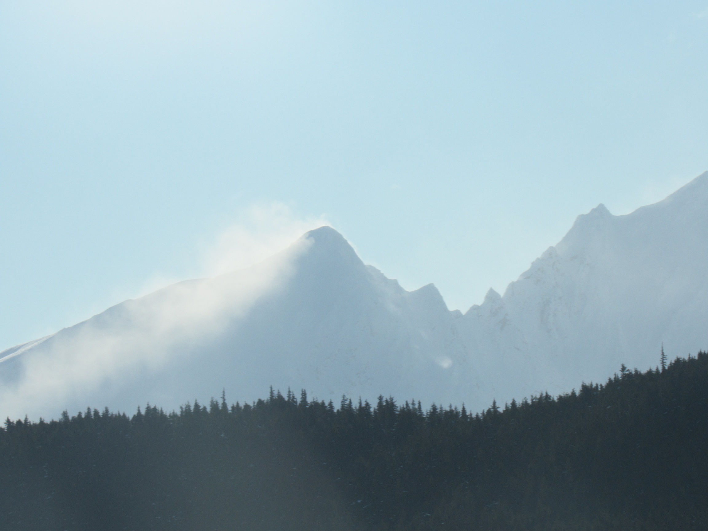
A example of outflow winds which we expect to build throughout the day today.  If you see windloading, the avalanche danger is likely increasing.  Lost Lake region.  Photo: Alex Mc Lain

Cornices:  Avoid travel on cornices and limit exposure underneath them.

Loose snow avalanches:  In areas that were protected from the wind, sluffs are possible in steep terrain.

Sun effect: Even with cold temperatures the sun may impact surface snow on steep solar aspects.  Be aware of moist surface snow, small roller balls or loose snow avalanches in wind protected spots, especially below steeper rocky areas.

Avalanche Problem 2
  • Deep Persistent Slabs
    Deep Persistent Slabs
  • Almost Certain
    Very Likely
    Likely
    Possible
    Unlikely
    Likelihood
  • Historic (D4-5)
    Very Large (D3)
    Large (D2)
    Small (D1)
    Size
Deep Persistent Slabs
Deep Persistent Slab avalanches are the release of a thick cohesive layer of hard snow (a slab), when the bond breaks between the slab and an underlying persistent weak layer deep in the snowpack. The most common persistent weak layers involved in deep, persistent slabs are depth hoar or facets surrounding a deeply buried crust. Deep Persistent Slabs are typically hard to trigger, are very destructive and dangerous due to the large mass of snow involved, and can persist for months once developed. They are often triggered from areas where the snow is shallow and weak, and are particularly difficult to forecast for and manage.

Likelihood of Avalanches
Terms such as "unlikely", "likely", and "certain" are used to define the scale, with the chance of triggering or observing avalanches increasing as we move up the scale. For our purposes, "Unlikely" means that few avalanches could be triggered in avalanche terrain and natural avalanches are not expected. "Certain" means that humans will be able to trigger avalanches on many slopes, and natural avalanches are expected.

Size of Avalanches
Avalanche size is defined by the largest potential avalanche, or expected range of sizes related to the problem in question. Assigned size is a qualitative estimate based on the destructive classification system and requires specialists to estimate the harm avalanches may cause to hypothetical objects located in the avalanche track (AAA 2016, CAA 2014). Under this schema, "Small" avalanches are not large enough to bury humans and are relatively harmless unless they carry people over cliffs or through trees or rocks. Moving up the scale, avalanches become "Large" enough to bury, injure, or kill people. "Very Large" avalanches may bury or destroy vehicles or houses, and "Historic" avalanches are massive events capable of altering the landscape.

Signal Word Size (D scale) Simple Descriptor
Small 1 Unlikely to bury a person
Large 2 Can bury a person
Very Large 3 Can destroy a house
Historic 4 & 5 Can destroy part or all of a village
More info at Avalanche.org

The snowpack structure for this avalanche problem still exists and an outlier avalanche could be a nasty surprise. There is nagging worry that someone will hit the wrong spot and trigger a very large avalanche that fails on the weak faceted snow from January. This is still lurking 3 to 6 feet deep in the snowpack. The wind slab triggered in Lynx Creek last Thursday was a larger avalanche because it ‘stepped down’ into these old weak layers. As time passes the likelihood of triggering a deep slab is decreasing, i.e. is unlikely. Areas that have a shallower snowpack are more concerning, places like Lynx Creek or Twin Peaks and south through Summit Lake.  As always, use good travel protocol and as you choose your route consider the consequences if a deep slab was triggered.

Weather
Tue, March 10th, 2020

Yesterday: Mostly cloudy skies with a trace of snow accumulation. Temperatures ranged from the high teens to high 20°Fs. Winds were light and westerly during the day and shifted to northwest overnight as temperatues dropped into the single digits.

Today: Mostly clear skies with a high temperature around 17°F and a low near -5°F. Winds will be from the northwest from 15 to the 20’s mph, gusting into the 30’s.

Tomorrow: Clear skies are expected with a high near 12°F and low of -5°F. Winds are expected to be from the west to northwest at 5 to 10 mph.

PRECIPITATION 24-hour data (6am – 6am)

Temp Avg (F) Snow (in) Water (in) Snow Depth (in)
Center Ridge (1880′) 23 0 0 69
Summit Lake (1400′) 22 0 0 31
Alyeska Mid (1700′) 23 1 0.06 82

RIDGETOP 24-hour data (6am – 6am)

Temp Avg (F) Wind Dir Wind Avg (mph) Wind Gust (mph)
Sunburst (3812′) 16 VAR 5 16
Seattle Ridge (2400′) 17 NW 8 21


Observations
Recent Observations for Turnagain Pass
Date Region Location
05/22/23 Turnagain Avalanche: Tincan
05/12/23 Turnagain Avalanche: Tincan, Sunburst, Magnum, Cornbiscuit
05/07/23 Turnagain Observation: Tincan – Bear Tracks
05/05/23 Turnagain Observation: Seattle Ridge
05/02/23 Turnagain Observation: Cornbiscuit
05/02/23 Turnagain Observation: Seward Hwy Turnagain Pass
04/30/23 Turnagain Observation: Magnum
04/29/23 Turnagain Observation: Tincan
04/28/23 Turnagain Avalanche: Taylor Pass/Pastoral
04/28/23 Turnagain Avalanche: Tincan
Riding Areas
Updated Thu, June 01st, 2023

Status of riding areas across the Chugach NF is managed by the Glacier and Seward Ranger Districts, not avalanche center staff. Riding area information is posted as a public service to our users and updated based on snow depth and snow density to prevent resource damage at trailhead locations. Riding area questions contact: mailroom_r10_chugach@fs.fed.us

Area Status Weather & Riding Conditions
Glacier District
Johnson Pass
Closed
Closed May 15.
Placer River
Closed
Closed May 15.
Skookum Drainage
Closed
Will close to motorized use on April 1, 2023 per the National Forest Plan.
Turnagain Pass
Closed
Will close on June 1.
Twentymile
Closed
Scheduled closure May 1.
Seward District
Carter Lake
Closed
Scheduled closure May 1.
Lost Lake Trail
Closed
Scheduled closure May 1.
Primrose Trail
Closed
Scheduled closure May 1.
Resurrection Pass Trail
Closed
Closed to motorized use for the 2022/23 winter season per Forest Plan. Open next season.
Snug Harbor
Closed
Extended opening until May 15.
South Fork Snow River Corridor
Closed
Scheduled closure May 1.
Summit Lake
Closed
Scheduled closure May 1.

Subscribe to Turnagain Pass
Avalanche Forecast by Email

This is a general backcountry avalanche advisory issued for Turnagain Arm with Turnagain Pass as the core advisory area. This advisory does not apply to highways, railroads or operating ski areas.