Turnagain Pass Avalanche Forecast RSS

Archives
ARCHIVED FORECAST - All forecasts expire after 24 hours from the posting date/time.
Issued
Sat, March 5th, 2022 - 7:00AM
Expires
Sun, March 6th, 2022 - 7:00AM
Forecaster
John Sykes
Avalanche risk The Bottom Line

The avalanche danger is CONSIDERABLE above 1000′. Strong winds over the past 24 hours and 2-6″ of snowfall expected today will make natural avalanches possible and human triggered avalanches likely. Wind slabs at upper elevations will be up to 2′ deep and could release on lower angle slopes and propagate more widely than normal due to a layer of buried surface hoar underneath the new snow from the past three days. Storm slabs are possible in protected areas that have received higher snowfall totals. The avalanche danger is MODERATE below 1000′.

PORTAGE/PLACER: Over the past three days this area has seen multiple feet of new snow. The snowpack needs time to adjust to this large new snow load and travel in avalanche terrain is not recommended.

Thanks to our sponsors!
Sat, March 5th, 2022
Alpine
Above 2,500'
Considerable (3)
Avalanche risk
Treeline
1,000'-2,500'
Considerable (3)
Avalanche risk
Below Treeline
Below 1,000'
Moderate (2)
Avalanche risk
Alpine
Above 2,500'
Avalanche risk
Considerable (3)
Treeline
1,000'-2,500'
Avalanche risk
Considerable (3)
Below Treeline
Below 1,000'
Avalanche risk
Moderate (2)
Danger Scale:
No Rating (0)
Low (1)
Moderate (2)
Considerable (3)
High (4)
Extreme (5)
Avalanche Problem 1
  • Storm Slabs
    Storm Slabs
  • Almost Certain
    Very Likely
    Likely
    Possible
    Unlikely
    Likelihood
  • Historic (D4-5)
    Very Large (D3)
    Large (D2)
    Small (D1)
    Size
Storm Slabs
Storm Slab avalanches are the release of a cohesive layer (a slab) of new snow that breaks within new snow or on the old snow surface. Storm-slabs typically last between a few hours and few days (following snowfall). Storm-slabs that form over a persistent weak layer (surface hoar, depth hoar, or near-surface facets) may be termed Persistent Slabs or may develop into Persistent Slabs.

Likelihood of Avalanches
Terms such as "unlikely", "likely", and "certain" are used to define the scale, with the chance of triggering or observing avalanches increasing as we move up the scale. For our purposes, "Unlikely" means that few avalanches could be triggered in avalanche terrain and natural avalanches are not expected. "Certain" means that humans will be able to trigger avalanches on many slopes, and natural avalanches are expected.

Size of Avalanches
Avalanche size is defined by the largest potential avalanche, or expected range of sizes related to the problem in question. Assigned size is a qualitative estimate based on the destructive classification system and requires specialists to estimate the harm avalanches may cause to hypothetical objects located in the avalanche track (AAA 2016, CAA 2014). Under this schema, "Small" avalanches are not large enough to bury humans and are relatively harmless unless they carry people over cliffs or through trees or rocks. Moving up the scale, avalanches become "Large" enough to bury, injure, or kill people. "Very Large" avalanches may bury or destroy vehicles or houses, and "Historic" avalanches are massive events capable of altering the landscape.

Signal Word Size (D scale) Simple Descriptor
Small 1 Unlikely to bury a person
Large 2 Can bury a person
Very Large 3 Can destroy a house
Historic 4 & 5 Can destroy part or all of a village
More info at Avalanche.org

Over the past three days there has been a big difference in the amount of new snowfall across our forecast area, with coastal areas like Portage and Placer receiving multiple feet of new snow and more inland areas like Turnagain Pass and Girdwood receiving less than a foot. Natural and human triggered avalanches are very likely in areas that received heavy snowfall, and the potential for remote triggering large avalanches exists because of a layer surface hoar that was buried underneath the new snow. The snowpack needs time to adjust to the large new snow load in these areas and travel in avalanche terrain is not recommended. Widespread avalanche activity was observed in the Spencer Bench area on Thursday and the added snowfall since then will have increased the likelihood of triggering and potential size of avalanches.

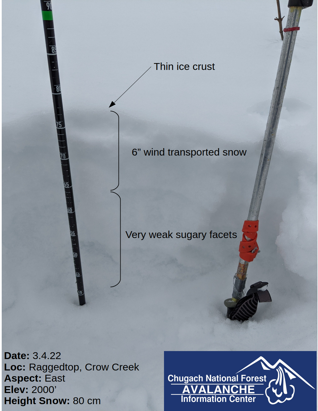
In areas that have not been favored by the recent snowfall, like Turnagain Pass and Girdwood, there has still been plenty of east wind to transport the new snow into wind slabs up to 2′ deep that are likely to be triggered by a person. The potential for buried surface hoar underneath the new snow could make triggering avalanches on lower angle slopes possible and produce avalanches with wider than typical propagation. In protected areas the depth of the new snow will determine whether storm slabs are possible to trigger today, with the likelihood increasing in areas with deeper snow totals. Another 2-6″ of new snow is expected today which will increase the potential for storm slab avalanches in protected areas and increase the snow available for wind transport. Using hand pits and test rolls is a great way to check how well the new snow is bonding to the old surface and determine if avalanches are possible in the area you are travelling.

Cornices: The new snow and strong winds over the past 24 hours will have added some fresh load to our existing cornices and could make them more sensitive to human triggers. With poor visibility expected today it is best to avoid spending time underneath areas with cornices because they could release naturally due to added wind loading.

Shooting crack on a wind loaded test roll in the treeline elevation band in the Crow Creek area. Photo 3.4.22

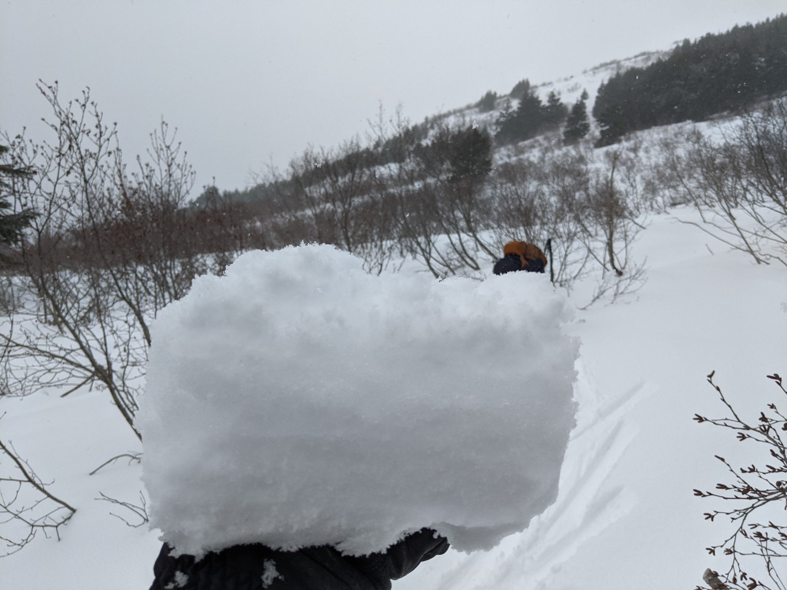
Only a few inches of new snow above a stout melt freeze crust at lower elevations in Crow Creek area yesterday. Photo 3.5.22


Additional Concern
  • Deep Persistent Slabs
    Deep Persistent Slabs
Deep Persistent Slabs
Deep Persistent Slab avalanches are the release of a thick cohesive layer of hard snow (a slab), when the bond breaks between the slab and an underlying persistent weak layer deep in the snowpack. The most common persistent weak layers involved in deep, persistent slabs are depth hoar or facets surrounding a deeply buried crust. Deep Persistent Slabs are typically hard to trigger, are very destructive and dangerous due to the large mass of snow involved, and can persist for months once developed. They are often triggered from areas where the snow is shallow and weak, and are particularly difficult to forecast for and manage.
More info at Avalanche.org

In the far northern and southern portions of our forecast area (i.e. Crow Creek, Lynx Creek, Silvertip Creek) the snowpack is thinner and the potential for triggering a large avalanche on a layer of facets from November exists. Yesterday we found the November facets only 6″ down from the surface in a wind scoured area near Crow Creek. This was quite surprising and indicates that human triggered avalanches could be possible on this deeper weak layer if a failure is initiated in a thin spot of the snowpack. Recent avalanche activity on this layer has been associated with significant snowfall events and since these thinner snowpack areas of the forecast region have not received much snow the past three days the likelihood of an avalanche on this layer is relatively low.

Similar thin snowpack conditions exist in the Summit Lake area, which is outside our forecast zone, and triggering avalanches on deeper weak layers is more likely.

Wind scoured area along our skin track with less than 3′ total snowpack depth and weak facets only buried 6″ deep. Photo 3.4.22

Weather
Sat, March 5th, 2022

Yesterday: Overcast skies with light to moderate snow in some areas of the forecast zone. Turnagain Pass and Summit Lake got 0″ of new snow in the past 24 hours, Girdwood got 0.5″ of water which should be about 6″ of new snow, and Portage/Placer got 1.0″ of water which is about 12″ of snow. Snow line was between 500-1000′. Winds were very strong at upper elevations yesterday morning with averages in the 20-30 mph range and gusts into the 60-70 mph range. During the afternoon winds backed off slightly and are currently in the 15-25 mph range with gusts of 30-50 mph.

Today: Snowfall is expected throughout the area today. Turnagain Pass should receive 2-4″ of new snow, with Girdwood, Portage, and Placer expected to receive 4-6″. Snow line is expected to be between 900-1100′. Winds will be in the 15-25 mph range at upper elevations and will shift to westerly this evening as the snowfall ends. Temperatures will remain relatively warm, with upper elevations in the mid-twenties and lower elevations in the mid to upper-thirties.

Tomorrow: Sunday looks like clouds will clear up for the most part and winds will be light to calm during the daylight hours. No new snow is expected for a few days. Temperatures will drop into the twenties at sea level.

PRECIPITATION 24-hour data (6am – 6am)

Temp Avg (F) Snow (in) Water (in) Snow Depth (in)
Center Ridge (1880′) 33 0 0 92
Summit Lake (1400′) 34 0 0 39
Alyeska Mid (1700′) 31 6 0.5 NA

RIDGETOP 24-hour data (6am – 6am)

Temp Avg (F) Wind Dir Wind Avg (mph) Wind Gust (mph)
Sunburst (3812′) 21 ENE 26 79
Seattle Ridge (2400′) 25 SE 17 34
Observations
Recent Observations for Turnagain Pass
Date Region Location
05/22/23 Turnagain Avalanche: Tincan
05/12/23 Turnagain Avalanche: Tincan, Sunburst, Magnum, Cornbiscuit
05/07/23 Turnagain Observation: Tincan – Bear Tracks
05/05/23 Turnagain Observation: Seattle Ridge
05/02/23 Turnagain Observation: Cornbiscuit
05/02/23 Turnagain Observation: Seward Hwy Turnagain Pass
04/30/23 Turnagain Observation: Magnum
04/29/23 Turnagain Observation: Tincan
04/28/23 Turnagain Avalanche: Taylor Pass/Pastoral
04/28/23 Turnagain Avalanche: Tincan
Riding Areas
Updated Mon, May 15th, 2023

Status of riding areas across the Chugach NF is managed by the Glacier and Seward Ranger Districts, not avalanche center staff. Riding area information is posted as a public service to our users and updated based on snow depth and snow density to prevent resource damage at trailhead locations. Riding area questions contact: mailroom_r10_chugach@fs.fed.us

Area Status Weather & Riding Conditions
Glacier District
Johnson Pass
Closed
Closed May 15.
Placer River
Closed
Closed May 15.
Skookum Drainage
Closed
Will close to motorized use on April 1, 2023 per the National Forest Plan.
Turnagain Pass
Open
Chugach NF staff will be assessing daily after May 15th. Please keep machines on the snow and avoid brown spots to keep this area open as long as possible.
Twentymile
Closed
Scheduled closure May 1.
Seward District
Carter Lake
Closed
Scheduled closure May 1.
Lost Lake Trail
Closed
Scheduled closure May 1.
Primrose Trail
Closed
Scheduled closure May 1.
Resurrection Pass Trail
Closed
Closed to motorized use for the 2022/23 winter season per Forest Plan. Open next season.
Snug Harbor
Closed
Extended opening until May 15.
South Fork Snow River Corridor
Closed
Scheduled closure May 1.
Summit Lake
Closed
Scheduled closure May 1.

Subscribe to Turnagain Pass
Avalanche Forecast by Email

This is a general backcountry avalanche advisory issued for Turnagain Arm with Turnagain Pass as the core advisory area. This advisory does not apply to highways, railroads or operating ski areas.