The avalanche danger is MODERATE at all elevations. Human triggered wind slab avalanches formed by the strong winds yesterday, up to a foot deep, are possible in the mid and upper elevations. Additionally, slab avalanches failing in buried weak layers 1-3′ deep are possible at all elevations. Assess the snowpack as you travel, identify areas of concern and evaluate terrain consequences.
SUMMIT LAKE/LOST LAKE/SNUG/SEWARD: The mountains south of the forecast zone saw significant wind yesterday. Heads up for triggering wind slab avalanches in these areas as well.
Mon, March 1st, 2021
Alpine
Above 2,500'
2 - Moderate
Treeline
1,000'-2,500'
2 - Moderate
Below Treeline
Below 1,000'
2 - Moderate
0 - No Rating
1 - Low
2 - Moderate
3 - Considerable
4 - High
5 - Extreme
Travel Advice
Generally safe avalanche conditions. Watch for unstable snow on isolated terrain features.
Heightened avalanche conditions on specific terrain features. Evaluate snow and terrain carefully; identify features of concern.
Natural avalanches likely; human-triggered avalanches very likely.
Natural and human-triggered avalanches certain.
Avalanche Size and Distribution
Small avalanches in isolated areas or extreme terrain.
Small avalanches in specific areas; or large avalanches in isolated areas.
Small avalanches in many areas; or large avalanches in specific areas; or very large avalanches in isolated areas.
Large avalanches in many areas; or very large avalanches in specific areas.
Very large avalanches in many areas.
Recent Avalanches
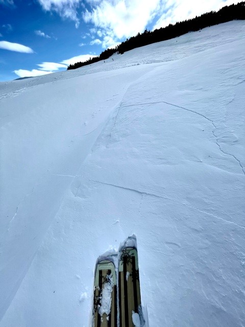
There was skier triggered avalanche in steep, complex terrain on an unsupported and cross-loaded slope below Hippy Bowl. Fracture broke at skier’s feet then propagated uphill 25 feet. Avalanche initiation was slow, and skier had continued out of its path by the time it gained momentum. The avalanche was 9″ deep and 20′ wide.
Observers in Lynx Creek noted wind slabs both natural and small snowmachine triggered.
Small natural wind slab avalanches were also observed in Girdwood Valley.
Wind Slab avalanches are the release of a cohesive layer of snow (a slab) formed by the wind. Wind typically transports snow from the upwind sides of terrain features and deposits snow on the downwind side. Wind slabs are often smooth and rounded and sometimes sound hollow, and can range from soft to hard. Wind slabs that form over a persistent weak layer (surface hoar, depth hoar, or near-surface facets) may be termed Persistent Slabs or may develop into Persistent Slabs.
Likelihood of Avalanches
Terms such as "unlikely", "likely", and "certain" are used to define the scale, with the chance of triggering or observing
avalanches increasing as we move up the scale. For our purposes, "Unlikely" means that few avalanches could be triggered in avalanche terrain and
natural avalanches are not expected. "Certain" means that humans will be able to trigger avalanches on many slopes, and natural avalanches are expected.
Size of Avalanches
Avalanche size is defined by the largest potential avalanche, or expected range of sizes related to the problem in question.
Assigned size is a qualitative estimate based on the destructive classification system and requires specialists to estimate the harm avalanches may cause to
hypothetical objects located in the avalanche track (AAA 2016, CAA 2014). Under this schema, "Small" avalanches are not large enough to bury humans and are
relatively harmless unless they carry people over cliffs or through trees or rocks. Moving up the scale, avalanches become "Large" enough to bury, injure,
or kill people. "Very Large" avalanches may bury or destroy vehicles or houses, and "Historic" avalanches are massive events capable of altering the landscape.
Please send lots of snow our way. The few inches in the forecast today won’t cut it and enough with the February wind events… We could use a good old crush n’ flush storm to get rid of the persistent weak layers and some powder would be lovely! Remember January? Just do that again. Thanks, Everyone
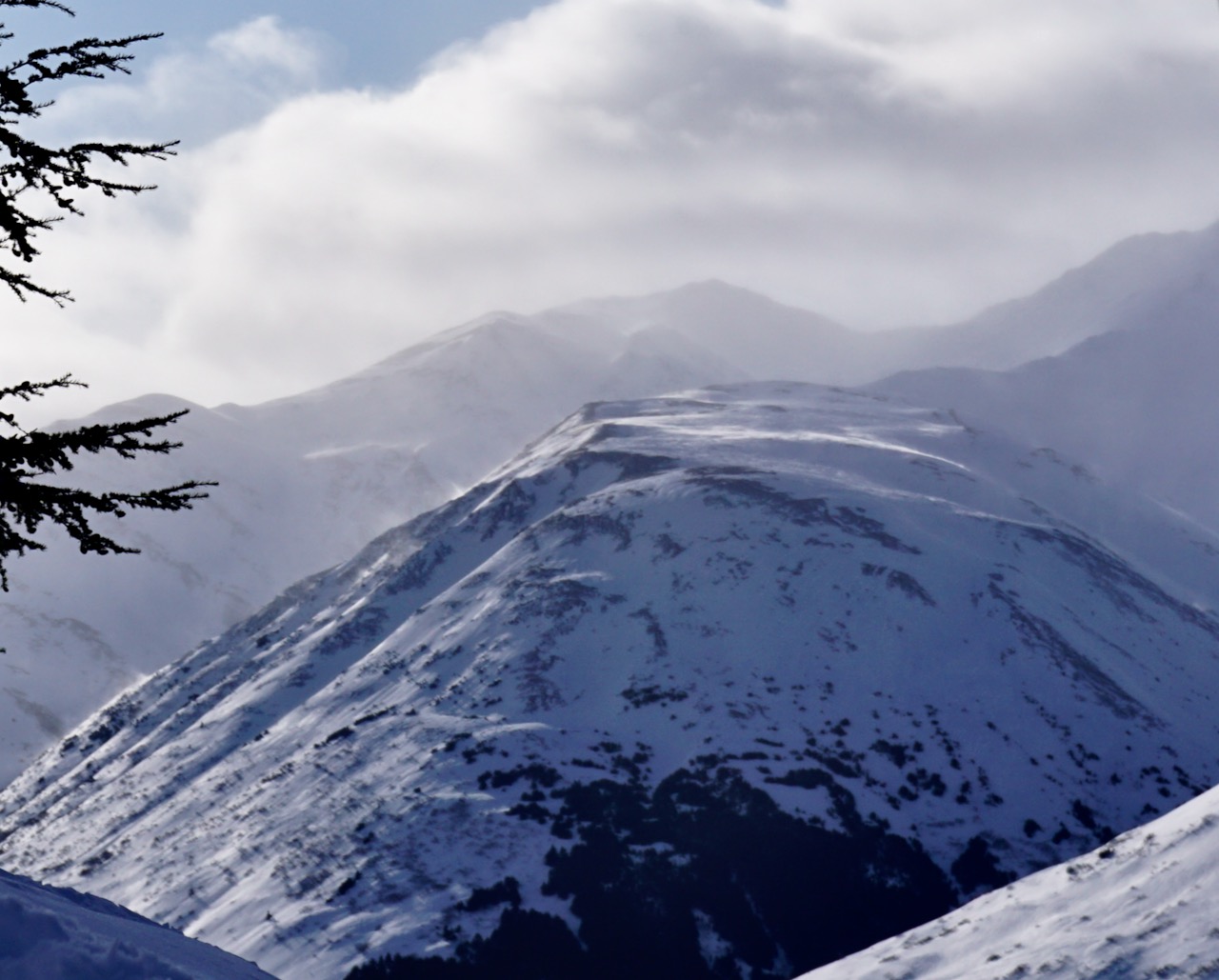
Yesterday observers from Girdwood to Seward noted blowing snow and wind affected surfaces as another northwest wind event impacted the region. Winds were sustained from the west/northwest throughout the day. There were a few natural wind slab avalanches observed as well as the small skier and snowmachine triggered wind slabs noted above. Triggering a wind slab will still be possible today but they might be a bit more stubborn. With snow forecast to fall throughout the day (2-6″/0.25 SWE), it may be hard to determine where the wind slabs are as the wind effect gets covered up. Consider wind slab habitat when choosing terrain. Slabs may be found near ridges, on steep unsupported slopes and in cross-loaded gullies. Watch for cracks shooting out from your snowmachine or skis, and ‘punchy’ feeling stiff snow over weaker snow under the new snow. Because of the multiple wind events and changing directions lingering wind slabs may be found on all aspects. If you do find and trigger a wind slab, remember it could step down to old buried weak layers deeper in the snowpack. In this case, a larger avalanche is possible (more on this in Problem 2).
Cornices: When traveling along ridgelines be sure to give cornices plenty of space, and minimize the amount of time spent traveling below them. Cornices could fail under the weight of a person on skis or a snowmachine, and might trigger an avalanche if the slope below is wind-loaded.
Wind transport on Gilpatrick in Summit Lake, 2.28.21 at 3 pm.
Cracking in recently wind-loaded snow on Eddies, 2.28.21. Photo Andy Moderow.
Persistent Slab avalanches are the release of a cohesive layer of snow (a slab) in the middle to upper snowpack, when the bond to an underlying persistent weak layer breaks. Persistent layers include: surface hoar, depth hoar, near-surface facets, or faceted snow. Persistent weak layers can continue to produce avalanches for days, weeks or even months, making them especially dangerous and tricky. As additional snow and wind events build a thicker slab on top of the persistent weak layer, this avalanche problem may develop into a Deep Persistent Slab.
Likelihood of Avalanches
Terms such as "unlikely", "likely", and "certain" are used to define the scale, with the chance of triggering or observing
avalanches increasing as we move up the scale. For our purposes, "Unlikely" means that few avalanches could be triggered in avalanche terrain and
natural avalanches are not expected. "Certain" means that humans will be able to trigger avalanches on many slopes, and natural avalanches are expected.
Size of Avalanches
Avalanche size is defined by the largest potential avalanche, or expected range of sizes related to the problem in question.
Assigned size is a qualitative estimate based on the destructive classification system and requires specialists to estimate the harm avalanches may cause to
hypothetical objects located in the avalanche track (AAA 2016, CAA 2014). Under this schema, "Small" avalanches are not large enough to bury humans and are
relatively harmless unless they carry people over cliffs or through trees or rocks. Moving up the scale, avalanches become "Large" enough to bury, injure,
or kill people. "Very Large" avalanches may bury or destroy vehicles or houses, and "Historic" avalanches are massive events capable of altering the landscape.
As we have said now for weeks, this snowpack has to be viewed with some uncertainty and caution. We continue to track two weak layers of snow (surface hoar and facets) buried in the top three feet of the snowpack. The data continues to show triggering an avalanche in one of these layers remains possible. The small human triggered avalanches observed in lower elevations north of the Girdwood Valley (1100-1900′) on Friday and Saturday failed on one of these layers. Observers also reported whumpfing associated with the buried weak layers in lower elevation terrain near Shark’s fin on Friday.
We know these layers are present in most areas and at all the elevation bands. The trick is, they are not reactive everywhere. They seems to be more of an issue below 2000′. However, a persistent slab avalanche in upper elevation terrain cannot be ruled out. Each snow event and wind-loading event add a little more stress to the snowpack. Triggering a recently formed wind slab or cornice fall may step down to one of these buried weak layers. There may be older hard wind slabs sitting on top of the weak layers allowing you to get well out onto the slope before an avalanche initiates or an avalanche may occur after other machines or skiers have have already ridden the slope. In addition to trying to figure out where wind slabs lurk today keep in mind that these buried weak layers exist. Watch for signs of instability, follow safe travel protocol and evaluate terrain consequences.
Weather
Mon, March 1st, 2021
Yesterday: Skies were partly cloudy. Temperatures were in the single digits in the Alpine and the teens to mid 20°Fs in mid to lower elevations. Winds were northwesterly 15-25 mph with gusts into the 30s. Overnight skies were mostly clear becoming mostly cloudy in the early morning. Temperatures were in the the single digits and teens. Winds eased off and were light and variable.
Today: Skies will be cloudy with snow throughout the day, 2-6″ expected. Temperatures will be in the 20°Fs. Winds will be easterly 5-15 mph with gusts into the 20s becoming light and variable in the afternoon. Skies will be mostly cloudy overnight with a chance of snow. Temperatures will be in the teens and winds will be light and westerly.
Tomorrow: Skies will be partly cloudy with a chance of snow showers in the morning. Temperatures in the teens to mid 20°Fs and light east winds. The weather looks fairly uneventful for the remainder of the week. It’s time for some snow dances! Fingers crossed for a more active storm track next week. Powder for spring break???
This is a general backcountry avalanche advisory issued for Turnagain Arm with Turnagain Pass as the core advisory area.
This advisory does not apply to highways, railroads or operating ski areas.