Turnagain Pass RSS

Archives
ARCHIVED - Forecasts expire after 24 hours.
Issued
Sun, February 14th, 2021 - 7:00AM
Expires
Mon, February 15th, 2021 - 7:00AM
Forecaster
Andrew Schauer
Avalanche risk The Bottom Line

The avalanche danger is MODERATE, and it is still possible to trigger an avalanche 1-2’ deep on steep, wind-loaded slopes. Moderate to strong winds will continue to create sensitive wind slabs on top of multiple buried layers of weak snow today. Since we are dealing with these persistent weak layers, it will also still be possible to trigger an avalanche on older wind slabs that have formed in the past few days. It will be important to avoid traveling on steep, wind-loaded terrain, which will have stiffer snow near the surface and may give you clear warning signs like shooting cracks or collapsing.

Sun, February 14th, 2021
Alpine
Above 2,500'
2 - Moderate
Avalanche risk
Treeline
1,000'-2,500'
2 - Moderate
Avalanche risk
Below Treeline
Below 1,000'
2 - Moderate
Avalanche risk
0 - No Rating
1 - Low
2 - Moderate
3 - Considerable
4 - High
5 - Extreme
Avalanche risk Avalanche risk Avalanche risk Avalanche risk Avalanche risk
Travel Advice Generally safe avalanche conditions. Watch for unstable snow on isolated terrain features. Heightened avalanche conditions on specific terrain features. Evaluate snow and terrain carefully; identify features of concern. Dangerous avalanche conditions. Careful snowpack evaluation, cautious route-finding, and conservative decision-making essential. Very dangerous avalanche conditions. Travel in avalanche terrain not recommended. Extraordinarily dangerous avalanche conditions. Avoid all avalanche terrain.
Likelihood of Avalanches Natural and human-triggered avalanches unlikely. Natural avalanches unlikely; human-triggered avalanches possible. Natural avalanches possible; human-triggered avalanches likely. Natural avalanches likely; human-triggered avalanches very likely. Natural and human-triggered avalanches certain.
Avalanche Size and Distribution Small avalanches in isolated areas or extreme terrain. Small avalanches in specific areas; or large avalanches in isolated areas. Small avalanches in many areas; or large avalanches in specific areas; or very large avalanches in isolated areas. Large avalanches in many areas; or very large avalanches in specific areas. Very large avalanches in many areas.
Recent Avalanches

Placer Valley: A snowmachine triggered an avalanche at low elevation near the approach to Squirrel Flats (photo below). The avalanche was about 6-12″ deep, 75′ wide, and ran for about 100′.

Crescent Lake: A snowmachine triggered a small wind slab avalanche near Crescent lake.

Snowmachine-triggered avalanche near the Squirrel Flats uptrack. Photo: Travis Smith. 02.13.2021.

Avalanche Problem 1
  • Wind Slabs
    Wind Slabs
  • Certain
    Very Likely
    Likely
    Possible
    Unlikely
    Likelihood
  • Historic (D4-5)
    Very Large (D3)
    Large (D2)
    Small (D1)
    Size
Wind Slabs
Wind Slab avalanches are the release of a cohesive layer of snow (a slab) formed by the wind. Wind typically transports snow from the upwind sides of terrain features and deposits snow on the downwind side. Wind slabs are often smooth and rounded and sometimes sound hollow, and can range from soft to hard. Wind slabs that form over a persistent weak layer (surface hoar, depth hoar, or near-surface facets) may be termed Persistent Slabs or may develop into Persistent Slabs.

Likelihood of Avalanches
Terms such as "unlikely", "likely", and "certain" are used to define the scale, with the chance of triggering or observing avalanches increasing as we move up the scale. For our purposes, "Unlikely" means that few avalanches could be triggered in avalanche terrain and natural avalanches are not expected. "Certain" means that humans will be able to trigger avalanches on many slopes, and natural avalanches are expected.

Size of Avalanches
Avalanche size is defined by the largest potential avalanche, or expected range of sizes related to the problem in question. Assigned size is a qualitative estimate based on the destructive classification system and requires specialists to estimate the harm avalanches may cause to hypothetical objects located in the avalanche track (AAA 2016, CAA 2014). Under this schema, "Small" avalanches are not large enough to bury humans and are relatively harmless unless they carry people over cliffs or through trees or rocks. Moving up the scale, avalanches become "Large" enough to bury, injure, or kill people. "Very Large" avalanches may bury or destroy vehicles or houses, and "Historic" avalanches are massive events capable of altering the landscape.

Signal Word Size (D scale) Simple Descriptor
Small 1 Unlikely to bury a person
Large 2 Can bury a person
Very Large 3 Can destroy a house
Historic 4 & 5 Can destroy part or all of a village
More info at Avalanche.org

With moderate winds yesterday evening through this morning, it remains possible to trigger an avalanche 1-2’ deep in steep, wind-loaded terrain. Winds began picking up late yesterday, blowing 10-15 mph out of the east with gusts above 30 mph near ridgetops, and we are expecting to see sustained winds of 15-30 mph through most of the day. Today we will be dealing with several generations of wind slabs. The slabs that have formed since last night, and continue to develop during the day, will be the most sensitive and may be up to a foot thick. But there are also persistent weak layers of buried surface hoar and near-surface facets buried up to 2’ deep that may still be reactive to human triggers, where they are capped by new or old wind slabs. While these buried weak layers are slowly gaining strength with time, we still cannot rule them out.

For today, safe travel will mean staying diligent in identifying and avoiding steep, wind-loaded terrain. You can recognize fresh wind slabs where there is stiff snow at the surface, which may feel punchy or sound hollow. They may also have a smooth, rounded appearance that looks different from adjacent terrain. In some areas, older wind slabs may be covered by a few inches of light snow, which will make them a little bit harder to identify. If you notice any cracks shooting out from your snowmachine, skis, or snowboard, it is a sure sign that the snow beneath you is capable of producing an avalanche. The same can be said if you experience a collapse, or whumpf. You can often expect to see wind loading below cornices and ridgelines, in cross-loaded gullies, or below convexities.

Sluffs: There is (hopefully) still some terrain in our area that has remained sheltered from recent wind events. We have been getting reports of folks triggering dry loose avalanches (sluffs) in steep terrain with loose snow at the surface. Be aware of these, as they can become dangerous if they carry you down steep slopes and into terrain traps.

Cornices: With another windy day today, our large cornices will continue to get bigger. If you are traveling along ridges be sure to give them plenty of space, and minimize the amount of time you spend traveling below them.

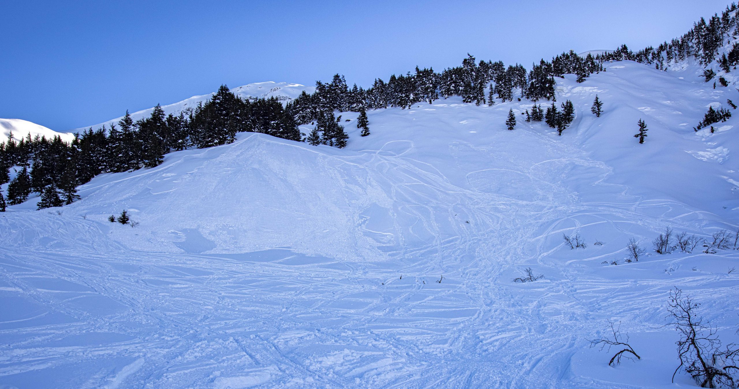
Wind textures along the ridgeline of Pete’s North at about 2750′. 02.13.2021. Photo: CNFAIC

Additional Concern
  • Glide Avalanches
    Glide Avalanches
Glide Avalanches
Glide Avalanches are the release of the entire snow cover as a result of gliding over the ground. Glide avalanches can be composed of wet, moist, or almost entirely dry snow. They typically occur in very specific paths, where the slope is steep enough and the ground surface is relatively smooth. They are often proceeded by full depth cracks (glide cracks), though the time between the appearance of a crack and an avalanche can vary between seconds and months. Glide avalanches are unlikely to be triggered by a person, are nearly impossible to forecast, and thus pose a hazard that is extremely difficult to manage.
More info at Avalanche.org

Glide cracks have opened up throughout the area. These avalanches are unpredictable and they are large since they involve the entire season’s snowpack. Avoid spending any time on or below slopes with glide cracks, as they can release unexpectedly. If you see any new glide activity, please let us know here.

Weather
Sun, February 14th, 2021

Yesterday: Light easterly winds were blowing 5-10 mph for most of the day, before increasing to 10-15 mph in the late afternoon and overnight. Skies were clear, with morning temperatures near 0 F at the lower elevations, and highs temperatures reaching the low 20’s to mid 30’s F. Overnight low temperatures were in the low teens to low 20’s F.

Today: Easterly winds are expected to pick up to 15-30 mph at the ridgetops under mostly cloudy skies. High temperatures will be in the upper teens to mid 20’s F, and we might see a few snowflakes during the day.

Tomorrow: Low temperatures tonight will be in the low to mid teens F, with mostly cloudy skies and a possible trace of snow. Winds are expected to calm down, blowing 5-10 mph out of the east at the ridgetops. Highs tomorrow should be in the low to mid 20’s F.

PRECIPITATION 24-hour data (6am – 6am)

Temp Avg (F) Snow (in) Water (in) Snow Depth (in)
Center Ridge (1880′) 22 0 0 117
Summit Lake (1400′) 10 0 0 42
Alyeska Mid (1700′) 20 0 0 110

RIDGETOP 24-hour data (6am – 6am)

Temp Avg (F) Wind Dir Wind Avg (mph) Wind Gust (mph)
Sunburst (3812′) 18 ENE 9 32
Seattle Ridge (2400′) 21 SE 8 18
Observations
Recent Observations for Turnagain Pass
Date Region Location
04/23/24 Turnagain Observation: Turnagain Sunny Side
04/21/24 Turnagain Observation: Bertha Creek
04/20/24 Turnagain Avalanche: Spokane Creek
04/16/24 Turnagain Observation: Cornbiscuit
04/15/24 Turnagain Observation: Taylor Pass
04/15/24 Turnagain Observation: Seward Highway – Tern Lake to Portage
04/14/24 Turnagain Observation: Sunburst
04/14/24 Turnagain Observation: Turnagain Pass Snomo
04/13/24 Turnagain Observation: Spokane Creek
04/11/24 Turnagain Observation: Tincan
Riding Areas

The riding areas page has moved. Please click here & update your bookmarks.


Subscribe to Turnagain Pass
Avalanche Forecast by Email

This is a general backcountry avalanche advisory issued for Turnagain Arm with Turnagain Pass as the core advisory area. This advisory does not apply to highways, railroads or operating ski areas.