Turnagain Pass RSS

Archives
ARCHIVED - Forecasts expire after 24 hours.
Issued
Mon, January 25th, 2021 - 7:00AM
Expires
Tue, January 26th, 2021 - 7:00AM
Forecaster
Aleph Johnston-Bloom
Avalanche risk The Bottom Line

The avalanche danger is MODERATE above 1,000′ today. Triggering a wind slab remains possible on slopes 35° and steeper. These slabs will be found near ridges, on wind-loaded slopes and in cross-loaded gullies. Look for signs of signs of wind effect and choose terrain carefully. Give cornices a wide berth and and limit time under glide cracks.

The avalanche danger is LOW below 1,000′ where there is a thick melt-freeze crust.

Mon, January 25th, 2021
Alpine
Above 2,500'
2 - Moderate
Avalanche risk
Treeline
1,000'-2,500'
2 - Moderate
Avalanche risk
Below Treeline
Below 1,000'
1 - Low
Avalanche risk
0 - No Rating
1 - Low
2 - Moderate
3 - Considerable
4 - High
5 - Extreme
Avalanche risk Avalanche risk Avalanche risk Avalanche risk Avalanche risk
Travel Advice Generally safe avalanche conditions. Watch for unstable snow on isolated terrain features. Heightened avalanche conditions on specific terrain features. Evaluate snow and terrain carefully; identify features of concern. Dangerous avalanche conditions. Careful snowpack evaluation, cautious route-finding, and conservative decision-making essential. Very dangerous avalanche conditions. Travel in avalanche terrain not recommended. Extraordinarily dangerous avalanche conditions. Avoid all avalanche terrain.
Likelihood of Avalanches Natural and human-triggered avalanches unlikely. Natural avalanches unlikely; human-triggered avalanches possible. Natural avalanches possible; human-triggered avalanches likely. Natural avalanches likely; human-triggered avalanches very likely. Natural and human-triggered avalanches certain.
Avalanche Size and Distribution Small avalanches in isolated areas or extreme terrain. Small avalanches in specific areas; or large avalanches in isolated areas. Small avalanches in many areas; or large avalanches in specific areas; or very large avalanches in isolated areas. Large avalanches in many areas; or very large avalanches in specific areas. Very large avalanches in many areas.
Recent Avalanches

A snowmachiner triggered a wind slab avalanche side hilling a NW facing slope in Triangle Bowl on the backside of Seattle Ridge yesterday. The crown was a foot deep. The rider wasn’t caught or carried in the avalanche.

Snowmachine triggered wind slab, Triangle Bowl, 1.24.21. Photo: Eric Scott.


Avalanche Problem 1
  • Wind Slabs
    Wind Slabs
  • Certain
    Very Likely
    Likely
    Possible
    Unlikely
    Likelihood
  • Historic (D4-5)
    Very Large (D3)
    Large (D2)
    Small (D1)
    Size
Wind Slabs
Wind Slab avalanches are the release of a cohesive layer of snow (a slab) formed by the wind. Wind typically transports snow from the upwind sides of terrain features and deposits snow on the downwind side. Wind slabs are often smooth and rounded and sometimes sound hollow, and can range from soft to hard. Wind slabs that form over a persistent weak layer (surface hoar, depth hoar, or near-surface facets) may be termed Persistent Slabs or may develop into Persistent Slabs.

Likelihood of Avalanches
Terms such as "unlikely", "likely", and "certain" are used to define the scale, with the chance of triggering or observing avalanches increasing as we move up the scale. For our purposes, "Unlikely" means that few avalanches could be triggered in avalanche terrain and natural avalanches are not expected. "Certain" means that humans will be able to trigger avalanches on many slopes, and natural avalanches are expected.

Size of Avalanches
Avalanche size is defined by the largest potential avalanche, or expected range of sizes related to the problem in question. Assigned size is a qualitative estimate based on the destructive classification system and requires specialists to estimate the harm avalanches may cause to hypothetical objects located in the avalanche track (AAA 2016, CAA 2014). Under this schema, "Small" avalanches are not large enough to bury humans and are relatively harmless unless they carry people over cliffs or through trees or rocks. Moving up the scale, avalanches become "Large" enough to bury, injure, or kill people. "Very Large" avalanches may bury or destroy vehicles or houses, and "Historic" avalanches are massive events capable of altering the landscape.

Signal Word Size (D scale) Simple Descriptor
Small 1 Unlikely to bury a person
Large 2 Can bury a person
Very Large 3 Can destroy a house
Historic 4 & 5 Can destroy part or all of a village
More info at Avalanche.org

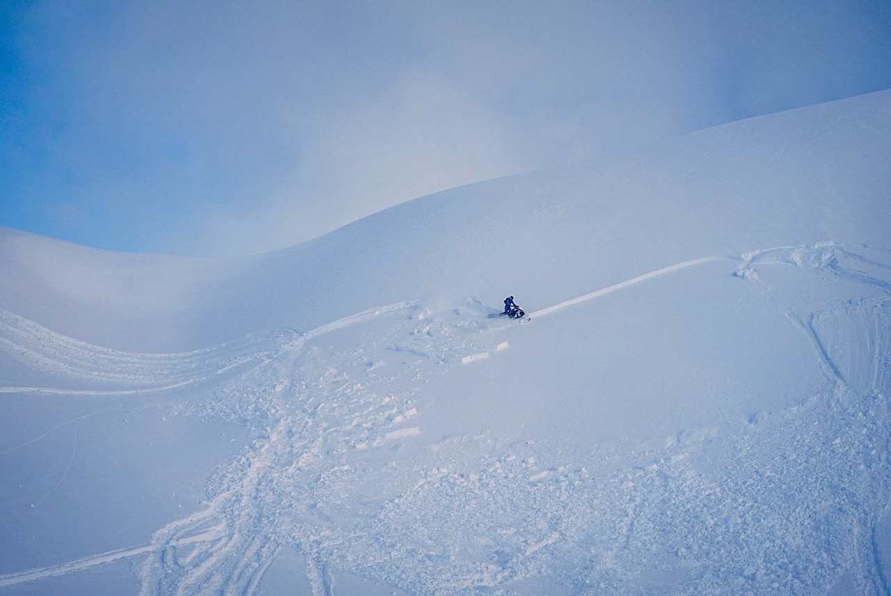
As skies cleared yesterday evidence of Saturday’s storm was easy to spot with a number of wind slab crowns and cornice falls. Observers across the region noted west/northwest winds moving snow throughout the day, wind crusts and a few human triggered wind slabs. The most notable being the one highlighted above. This wind direction gets channeled through Turnagain Pass as southerly winds at mid and lower elevations, is not well captured by the weather stations and is often stronger in Summit Lake. Today be on the lookout for lingering wind slabs, 1-2′ deep, in steep wind-loaded terrain. Remember the loading patterns might be a bit different from what we have been seeing for most of season from the prevailing east winds. With clear skies and easier travel at upper elevations take this into consideration as you choose terrain. Watch for cracks shooting out from your snowmachine or skis, smooth rounded pillows of snow, and ‘punchy’ feeling stiff snow over weaker snow. Even shallow wind slabs can be quite dangerous in high consequence terrain and hard wind slabs may break above you as you travel out onto the slope.

Cornices: The recent strong winds and wet snow have been ideal for building large cornices and causing cornice falls. There were a number of recent cornice falls observed yesterday that failed on Saturday during the storm. As you travel today keep in mind cornices have a bad reputation for breaking much farther back than one would expect. If you find yourself traveling along ridgelines be sure to give them plenty of space.

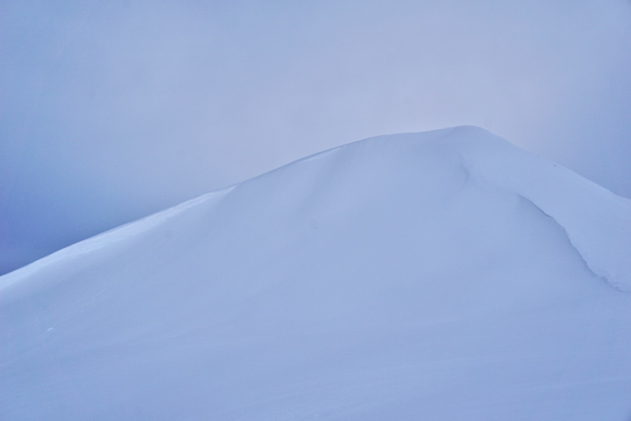
Wind-loading along both ridges of Eddies Headwall from opposite wind directions, 1.24.21. Photo: Andy Moderow 

Wind-loading from the south on Tincan ridge, 1.24.21. Photo: Andy Moderow

Additional Concern
  • Glide Avalanches
    Glide Avalanches
Glide Avalanches
Glide Avalanches are the release of the entire snow cover as a result of gliding over the ground. Glide avalanches can be composed of wet, moist, or almost entirely dry snow. They typically occur in very specific paths, where the slope is steep enough and the ground surface is relatively smooth. They are often proceeded by full depth cracks (glide cracks), though the time between the appearance of a crack and an avalanche can vary between seconds and months. Glide avalanches are unlikely to be triggered by a person, are nearly impossible to forecast, and thus pose a hazard that is extremely difficult to manage.
More info at Avalanche.org

Glide cracks continue to open and there were recent glide avalanches observed in one of the Eddies south chutes and on the east side of Raggedtop yesterday. As more and more glide cracks appear remember it is important to limit time spent underneath them. Glide avalanches are totally unpredictable, not triggered by people and are the entire snowpack sliding at the ground. This type of avalanche could be large and unsurvivable if you happened to be in wrong place when one releases. If you see recent glide activity please let us know.

Weather
Mon, January 25th, 2021

Yesterday: Skies were overcast in the morning and became partly cloudy in the afternoon. Ridgetop winds were WNW 10-20 mph with gusts into the 30s. Temperatures were in 20°Fs at upper elevations and 30°Fs at sea level. Skies cleared overnight, temperatures decreased to the teens and mid 20°Fs and winds became light and easterly.

Today: Clear skies, light to calm east winds and temperatures in the teens to mid 20°Fs. Overnight skies remain clear, temperatures will be in the low teens to low 20°Fs and winds remain calm.

Tomorrow: Another day of clear skies, light winds and temperatures in the teens to mid 20°Fs.  Clouds start to build on Wednesday in advance of the next storm.

PRECIPITATION 24-hour data (6am – 6am)

Temp Avg (F) Snow (in) Water (in) Snow Depth (in)
Center Ridge (1880′) 29* 0 0 133
Summit Lake (1400′) 27* 0 0 45
Alyeska Mid (1700′) 27 0 0 112

Both the Center Ridge and Summit Lake SNOTELS stopped reporting data after 7 pm last night.

RIDGETOP 24-hour data (6am – 6am)

Temp Avg (F) Wind Dir Wind Avg (mph) Wind Gust (mph)
Sunburst (3812′) 19 WNW 7 27
Seattle Ridge (2400′) 22 W* 2* 15*

*Seattle Ridge anemometer started reporting again at 2 pm yesterday.

Observations
Recent Observations for Turnagain Pass
Date Region Location
04/16/24 Turnagain Observation: Cornbiscuit
04/15/24 Turnagain Observation: Taylor Pass
04/15/24 Turnagain Observation: Seward Highway – Tern Lake to Portage
04/14/24 Turnagain Observation: Sunburst
04/14/24 Turnagain Observation: Turnagain Pass Snomo
04/13/24 Turnagain Observation: Spokane Creek
04/11/24 Turnagain Observation: Tincan
04/10/24 Turnagain Avalanche: Seattle Ridge
04/10/24 Turnagain Observation: Cornbiscuit South Face
04/10/24 Turnagain Avalanche: Tincan
Riding Areas

The riding areas page has moved. Please click here & update your bookmarks.


Subscribe to Turnagain Pass
Avalanche Forecast by Email

This is a general backcountry avalanche advisory issued for Turnagain Arm with Turnagain Pass as the core advisory area. This advisory does not apply to highways, railroads or operating ski areas.