Turnagain Pass Avalanche Forecast
|
![]() ![]() |
Today’s avalanche danger will be CONSIDERABLE at elevations above 2500’, where it is likely a human could trigger an avalanche 1-2’ deep on wind-loaded terrain. Yesterday’s easterly ridgetop winds shifted overnight and are now blowing out of the northwest, which means fresh wind slabs may be found on multiple aspects today. There has been less wind-loading in the middle elevation band, but human-triggered avalanches will still be possible and the avalanche danger will be MODERATE from 1000’ to 2500’. With little to no new snow below 1000’, avalanches are unlikely and the avalanche danger is LOW.
Summit Lake: In addition to the concerns related fresh wind slabs, weak layers buried deeper in the relatively thin snowpack in the Summit Lake area mean deeper avalanches are possible.
Seward/Lost Lake/Snug: We have limited data on the snowpack in this area. If you get out in the Central Kenai mountains, or around Seward, please share your observations here.
Tincan: Skiers reported sensitive storm slabs on short, steep terrain in the Tincan trees yesterday, which were very sensitive to ski cuts.
Skier-triggered storm slab release in the Tincan trees yesterday. That new snow is being drifted into sensitive wind slabs today. Photo: Matti Silta. 01.23.2021
Signal Word | Size (D scale) | Simple Descriptor |
Small | 1 | Unlikely to bury a person |
Large | 2 | Can bury a person |
Very Large | 3 | Can destroy a house |
Historic | 4 & 5 | Can destroy part or all of a village |
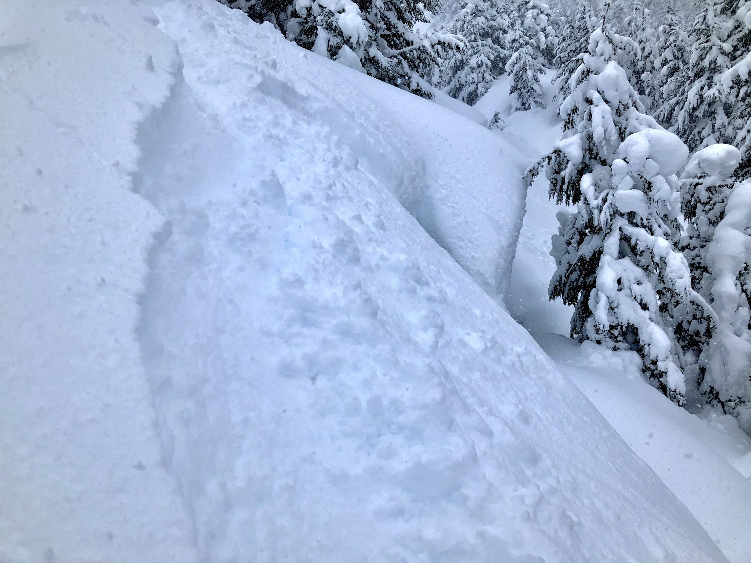
After another round of strong winds and heavy snowfall yesterday, and continued winds through today, it is likely a person could trigger an avalanche 1-2’ deep on wind-loaded slopes. As visibility improves through the day, it will once again be possible to travel into higher elevations where it will be most likely to encounter fresh wind slabs. Luckily, there are some clues that can help you identify fresh wind loading:
Today it will be important to avoid steep slopes with any of these characteristics. Winds are expected to continue to be strong enough to blow snow around, and wind slabs will continue to be sensitive through the day. Yesterday’s strong easterly winds have shifted overnight and are now blowing out of the northwest, which means we will likely find fresh wind slabs on multiple aspects. Winds will not be as strong at mid- and low- elevations, making conditions less dangerous as you decrease in elevation.
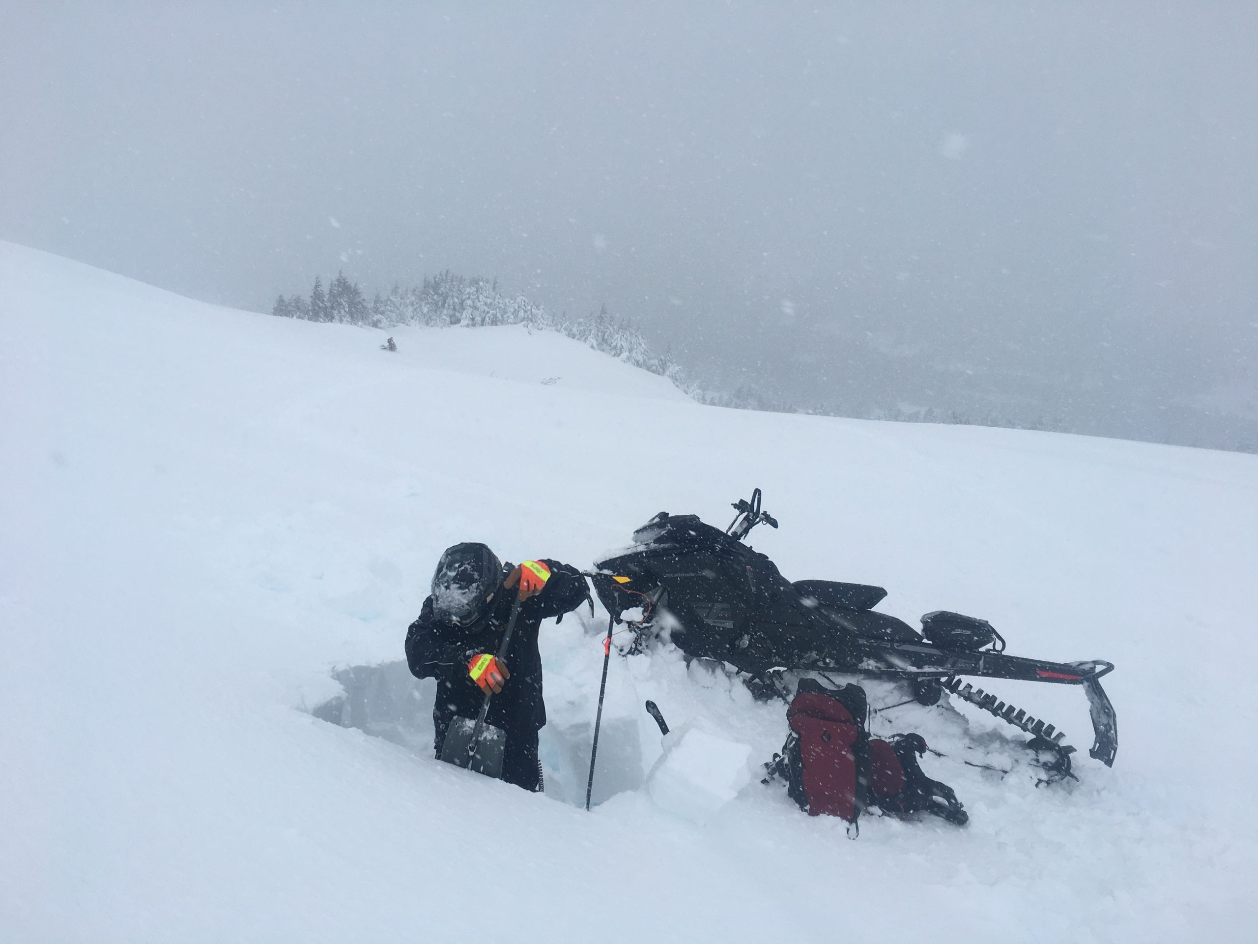
Heavy snowfall and strong winds yesterday while we were riding and digging pits around Seattle Ridge. 01.23.2021
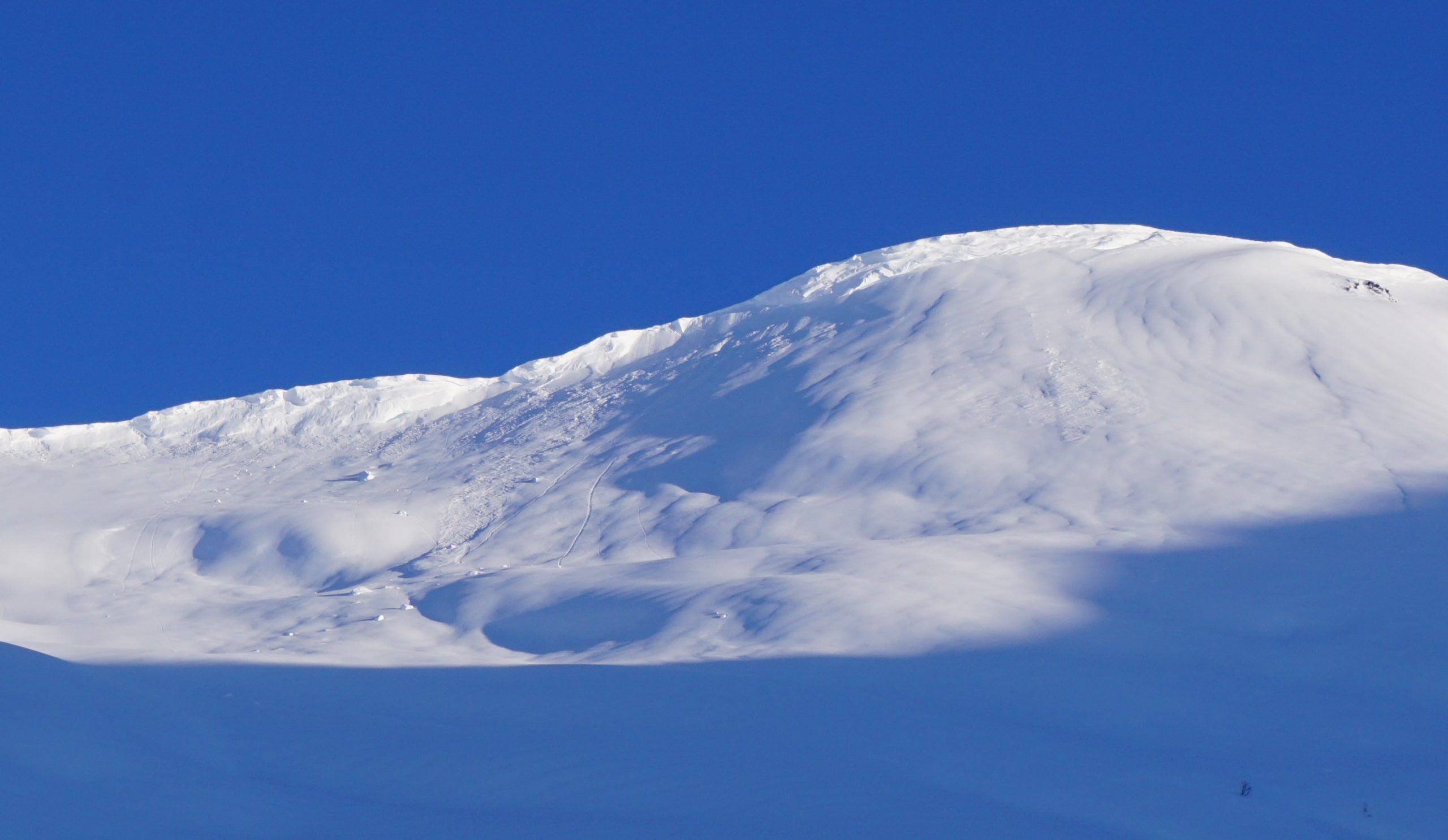
Cornices: The recent strong winds and wet snow have been ideal for building large cornices. We saw multiple natural cornice failures as the skies cleared following Monday’s storm, and we are expecting to see more of the same today. Cornices have a bad reputation for breaking much farther back than one would expect. If you find yourself traveling along ridgelines as skies begin to clear today, be sure to give them plenty of space. It will also be important to minimize the amount of time spent traveling under large cornices, as they can release naturally and unexpectedly.
Evidence of a large cornice fall above PMS bowl during the 1/18 storm. Similar activity is expected today. 01.19.2021.
In addition to these wind-related issues, we are also tracking a crust buried 1.5-2′ deep. We have gotten poor test results on weak snow associated with this crust on Cornbiscuit and just north of the Seattle Ridge uptrack. At this point, the layer is not giving us enough to concern to adjust our terrain use, but it is something we are paying attention to. If you get out and have any observations related to this layer, we’d love to hear about it.
We are continuing to track the glide cracks opening up around the area. It is nearly impossible to predict when these cracks will release as large avalanches, so it is important to avoid spending near them or below them. So far, we have seen reports of recent glide activity at the following locations:
Girdwood Valley: Goat shoulder, Raggedtop lower SE shoulder, the far NE end of Penguin Ridge above Girdwood.
Turnagain Pass: The far northern end and SE aspect of Seattle Ridge, Warmup Bowl (-1 Bowl) NE aspect on the backside of Seattle Ridge.
Summit Lake: Gilpatrick’s S face, Devil’s Creek south side.
Yesterday: A warm storm brought 1-1.5” water, with mostly rain below 1000’, and 6-10” snow at elevations above 1500’. Ridgetop winds were out of the east at 30-50 mph, and high temperatures were in the upper 20’s F at upper elevations and in the mid-30’s F at lower elevations.
Today: Winds have shifted and are now blowing out of the northwest, which will continue through the day, with ridgetop speeds expected to be around 20-25 mph. There is a chance of light snowfall this morning, but skies will clear up through the day, with partly sunny skies expected by this afternoon. Temperatures this morning are in the low 20’s to low 30’s F, and are expected to decline through the day and into tonight, reaching the high teens to high 20’s F overnight. We may see some lingering valley fog as skies clear and colder air moves in this afternoon.
Tomorrow: Skies will continue to clear up overnight, with mostly sunny skies on tap for tomorrow. Light easterly winds are expected to be around 5-10 mph, and high temperatures will be in the upper teens to low 20’s F.
PRECIPITATION 24-hour data (6am – 6am)
Temp Avg (F) | Snow (in) | Water (in) | Snow Depth (in) | |
---|---|---|---|---|
Center Ridge (1880′) | 32 | 9 | 0.6 | 135 |
Summit Lake (1400′) | 32 | 0 | 0.1 | 45 |
Alyeska Mid (1700′) | 31 | 5 | 1.05 | 116 |
RIDGETOP 24-hour data (6am – 6am)
Temp Avg (F) | Wind Dir | Wind Avg (mph) | Wind Gust (mph) | |
---|---|---|---|---|
Sunburst (3812′) | 23 | NE | 23 | 72 |
Seattle Ridge (2400′) | 27 | SE* | 14* | 35* |
*Seattle Ridge anemometer has been rimed over and not reporting since 5 p.m. yesterday.
Date | Region | Location | Observer |
---|---|---|---|
05/22/23 | Turnagain | Avalanche: Tincan | Nick D'Alessio |
05/12/23 | Turnagain | Avalanche: Tincan, Sunburst, Magnum, Cornbiscuit | Heather Thamm |
05/07/23 | Turnagain | Observation: Tincan – Bear Tracks | CNFAIC Staff |
05/05/23 | Turnagain | Observation: Seattle Ridge | AS/ WW Forecaster |
05/02/23 | Turnagain | Observation: Cornbiscuit | Schauer/ Sturgess Forecaster |
05/02/23 | Turnagain | Observation: Seward Hwy Turnagain Pass | Joel Curtis |
04/30/23 | Turnagain | Observation: Magnum | Ayla, Kit Crosby, Barton |
04/29/23 | Turnagain | Observation: Tincan | John Sykes |
04/28/23 | Turnagain | Avalanche: Taylor Pass/Pastoral | Schauer/ Creighton Forecaster |
04/28/23 | Turnagain | Avalanche: Tincan | Andy Moderow |
Status of riding areas across the Chugach NF is managed by the Glacier and Seward Ranger Districts, not avalanche center staff. Riding area information is posted as a public service to our users and updated based on snow depth and snow density to prevent resource damage at trailhead locations. Riding area questions contact: mailroom_r10_chugach@fs.fed.us
Area | Status | Weather & Riding Conditions |
---|---|---|
Glacier District |
Subscribe to Turnagain Pass
Avalanche Forecast by Email
This is a general backcountry avalanche advisory issued for Turnagain Arm with Turnagain Pass as the core advisory area. This advisory does not apply to highways, railroads or operating ski areas.