Turnagain Pass RSS

Archives
ARCHIVED - Forecasts expire after 24 hours.
Issued
Sun, January 17th, 2021 - 7:00AM
Expires
Mon, January 18th, 2021 - 7:00AM
Forecaster
Andrew Schauer
Avalanche risk The Bottom Line

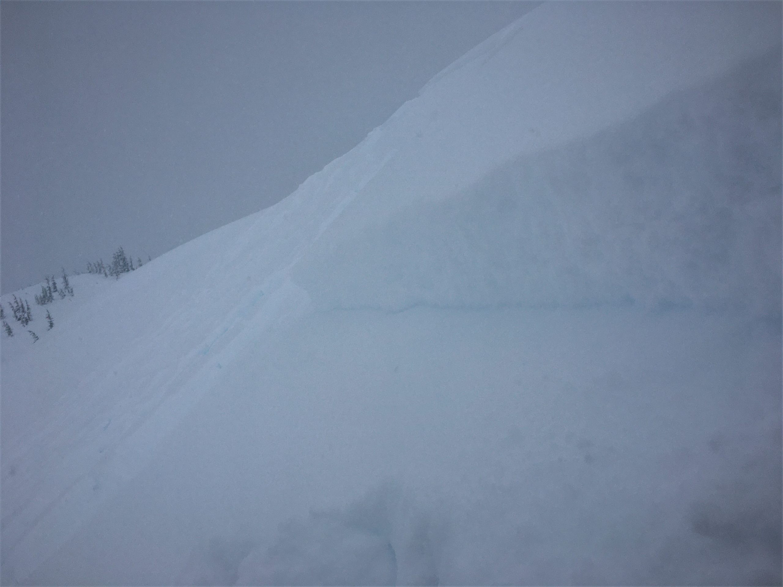
The avalanche danger will be CONSIDERABLE above 1000’ as strong winds and continued snowfall will make human-triggered avalanches likely during the day. Dangerous avalanche conditions will warrant conservative decision making today. Pay attention to indicators of instability, and be aware of the potential for increasing danger as the next storm approaches. We are expecting avalanche danger to rise as the next round of snowfall picks up this evening into tomorrow.

The danger is MODERATE below 1000’, where continued rainfall will make loose wet avalanches possible.

Summit Lake: The snowpack in the Summit Lake area is quite different from the snowpack at Turnagain Pass and in the Girdwood Valley. With a thinner pack, we are still paying attention to various buried weak layers. While this is important to be aware of, it will not be a major concern until we see a large loading event in the area.

Seward/Lost Lake/Snug: The next round of snow and winds is expected to impact the Seward area earlier than Turnagain Pass/Girdwood. If you are getting out around Seward, be aware of the increasing chance for triggering avalanches as snowfall and winds begin to pick up later today. We still do not have a lot of data about the snowpack in this area, so if you do get out please share some observations Here.


Sun, January 17th, 2021
Alpine
Above 2,500'
3 - Considerable
Avalanche risk
Treeline
1,000'-2,500'
3 - Considerable
Avalanche risk
Below Treeline
Below 1,000'
2 - Moderate
Avalanche risk
0 - No Rating
1 - Low
2 - Moderate
3 - Considerable
4 - High
5 - Extreme
Avalanche risk Avalanche risk Avalanche risk Avalanche risk Avalanche risk
Travel Advice Generally safe avalanche conditions. Watch for unstable snow on isolated terrain features. Heightened avalanche conditions on specific terrain features. Evaluate snow and terrain carefully; identify features of concern. Dangerous avalanche conditions. Careful snowpack evaluation, cautious route-finding, and conservative decision-making essential. Very dangerous avalanche conditions. Travel in avalanche terrain not recommended. Extraordinarily dangerous avalanche conditions. Avoid all avalanche terrain.
Likelihood of Avalanches Natural and human-triggered avalanches unlikely. Natural avalanches unlikely; human-triggered avalanches possible. Natural avalanches possible; human-triggered avalanches likely. Natural avalanches likely; human-triggered avalanches very likely. Natural and human-triggered avalanches certain.
Avalanche Size and Distribution Small avalanches in isolated areas or extreme terrain. Small avalanches in specific areas; or large avalanches in isolated areas. Small avalanches in many areas; or large avalanches in specific areas; or very large avalanches in isolated areas. Large avalanches in many areas; or very large avalanches in specific areas. Very large avalanches in many areas.
Recent Avalanches

Tincan: Storm slabs were very touchy yesterday in the Tincan Trees. These avalanches were not very big– most of them were around 6-8” deep and 50’ wide. One did propagate several hundred feet, but it did not run very far.

Notch Mountain: Skiers saw a small natural avalanche release on a steep slope near treeline, which was not large enough to bury a person.

This storm slab in the Tincan trees was about 300′ wide, but only 6-8″ deep. 01.16.2021

Avalanche Problem 1
  • Wind Slabs
    Wind Slabs
  • Certain
    Very Likely
    Likely
    Possible
    Unlikely
    Likelihood
  • Historic (D4-5)
    Very Large (D3)
    Large (D2)
    Small (D1)
    Size
Wind Slabs
Wind Slab avalanches are the release of a cohesive layer of snow (a slab) formed by the wind. Wind typically transports snow from the upwind sides of terrain features and deposits snow on the downwind side. Wind slabs are often smooth and rounded and sometimes sound hollow, and can range from soft to hard. Wind slabs that form over a persistent weak layer (surface hoar, depth hoar, or near-surface facets) may be termed Persistent Slabs or may develop into Persistent Slabs.

Likelihood of Avalanches
Terms such as "unlikely", "likely", and "certain" are used to define the scale, with the chance of triggering or observing avalanches increasing as we move up the scale. For our purposes, "Unlikely" means that few avalanches could be triggered in avalanche terrain and natural avalanches are not expected. "Certain" means that humans will be able to trigger avalanches on many slopes, and natural avalanches are expected.

Size of Avalanches
Avalanche size is defined by the largest potential avalanche, or expected range of sizes related to the problem in question. Assigned size is a qualitative estimate based on the destructive classification system and requires specialists to estimate the harm avalanches may cause to hypothetical objects located in the avalanche track (AAA 2016, CAA 2014). Under this schema, "Small" avalanches are not large enough to bury humans and are relatively harmless unless they carry people over cliffs or through trees or rocks. Moving up the scale, avalanches become "Large" enough to bury, injure, or kill people. "Very Large" avalanches may bury or destroy vehicles or houses, and "Historic" avalanches are massive events capable of altering the landscape.

Signal Word Size (D scale) Simple Descriptor
Small 1 Unlikely to bury a person
Large 2 Can bury a person
Very Large 3 Can destroy a house
Historic 4 & 5 Can destroy part or all of a village
More info at Avalanche.org

The wind has been at work loading heavy snow from Friday and Saturday on a layer of low-density snow that fell on Thursday. This upside-down setup is very sensitive to human triggers, and we also had reports of some natural activity yesterday. These avalanches were small yesterday, but with 9″ snow equal to 1.1″ snow water equivalent (SWE) over the past two days, it will be likely that a person could trigger a dangerous avalanche large enough to get fully buried today on a wind-loaded slope.  The most likely places to find fresh wind slabs will be below ridgelines, in cross-loaded gullies, and below convex rollers.

These slabs remain sensitive, and danger will increase when we start to see increased winds and precipitation. The National Weather Service has issued a Winter Storm Watch and a High Wind Warning starting tonight through Monday evening. Pay attention to changing conditions as this next storm approaches, and be aware of clear signs of instability like shooting cracks, collapsing, and recent avalanche activity. We are starting the day with dangerous avalanche conditions, and the weather is not going to make things any safer in the short term. Today is not the day to move into bigger terrain.

Shooting cracks on a small slope yesterday were just one indicator of poor stability. 01.16.2021

This was one of many small skier-triggered storm slabs we saw yesterday at Tincan. We are expecting more activity today as winds continue to load slopes. 01.16.2021


Weather
Sun, January 17th, 2021

Yesterday: We received 4-6” snow at mid elevations, with the mixed precipitation up to around 1400’ for brief periods, and sustained rain below 1000’. Easterly winds picked up during the day, with average ridgetop speeds up to 47 mph and gusts to 77 mph at the ridgetops. High temperatures reached into the upper 30’s F at lower elevations and in the high 20’s F at upper elevations.

Today: Moderate to strong easterly winds continue today, blowing 20-30 mph at the ridgetops. Temperatures are expected to stay in the mid-to upper 20’s F at upper elevations and in the low to mid-30’s at lower elevations. The rain line could reach up to 1500’ today, but we are not expecting to see much precipitation until later tonight. We could get 1-3” snow during the day today.

Tomorrow: The National Weather Service has issued a Winter Storm Watch and a High Wind Advisory beginning tonight and extending through Monday evening. We could see as much as 1-2′ of snow by the end of the day tomorrow. Winds are expected to pick up substantially overnight, with sustained ridgetop speeds above 50 mph. Temperatures are expected to remain in the high 20’s to low 30’s F through the day tomorrow. We should see the rain line drop back down, with snow to sea level tonight.

PRECIPITATION 24-hour data (6am – 6am)

Temp Avg (F) Snow (in) Water (in) Snow Depth (in)
Center Ridge (1880′) 35 5 0.9 129
Summit Lake (1400′) 34 tr 0.1 42
Alyeska Mid (1700′) 33 3 0.5 112

RIDGETOP 24-hour data (6am – 6am)

Temp Avg (F) Wind Dir Wind Avg (mph) Wind Gust (mph)
Sunburst (3812′) 25 NE 28 77
Seattle Ridge (2400′) 28 SE 13 32


Observations
Recent Observations for Turnagain Pass
Date Region Location
04/15/24 Turnagain Observation: Taylor Pass
04/14/24 Turnagain Observation: Sunburst
04/14/24 Turnagain Observation: Turnagain Pass Snomo
04/13/24 Turnagain Observation: Spokane Creek
04/11/24 Turnagain Observation: Tincan
04/10/24 Turnagain Avalanche: Seattle Ridge
04/10/24 Turnagain Observation: Cornbiscuit South Face
04/10/24 Turnagain Avalanche: Tincan
04/10/24 Turnagain Avalanche: Cornbiscuit
04/07/24 Turnagain Observation: Seattle Creek Headwall
Riding Areas

The riding areas page has moved. Please click here & update your bookmarks.


Subscribe to Turnagain Pass
Avalanche Forecast by Email

This is a general backcountry avalanche advisory issued for Turnagain Arm with Turnagain Pass as the core advisory area. This advisory does not apply to highways, railroads or operating ski areas.