Current Weather
National Weather Service Forecast for 6 Miles ENE Silvertip AK
Issued by: National Weather Service Anchorage, AK.
Updated: 8:42 pm AKDT Apr 24, 2024
Overnight Mostly Clear |
Thursday Mostly Sunny |
Thursday Night  Slight Chance Rain then Rain/Snow Likely |
Friday Rain/Snow Likely then Chance Rain |
Friday Night  Scattered Showers then Scattered Rain/Snow |
Saturday Scattered Snow Showers then Mostly Sunny |
Saturday Night  Chance Rain |
Sunday Sunny |
Sunday Night Mostly Clear |
| Lo 29 °F | Hi 48 °F | Lo 35 °F | Hi 45 °F | Lo 32 °F | Hi 50 °F | Lo 32 °F | Hi 50 °F | Lo 33 °F |
| Overnight: Mostly clear, with a low around 29. East wind around 5 mph. |
| Thursday: Mostly sunny, with a high near 48. East wind around 5 mph. |
| Thursday Night: A slight chance of rain before 1am, then rain and snow likely. Mostly cloudy, with a low around 35. East wind around 5 mph. Chance of precipitation is 60%. Little or no snow accumulation expected. |
| Friday: Rain and snow likely before 10am, then a chance of rain. Mostly cloudy, with a high near 45. East wind around 5 mph. Chance of precipitation is 60%. |
| Friday Night: Scattered rain showers before 4am, then scattered rain and snow showers. Mostly cloudy, with a low around 32. East wind around 5 mph. Chance of precipitation is 40%. |
| Saturday: Scattered snow showers, mainly before 10am. Partly sunny, with a high near 50. East wind around 5 mph becoming calm. Chance of precipitation is 30%. |
| Saturday Night: A 30 percent chance of rain after 10pm. Mostly cloudy, with a low around 32. |
| Sunday: Sunny, with a high near 50. |
| Sunday Night: Mostly clear, with a low around 33. |
| Monday: Mostly sunny, with a high near 50. |
| Monday Night: A chance of rain. Partly cloudy, with a low around 31. |
| Tuesday: A chance of rain. Partly sunny, with a high near 44. |
| Tuesday Night: A chance of rain. Partly cloudy, with a low around 34. |
| Wednesday: A chance of rain. Mostly cloudy, with a high near 47. |
Weather Station Roundup
| Region | Site | Elev | Date | Temp | MxTp 24hr | MnTp 24hr | RH | Spd | Gst | MxGust 24hr | Dir | SnoHt | SWE 24hr_new |
|---|---|---|---|---|---|---|---|---|---|---|---|---|---|
| hatcher | AKRR Site at Hurricane | 1630 | 04/25/2024 1:00 am | 26.0 | 51.0 | 21.0 | 1 | 2 | 7 | 58 | |||
| hatcher | Gold Cord Mine | 4050 | 04/25/2024 1:00 am | 26.6 | 47.3 | 23.8 | 81 | 2 | 3 | 5 | 67 | ||
| hatcher | Hatch Peak | 4561 | 04/25/2024 1:00 am | 28.1 | 33.2 | 26.8 | 73 | 3 | 5 | 9 | |||
| hatcher | Independence Mine | 3450 | 04/24/2024 12:00 am | 36.0 | 28.0 | - | 24.4 0 |
||||||
| hatcher | Lucky Shot 2,155 Elevation | 2155 | 04/24/2024 2:00 pm | 43.0 | 43.0 | 29.0 | 43 | 7 | 4 | 5 | 32 | ||
| hatcher | Lucky Shot 4,315 Elevation | 4315 | 04/24/2024 2:00 pm | 36.0 | 40.0 | 29.0 | 51 | 4 | 9 | 9 | |||
| hatcher | Marmot Ridge | 4500 | 04/25/2024 1:00 am | 27.5 | 38.9 | 25.9 | 76 | 1 | 3 | 8 | |||
| turnagain | AKRR Mile 43 | 3700 | 04/25/2024 1:00 am | 30.0 | 38.0 | 29.0 | 71 | 1 | 4 | 7 | |||
| turnagain | Crown Point | 300 | 05/24/2019 10:00 am | old | old | old | old | old | old | old | old | old | old |
| turnagain | Grandview | 1100 | 04/24/2024 12:00 am | 46.0 | 31.0 | - | 77 | 30.9 0 |
|||||
| turnagain | Granite | 512 | 04/24/2024 12:55 am | 28.3 | 55.3 | 23.3 | 93 | 0 | 2 | 8 | - | ||
| turnagain | Seattle Ridge | 2400 | 04/25/2024 1:00 am | 33.2 | 37.7 | 31.5 | 76 | 5 | 7 | 9 | |||
| turnagain | Summit Lake | 1400 | 04/24/2024 12:00 am | 48.0 | 23.0 | 92 | - | 37 | 13.5 0 |
||||
| turnagain | Summit Lake DOT | 1348 | 04/25/2024 1:20 am | 28.9 | 51.5 | 23.8 | 94 | 2 | 3 | 10 | |||
| turnagain | Summit Lake Ridgetop | 3800 | 04/25/2024 1:00 am | 27.7 | 36.1 | 26.7 | 86 | 2 | 3 | 5 | |||
| turnagain | Sunburst | 3812 | 04/25/2024 2:00 am | 29.8 | 34.8 | 28.3 | 70 | 8 | 10 | 14 | |||
| turnagain | Tunnel | 10 | 04/25/2024 1:00 am | 31.0 | 56.0 | 30.0 | 0 | 1 | 3 | - | 0 | ||
| turnagain | Turnagain Pass Center Ridge | 1880 | 04/24/2024 12:00 am | 45.0 | 31.0 | 0 | - | 85 | 33.6 0.1 |
||||
| turnagain | Turnagain Pass DOT | 1020 | 04/25/2024 1:20 am | 31.0 | 47.9 | 27.2 | 86 | 4 | 5 | 10 | |||
| anchorage | Arctic Valley | 3900 | 04/25/2024 1:00 am | 30.4 | 39.7 | 29.1 | 73 | 4 | 12 | 17 | |||
| anchorage | Arctic Valley Lodge | 2683 | 04/25/2024 1:47 am | 35.0 | 46.0 | 31.0 | 74 | 7 | 9 | 15 | |||
| anchorage | Bird Point DOT | 62 | 04/25/2024 1:20 am | 39.8 | 55.7 | 34.1 | 77 | 3 | 4 | 19 | |||
| anchorage | Hillside Home | 1354 | 04/25/2024 1:00 am | 37.8 | 51.1 | 34.7 | 52 | 2 | 8 | 10 | |||
| anchorage | Hillside Snotel (Glen Alps) | 2080 | 04/24/2024 12:00 am | 48.0 | 25.0 | 74 | 3 | 43 | 14.2 0 |
||||
| anchorage | Indian Pass | 2350 | 04/24/2024 12:00 am | - | 75 | 28.5 0 |
|||||||
| anchorage | Moraine Snotel Site | 2100 | 04/24/2024 12:00 am | 50.0 | 31.0 | 72 | 1 | 26 | 9.0 0 |
||||
| anchorage | Penguin Peak (AKDOT) | 4200 | 04/25/2024 1:00 am | 27.6 | 36.7 | 27.3 | 84 | 9 | 14 | 18 | |||
| anchorage | S. Fork Eagle R. #2 | 2164 | 04/25/2024 1:45 am | 26.0 | 42.0 | 23.0 | 86 | 10 | - | ||||
| girdwood | Alyeska (Base) | 100 | 04/25/2024 1:00 am | 35.0 | 51.0 | 31.0 | 85 | - | |||||
| girdwood | Alyeska (Max Mtn.) | 3200 | 04/25/2024 1:00 am | 33.0 | 40.0 | 32.0 | 78 | 3 | 10 | 17 | |||
| girdwood | Alyeska (Mid Mtn) | 1700 | 04/25/2024 1:00 am | 36.0 | 52.0 | 34.0 | 79 | - | 96 | ||||
| girdwood | Alyeska (Summit) | 3664 | 04/25/2024 1:00 am | 33.0 | 37.0 | 32.0 | 66 | 14 | 20 | 20 | |||
| girdwood | Alyeska (Top of Quad) | 2800 | 04/25/2024 1:00 am | 36.0 | 41.0 | 32.0 | 7 | 13 | 13 | ||||
| girdwood | Camp Road @ Whittier Tunnel | 102 | 04/25/2024 1:20 am | 34.8 | 53.5 | 31.6 | 84 | 1 | 1 | 8 | |||
| girdwood | Girdwood DOT | 31 | 04/25/2024 1:00 am | 36.0 | 56.0 | 30.0 | 73 | 4 | 8 | 15 | 0 | ||
| girdwood | Mt. Alyeska (NRCS) | 1539 | 04/24/2024 12:00 am | 45.0 | 36.0 | - | 83 | 32.8 0 |
|||||
| girdwood | Portage | 10 | 04/25/2024 1:00 am | 34.0 | 54.0 | 28.0 | 3 | 6 | 19 | 33 | |||
| girdwood | Portage (PATO) | 95 | 04/25/2024 1:45 am | 30.5 | 52.1 | 26.9 | 93 | 0 | 9999 | 18 | - | ||
| girdwood | Portage DOT | 66 | 04/25/2024 1:20 am | 32.3 | 52.3 | 28.0 | 97 | 2 | 2 | 19 | |||
| girdwood | Whittier Access Rd Tunnel MP 6.5 | 115 | 04/25/2024 1:20 am | 32.8 | 51.0 | 25.4 | 93 | 1 | 2 | 12 | |||
| girdwood | Whittier Harbor | 13 | 04/25/2024 1:41 am | 37.3 | 49.3 | 33.3 | 83 | 0 | 2 | 8 | - | ||
| seward | Grouse Creek Divide | 700 | 04/24/2024 12:00 am | 51.0 | 30.0 | - | 63 | 27.7 0 |
|||||
| seward | Lost Lake | 3722 | 04/25/2024 1:00 am | 28.9 | 32.7 | 28.2 | 96 | 4 | 6 | 8 | |||
| seward | Moose Pass | 04/25/2024 1:00 am | 29.0 | 53.0 | 26.0 | 0 | 0 | 8 | - | 8 | |||
| seward | Seward Hwy @ Divide MP 11.7 | 709 | 04/25/2024 1:20 am | 32.1 | 48.5 | 29.8 | 86 | 2 | 3 | 19 | |||
| seward | Sterling Hwy DOT @ Tern Lake | 686 | 04/25/2024 1:15 am | 31.7 | 53.3 | 27.2 | 97 | 3 | 6 | 12 | |||
| seward | Sterling Wye Ridgetop | 3700 | 04/25/2024 1:00 am | 30.0 | 36.4 | 28.8 | 66 | 3 | 4 | 7 | |||
| seward | Wolverine Glacier | 3250 | 04/25/2024 1:00 am | 32.5 | 36.3 | 29.8 | 56 | 7 | 8 | 10 |
Weather Links
Weather Forecasts
- National Weather Service: Anchorage Forecast Office with direct link to the local area forecast
- Southcentral Alaska Mountain Forecast: NWS Recreational forecast issued in winter months for Turnagain, Thompson Pass and Hatcher Pass.
- AOOS Interactive Map: Integrates RWIS, NWS, DOT, FAA Wx stations (including webcams) all into one map.
- Mountainweather.com Alaska page: Online weather forecasting resources, focused on Alaska
Weather Data
- Alaska - Snow Depth: Alaska Pacific River Forecast Center links to snow data graphs
- Alaska - SWE: Alaska Snow Water Equivalent Map
- Alaska Climate Research Center: State wide weather information, including a vast network of weather stations
- AMBCS: AMBCS SNOTEL Site Viewer
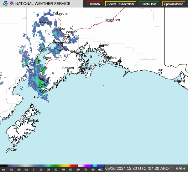
- Satellite/Radar Images and Loops: Anchorage Forecast Office direct links to the satellite/radar page
- Upper 6000 FT Winds: Estimated and Forecasted 6000 Ft. Wind and Temperature Data
Alaska Weather Links
- ADOT&PF 511 Driving Conditions: Road conditions and alerts including avalanche related traffic delays
- ADOT&PF Road Weather Information System (RWIS): Highway weather station data and webcams
- Alaska State Park Snow Conditions: Hatcher Pass, Chugach, Nancy Lake and Chena State Park snow conditions