Turnagain Pass Avalanche Forecast
|
![]() ![]() |
The avalanche danger is CONSIDERABLE today. Very large avalanches occurred naturally Sunday and Monday sending debris far into runout zones and through flat areas. Slopes are loaded with 8 to 15 feet of snow. Today is a break between storms. However, natural avalanches are still possible and human triggered avalanches are likely today. These could be very deep and dangerous and extra caution is advised. Give cornices a wide berth. Careful snowpack evaluation, cautious route-finding and conservative decision-making are essential.
PORTAGE VALLEY: Travel in runout zones from avalanches including venturing along and past the Byron Glacier Trail continues to be not recommended.
SUMMIT LAKE (& INTERIOR EASTERN KENAI MTS): Large to very large human triggered avalanches remain likely. Between 2-3 feet of snow has fallen onto a very weak snowpack and avalanches are releasing in old buried weak layers.
SEWARD/LOST LAKE: Large and dangerous natural avalanches have been observed in this area. Today human triggered avalanches are likely in this region as well.
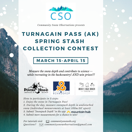
Signal Word | Size (D scale) | Simple Descriptor |
Small | 1 | Unlikely to bury a person |
Large | 2 | Can bury a person |
Very Large | 3 | Can destroy a house |
Historic | 4 & 5 | Can destroy part or all of a village |
Yesterday the large natural avalanches kept occurring with notable avalanches observed in Crow Creek, on Tincan, Seattle Ridge, Petes North, Twin Peaks, and through Summit Lake. These had very deep crowns, and were running into the flats in many locations. This was the second day in a row of very large slab avalanches. Today is a break in the barrage of storms after 6 days of HIGH avalanche danger. Temperatures are dropping this morning but are expected to rise again this afternoon and it should be partly sunny today. The natural avalanche activity should decrease but the potential for a very large human triggered slab avalanche remains. The current snowpack needs some time to adjust to all the loading from multiple feet of snow, strong winds and rain. Be patient! We are optimistic that at some point it will stabilize but today is definitely not the day test it out. Choose terrain very wisely. The slabs could be very deep, there may be no signs of instability and it could be the 1st or the 10th skier or snowmachine on the slope that triggers the avalanche. Avalanches could be triggered remotely from thin spots. In addition, pay attention to solar warming and the potential for roller balls and wet loose avalanches on sunny aspects.
Tincan avalanche. Occurred sometime between 12:15-12:25 pm. 3-18-19. Photo: Corey Anderson
Avalanche to the ground on Seattle Ridge, 3-18-19.
Large avalanches, Templeton – Summit Lake, 3-18-19.
Stay away from cornices. They have grown large and could be very tender and dangerous today. Triggering a cornice fall also has the potential to trigger a deep avalanche on the slope below.
Yesterday: Mostly cloudy skies and rain/snow showers on and off throughout the day favoring Portage and Girdwood. Temperatures were in the 30Fs and 40Fs. Winds were northeasterly 15-25 mph with gusts into the 50s. Overnight skies became broken and temperatures dropped slightly. Easterly winds decreased blowing in the teens with gusts into the 30s.
Today: Partly sunny skies with temperatures in the 20Fs to high 30Fs. Sea level temperatures will be around 40F. Winds will be easterly 5-15 mph with gusts into the 20s. Clouds move back in tonight and winds pick up early morning Wednesday as the next warm wet storm moves over the region. Snow should start overnight.
Tomorrow: Mostly cloudy with rain and snow showers that could be heavy at times. Rain/snowline is forecasted around 2000′. Easterly winds blowing 20-30 mph gusting into the 50s. The warm wet pattern is forecast to continue into the weekend.
Temp Avg (F) | Snow (in) | Water (in) | Snow Depth (in) | |
Center Ridge (1880′) | 35 | 0 | 0.1 | 88 |
Summit Lake (1400′) | 37 | 0 | 0.1 | 30 |
Alyeska Mid (1700′) | 34 | 0 | 0.46 | 78 |
Temp Avg (F) | Wind Dir | Wind Avg (mph) | Wind Gust (mph) | |
Sunburst (3812′) | 25 | NE | 20 | 62 |
Seattle Ridge (2400′) | 30 | *N/A | *N/A | *N/A |
Date | Region | Location | Observer |
---|---|---|---|
05/22/23 | Turnagain | Avalanche: Tincan | Nick D'Alessio |
05/12/23 | Turnagain | Avalanche: Tincan, Sunburst, Magnum, Cornbiscuit | Heather Thamm |
05/07/23 | Turnagain | Observation: Tincan – Bear Tracks | CNFAIC Staff |
05/05/23 | Turnagain | Observation: Seattle Ridge | AS/ WW Forecaster |
05/02/23 | Turnagain | Observation: Cornbiscuit | Schauer/ Sturgess Forecaster |
05/02/23 | Turnagain | Observation: Seward Hwy Turnagain Pass | Joel Curtis |
04/30/23 | Turnagain | Observation: Magnum | Ayla, Kit Crosby, Barton |
04/29/23 | Turnagain | Observation: Tincan | John Sykes |
04/28/23 | Turnagain | Avalanche: Taylor Pass/Pastoral | Schauer/ Creighton Forecaster |
04/28/23 | Turnagain | Avalanche: Tincan | Andy Moderow |
Status of riding areas across the Chugach NF is managed by the Glacier and Seward Ranger Districts, not avalanche center staff. Riding area information is posted as a public service to our users and updated based on snow depth and snow density to prevent resource damage at trailhead locations. Riding area questions contact: mailroom_r10_chugach@fs.fed.us
Area | Status | Weather & Riding Conditions |
---|---|---|
Glacier District |
Subscribe to Turnagain Pass
Avalanche Forecast by Email
This is a general backcountry avalanche advisory issued for Turnagain Arm with Turnagain Pass as the core advisory area. This advisory does not apply to highways, railroads or operating ski areas.