Turnagain Pass Avalanche Forecast RSS

Archives
ARCHIVED FORECAST - All forecasts expire after 24 hours from the posting date/time.
Issued
Wed, March 6th, 2019 - 7:00AM
Expires
Thu, March 7th, 2019 - 7:00AM
Forecaster
Aleph Johnston-Bloom
Avalanche risk The Bottom Line

A generally  LOW  avalanche danger remains across the advisory area. Triggering a slab avalanche is unlikely. Watch for sluffing on steep shaded slopes, avoid travel under glide cracks and give cornices a wide berth. Pay attention to changing conditions.

Special Announcements
  • The Friends of the Chugach National Forest Avalanche Center is an  official Pick. Click. Give. organization.  When you apply for your PFD please consider supporting your public avalanche center. We rely heavily on your contributions, which provides not only weather stations and daily forecasts but a host of other public avalanche services. Thank you to all of our donors past, present and future!
Thanks to our sponsors!
Wed, March 6th, 2019
Alpine
Above 2,500'
Low (1)
Avalanche risk
Treeline
1,000'-2,500'
Low (1)
Avalanche risk
Below Treeline
Below 1,000'
Low (1)
Avalanche risk
Alpine
Above 2,500'
Avalanche risk
Low (1)
Treeline
1,000'-2,500'
Avalanche risk
Low (1)
Below Treeline
Below 1,000'
Avalanche risk
Low (1)
Danger Scale:
No Rating (0)
Low (1)
Moderate (2)
Considerable (3)
High (4)
Extreme (5)
Avalanche Problem 1
  • Normal Caution
    Normal Caution
Normal Caution
Normal Caution means triggering an avalanche is unlikely but not impossible.
More info at Avalanche.org

Southeasterly winds kicked up yesterday averaging 5-10 mph with gusts into the high teens. This may have formed very shallow, small wind slabs in leeward terrain. Hopefully the wind was enough to knock over/blow away some of the surface hoar in exposed terrain but that is probably wishful thinking. In anticipation of snow, we have been closely mapping the surface conditions as well as watching for new surface hoar growth. Surface hoar has been observed from valley bottoms to the Alpine and is resting on a variety of surfaces. There is a stout sun crust on southerly facing slopes. On shaded aspects 4-8″ or so of soft near surface facets sit over a firmer base. Along ridgelines and areas affected by the NW wind events there is hard sastrugi, wind crust and/or rime crust. This set-up does not bode well for bonding when then next loading event does occur and the surface hoar gets buried. Cloudy skies, light winds and a chance of snow today should not change the avalanche danger yet. However, watch for changing conditions if more snow falls than forecasted. 

Today will be another day of Normal Caution (LOW danger). In addition to looking for mini wind slabs here are things to keep in mind if you are headed into the backcountry:

  • Glide avalanches – These types of avalanches are highly unpredictable and not associated with human triggers. It’s always best to watch for and limit exposure under glide cracks.
  • Dry-loose sluffs – Watch your sluff on steep shaded slopes.
  • Cornice falls – As always, give cornices a wide berth. 
  • An outlier slab avalanche – Although it is unlikely a person could trigger a slab avalanche, the mountains can harbor surprises, especially in thin snowpack areas. South of Turnagain in the Summit Lake and Silvertip zones there is a shallow snowpack with a generally poor structure. A variety of old weak layers (facets and buried surface hoar) sit in the mid and base of the snowpack. The most suspect place to trigger an avalanche is steep terrain with old, hard wind slabs sitting on weak snow. 
  • Considering the consequences before entering into committing terrain and maintaining good travel protocol are good habits to keep on LOW danger days.

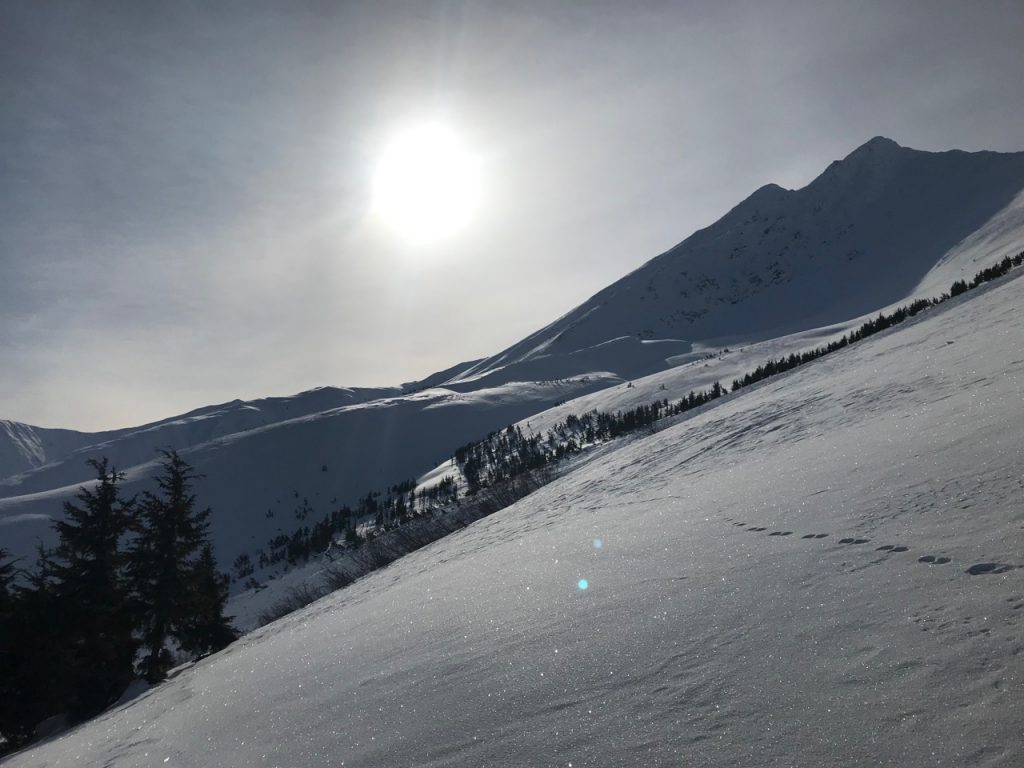
Surface hoar on a wind crust, Twin Peaks, 3-4-19. 

Surface hoar at 1600′ on Tenderfoot, 3-1-19. Photo: Jacob Kayes


Weather
Wed, March 6th, 2019

Yesterday: Mostly cloudy skies with temperatures in the 20Fs to low 30Fs and no precipitation. Winds were southeasterly 5-10 mph with gusts into the high teens. Overnight winds became calm.

Today: Mostly cloudy with a chance of snow showers. Temperatures will be in the 20F and 30Fs. Winds will be light and easterly. More of the same overnight.  

Tomorrow: The day looks to start off similar to today with cloudy skies, chance of snow, light winds and temperatures in the 20Fs. Wind speeds and the likelihood of snow will increase in the late afternoon.   Overnight into Friday looks to be the beginning of the active pattern for the advisory area with up to a foot of snow in the forecast! Stay tuned for more details and think cold thoughts.  

PRECIPITATION 24-hour data (6am – 6am)

  Temp Avg (F) Snow (in) Water (in) Snow Depth (in)
Center Ridge (1880′) 28   0   0 58  
Summit Lake (1400′)  29      0      0    27    
Alyeska Mid (1700′) 28   0    0   52  

RIDGETOP 24-hour data (6am – 6am)

  Temp Avg (F) Wind Dir Wind Avg (mph) Wind Gust (mph)
Sunburst (3812′)  18  SE  9 20  
Seattle Ridge (2400′)  23  SE  8  14  
Observations
Recent Observations for Turnagain Pass
Date Region Location
05/22/23 Turnagain Avalanche: Tincan
05/12/23 Turnagain Avalanche: Tincan, Sunburst, Magnum, Cornbiscuit
05/07/23 Turnagain Observation: Tincan – Bear Tracks
05/05/23 Turnagain Observation: Seattle Ridge
05/02/23 Turnagain Observation: Cornbiscuit
05/02/23 Turnagain Observation: Seward Hwy Turnagain Pass
04/30/23 Turnagain Observation: Magnum
04/29/23 Turnagain Observation: Tincan
04/28/23 Turnagain Avalanche: Taylor Pass/Pastoral
04/28/23 Turnagain Avalanche: Tincan
Riding Areas
Updated Sat, September 23rd, 2023

Status of riding areas across the Chugach NF is managed by the Glacier and Seward Ranger Districts, not avalanche center staff. Riding area information is posted as a public service to our users and updated based on snow depth and snow density to prevent resource damage at trailhead locations. Riding area questions contact: mailroom_r10_chugach@fs.fed.us

Area Status Weather & Riding Conditions
Glacier District
Johnson Pass
Closed
Scheduled opening per Chugach National Forest plan December 1. Subject to adequate snow cover.
Placer River
Closed
Scheduled opening per Chugach National Forest plan December 1. Subject to adequate snow cover.
Skookum Drainage
Closed
Scheduled opening per Chugach National Forest plan December 1. Subject to adequate snow cover.
Turnagain Pass
Closed
Scheduled opening on the Wednesday before Thanksgiving per Chugach National Forest plan. Subject to adequate snow cover.
Twentymile
Closed
Scheduled opening per Chugach National Forest plan December 1. Subject to adequate snow cover.
Seward District
Carter Lake
Closed
Scheduled opening per Chugach National Forest plan December 1. Subject to adequate snow cover.
Lost Lake Trail
Closed
Scheduled opening per Chugach National Forest plan December 1. Subject to adequate snow cover.
Primrose Trail
Closed
Scheduled opening per Chugach National Forest plan December 1. Subject to adequate snow cover.
Resurrection Pass Trail
Closed
Scheduled opening per Chugach National Forest plan December 1. Subject to adequate snow cover.
Snug Harbor
Closed
Scheduled opening per Chugach National Forest plan December 1. Subject to adequate snow cover.
South Fork Snow River Corridor
Closed
Scheduled opening per Chugach National Forest plan December 1. Subject to adequate snow cover.
Summit Lake
Closed
Scheduled opening per Chugach National Forest plan December 1. Subject to adequate snow cover.

Subscribe to Turnagain Pass
Avalanche Forecast by Email

This is a general backcountry avalanche advisory issued for Turnagain Arm with Turnagain Pass as the core advisory area. This advisory does not apply to highways, railroads or operating ski areas.