Turnagain Pass Avalanche Forecast RSS

Archives
ARCHIVED FORECAST - All forecasts expire after 24 hours from the posting date/time.
Issued
Fri, December 28th, 2018 - 7:00AM
Expires
Sat, December 29th, 2018 - 7:00AM
Forecaster
Heather Thamm
Avalanche risk The Bottom Line

The avalanche danger is MODERATE above 1000′ for triggering an unstable cornice or a new/old wind slab.   Triggering a slab on an older layer 2+’ deep is becoming less likely, but not impossible in the periphery of the forecast zone near Johnson Pass and Silvertip.   Identify glide cracks and avoid traveling under these unpredictable avalanche hazards.

JOHNSON PASS / LYNX DRAINAGE / SUMMIT LAKE:    South of Turnagain Pass weak layers exists under 2-3′ of snow. Human triggered slab avalanches over 2′ thick are possible on slopes over 35 degrees.

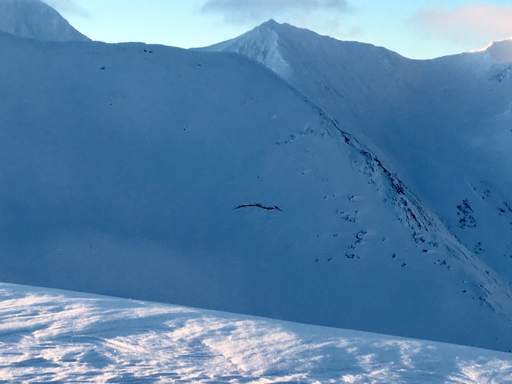
LOST LAKE:    This zone is out of the advisory area, but is also suspect for harboring weak layers 2-3′ below the snow surface due to recent reports. Pay attention for signs of instability like collapsing and recent avalanches.  

Special Announcements

For the Hatcher Pass Avalanche Center mid-week summary click  HERE.

Thanks to our sponsors!
Fri, December 28th, 2018
Alpine
Above 2,500'
Moderate (2)
Avalanche risk
Treeline
1,000'-2,500'
Moderate (2)
Avalanche risk
Below Treeline
Below 1,000'
Low (1)
Avalanche risk
Alpine
Above 2,500'
Avalanche risk
Moderate (2)
Treeline
1,000'-2,500'
Avalanche risk
Moderate (2)
Below Treeline
Below 1,000'
Avalanche risk
Low (1)
Danger Scale:
No Rating (0)
Low (1)
Moderate (2)
Considerable (3)
High (4)
Extreme (5)
Avalanche Problem 1
  • Cornice
    Cornice
  • Almost Certain
    Very Likely
    Likely
    Possible
    Unlikely
    Likelihood
  • Historic (D4-5)
    Very Large (D3)
    Large (D2)
    Small (D1)
    Size
Cornice
Cornice Fall is the release of an overhanging mass of snow that forms as the wind moves snow over a sharp terrain feature, such as a ridge, and deposits snow on the downwind (leeward) side. Cornices range in size from small wind drifts of soft snow to large overhangs of hard snow that are 30 feet (10 meters) or taller. They can break off the terrain suddenly and pull back onto the ridge top and catch people by surprise even on the flat ground above the slope. Even small cornices can have enough mass to be destructive and deadly. Cornice Fall can entrain loose surface snow or trigger slab avalanches.

Likelihood of Avalanches
Terms such as "unlikely", "likely", and "certain" are used to define the scale, with the chance of triggering or observing avalanches increasing as we move up the scale. For our purposes, "Unlikely" means that few avalanches could be triggered in avalanche terrain and natural avalanches are not expected. "Certain" means that humans will be able to trigger avalanches on many slopes, and natural avalanches are expected.

Size of Avalanches
Avalanche size is defined by the largest potential avalanche, or expected range of sizes related to the problem in question. Assigned size is a qualitative estimate based on the destructive classification system and requires specialists to estimate the harm avalanches may cause to hypothetical objects located in the avalanche track (AAA 2016, CAA 2014). Under this schema, "Small" avalanches are not large enough to bury humans and are relatively harmless unless they carry people over cliffs or through trees or rocks. Moving up the scale, avalanches become "Large" enough to bury, injure, or kill people. "Very Large" avalanches may bury or destroy vehicles or houses, and "Historic" avalanches are massive events capable of altering the landscape.

Signal Word Size (D scale) Simple Descriptor
Small 1 Unlikely to bury a person
Large 2 Can bury a person
Very Large 3 Can destroy a house
Historic 4 & 5 Can destroy part or all of a village
More info at Avalanche.org

Cornices remain large and looming along many ridgelines of our forecast zone. On Sunday and Monday evidence of natural cornice fall was observed and several human triggered cornices were reported. The best way to manage this hazard is to give cornices a lot of space and avoid travel directly underneath them. Approach ridgelines with caution and be aware of groups traveling in the same zone as you who could inadvertently triggered one from above.

WIND SLAB: There is plenty of snow available for transport and we may see winds pick up into the 20’s mph later in the day. There is a layer of buried surface hoar below 2-5” of new snow from the last few days and this may become our next weak layer. Today keep an eye out for drifting snow and shooting cracks. These are signs of fresh wind slab development. Triggering an older wind slab is becoming pretty unlikely at this point, but not out of the question in very steep terrain. A period of strong winds on Christmas has created some stiffer pockets of snow in the Alpine. 

Large cornices still intact on the SW facing terrain of Magnum. This photo also has some natural cornice fall observed on Mon (12.24) as well as glide cracks opening up in the lower right corner. 


A thin layer of surface hoar lays below a few inches of snow accross our forecast zone and will be a suspected weak layer if winds pick up and form wind slabs. 

Avalanche Problem 2
  • Glide Avalanches
    Glide Avalanches
  • Almost Certain
    Very Likely
    Likely
    Possible
    Unlikely
    Likelihood
  • Historic (D4-5)
    Very Large (D3)
    Large (D2)
    Small (D1)
    Size
Glide Avalanches
Glide Avalanches are the release of the entire snow cover as a result of gliding over the ground. Glide avalanches can be composed of wet, moist, or almost entirely dry snow. They typically occur in very specific paths, where the slope is steep enough and the ground surface is relatively smooth. They are often proceeded by full depth cracks (glide cracks), though the time between the appearance of a crack and an avalanche can vary between seconds and months. Glide avalanches are unlikely to be triggered by a person, are nearly impossible to forecast, and thus pose a hazard that is extremely difficult to manage.

Likelihood of Avalanches
Terms such as "unlikely", "likely", and "certain" are used to define the scale, with the chance of triggering or observing avalanches increasing as we move up the scale. For our purposes, "Unlikely" means that few avalanches could be triggered in avalanche terrain and natural avalanches are not expected. "Certain" means that humans will be able to trigger avalanches on many slopes, and natural avalanches are expected.

Size of Avalanches
Avalanche size is defined by the largest potential avalanche, or expected range of sizes related to the problem in question. Assigned size is a qualitative estimate based on the destructive classification system and requires specialists to estimate the harm avalanches may cause to hypothetical objects located in the avalanche track (AAA 2016, CAA 2014). Under this schema, "Small" avalanches are not large enough to bury humans and are relatively harmless unless they carry people over cliffs or through trees or rocks. Moving up the scale, avalanches become "Large" enough to bury, injure, or kill people. "Very Large" avalanches may bury or destroy vehicles or houses, and "Historic" avalanches are massive events capable of altering the landscape.

Signal Word Size (D scale) Simple Descriptor
Small 1 Unlikely to bury a person
Large 2 Can bury a person
Very Large 3 Can destroy a house
Historic 4 & 5 Can destroy part or all of a village
More info at Avalanche.org

The most recent glide avalanches observed were in Lynx Creek drainage on Monday. Numerous glide cracks have been slowly opening up around our region including commonly traveled areas like the SW aspect of Sunburst and Corn Biscuit, and in Warm-up (-1) Bowl on Seattle Ridge. It is important to remember glide cracks can release into full-blown avalanches at any time and are not associated with human triggers. The best way to manage this problem is to keep your eyes peeled for cracks and limit travel underneath them.

Glide crack in Warmup (-1 Bowl) on the North facing slope. This is a common crack that forms and has been known to release. Photo taken on 12.24 by Wendy Wagner.


Additional Concern
  • Persistent Slabs
    Persistent Slabs
Persistent Slabs
Persistent Slab avalanches are the release of a cohesive layer of snow (a slab) in the middle to upper snowpack, when the bond to an underlying persistent weak layer breaks. Persistent layers include: surface hoar, depth hoar, near-surface facets, or faceted snow. Persistent weak layers can continue to produce avalanches for days, weeks or even months, making them especially dangerous and tricky. As additional snow and wind events build a thicker slab on top of the persistent weak layer, this avalanche problem may develop into a Deep Persistent Slab.
More info at Avalanche.org

If you are headed to areas south of Turnagain, keep in mind triggering a large slab avalanche is still possible. Buried weak layers, roughly 2-3′ below the snow surface, have been found in the Summit Lake zone and as far south as Lost Lake. Numerous observations this week in Turnagain Pass have been finding a stable snowpack in the older November snow near the ground. Some uncertainty remains around Johnson Pass, Lynx Cr drainage and Twin Peaks/Silver Tip where the snowpack often transitions to a shallower structure similar to Summit Lake. Observations in Summit Lake over the last few weeks have been finding facets associated with several crusts near the ground with reactivity in stability tests. The most recent avalanche activity in this zone was observed last week (Dec.20) where some of these avalanches stepped down to older layers within the snowpack. Should you head into the periphery of our forecast zone evaluate the snowpack and terrain as you travel, and keep your senses alert for any whumpfing — an obvious clue for triggering a slab avalanche.

Weather
Fri, December 28th, 2018

Yesterday: Skies were obscured and snow showers left a few inches of new snow (1-3 €) across our region. Temperatures decreased into the low 30Fs near sea level and mid 20Fs at 1000′. Ridgetop winds remained light from the East shifting to the North overnight as skies cleared.

Today: Expect partly cloudy skies in the morning becoming mostly cloudy by the afternoon. Snow showers are expected by late afternoon and into the evening with 3-7 € possible overnight. Ridgetop winds should start out calm and could increase to 10-25mph from the East by the afternoon. Temperatures should be similar to yesterday and remain cool enough for snow at sea level.

Tomorrow: Snow flurries will taper off in the morning with another break between snow showers. We may see another period of partly cloudy skies before another storm moves into our region on Sunday through Monday. There remains some uncertainty around how much precipitation, but expect a period of warmer temperatures and increased winds.

*Seattle Ridge weather station was heavily rimed and the anemometer (wind sensor) was destroyed.    

PRECIPITATION 24-hour data (6am – 6am)

  Temp Avg (F) Snow (in) Water (in) Snow Depth (in)
Center Ridge (1880′) 27   1   .1   55  
Summit Lake (1400′) 26   1   .1   13  
Alyeska Mid (1700′) 26   3   .27   37  

RIDGETOP 24-hour data (6am – 6am)

  Temp Avg (F) Wind Dir Wind Avg (mph) Wind Gust (mph)
Sunburst (3812′) 20   ENE   4   19  
Seattle Ridge (2400′) 25   *N/A   *N/A     *N/A    
Observations
Recent Observations for Turnagain Pass
Date Region Location
05/22/23 Turnagain Avalanche: Tincan
05/12/23 Turnagain Avalanche: Tincan, Sunburst, Magnum, Cornbiscuit
05/07/23 Turnagain Observation: Tincan – Bear Tracks
05/05/23 Turnagain Observation: Seattle Ridge
05/02/23 Turnagain Observation: Cornbiscuit
05/02/23 Turnagain Observation: Seward Hwy Turnagain Pass
04/30/23 Turnagain Observation: Magnum
04/29/23 Turnagain Observation: Tincan
04/28/23 Turnagain Avalanche: Taylor Pass/Pastoral
04/28/23 Turnagain Avalanche: Tincan
Riding Areas
Updated Thu, June 01st, 2023

Status of riding areas across the Chugach NF is managed by the Glacier and Seward Ranger Districts, not avalanche center staff. Riding area information is posted as a public service to our users and updated based on snow depth and snow density to prevent resource damage at trailhead locations. Riding area questions contact: mailroom_r10_chugach@fs.fed.us

Area Status Weather & Riding Conditions
Glacier District
Johnson Pass
Closed
Closed May 15.
Placer River
Closed
Closed May 15.
Skookum Drainage
Closed
Will close to motorized use on April 1, 2023 per the National Forest Plan.
Turnagain Pass
Closed
Will close on June 1.
Twentymile
Closed
Scheduled closure May 1.
Seward District
Carter Lake
Closed
Scheduled closure May 1.
Lost Lake Trail
Closed
Scheduled closure May 1.
Primrose Trail
Closed
Scheduled closure May 1.
Resurrection Pass Trail
Closed
Closed to motorized use for the 2022/23 winter season per Forest Plan. Open next season.
Snug Harbor
Closed
Extended opening until May 15.
South Fork Snow River Corridor
Closed
Scheduled closure May 1.
Summit Lake
Closed
Scheduled closure May 1.

Subscribe to Turnagain Pass
Avalanche Forecast by Email

This is a general backcountry avalanche advisory issued for Turnagain Arm with Turnagain Pass as the core advisory area. This advisory does not apply to highways, railroads or operating ski areas.