Turnagain Pass |
Archives |
Warm weather conditions are keeping the avalanche danger MODERATE for wet loose avalanches and the chance for a slab avalanche. Wet loose avalanches will be possible to trigger on steep slopes facing South, East and Westerly. Triggering a slab avalanche 1-2′ thick remains possible on Northerly aspects where soft dry snow exists. Watch for cornices and give them a wide berth.
Travel Advice | Generally safe avalanche conditions. Watch for unstable snow on isolated terrain features. | Heightened avalanche conditions on specific terrain features. Evaluate snow and terrain carefully; identify features of concern. | Dangerous avalanche conditions. Careful snowpack evaluation, cautious route-finding, and conservative decision-making essential. | Very dangerous avalanche conditions. Travel in avalanche terrain not recommended. | Extraordinarily dangerous avalanche conditions. Avoid all avalanche terrain. |
Likelihood of Avalanches | Natural and human-triggered avalanches unlikely. | Natural avalanches unlikely; human-triggered avalanches possible. | Natural avalanches possible; human-triggered avalanches likely. | Natural avalanches likely; human-triggered avalanches very likely. | Natural and human-triggered avalanches certain. |
Avalanche Size and Distribution | Small avalanches in isolated areas or extreme terrain. | Small avalanches in specific areas; or large avalanches in isolated areas. | Small avalanches in many areas; or large avalanches in specific areas; or very large avalanches in isolated areas. | Large avalanches in many areas; or very large avalanches in specific areas. | Very large avalanches in many areas. |
Signal Word | Size (D scale) | Simple Descriptor |
Small | 1 | Unlikely to bury a person |
Large | 2 | Can bury a person |
Very Large | 3 | Can destroy a house |
Historic | 4 & 5 | Can destroy part or all of a village |
The sunshine that has been heating up the snowpack the past several days has been replaced with cloudy, warm and windy weather. Instead of cooling off and freezing overnight, the clouds have kept the heat in. This morning, temperatures sit near 40F below 1,500′ and much of the wet surface snow from yesterday has likely seen very little re-freeze. To add to this, light rain could fall up to 2,500′ today. Although the snowpack has been slow to undergo the springtime transition this year, the warm and cloudy weather today and tomorrow may start to push it over the edge. What this means is we could start seeing larger wet snow avalanches – something to keep in mind moving forward into the middle of April.
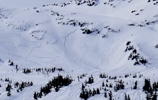
Wet loose avalanches: We have seen several small wet loose slides composed of last Wednesday’s storm snow over the past several days. Today, these are possible again and most likely in the mid-elevation band where the temperatures are warmer. Triggering one of these is possible on steep slopes with wet and saturated surface snow (East, West and South facing). The rule of thumb is, if you find yourself in saturated snow up to your boot tops, it’s time to head to lower slope angles or a different aspect with a drier snow surface.
Wet slab avalanches: We have not seen any wet slab avalanche activity, but it’s not out of the question a wet loose slide could trigger a wet slab today/tomorrow.
Recent wet loose avalanches on South facing Magnum Ridge (photo Allen Dahl).
Roller balls on Magnum’s Northerly face. These occurred yesterday and a sign Northerly aspects are beginning to warm. Roller balls are also a sign that wet loose avalanches are possible.
–
Signal Word | Size (D scale) | Simple Descriptor |
Small | 1 | Unlikely to bury a person |
Large | 2 | Can bury a person |
Very Large | 3 | Can destroy a house |
Historic | 4 & 5 | Can destroy part or all of a village |
Triggering a slab avalanche 1-2′ thick in the dry/moist snow on North shaded aspects is becoming more unlikely, but still possible. These slopes that harbored soft settled powder yesterday will become moister today. This change in surface character can add to instability in areas Wednesday’s storm snow has yet to bond well with the underlying surface. Most slopes are showing good bonding, yet we know there are areas with a facet/crust combination under the storm snow that keeps this concern in our minds.
Old storm slab on a Northerly aspect in Seattle Ck drainage (Main Bowl/1st Bowl) from last Thursday. Despite the initially poor bonding with the new/old snow last week, the snowpack was showing signs of good bonding now.
–
It’s that time of year where the snowpack is slowly warming up and cornices will begin to break. We can’t let ourselves get complacent when traveling along ridgelines – give these guys a wide berth.
Large cornice that forms yearly over Zero (Momma’s) Bowl at the top of the up-track on Seattle Ridge. It’s easy to get lured into thinking we are over ground when in fact we may be over only snow and air.
–
Partly cloudy skies were seen over the region yesterday before becoming mostly cloudy overnight. Ridgetop winds over the past 24-hours have been Easterly in the 10-15mph range. Temperatures rose to 50F below 1,000′ and up to the mid 30’sF along ridgetops. Overnight, clouds have kept temperatures warm and most elevations are reporting temperatures in the 30-40F range. No precipitation was recorded.
For today, a warm and windy day is on tap due to a low-pressure system in the Gulf ushering warm moist air our way. Light rain up to 2,000-2,500′ is expected with wet snow above this. Precipitation amounts expected are small, .2-.4″ of rain and 2-4″ of snow by tomorrow morning. Ridgetop winds will remain Easterly and increase to the 15-25mph range with stronger gusts. Temperatures will stay in the 40-50F range in valley bottoms and near 32F along ridgetops.
Tomorrow, Tuesday, continued cloudy, warm and windy weather will remain before the low-pressure system slowly moves South allowing cooler and possibly drier air for Wednesday into Thursday.
Temp Avg (F) | Snow (in) | Water (in) | Snow Depth (in) | |
Center Ridge (1880′) | 40 | 0 | 0 | 77 |
Summit Lake (1400′) | 41 | 0 | 0 | 32 |
Alyeska Mid (1700′) | 40 | 0 | 0 | 74 |
Temp Avg (F) | Wind Dir | Wind Avg (mph) | Wind Gust (mph) | |
Sunburst (3812′) | 31 | NE | 12 | 34 |
Seattle Ridge (2400′) | 35 | SE | 15 | 36 |
Date | Region | Location | Observer |
---|---|---|---|
10/27/24 | Turnagain | Observation: Tincan | Michael Kerst |
10/21/24 | Turnagain | Observation: Turnagain Pass Road Observation | Trevor Clayton |
10/19/24 | Turnagain | Observation: Tincan – Below Todds Run | Andy Moderow |
10/18/24 | Turnagain | Observation: Taylor Pass | Eli Neuffer |
10/15/24 | Turnagain | Observation: Tincan Common | John Sykes Forecaster |
10/14/24 | Turnagain | Avalanche: Tincan | CNFAC Staff |
05/13/24 | Turnagain | Observation: Eddie’s, Sunburst, Seattle, Cornbiscuit, Pete’s South | H Thamm |
05/13/24 | Turnagain | Observation: Turnagain Pass non-motorized side | Amy Holman |
05/12/24 | Turnagain | Observation: Warm up Bowl | Tony Naciuk |
05/07/24 | Turnagain | Observation: Turnagain Pass Wet Slabs | A S |
The riding areas page has moved. Please click here & update your bookmarks.
Subscribe to Turnagain Pass
Avalanche Forecast by Email