Turnagain Pass RSS

Archives
ARCHIVED - Forecasts expire after 24 hours.
Issued
Tue, February 27th, 2018 - 7:00AM
Expires
Wed, February 28th, 2018 - 7:00AM
Forecaster
Aleph Johnston-Bloom
Avalanche risk The Bottom Line

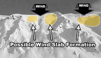
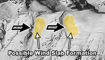
The avalanche danger is MODERATE at all elevations due to yesterday’s storm snow combined with moderate to strong winds overnight. Human triggered wind slabs 1-2′ thick will be possible. Expect loose snow sluffs in steep protected terrain.  Additionally,  old weak layers deeper in the pack may be triggered, creating a larger avalanche. Evaluate snow and terrain carefully.  

Special Announcements

Dangerous avalanche conditions are expected in areas seeing new snow such as Hatcher Pass and the Western Chugach. See the  Hatcher Pass Avalanche Center Facebook page  – avalanche danger has increased to CONSIDERABLE.

Tue, February 27th, 2018
Alpine
Above 2,500'
2 - Moderate
Avalanche risk
Treeline
1,000'-2,500'
2 - Moderate
Avalanche risk
Below Treeline
Below 1,000'
2 - Moderate
Avalanche risk
0 - No Rating
1 - Low
2 - Moderate
3 - Considerable
4 - High
5 - Extreme
Avalanche risk Avalanche risk Avalanche risk Avalanche risk Avalanche risk
Travel Advice Generally safe avalanche conditions. Watch for unstable snow on isolated terrain features. Heightened avalanche conditions on specific terrain features. Evaluate snow and terrain carefully; identify features of concern. Dangerous avalanche conditions. Careful snowpack evaluation, cautious route-finding, and conservative decision-making essential. Very dangerous avalanche conditions. Travel in avalanche terrain not recommended. Extraordinarily dangerous avalanche conditions. Avoid all avalanche terrain.
Likelihood of Avalanches Natural and human-triggered avalanches unlikely. Natural avalanches unlikely; human-triggered avalanches possible. Natural avalanches possible; human-triggered avalanches likely. Natural avalanches likely; human-triggered avalanches very likely. Natural and human-triggered avalanches certain.
Avalanche Size and Distribution Small avalanches in isolated areas or extreme terrain. Small avalanches in specific areas; or large avalanches in isolated areas. Small avalanches in many areas; or large avalanches in specific areas; or very large avalanches in isolated areas. Large avalanches in many areas; or very large avalanches in specific areas. Very large avalanches in many areas.
Avalanche Problem 1
  • Wind Slabs
    Wind Slabs
  • Certain
    Very Likely
    Likely
    Possible
    Unlikely
    Likelihood
  • Historic (D4-5)
    Very Large (D3)
    Large (D2)
    Small (D1)
    Size
Wind Slabs
Wind Slab avalanches are the release of a cohesive layer of snow (a slab) formed by the wind. Wind typically transports snow from the upwind sides of terrain features and deposits snow on the downwind side. Wind slabs are often smooth and rounded and sometimes sound hollow, and can range from soft to hard. Wind slabs that form over a persistent weak layer (surface hoar, depth hoar, or near-surface facets) may be termed Persistent Slabs or may develop into Persistent Slabs.

Likelihood of Avalanches
Terms such as "unlikely", "likely", and "certain" are used to define the scale, with the chance of triggering or observing avalanches increasing as we move up the scale. For our purposes, "Unlikely" means that few avalanches could be triggered in avalanche terrain and natural avalanches are not expected. "Certain" means that humans will be able to trigger avalanches on many slopes, and natural avalanches are expected.

Size of Avalanches
Avalanche size is defined by the largest potential avalanche, or expected range of sizes related to the problem in question. Assigned size is a qualitative estimate based on the destructive classification system and requires specialists to estimate the harm avalanches may cause to hypothetical objects located in the avalanche track (AAA 2016, CAA 2014). Under this schema, "Small" avalanches are not large enough to bury humans and are relatively harmless unless they carry people over cliffs or through trees or rocks. Moving up the scale, avalanches become "Large" enough to bury, injure, or kill people. "Very Large" avalanches may bury or destroy vehicles or houses, and "Historic" avalanches are massive events capable of altering the landscape.

Signal Word Size (D scale) Simple Descriptor
Small 1 Unlikely to bury a person
Large 2 Can bury a person
Very Large 3 Can destroy a house
Historic 4 & 5 Can destroy part or all of a village
More info at Avalanche.org

Yesterday snow fell throughout day with storm totals ranging from 10-15+ inches of low density snow. Avalanche activity reported yesterday was limited to easily initiated loose snow sluffing and small storm slabs. The winds increased last night from the West gusting as high 58 mph on Sunburst. The storm snow is so light that it will have likely been blown into wind slabs that may be tender today. Expect loading and slabs along ridgelines and look for pillowed or drifted snow. The winds are forecast to shift to more Northerly today and there maybe loading on multiple aspects. Watch for shooting cracks and areas with stiffer snow. Steep, unsupported slopes that are loaded will be the most suspect. Look for blowing snow and pay attention to changing conditions.

Loose snow avalanches (sluffs): On steep slopes protected from the wind expect the new snow to sluff easily. These loose snow avalanches may be fast running and entrain snow quickly. 

Sunburst winds yesterday and overnight.


Look for loading patterns across the terrain today. 


Avalanche Problem 2
  • Persistent Slabs
    Persistent Slabs
  • Certain
    Very Likely
    Likely
    Possible
    Unlikely
    Likelihood
  • Historic (D4-5)
    Very Large (D3)
    Large (D2)
    Small (D1)
    Size
Persistent Slabs
Persistent Slab avalanches are the release of a cohesive layer of snow (a slab) in the middle to upper snowpack, when the bond to an underlying persistent weak layer breaks. Persistent layers include: surface hoar, depth hoar, near-surface facets, or faceted snow. Persistent weak layers can continue to produce avalanches for days, weeks or even months, making them especially dangerous and tricky. As additional snow and wind events build a thicker slab on top of the persistent weak layer, this avalanche problem may develop into a Deep Persistent Slab.

Likelihood of Avalanches
Terms such as "unlikely", "likely", and "certain" are used to define the scale, with the chance of triggering or observing avalanches increasing as we move up the scale. For our purposes, "Unlikely" means that few avalanches could be triggered in avalanche terrain and natural avalanches are not expected. "Certain" means that humans will be able to trigger avalanches on many slopes, and natural avalanches are expected.

Size of Avalanches
Avalanche size is defined by the largest potential avalanche, or expected range of sizes related to the problem in question. Assigned size is a qualitative estimate based on the destructive classification system and requires specialists to estimate the harm avalanches may cause to hypothetical objects located in the avalanche track (AAA 2016, CAA 2014). Under this schema, "Small" avalanches are not large enough to bury humans and are relatively harmless unless they carry people over cliffs or through trees or rocks. Moving up the scale, avalanches become "Large" enough to bury, injure, or kill people. "Very Large" avalanches may bury or destroy vehicles or houses, and "Historic" avalanches are massive events capable of altering the landscape.

Signal Word Size (D scale) Simple Descriptor
Small 1 Unlikely to bury a person
Large 2 Can bury a person
Very Large 3 Can destroy a house
Historic 4 & 5 Can destroy part or all of a village
More info at Avalanche.org

The overall snowpack structure across the advisory area is poor and it is important to keep in mind that larger slides breaking in persistent weak layers could still occur.  The new load yesterday added to the weight from snow and winds over the weekend and earlier last week. This incremental loading can slowly overload weak layers making them more prone to triggering. Furthermore, avalanches triggered in the upper layers of the snowpack, like a fresh wind slab, have the potential to step down to the buried weak layers. In the upper elevations a layer of buried surface hoar from Jan. 21st continues to show signs of reactivity and in the mid-elevations a layer of facets over a melt-freeze crust is suspect. Observers on Tincan noted both layers yesterday. 

Deep Persistent Slabs:  At the high elevations above 3,000′, deeper persistent layers could ‘wake up’ if the wrong spot is found. Old weak layers of facets and buried surface hoar sit in the bottom half of the snowpack. This structure is most pronounced in places with a thin overall snow cover, such as the South end of Turnagain Pass, the Summit Lake area and Crow Pass. 

Snowpack structure on Magnum. The slab depth over the buried surface hoar and facets has now increased.

Weather
Tue, February 27th, 2018

Yesterday snow fell throughout the day. Storm totals ranged from 10-15 inches of low density snow. Winds were Southerly 10-20 mph during the day. They shifted to the West in the evening and increased to 15-30 mph with gusting into the 40s and 50s. Temperatures were in the teens and 20Fs. Temperatures steadily dropped overnight into this morning.

Today is forecast to be mostly to partly cloudy with temperatures in the single digits to low teens. There is a chance of snow showers this evening. Winds will be Northwesterly 10-20 mph gusting into the 30s. They are forecast to increase overnight.  

Tomorrow look for clearing skies, sunshine and temperatures in the teens. Northwesterly winds may continue tomorrow. The sunshine continues Thursday and then clouds build with a chance of snow over the weekend.  

PRECIPITATION 24-hour data (6am – 6am)

  Temp Avg (F) Snow (in) Water (in) Snow Depth (in)
Center Ridge (1880′)  24  8  0.2  74
Summit Lake (1400′)  18  3  0.4  31
Alyeska Mid (1700′)  20  5  0.24  67

RIDGETOP 24-hour data (6am – 6am)

  Temp Avg (F) Wind Dir Wind Avg (mph) Wind Gust (mph)
Sunburst (3812′)  13 ESE-WSW   17   58  
Seattle Ridge (2400′)  17 E-W   15 40  
Observations
Recent Observations for Turnagain Pass
Date Region Location
04/23/24 Turnagain Observation: Turnagain Sunny Side
04/21/24 Turnagain Observation: Bertha Creek
04/20/24 Turnagain Avalanche: Spokane Creek
04/16/24 Turnagain Observation: Cornbiscuit
04/15/24 Turnagain Observation: Taylor Pass
04/15/24 Turnagain Observation: Seward Highway – Tern Lake to Portage
04/14/24 Turnagain Observation: Sunburst
04/14/24 Turnagain Observation: Turnagain Pass Snomo
04/13/24 Turnagain Observation: Spokane Creek
04/11/24 Turnagain Observation: Tincan
Riding Areas

The riding areas page has moved. Please click here & update your bookmarks.


Subscribe to Turnagain Pass
Avalanche Forecast by Email

This is a general backcountry avalanche advisory issued for Turnagain Arm with Turnagain Pass as the core advisory area. This advisory does not apply to highways, railroads or operating ski areas.